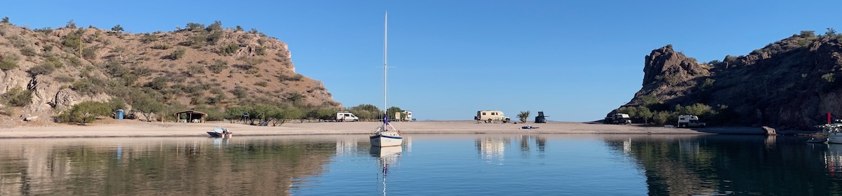
Tomorrow morning I’m going to slip my mooring here in Langkawi and head south. In theory this should be a simple operation. The plan is to get some fuel at the dock here, then I can do a 3-4 hour trip to an island called Pulau Paya (2 on the map), if all is going well I might continue onto another island 3-4 hours ahead called Pulau Songsong (3), I have stopped here before a few times doing the sail from Penang (4/5) to Langkawi. It all depends how quickly I can get away, the fuel dock doesn’t open till 9am.
The plan so far is to get as far as Pangkor Island (8/9), which is not far from Kuala Lumpur by Friday. There I can haul out the boat and check how much damage I did on the rock. I can also see if the osmosis has re-appeared and I may try to adjust the Max-Prop propellor to see if I can’t get some better efficiency from it.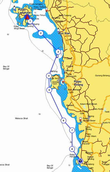 Since Kathy went home I have been busy doing chores on the boat. I have fitted the new Throttle and gear cables, Changed the oil and filter, cleaned out the raw water filter and changed both the fuel filters. On my last Volvo engine on the baba 30, I only had to look at the fuel system to induce an air leak into the system. These were always annoying, often they would hide while the revs where high, but as soon as I throttled back entering the marina the engine would stop and not want to start, good game. So after changing these filters I bled the system and it has started perfectly, high revs, low revs, it works great. I haven’t tested the new cables away from the dock, but they seem fine now. What could possibly go wrong 😉
What could go wrong is the weather!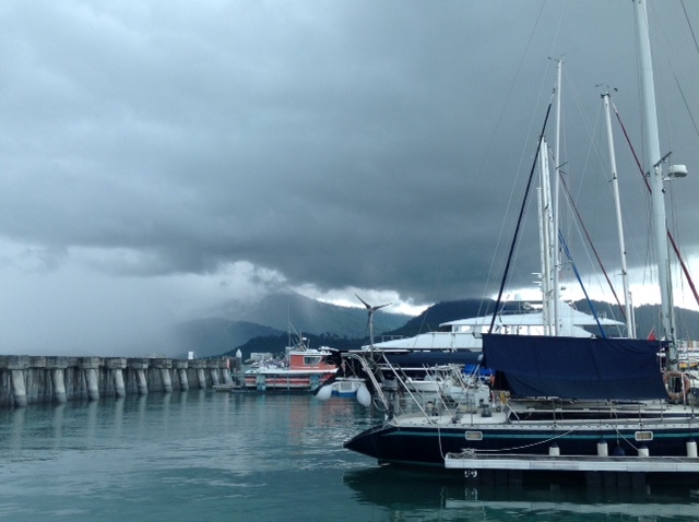 Above is typical of the weather here now. It’s forecast for thunderstorms for the next 7 days. A met office warning to shipping for the Malacca straits for today warned small ships to stay home, the forecast said in areas of multiple thunderstorms, waves could reach 12ft high with 30 knt winds. However that was for today, no warnings for tomorrow. I have a variety of sources for weather information, The national weather services for maritime service, the equivalent of the uk shipping forecast is a main one. I make a lot of use of grib files. These are weather data files you download over the net. They are a very compact form of data, so ideal for loading over HF radios, or expensive satellite links. With a viewer on your PC you can see the data as wind and wave patterns as shown below
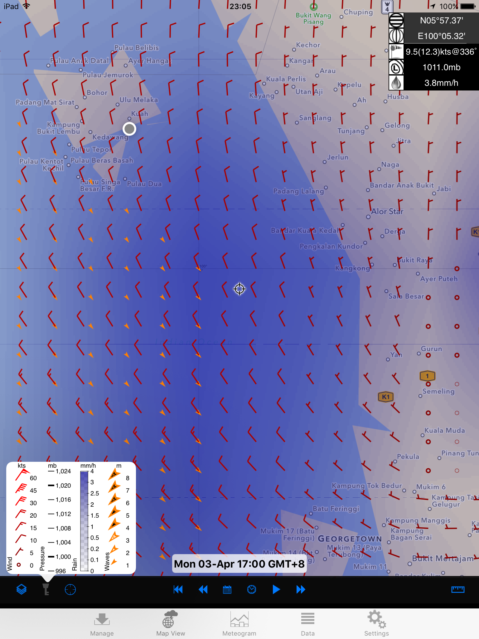 This covers the area I will be in tomorrow. It is animated on our iPad, showing the changes every hour over a 96 hour period. Here is the legend/key expanded
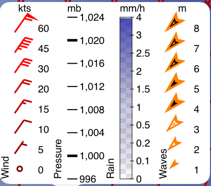
So the worst weather tomorrow will be at 17:00 and you can see inshore the wind is about 5 knots, calm, and further offshore, at the extent of where I might be, the wind increases to 15 knots, very healthy for sailing, plus it’s from behind me, so that’s even better. Also the waves go from <1m inshore to 2 mtrs offshore, This might make it a bit more lively, but as they are in the same direction as the wind, and behind me, I’m not too concerned. The only problem is that at some point there will be a strong current flowing north, on the ebb tide, this will slow my progress down and make it less fun, but at the same time, well actually 6 hours later or earlier, the tide will be pushing me along adding a couple of knots to my speed. I think High tide is about 5pm, so the southbound current will be strongest between 3 and 6 pm, roughly. and the current against me between 9-12pm.
I bought a stack of squid from the street market last night, and had them for dinner just now, I’m very pleased at how quick I can prepare them, ripping the body out, removing the plastic spine thing, and skinning them, all in seconds now. Just need to work out how to catch them myself. I don’t eat the tentacles, seems like to much effort, which I know some will think a crime.
I read an article today about how Trump was turning off GPS Accuracy for non military use, and would allow Americans and certain others to buy a license to use it. This would not be great news for sailors, even worse for satnav users, I was concerned. He was quoted as saying it was a great way to raise money for ‘the wall’, he might even make so much money from it he would build a second wall on the Canadian border. At that point I checked the date on the article to see it was the 1st April, I’m just hoping it was a hoax. It did make me think though, just how dependent we are on GPS these days. However I think the European system should be online soon, oh, just realised, as a Brit, we might not be allowed to use it, damm 😉 !!
Paul Collister