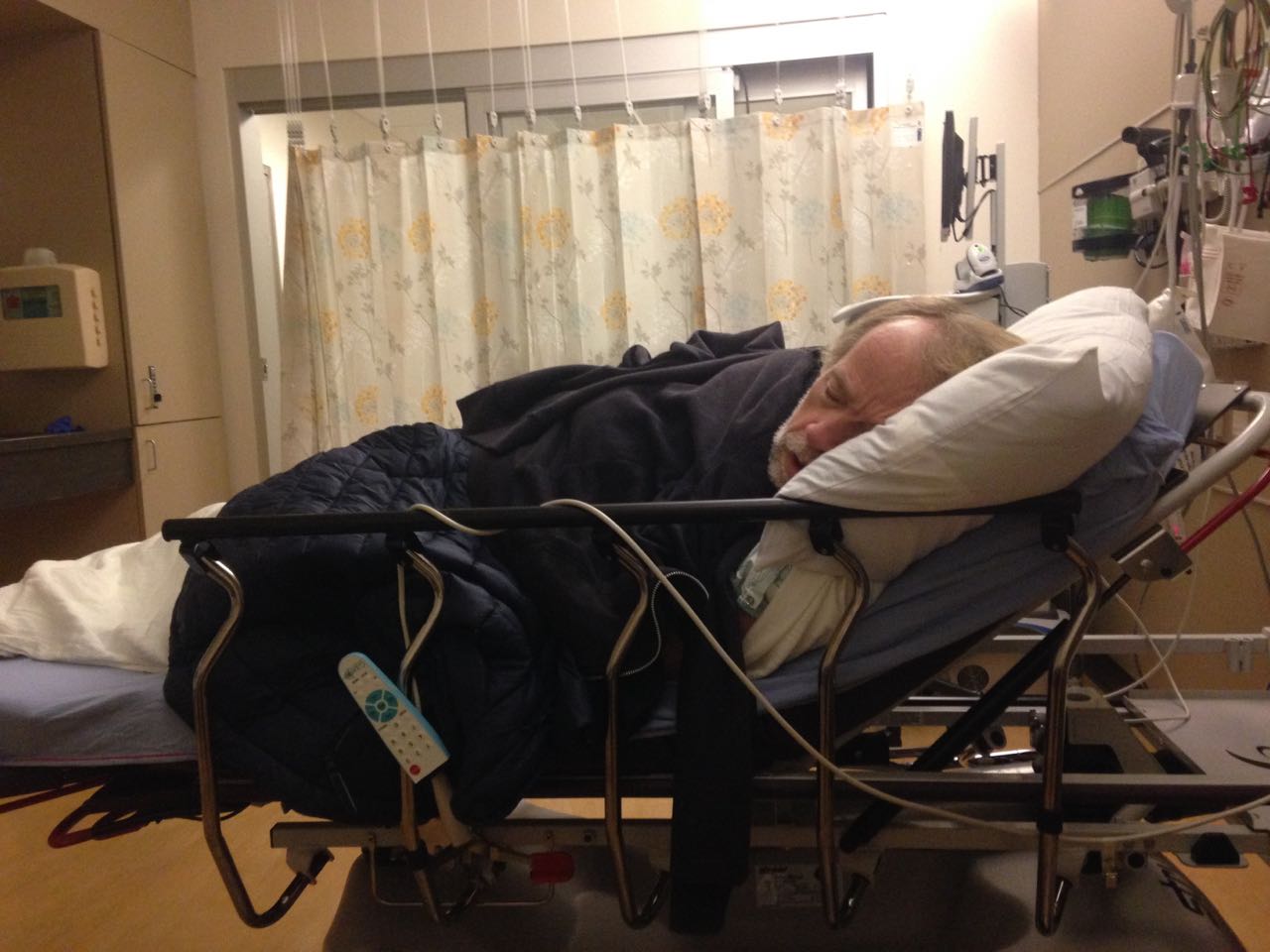
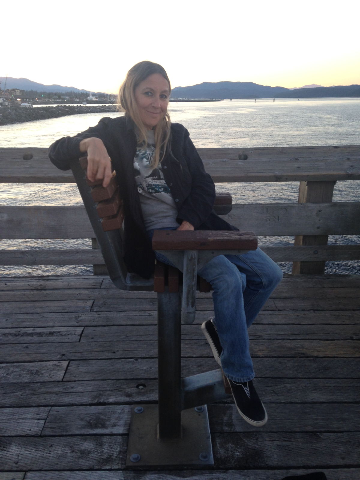
Yesterday saw me back in hospital, It’s called ER here, A&E back home. But no sign of George Clooney or Hugh Laurie anywhere.
I’m often seeing stuff on Quora about the differences between US and UK Healthcare so I now had a chance to check it out myself. I might even be able to answer one of those Quora questions.
The problems started after a long bike ride a few days earlier, I thought I must have been sitting uncomfortably, as I had quite a pain later in my groin region. Perhaps that’s all the detail that I need to give, other than there was some considerable swelling.
The swelling continued and the pain increased over the weekend, so a search on google revealed many possible causes, most of them quite serious. Bruising didn’t seem likely.
So we headed on down to an urgent care place, these are like ER but for non life threatening issues, they are also supposed to be a lot cheaper than ER, so for just $125 they should be able to give me an opinion and maybe some treatment. Unfortunately, when I explained the problem they said they couldn’t do anything for me and I should head to ER immediately, which was a bit worrying.
They also said they wouldn’t charge me, which was nice.
So Kathy and I jumped into a cab and headed to ER in Ballard for a very efficient check in process, I do have medical insurance, but I had only just taken it out, and I selected a high excess. This was going to be an expensive day. The check-in process took about 5 minutes, in the UK it’s about the same. Next came triage, which in my opinion should be a fairly prompt process, in the UK this normally happens within an hour, here in Seattle it was right away.
I was taken to lovely examination room, where they took my vitals, hooked me up to some monitors then scheduled a specialist to visit. He came about 30 minutes later and ordered an ultrasound scan, In the UK we might well be in the 3 -6 hour period by now. They also took blood and urine samples.
The ultrasound revealed no serious issues, just inflammation, most probably caused by an infection. The actual diagnosis was Epididymitis, and the treatment was to be a course of antibiotics, rest and loads of painkillers.
After a few hours of being at ER I was discharged with a list of drugs I had to go and buy. However I was now feeling more ill than when we arrived, so a quick uber back to the boat and I went straight to sleep, while Kathy went off in search of the medication.
Buying medicine is a bit different here; in the UK any prescribed drugs will cost the same amount, so 10 antibiotic pills will cost about $10 total, here you have to shop around, we had a discount card from the insurers and their recommended retailers, of which safeway was the closest. Kathy popped out to get the medicine and came back, waiting for the right moment to tell me the pills cost $185!! A bit of googling showed safeway are the most expensive place around here. The pharmacy said the insurer won’t pay for antibiotics, or perhaps I need to make a claim. Still another lesson learned.
I won’t be surprised if the cost of the ER visit is in the region of $1000 (in 2013 the average ER visit in WA costed $1200), the bulk of which I will have to pay.
So to compare systems, well I can’t really on such a flimsy illness, but I’msure that the outcome of either an ER or A&E visit would have been the same for me, a course of antibiotics. A&E back home would have had me sitting for a few hours in a noisy room, possibly with crying babies, noisy toddlers and the odd drunk falling off his chair. whereas here I waited for 5 minutes in a very flash foyer / reception area, before being whisked off to a private room. Nurses and Doctors here seemed very professional and caring, just like back home, which is what you would expect. However they didn’t seem as rushed here, in fact that was the main difference I think, here they had plenty of room, and seemed quite laid back. All in all I think I prefer the UK setup, I think the wage deductions for National Insurance (Health care) are way lower than the cost of medical insurance, and even with insurance here, the deductibles and co-pay charges can soon add up. Still one visit and a few weeks in the country doesn’t really qualify me as an expert.
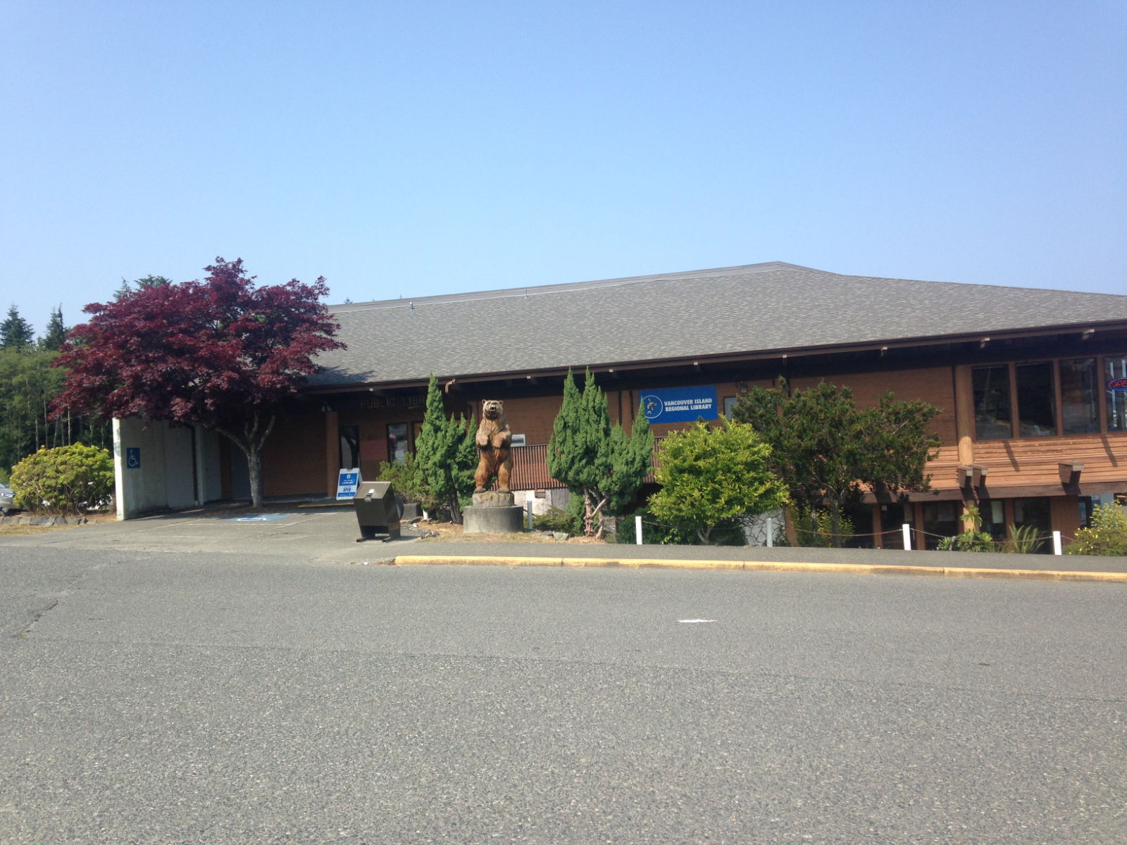
That was yesterday, and I’m already feeling better today, hopefully we can get out again soon. Nurse Kathy has been doing a wonderful job as I haven’t been able to move around much. We had plans to do loads of stuff here, and may stay a bit longer to make up for lost time. Seattle seems like a great place, and for the last few days the smoke has lifted and it’s been lovely and sunny. BTW I thought smoke was a technical term for a light fog, it was on the marine forecasts a lot, but it turns out to be actual smoke from fires. It seems like there are lots of large fires burning on Vancouver Island. One newspaper in Seattle last week reported air quality to be so bad it was equivalent to smoking 5 cigarettes a day. Looks like we were very lucky to have seen as much of the island as we did. In fact I hear most of the western coast is suffering from big forest fires.
Before I got ill I took a trip down to West Marine, which is a short walk from the marina, they have such a great range of marine products, so far it’s the best chandlery I have ever been in, aisle after aisle of everything you could ever need for the boat, in fact I bought quite a few things that weren’t on my ‘to buy’ list. I was enrolled into the West Marine discount club, and was told they will match any price I can get from anywhere else (except eBay), which seems like a good deal. I have also ordered tons of stuff online to be sent here and I’m just pondering if I should buy a load of sunbrella, a fabric used to make boat covers/canopies etc as it’s hard to get in Asia.
I need to visit Fisheries next, as that’s supposed to be a great chandlery and more down to earth than West Marine.
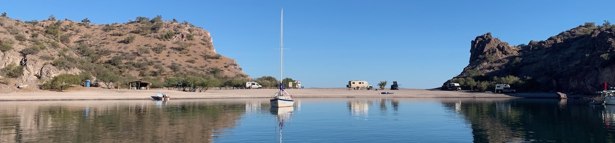
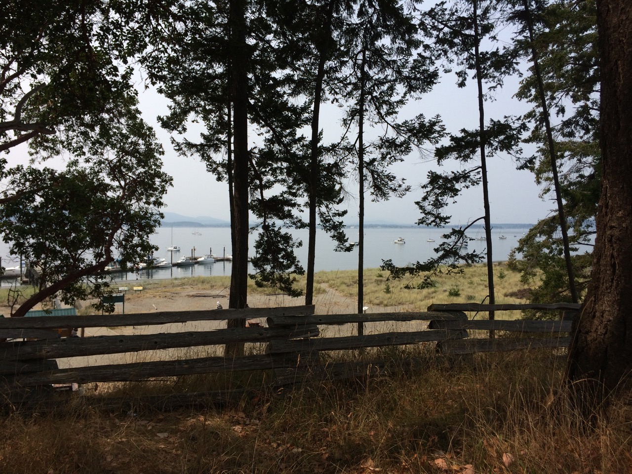
Elliott Bay Marina below with Downtown Seatlle in the distance
I knew we were in for some lively company when Paul called down to ask if I was decent because we had company, and I heard a rich Canadian voice loudly respond ‘can’t I wait until she’s not!’ Two young guys stumbled on board, one of them literally, cursing when he caught his foot on the side deck shackle after taking his shoes off. Down the steps and into the cabin came Keith and Frank who had been on a Friday afternoon drinking session at the marina pub before returning to their respective boats near to ours in French Creek Harbour. Admiring Sister Midnight, they’d got talking to Paul about our journey and were interested to look inside the boat that had crossed the Pacific. They proved to be entertaining company, recommended some places to visit and told us about their boats. Keith had (we think he’d inherited it) a huge motor launch that he’d been trying to sell with little success. Frank (a fisherman, his boat stern to stern with ours) told us he’d been trying to persuade Keith to keep it. He’d told him of the fun they could have on it and how it was big enough to host some great parties. These guys loved to party from the stories we heard and would have no doubt loved it if we’d hosted one then and there but sadly we had places to go. After answering all their questions about the trip and asking a few of our own regarding the nearest shops, they sloped off, presumably to sleep away the rest of the afternoon.
Saw several cabins like this journeying along the islands in the Inside PassageRafted up in French Creek Harbour
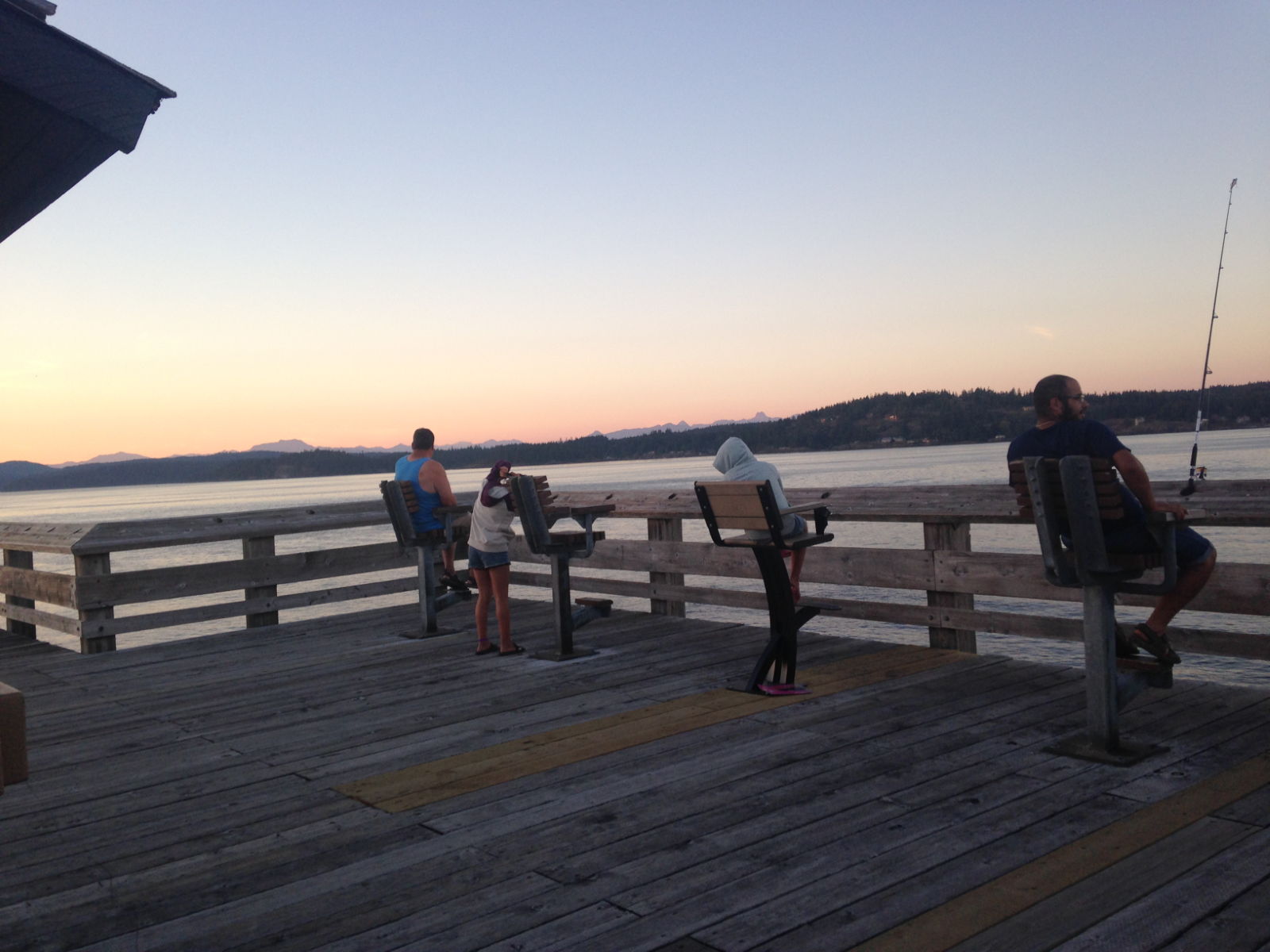
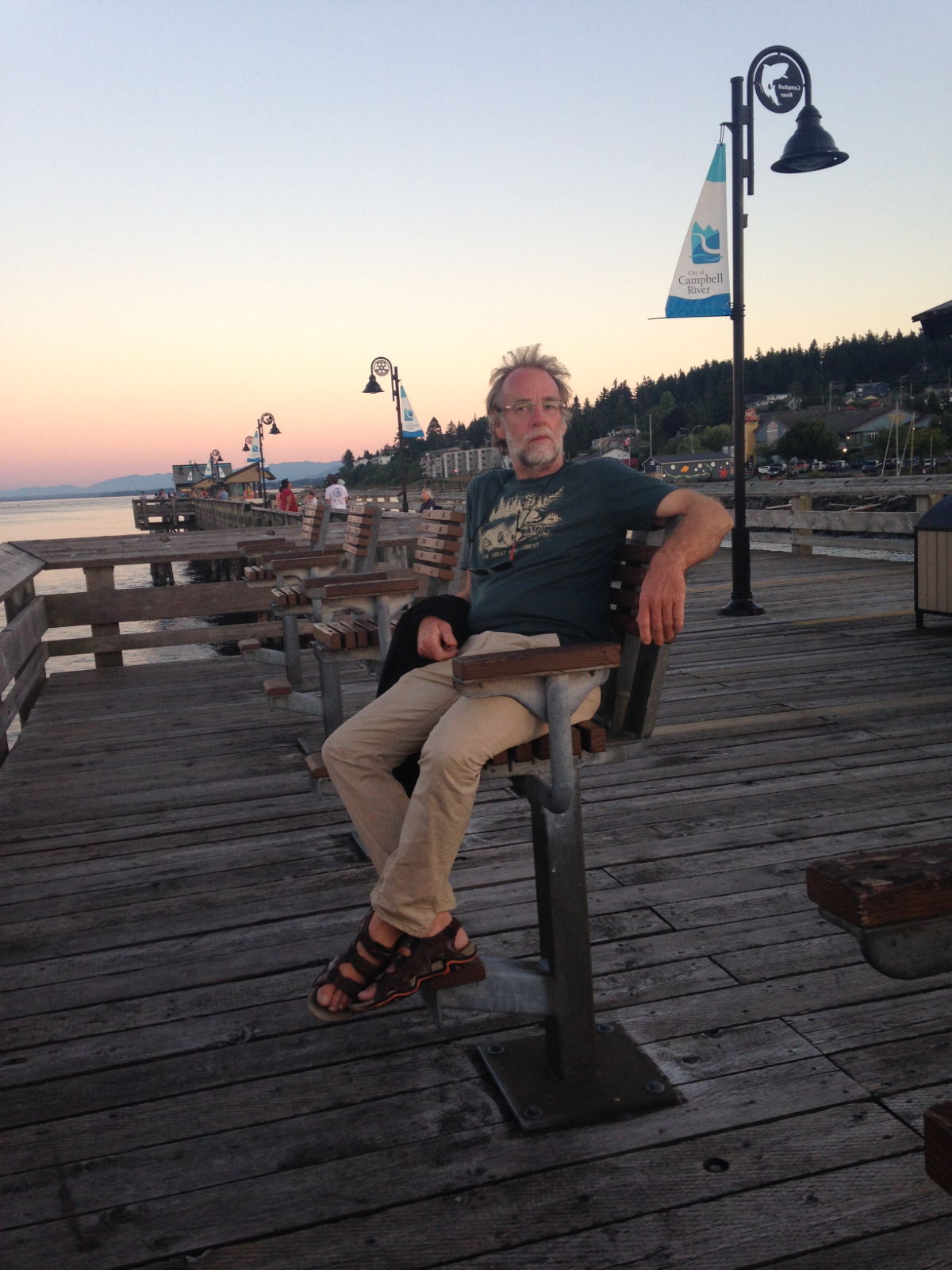
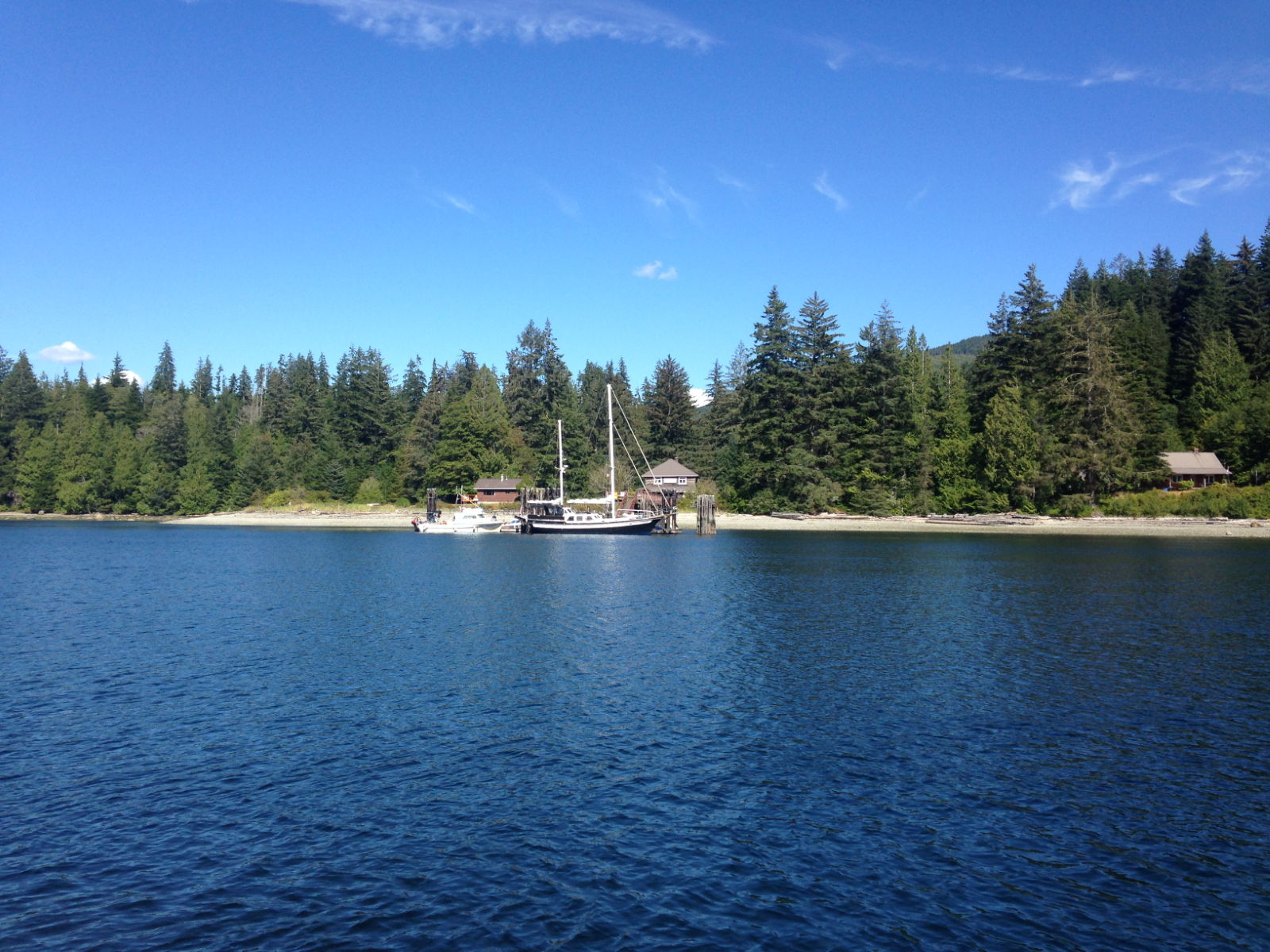
We’d arrived in French Creek earlier that day after three days spent in Campbell River, a fair-sized city on the east coast of Vancouver Island. Paul had developed a heavy cold so we had extended our stay until he felt fit enough to carry on. We didn’t do a lot there, apart from a walk along the waterfront and pier on our first evening, and a visit to the museum the following afternoon. The museum had plenty of information about the region’s First Nation history, as well as some exhibits about fishing and logging in the area. I particularly loved the detailed replicas of a pioneer cabin and a 19th century hotel lobby that looked as though they were straight out of a Western film set. We also watched a fascinating film of the actual blast that destroyed Ripple Rock at Seymour Narrows in 1958 in order to make it safe for crafts to pass over. As we drew closer to America we needed to use up any fresh produce on board because it’s forbidden to take any in from Canada, so I found myself making vegetable soup for the freezer on one of the hottest afternoons we’d experienced since arriving in the country. It made shopping easy though: we just stocked up with drinks and bread, having enough of everything else to last us until America.
Campbell River MarinaThe waterfront at Campbell River
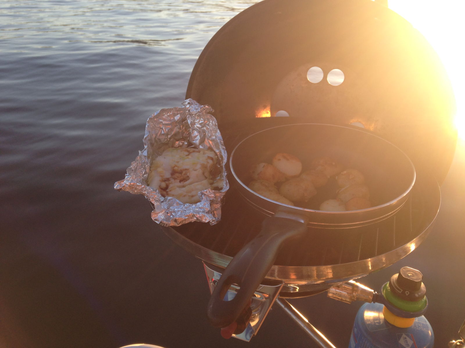
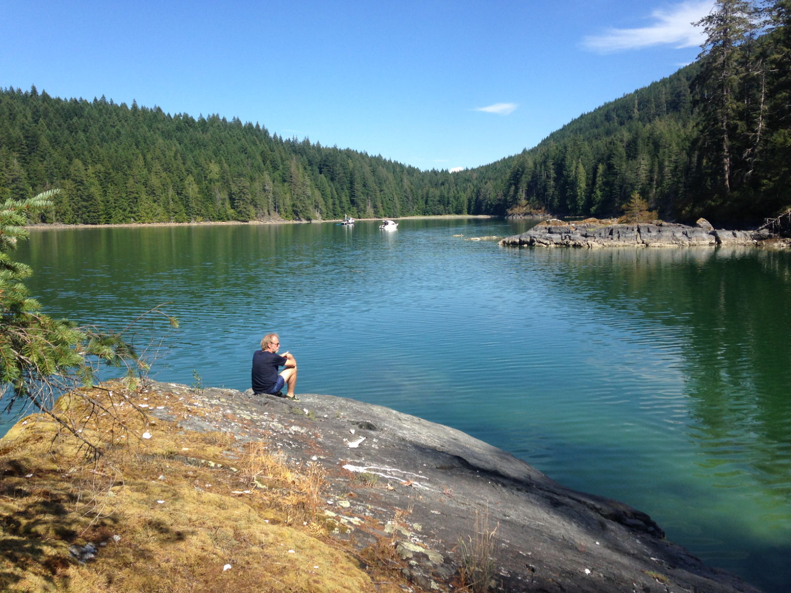
We’d spent the night before French Creek at anchor at Hornby Island. Known as The Hawaii of the North due to its golden sandy beaches (most of the beaches here have greyish-coloured shingle instead of sand) and warm waters, it was the busiest anchorage so far. Yachties flock there to go canoeing, kayaking and paddleboarding in the calm bay and at this time of year the beach was predictably crowded with families. Neither of us felt like going ashore. Paul had bought a fresh fish in Cambell River and inspired by the smells wafting over from beach barbecues and from neighbouring boats, he decided to use the barbecue in the cockpit. We need to cook more things on it – it smelled delicious and I don’t even like fish!
Paul’s fish dinnerAt anchor, Hornby Island
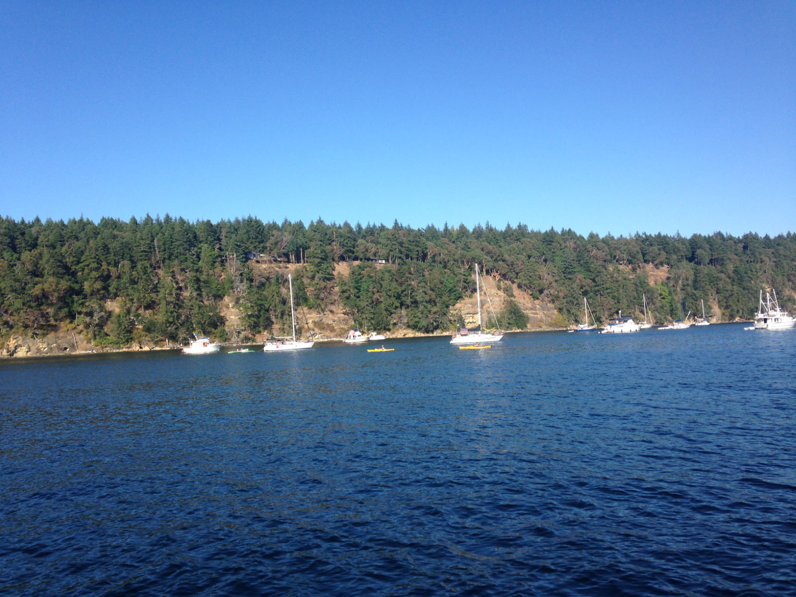
Hornby Island to French Creek was only a three hour trip and we arrived there just before 2pm. It’s another fisherman’s wharf so we had to raft up to another boat which is a simple enough thing to do, except that a guy watching us from the opposite pontoon saw fit to point out that we were breaking the rules by being three abreast (the boat we had rafted to was rafted to one next to the pontoon). The man who had helped us in told him it wouldn’t matter that much, at which the other guy threw his hands in the air and declared it was none of his business, he was merely pointing out the rule displayed on the signs. He was so insistent that it was nothing to do with him that he effectively suggested it was personal. Anyway, after he’d motored off we did in fact move so that we were only two abreast and could finally take a look around. I’ve come to prefer staying at the working fishermen’s wharves or commercial marinas as opposed to public marinas for their friendly, informal atmosphere and the hive of activity that is usually going on in them. French Creek was no different, and at the recommendation of our friends earlier, I suggested we have a drink in the pub on site. It really didn’t have much to recommend it once we were inside. Televisions were playing various sporting events all around the bar and it was crowded, noisy and soulless. We took our drinks outside and didn’t stay for another. A much more sober and quieter Frank chatted with Paul from the stern of his boat that evening. I have a feeling he asked the same questions as those from the afternoon but at least he had a chance of remembering them this time.
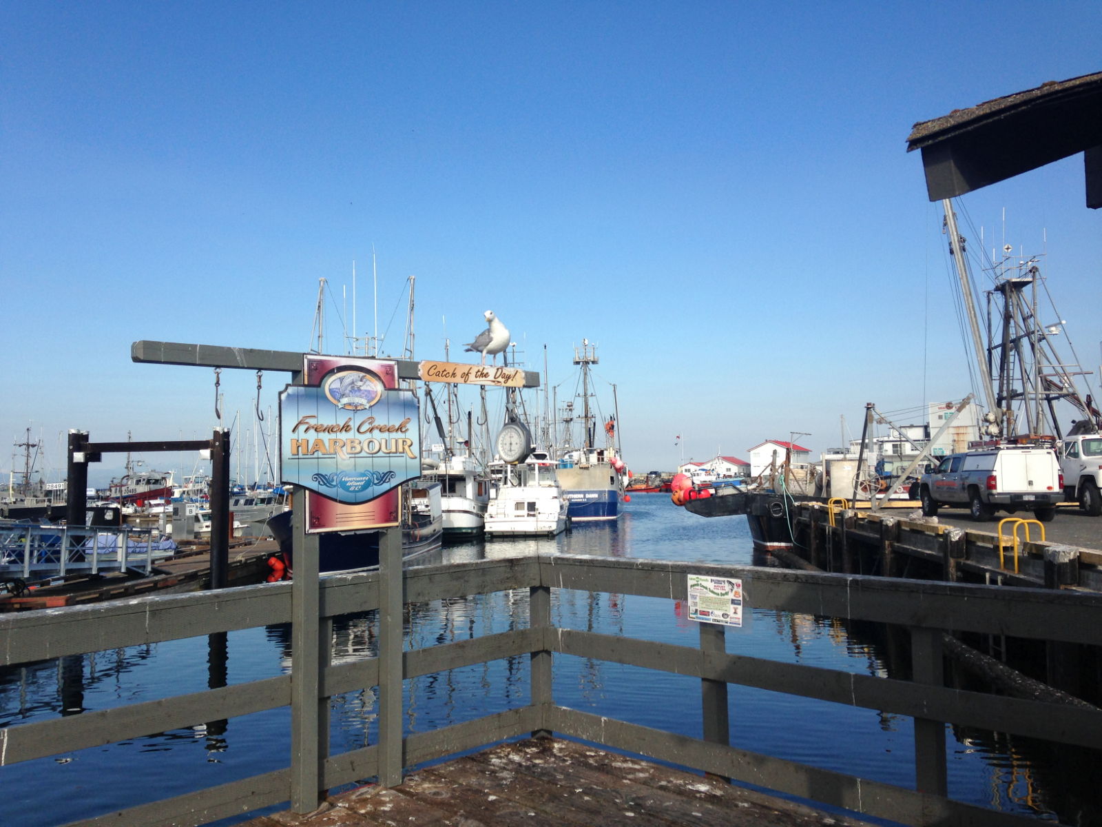
The harbour at French Creek
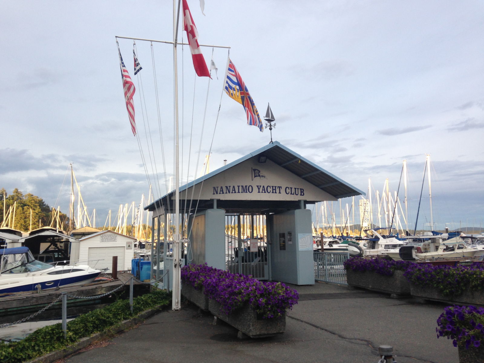
From French Creek, we headed for Nanaimo on a very choppy sea with the rain pelting down and a decidedly cold wind. Poor Paul was up above the whole time. We had the sails up and the journey was extended because we had to tack a few times. It was a seven hour journey all in all and we pulled in to Nanaimo Yacht Club at 5pm, by which time the weather had improved considerably. The yacht club had been another suggestion from the French Creek guys and was much appreciated because it was cheaper and had good wifi. We walked along the prom in the evening and I saw buildings that although not quite skyscrapers, were the tallest I’d seen since Japan. The city of Nanaimo has one of the largest shorelines in Canada and is popularly known as The Harbour City with enough attractions for visitors to warrant a few days’ stay. We would only be spending one full day there so had to choose and slot in our activities beforehand. On the way back to the boat I spotted two second hand bookshops and resolved to check them out before the planned excursion across the water to Newcastle Island.
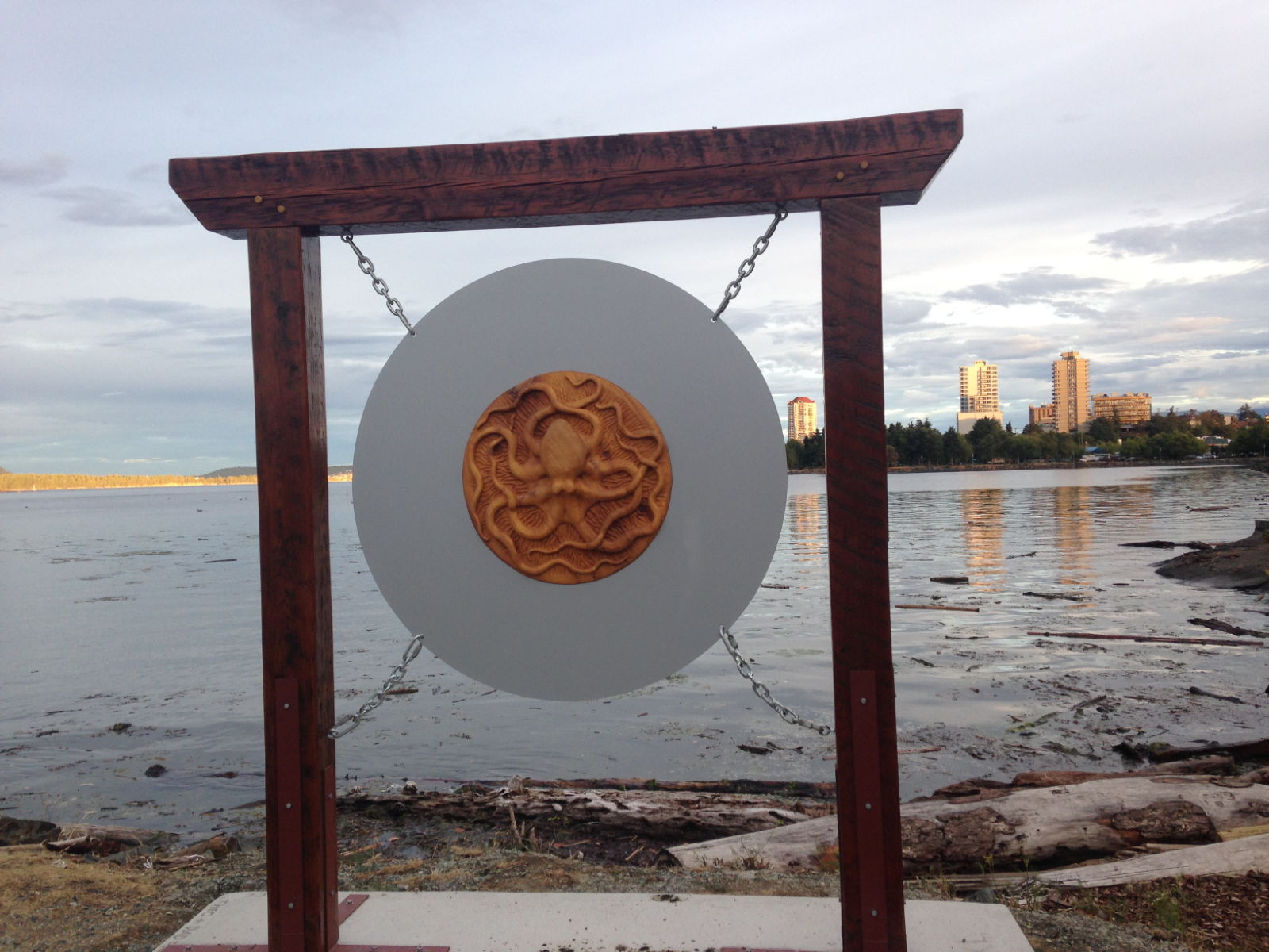
Commemorating the huge octopus that was caught here some years ago.
Browsing in the bookshops the next morning while Paul had a coffee in the café opposite, turned out to be a good move because by the time I emerged, the murky, overcast morning had developed into a clear, warm early afternoon; just right for a nature trail.
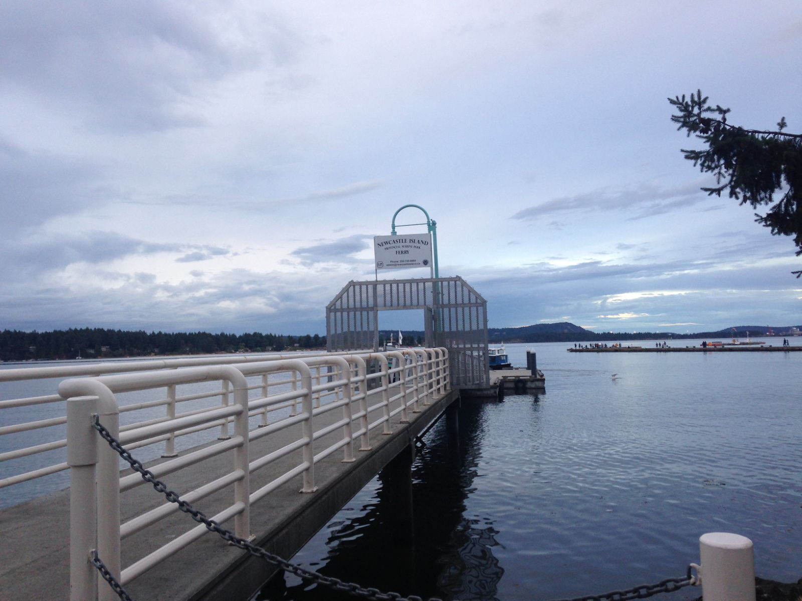
It took a bit of time to go around them both 😉Note the colourful possessions of one of the city’s eccentricsFor Newcastle Island Ferry
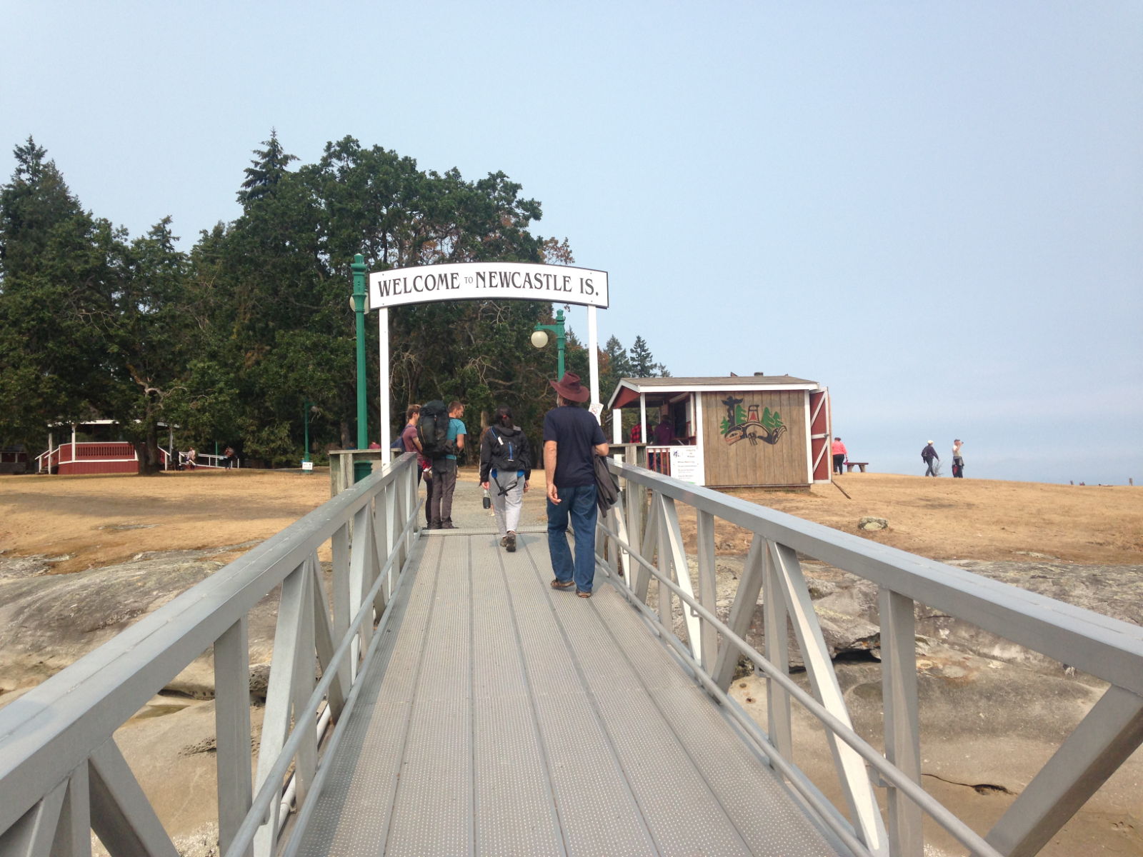
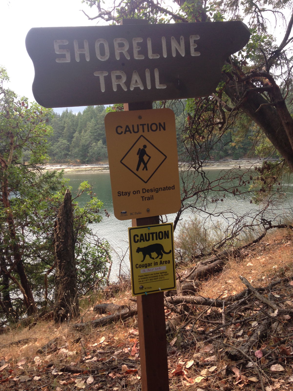
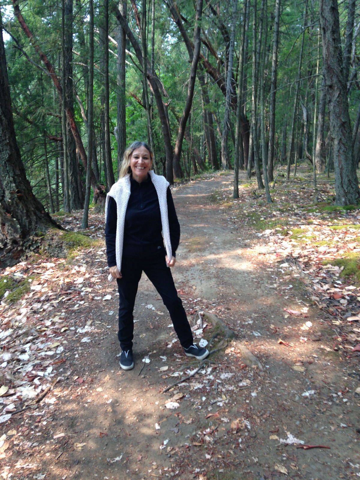
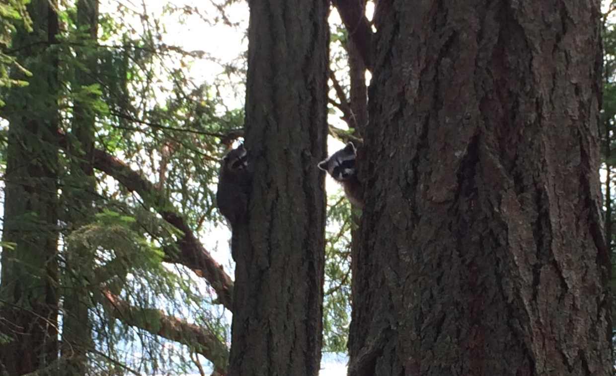
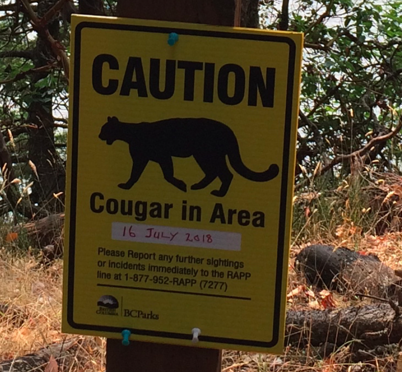
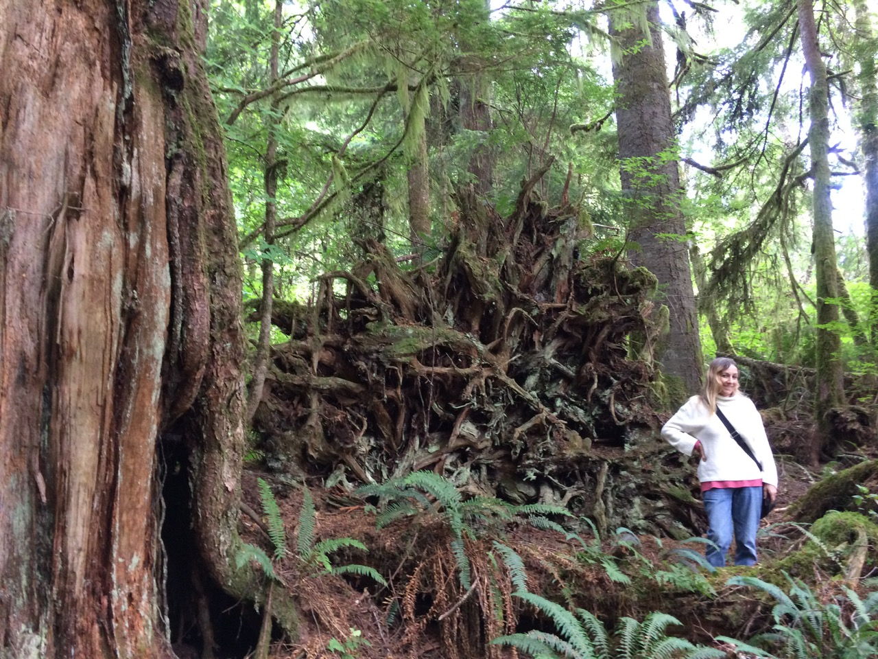
We caught the 2pm ferry for the short journey over the water, along with several people who were carrying an impressive array of heavy camping gear. Sporting heavy, cumbersome rucksacks, they transported their stuff down the jetty with the aid of wheelbarrows and ferry staff helped to load it on board. Newcastle Island is clearly a popular spot for camping breaks. The island is a marine provincial park, and a sacred site of the unpronounceable First Nation Snuneymuxw people, who know it as Saysutshun Island. The name Newcastle came about from the discovery of coal on the island in 1849 and took the name from the mining town of Newcastle-upon-Tyne when the British needed good quality coal from North America for their steamships. It boasts rustic and pristine beaches, playgrounds, family-friendly camping and a 22km hiking trail. We chose the shorter, outer loop trail that took in some of the coastal path. At the start of the trail was a sign warning that a cougar had been sighted a few weeks previously. As for bear-confrontations, the advice is to make yourself bigger and to roar at the animal. You most definitely should not run away. I’m all for standing up to bullies but I’m not sure I could follow that advice! Two cute raccoons were what we spotted first anyway. A group of people ahead of us were pointing upwards and there they were. First, we saw one clinging to the trunk and staring wide-eyed at us and as we got ready to photograph it, a smaller little black and white face popped out from a nearer tree as if to see what all the noise was. I’m not sure I’ve ever seen a raccoon before let alone in its natural state. It still gives me a thrill to think of it now.
Spot the raccoon
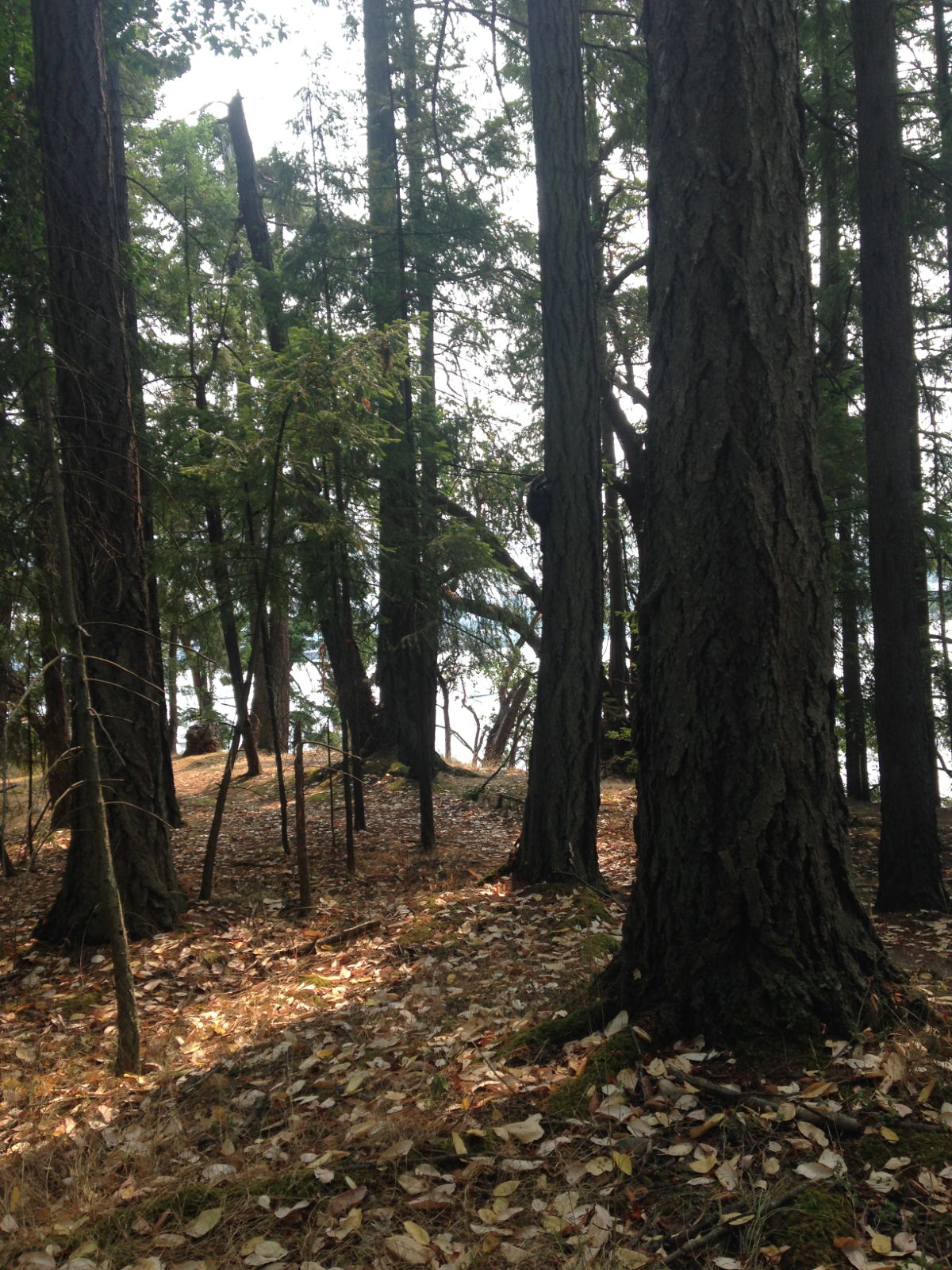
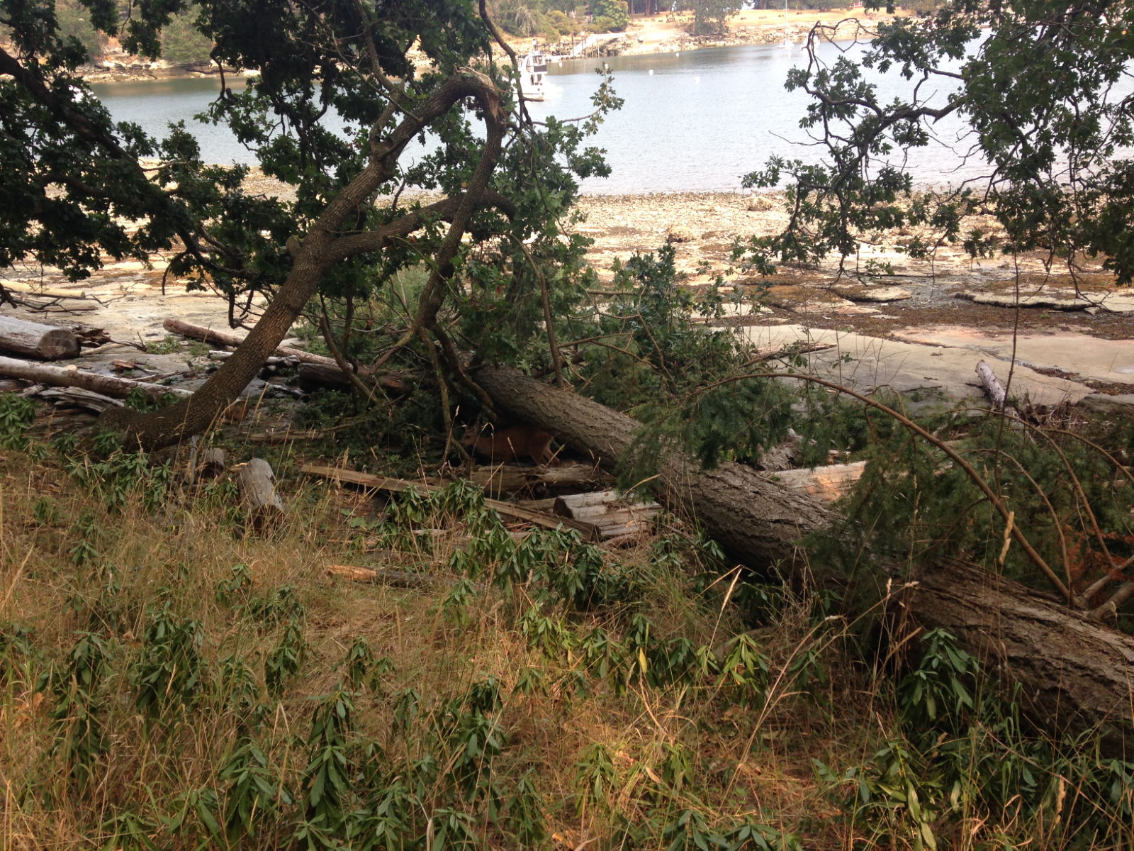
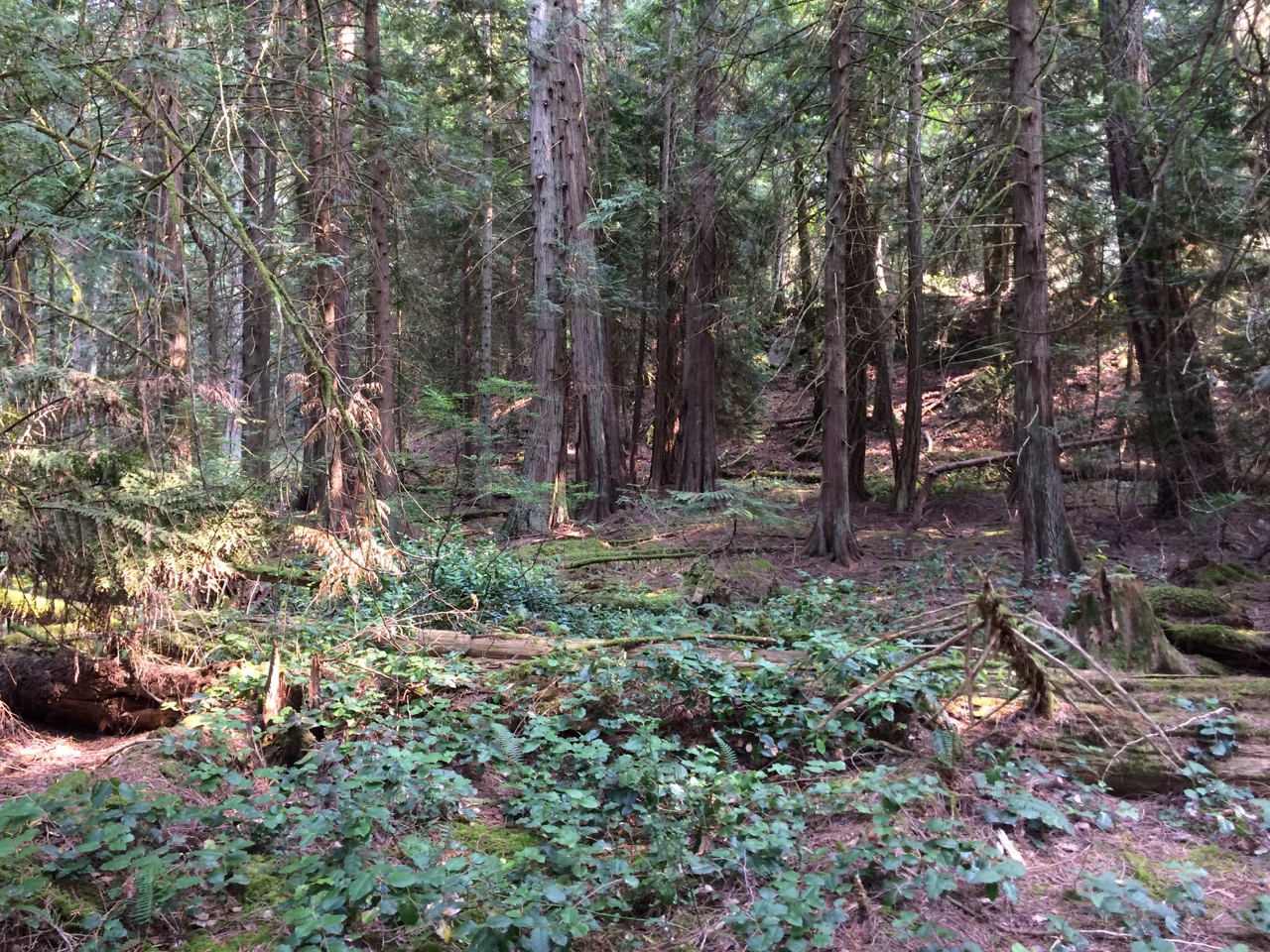
The walk was wonderful. Unlike our treks in Asia I didn’t have to worry about leeches or millipedes. There was no humidity or swamps and every now and then a cool breeze refreshed us from the afternoon heat. The various trees in the interior forested landscape were interesting enough in themselves. They were huge, gnarled and very tall Douglas fir, Oak and Big Leaf Maple trees. The colours were beautiful, and must be a glorious sight to behold in the autumn. We saw a deer nibbling at the leaves of a fallen tree near a beach, but we didn’t come across the cougar. At the end of the two hour walk we were going to have a drink in the bistro but it had closed a few minutes before we got there –at the early hour of 5pm! There were several families camping nearby and it seemed such a wasted opportunity for a restaurant to miss out on making money from holidaymakers and visitors at the height of the summer season. We caught the 5 15 ferry back to Nanaimo and had a slow walk back along the waterfront to the yacht club.
Spot the deer 🙂
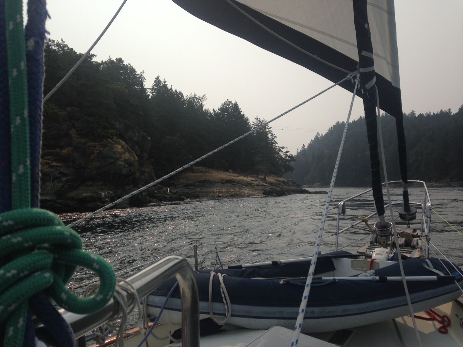
Prevost Island was our next stop on 13th August. This passage would take in another notorious narrow pass called Dodd Narrows. It’s the narrowest pass in the Gulf Islands and subject to swift currents according to Joe Upton, the author of my guide to the Inside Passage. He tells of the time in 1982 when he was towing a gill-netter with engine problems and failed to heed the warning to avoid passing through it against the tidal stream. He ended up swerving violently back and forth in the current while the guy he was towing had a tough time steering to stay off the rocks. Apparently he’d become so alarmed during the crossing he’d bitten his cigar in half! Needless to say Paul had done his research on the best time to go through, and when we arrived at the entrance, several other vessels were stationary, presumably waiting for the ideal time slot of midday. We heard boats from the north and south entrances on VHF broadcasting their intentions to go through and for any concerned vessels to radio back. We sped through it at 11 15! I think Paul was hoping for a bit of a ‘white water’ thrill. The gap looked very narrow from a distance and once we were going through I could see it would be tricky for wide boats to pass each other comfortably. Looking up at the holiday resort on the hill above us I noticed a bench that looked as if it had been placed for the sole purpose of watching the boats traversing the channel: a prime position to film or snap any drama. Two people were sat on it looking down as our group of boats motored past. Apart from more of a swirly sea, it was hard to know we’d gone over any rapids, although Paul said he felt the steering ‘pull’ a bit.
IMG_8311
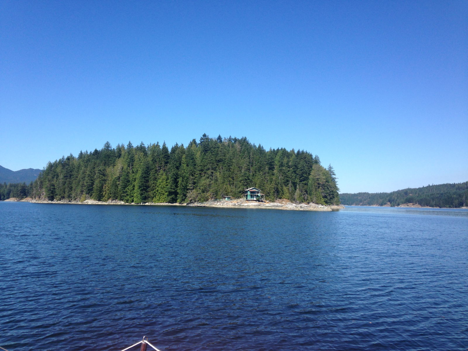
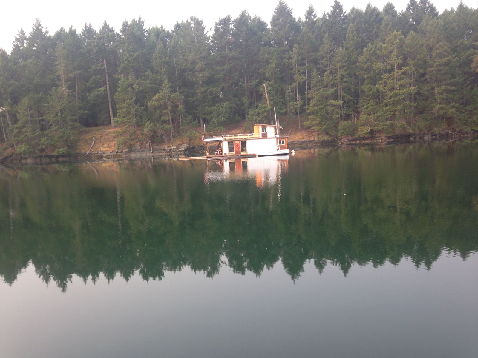
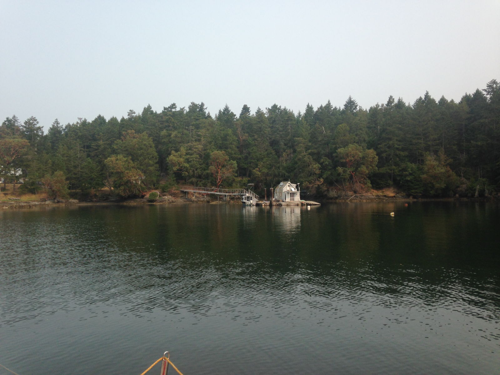
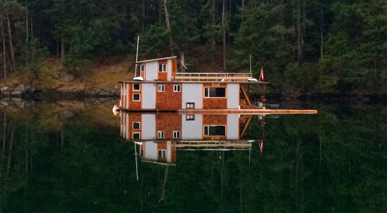
Annette Bay was a picturesque little sheltered bay to anchor for the night. Paul’s guide had mentioned river otters frequenting the banks but we didn’t see any. There were a couple of intriguing floating houses in the bay that I would have loved to look inside. I’d never seen anything quite like them before.
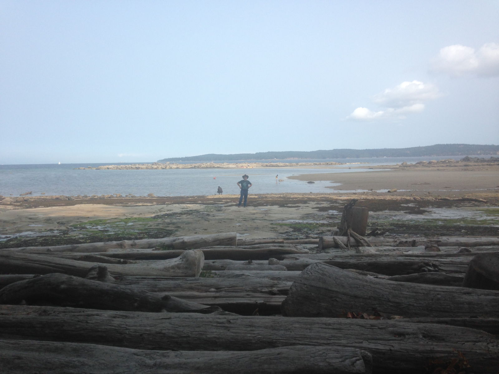
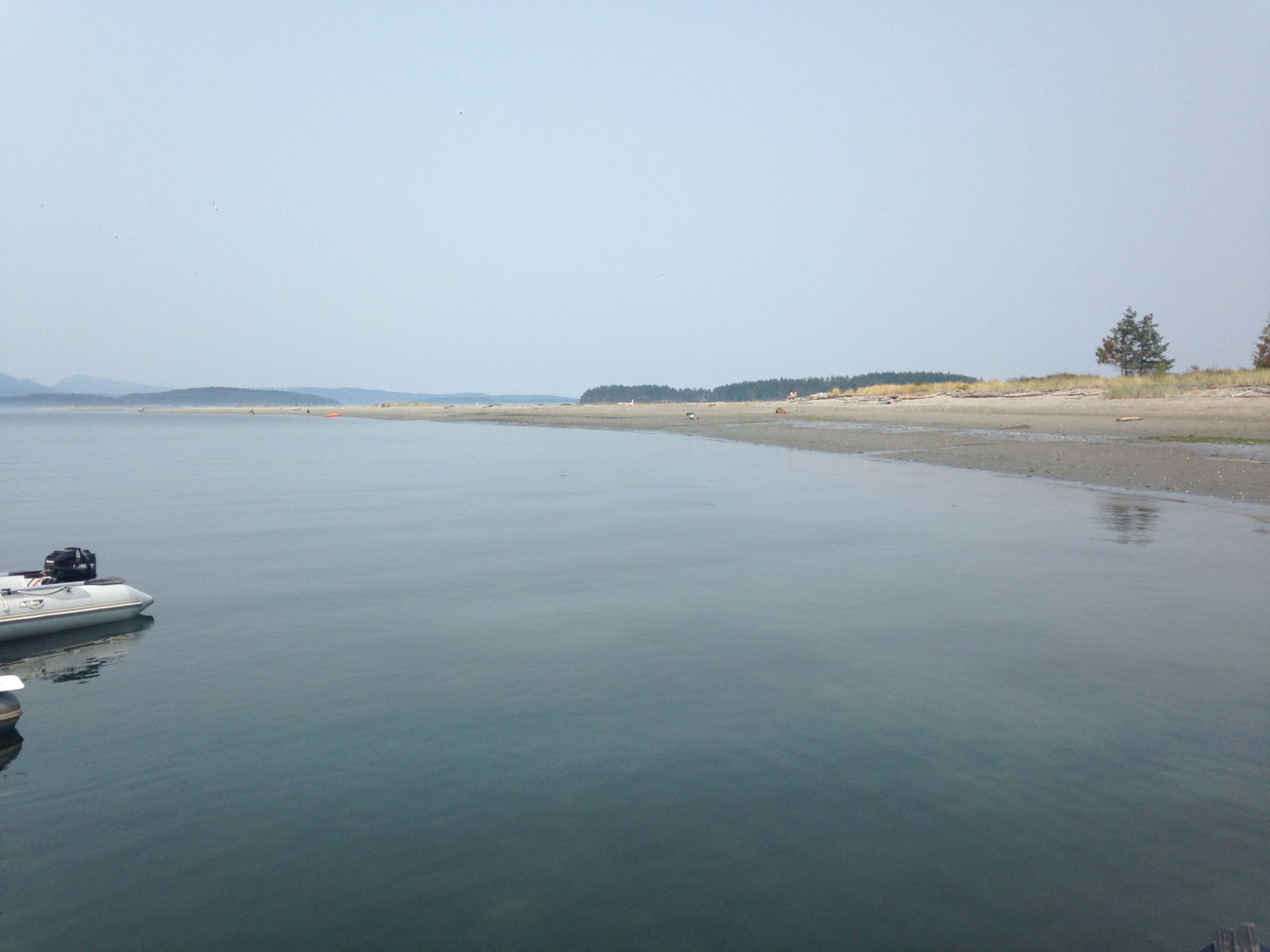
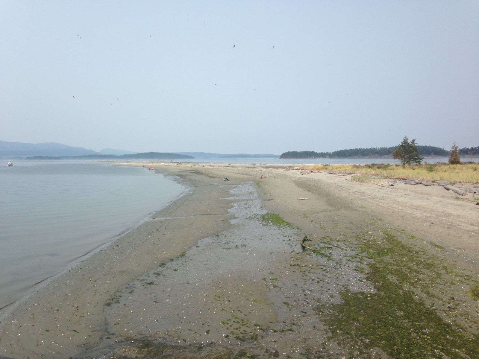
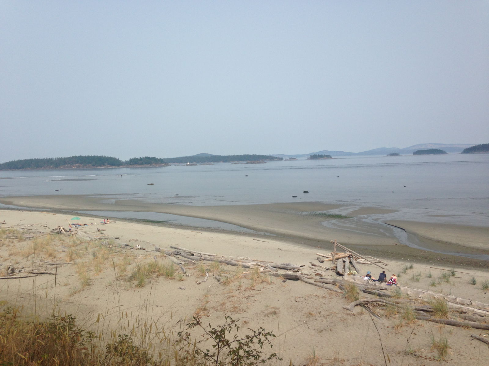
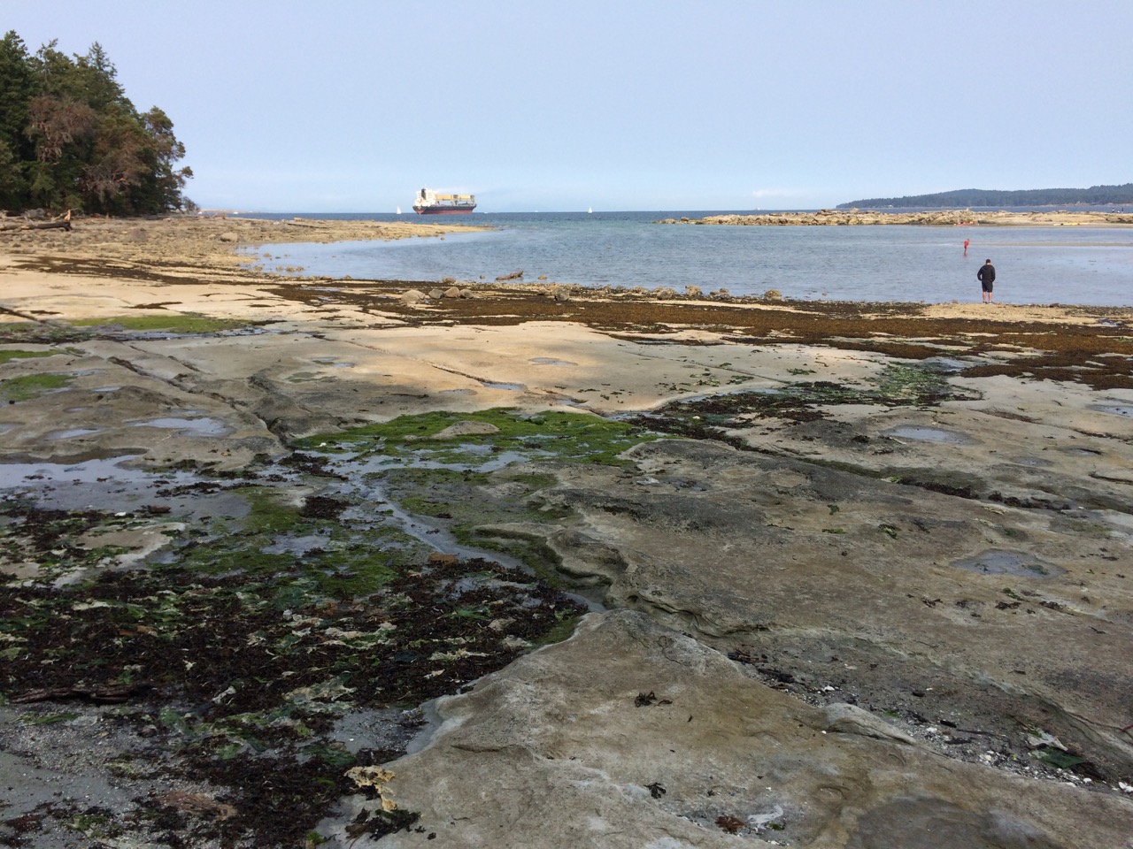
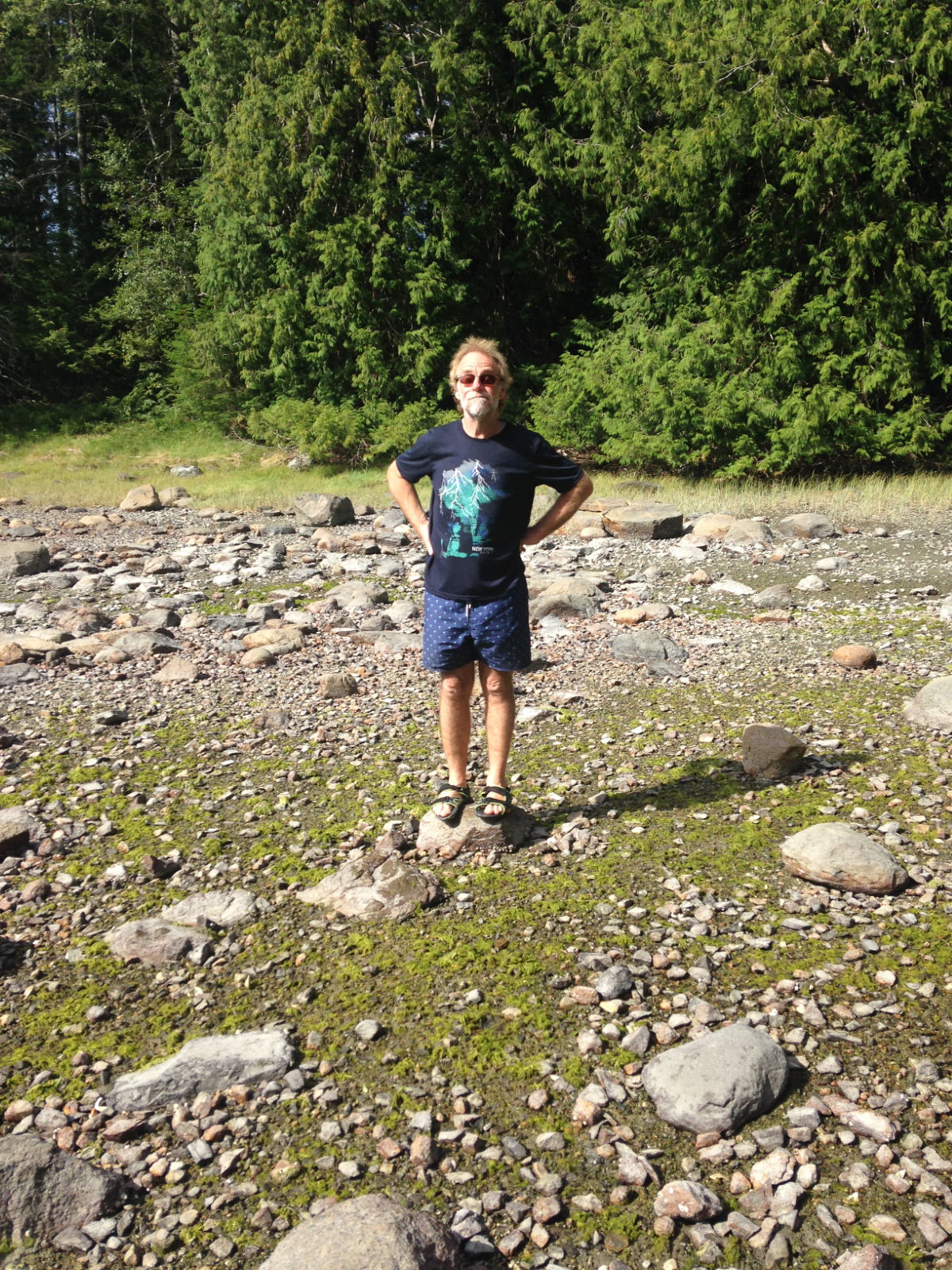
Our final place in Canada before we crossed the border to the US was Sidney Spit on Sidney Island, part of the Gulf Islands National Park. After trying unsuccessfully to anchor on the slippery kelp seabed, we picked up a mooring buoy. As it was early afternoon we launched the dinghy, parked it at the jetty and walked the length of the narrow sandy spit and back. It hadn’t looked very inspiring from the boat, being so flat and colourless but the sand was littered with enough things to delight any beachcomber. We saw all kinds of pretty shells and stones, fishing debris, unusual plants and washed-up logs, but thankfully no unsightly rubbish or plastic bottles.
Paul in the kayak, Sidney Spit
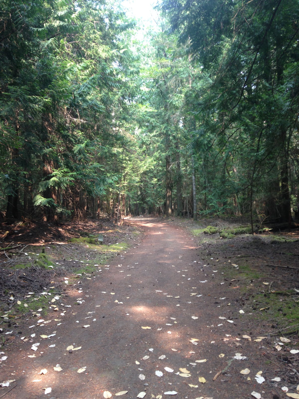
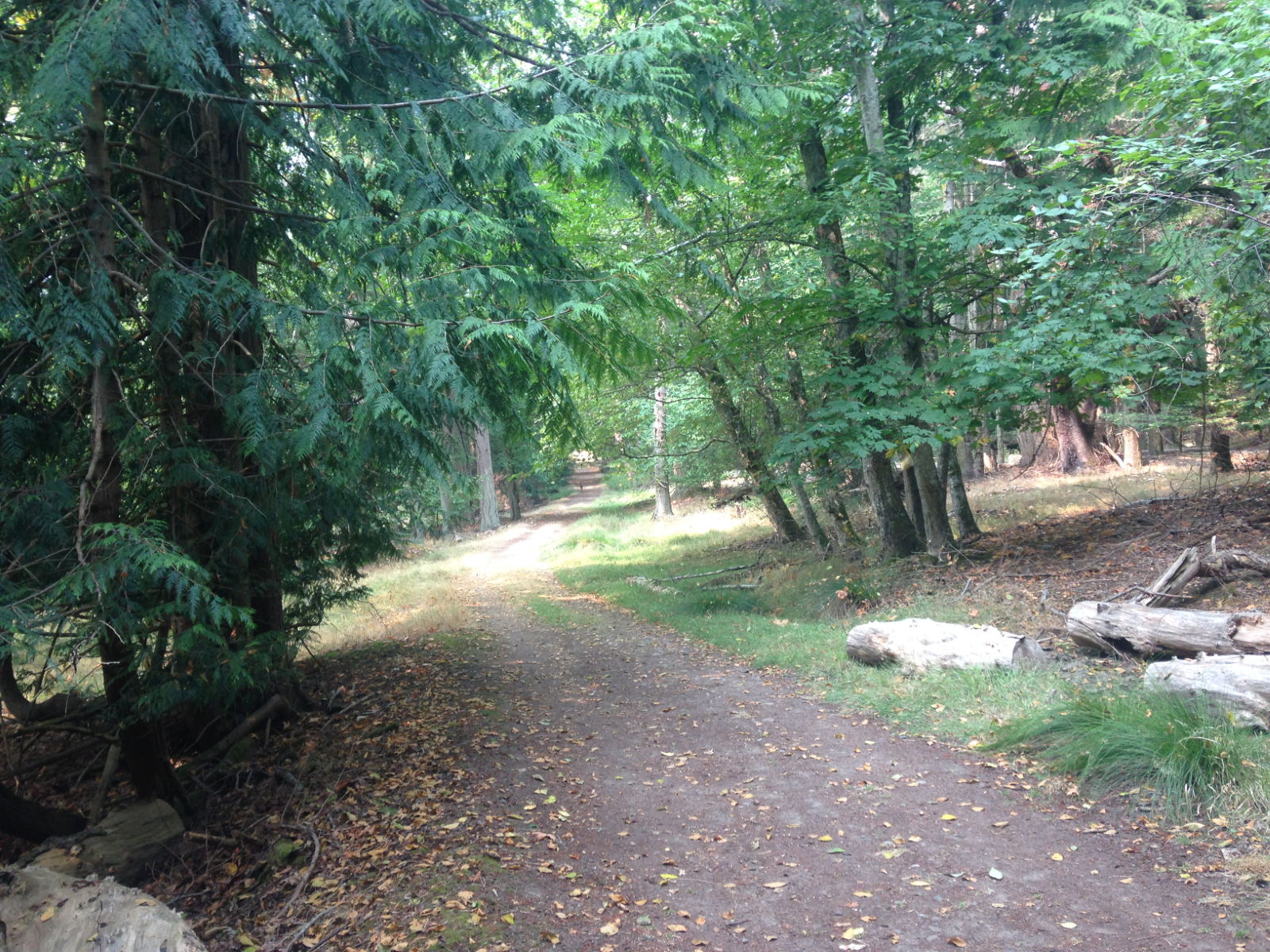
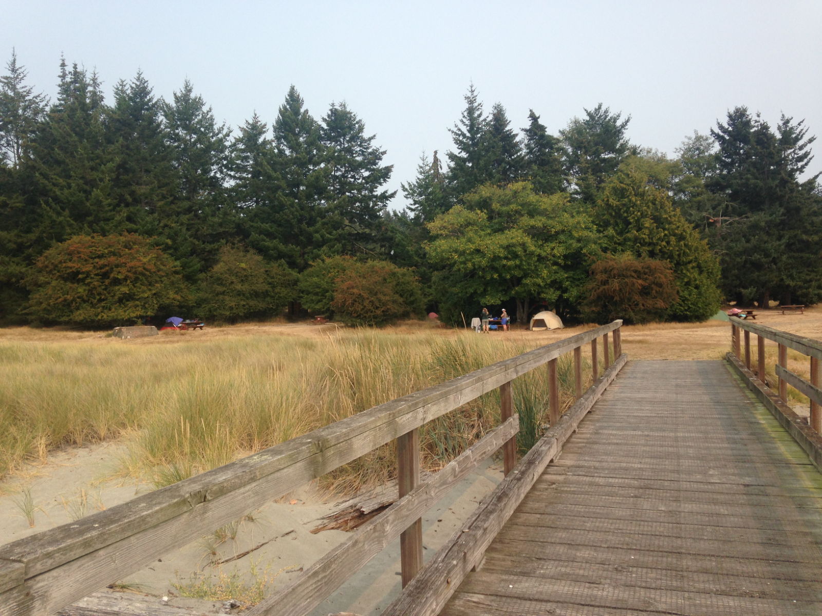
We spent two nights at Sidney and on the second day we went on another nature trail. Having spotted picnic tables the day before, we took a packed lunch with us and after parking the dinghy, set off through the forest. The only wildlife we saw was a solitary deer in a classic ‘deer in the headlights’ pose in the centre of the path. It was a lovely walk though, and the tall, red-trunked cedar trees gave off a wonderful aroma. We ate our lunch near a campsite by the old brickworks. Surprisingly, from 1906 until 1915 the Sidney Tile and Brick Company operated a thriving brick making service utilising the island’s clay. There are still lots of red bricks littering the area. Children from the campsites build towers and structures with them now.
There is a deer in the distance 😉Campers on Sidney Island
Back on the boat that evening, Paul was on the coach roof with binoculars looking at whales in the distance, their blowholes spouting water – a bit too far away to see properly but great to see nevertheless. We also saw seals diving and resurfacing in the flat calm water. I could still smell the gorgeous aromas coming from the forest on the evening breeze. No air freshener could ever capture that unique fragrance. It was a fitting evening for our last one in Canada for a while. The next day we would be travelling on to the United States.
Monday morning
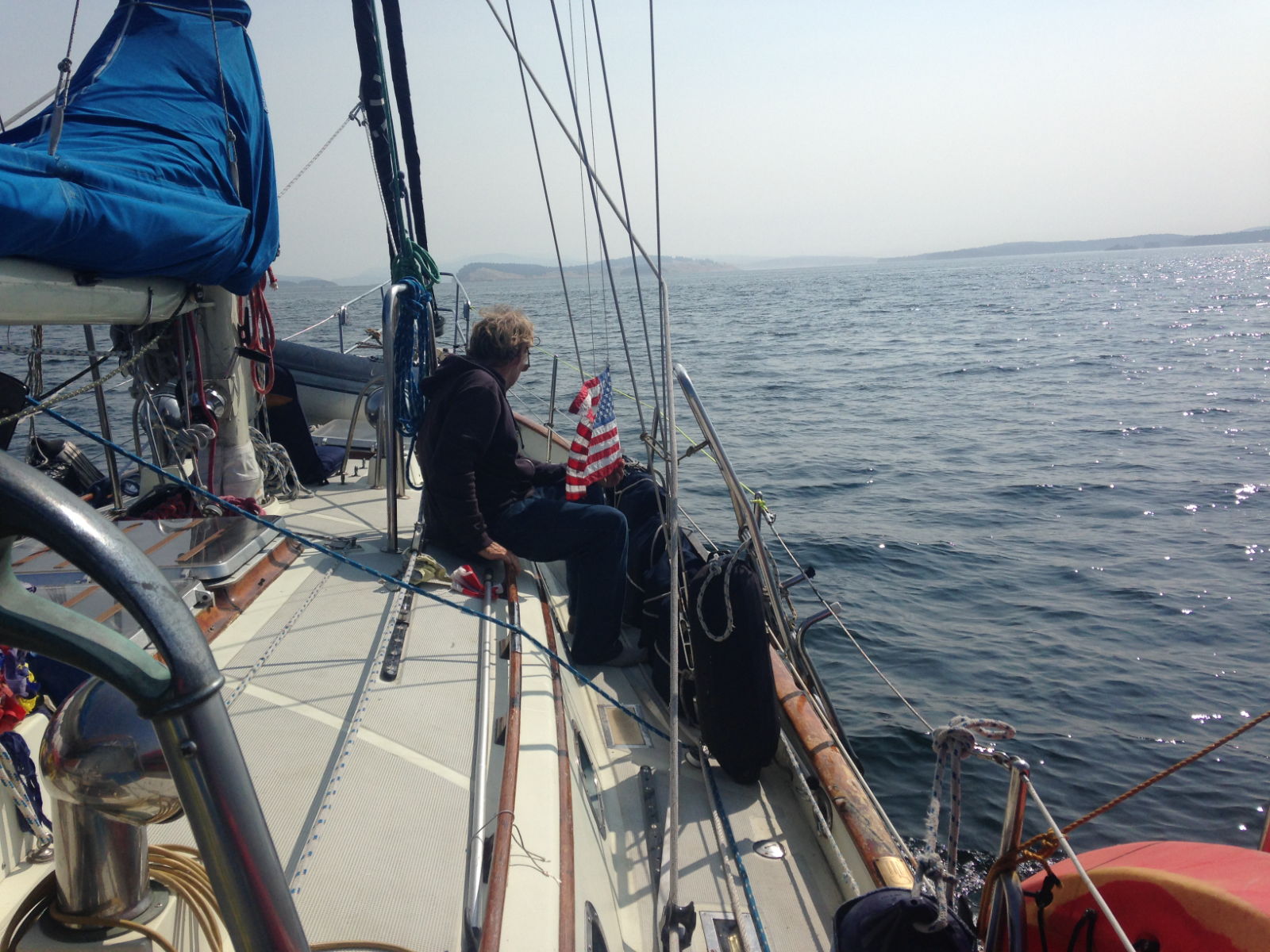
We left Port Ludlow in a most relaxing manner, not an early start, but with a little wind blowing us onto the dock I thought it was a good time for Kathy to try springing us off using the prop walk. This is the way many big boats often get away from the dock when space or wind is making it difficult. Basically if you are port side too, as we were, you put the wheel hard to port, full ahead with the throttle and basically try to run over the finger, but before the boat makes any real headway, the stern has swung out, and you slam it into reverse, wheel amidships and back you go. It works a treat when you have the room for the bowsprit to swing over the finger, and not take out the mooring pile.
Once away we were out into the foggy waters of Puget Sound. Many other yachts and motor boats appeared and were all heading roughly the same way. We crossed through the Traffic Separation Scheme at one of the roundabouts and just a few hours out of Port Ludlow we were hanging out the fenders for Shilshole Marina, Ballard, Seattle. I hoped when we arrived, to find a shop with a lady selling shells, so I could point her out to Kathy and remark that “She Sells Sea Shells in a Shilshole Shop”, but we didn’t find one 🙁
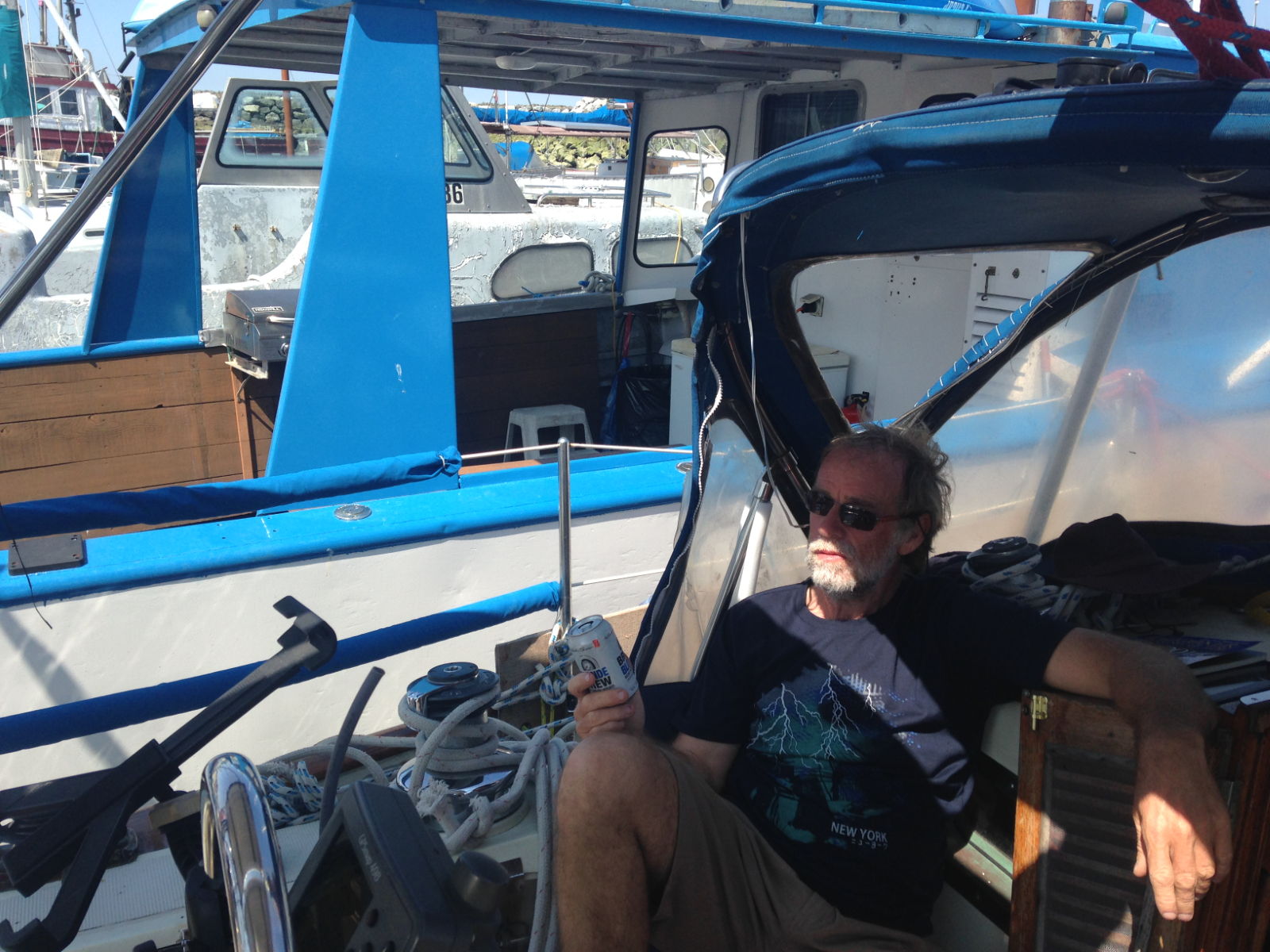
This guy enjoys his ham radio
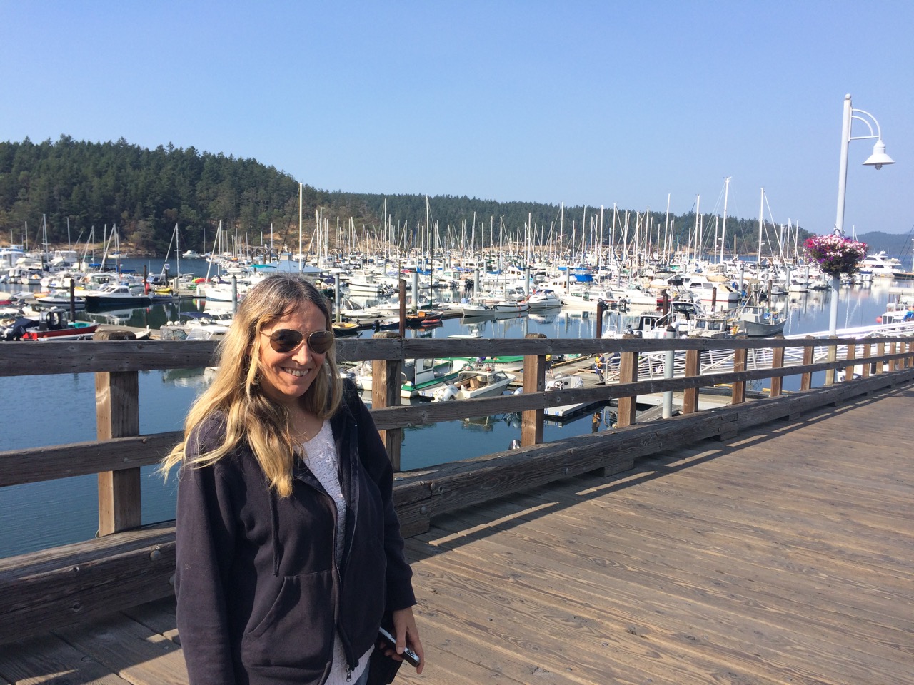
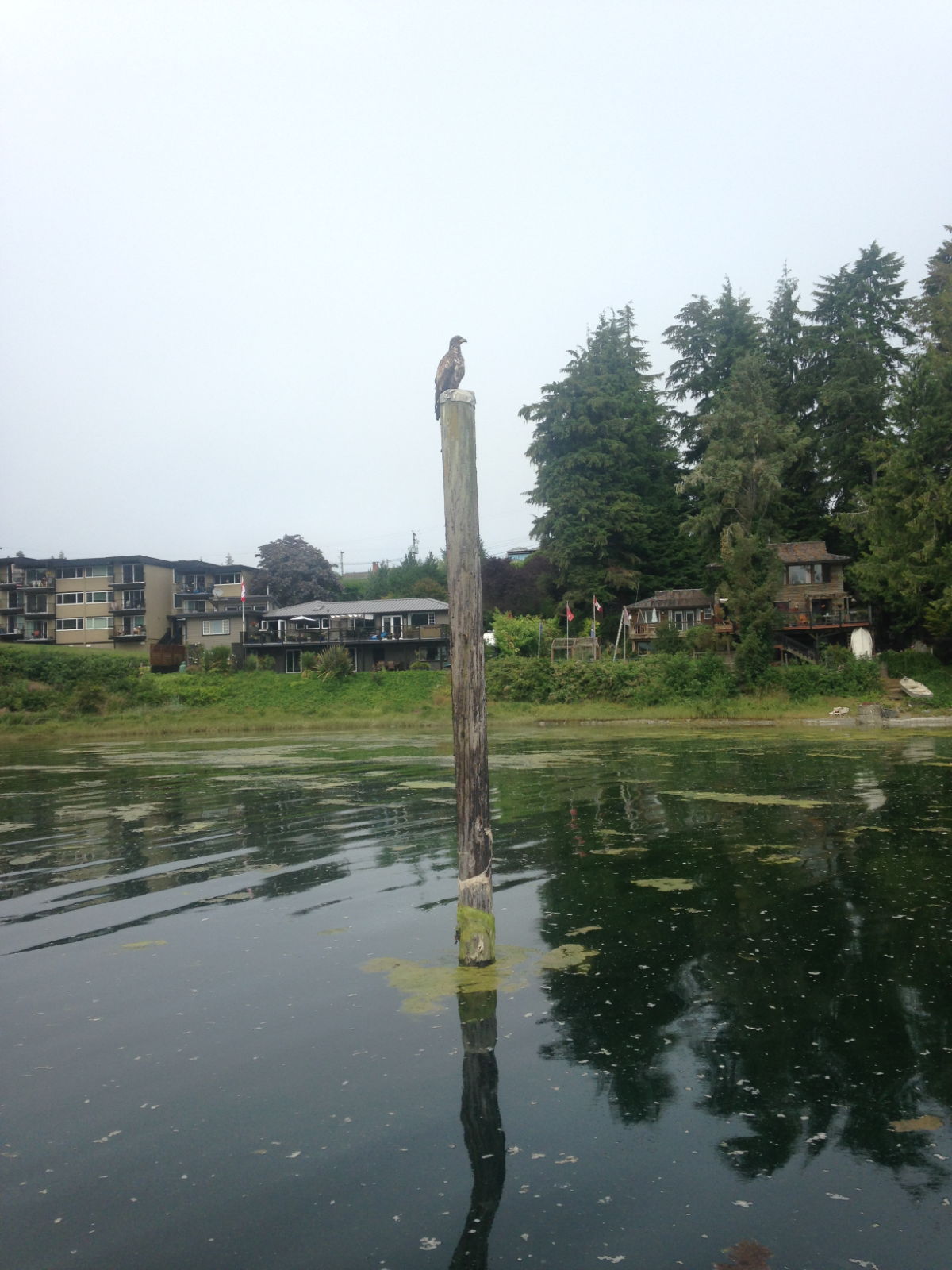
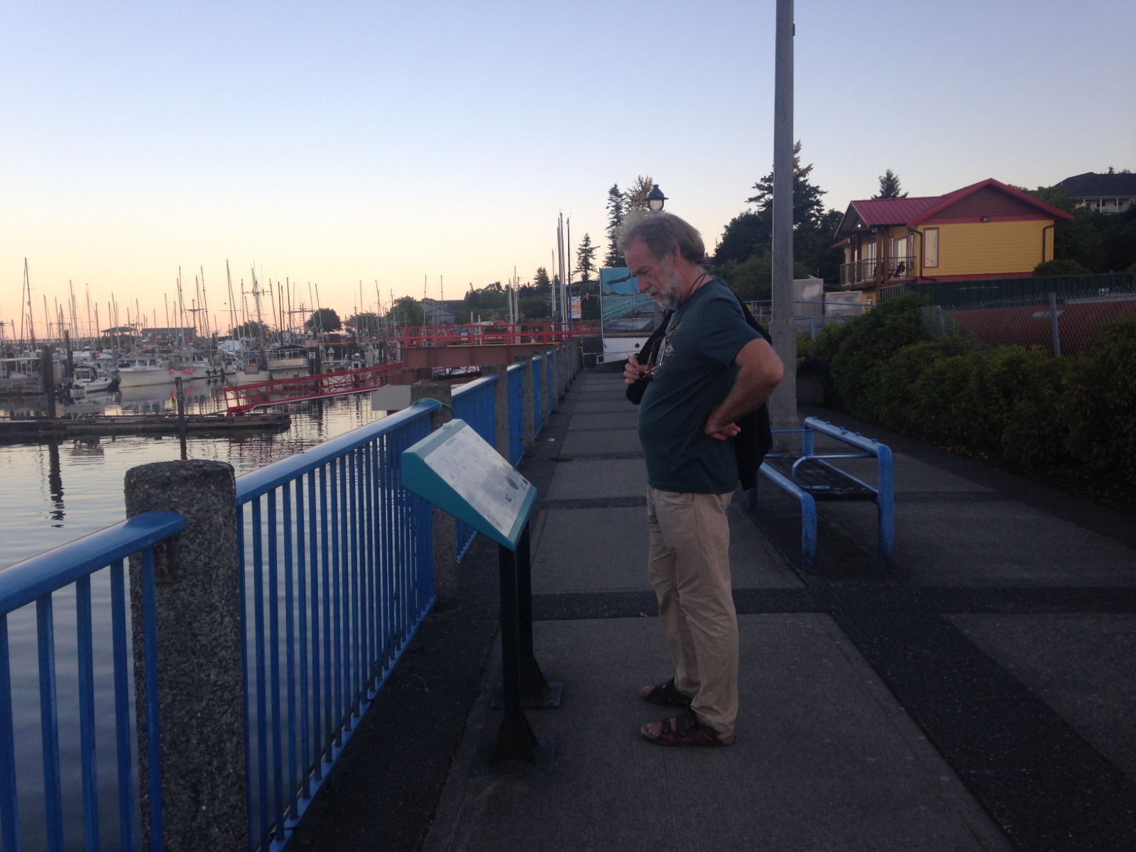
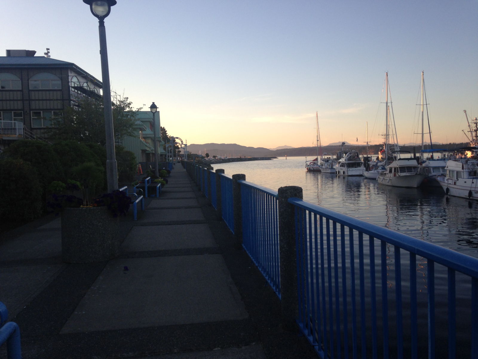
Shilshole Marina is on the northern shores of Seattle City, on the edge of a district called Ballard. It’s a huge marina, hundreds of berths with some interesting boatsand is next to the entrance to Lake Union and Lake Washington, which you access via the Washington Ship Canal after passing up the Ballard Locks.
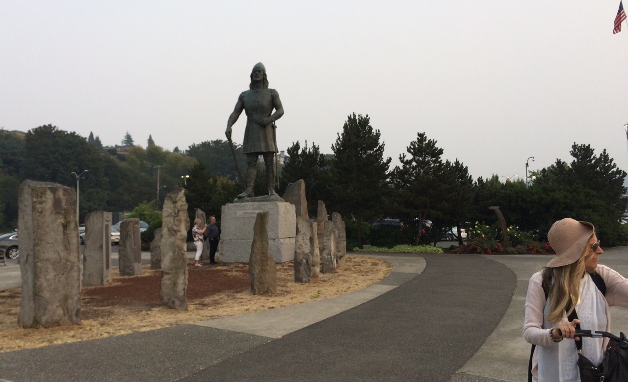
Lief Erickson who is famous I believe.
We easily tied up, checked in for two nights then set off to get provisions from the local Safeway. My local supermarket in the UK was a Safeway until they went bust and Morrisons took over, so I was keen to see if this Safeway did the 6 brown rolls for a pound offer. Again I was disappointed, however they did have a stunning array of Artisan bread, but I’m past paying $4 for a loaf. On the way to the grocery store (as they call it here) we stopped by the Ballard locks, there’s a good chance we might be going through them soon, and watched some boats pass into the lake side, it all looked pretty straightforward. We also watched the salmon in the salmon steps making their way home. A special underground viewing spot has been built to allow you to watch the salmon trying to get back to their birthplace. You can also see outside the locks, many salmon waiting to enter the passage with the steps. This is a man made version of the rocky rivers and waterfalls they would normally be tackling, all built by the US Army when the canal was first created.
My first job was to get SIM cards for us and get some data connectivity. Seattle doesn’t seem too hot on giving away free internet, and most of the marinas don’t have it, but in Shilshole you can subscribe to a fancy service. However for $45 with AT&T we each got a month of free calls/text and 6gb of data, which isn’t bad, a lot better than Canada, but nothing like Malaysia where 1gb of 4g costs 50 cent.We now have AT&T US numbers and are up and running on the net.
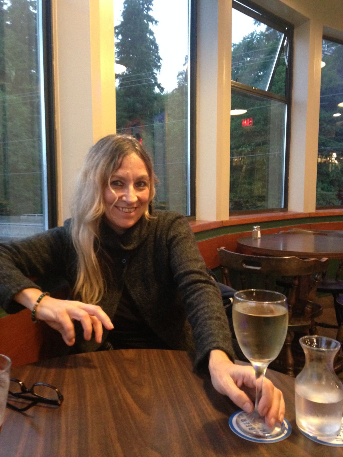
We popped into a bar on the way back and Kathy enjoyed her glass of wine while I spent an hour trying to get my SIM card to work. (It looks like they like the stout here)
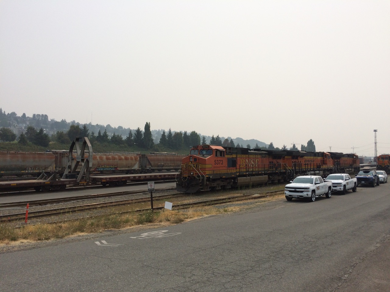
I’m taking my time to get used to the American gregariousness, one one level, I’m sure the checkout staff at Safeway don’t give a monkeys about whether I have a good day or not, and I guess when you have said it/ heard it a million times, it probably loses its meaning anyway, on the other hand we meet some very friendly helpful people, who genuinely do seem to want me to have a nice day. Being a normally reserved Englishman, it’s a little confusing. A smile is usually sufficient 😉 Things are pricey here in Seattle, as they were in Canada, I could just be getting too miserly, if I divide the cost of everything by 2 then everything seems fine, but that plan has a long term flaw. Also we are coming from a few years in SE Asia where $3 gets you a very nice dinner.It’s great to have a good choice of quality produce here, also I love the sights and sounds, big trains, pulling never ending cars (They call train trucks cars here). The whistle of the locos and the sounds of the police cars make me think of Casey Jones and Hill Street Blues!
Yesterday we headed downtown, we took in the Elliot Bay marina on the way as they had an offer for longer term visitors I wanted to check out. The city have made great bike trails here, but sadly for us the Seattle port Authority made a new cruise terminal dock on top of the trail, at least that what it looks like on google maps, so we had quite a detour to get to the marina.However once there we signed up for 2 weeks berthing. We cycled onto the space needle area, as we planned to spend a few hours in the Pop Music Museum there, however when we arrived it was getting late and I was surprised to see the admission fee was nearly $30 each, and I don’t even like grunge. $30 buys a lot of shackles! So we decided that Kathy would come back later in the week and spend the whole day there to get her moneys worth while I took my $30 down to the docks to see what I could find (In the chandleries).
One thing I hadn’t really appreciated about Seattle was the amount of hills around, for some reason I had always thought of it as a coastal town on a strip of coast in the NW of America, but looking at a map it’s a complete mess of mainland, islands, islands that are actually connected to mainland by spits, canals and lakes.Once again I find myself in a place where I think I need a year or more to fully get to know the geography and a bit of the culture.
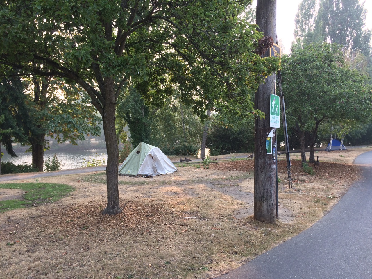
After the Museum recce we headed back hoping to take in one of the other big supermarkets here. It was going to be a ‘Fred Meyer’ or ‘Trader Joe’, both great names I thought. We followed the shoreline of Lake Union on the way back.Then over to Ballard across the Ship Canal.There is no shortage of homeless people sleeping on the sidewalks and in tents on grass verges here.
We ended up at a gigantic Fred Meyer, that was like a B&Q and Tesco in one. Good prices too, so stocked up we headed back to the boat.
This morning (Wednesday) we slept in, and at 11:30 slipped our berth in Shilshole and motored the 4.9NM West then South East to Elliot Bay Marina where we are checked in for 14 days. It’s lovely here, very peaceful,It’s about 25 minutes to cycle into the centre of Seattle from here, so I expect to be doing a bit of that, also it’s close to Ballard where there are stacks of marine companies that can help me get some of the boat jobs completed.
We left Nanaimo at a decent time, around 10:00 to make the 90 minute passage to Dodd Narrows. At full flood the currents here are over 10 knots and this is considered one of the most treacherous passes in the region.
Courtesy of sv silhouette
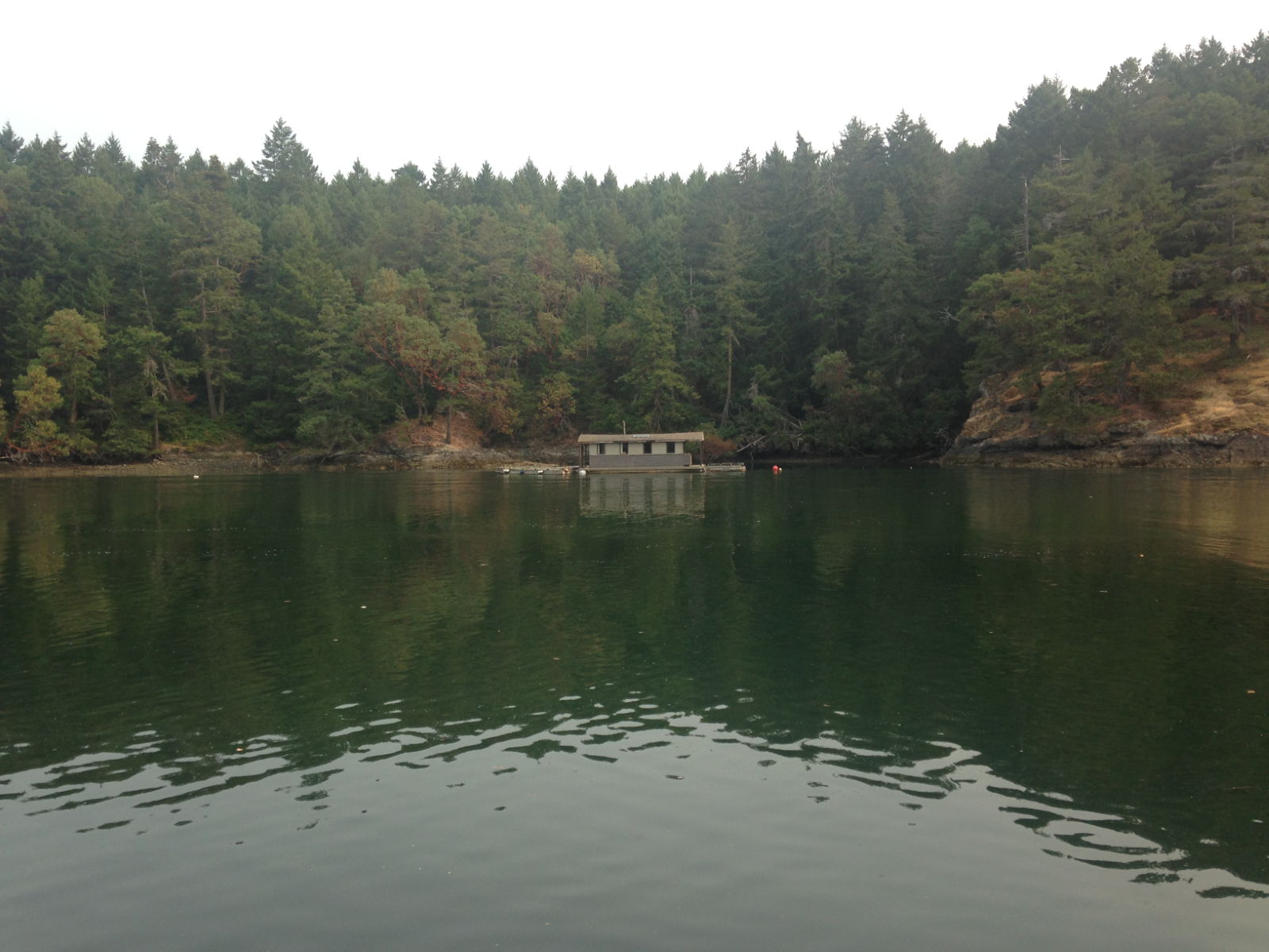
Slack water was around midday and we actually arrived an hour early. I watched a yacht go through using my binoculars, it looked a little bumpy but I figured we could make it. We had the ebb tide with us giving us about 4 knots of push, and by going now it was less likely we would meet any boats heading in the opposite direction. It has a bend in it so you cant see the exit. There were a lot of other yachts and power boats hanging around for slack water. We put out a ‘Securitie’ announcement on channel 16 for any concerned vessels to contact us before we entered the narrows then headed in. I would soon see how difficult it could get, there where whirlpools all around us and standing waves in places, but right in the middle it looked calm. This didn’t stop the water from yanking the boat off course several times and I had to be quick with the steering to get us back on course. It only took about 5 minutes in all to get through then we were into boring calm waters again. We proceeded south towards America, next stop Prevost Island and a little bay called Annette bay. This was another lovely wooded calm spot, but quite popular with other boaters. There was a floating holiday home in the bay which was tied to a mooring buoyLater in the day the tide turned and we got to see a different aspect of the house. For the people sitting on the deck in their loungers it must be great for the view to be changing all the time.It was a very peaceful evening there and early the next day we were up and off to Sidney spit, a small nature reserve just of Sidney, Vancouver Is.
There was a small jetty and mooring buoys. The chart and guides show anchoring locations around the buoys so to save a few pounds we dropped the anchor, first time failed and I recovered the anchor completely covered in Kelp, we motored to the other side of the mooring buoys and tried again, this time it set but then under a good pull from our engine the hook jumped out and I recovered the anchor to find an old rope wrapped around it. By now I was thinking we were going to struggle and boats were arriving fast with only a couple of free mooring buoys left, so I motored over to one, Kathy took the helm and expertly brought us alongside one buoy which I hooped a rope through and that was it, job done, retire to a diet coke for me and a Pinot Grigio for Kathy.
We stayed for two nights here, the first night we walked the length of the spit along a shingle beach, the next day we walked the forest trails around the island.
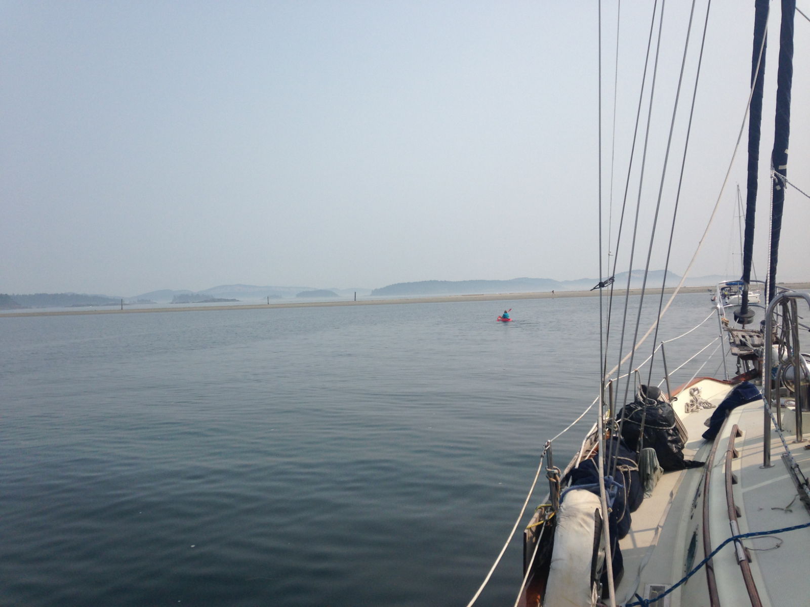
Next we headed off to Port Friday which is in the USA on the Island of San Juan. This was a little stressful as we knew we had to go through the US Customs and Border Protection officials to be allowed in. We had already got our mandatory visas in London last year, and had phoned ahead to inform them of our arrival, but having heard of some problems people have had at airports when they are in anyway ‘different’ from your regular joe, and stories of passwords being demanded so they can search your phones, facebook accounts etc, we wondered how this would go. Another worry was to do with what food we could bring in. We still have a few dozen tins of tuna, beans, custard etc, some cheese and soy products. The website is quite vague and refers you to other departments that suggest you contact them if you’re not sure. For example most animal products are banned, but that doesnt cover cheese or chicken, but does cover beef.
As it turned out the worry was all for nothing, the biggest problem we had was getting alongside on the customs dock. When we arrived it was full with two huge superyachts, once they moved a queue of returning american power boats jostled to get in, we waited for them to clear, but we had to be careful as the water off the dock was also the airstrip for the float planes, which seemed to be taking off and arriving every 5 minutes.
Once ashore the CBP lady explained the procedure to me, I had to fill in a form, much like you do on a plane, she inspected the boat by standing on the dock and looking at it. She asked if we had any goods to declare, I said cheese, she said “CHEESE IS OK” and we were done, She was probably the most no nonsense lady I have ever met, I had thought about being jovial, but decided against that. We got 9 month visas and given a cruising permit to make our lives easier when travelling around.
Port of Friday Harbour is a massive place, with a great range of vessels berthed here
We spent one night here and left at 5:50 AM the next day for Port Ludlow. We had to leave early as the forecast was for stronger winds in the afternoon and adverse currents, as it turned out the currents were bad enough and the weather forecast was wrong again. Still we got to Port Ludlow in 9 hours.On the way we saw many luxury houses set back in the trees along the coast. They looked wonderful and I mused on the fact that I might have had one if I had been born in Seattle. I was writing software for a word processor, much like Microsoft Word , back in the 80’s. Had I been in Seattle, I might have been on the Microsoft team writing Word, and by now be head of word processor hyphenation and line wrapping, or some other wonderful title. My small allotment of company stock might have bought me one of these waterfront mansions, and as I said to Kathy that I might also be on my third young blonde leggy wife by now too. She pointed out that if that was the case, I probably would be broke and have lost the house by then!
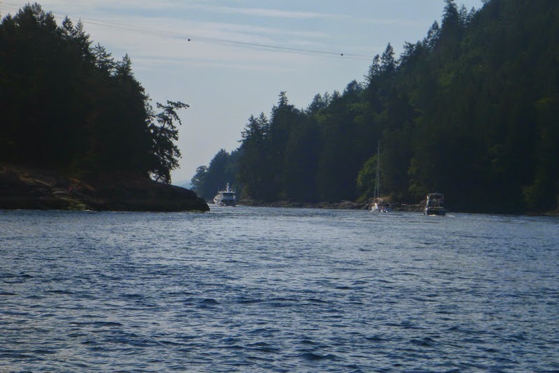
But back to reality and a sharp lookout had to be kept, these are busy shipping lanes, but fortunately they were quite quiet for us, however we could hear naval activity on Ch16 and the local VTS (local traffic management) channel, I couldn’t figure it out until I saw a submarine and escort vessels approaching us. We were planning to cross the traffic separation lane soon and they would be in my way, so I crossed early, basically at a right angle to their path, which won’t have looked good to them. They weren’t transmitting AIS so I couldn’t work out how close we would get, but we were over the separation zone long before they got anywhere near, so I was a bit disappointed that a high speed coast guard rib was dispatched to tell me to watch out as there was a submarine passing by, Duh, and that I would be ok if I kept my course, which I thought was fairly obvious. Talking to a local later in the day I heard this is very normal, and in fact they will buzz any yacht in the vicinity and chase them ‘into the hedges’ as the guy explained.Arriving into Port Ludlow saw the wind drop to zero, and the sun come out, the fog left and it became a glorious day. Port Ludlow is a small community town, with a few shops, a marina which is part of a Golf course resort, and a few holiday homes and ‘condos’.
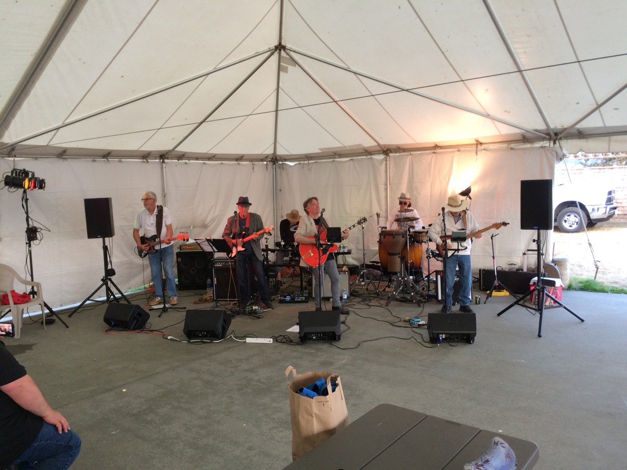
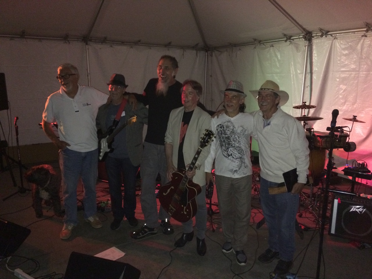
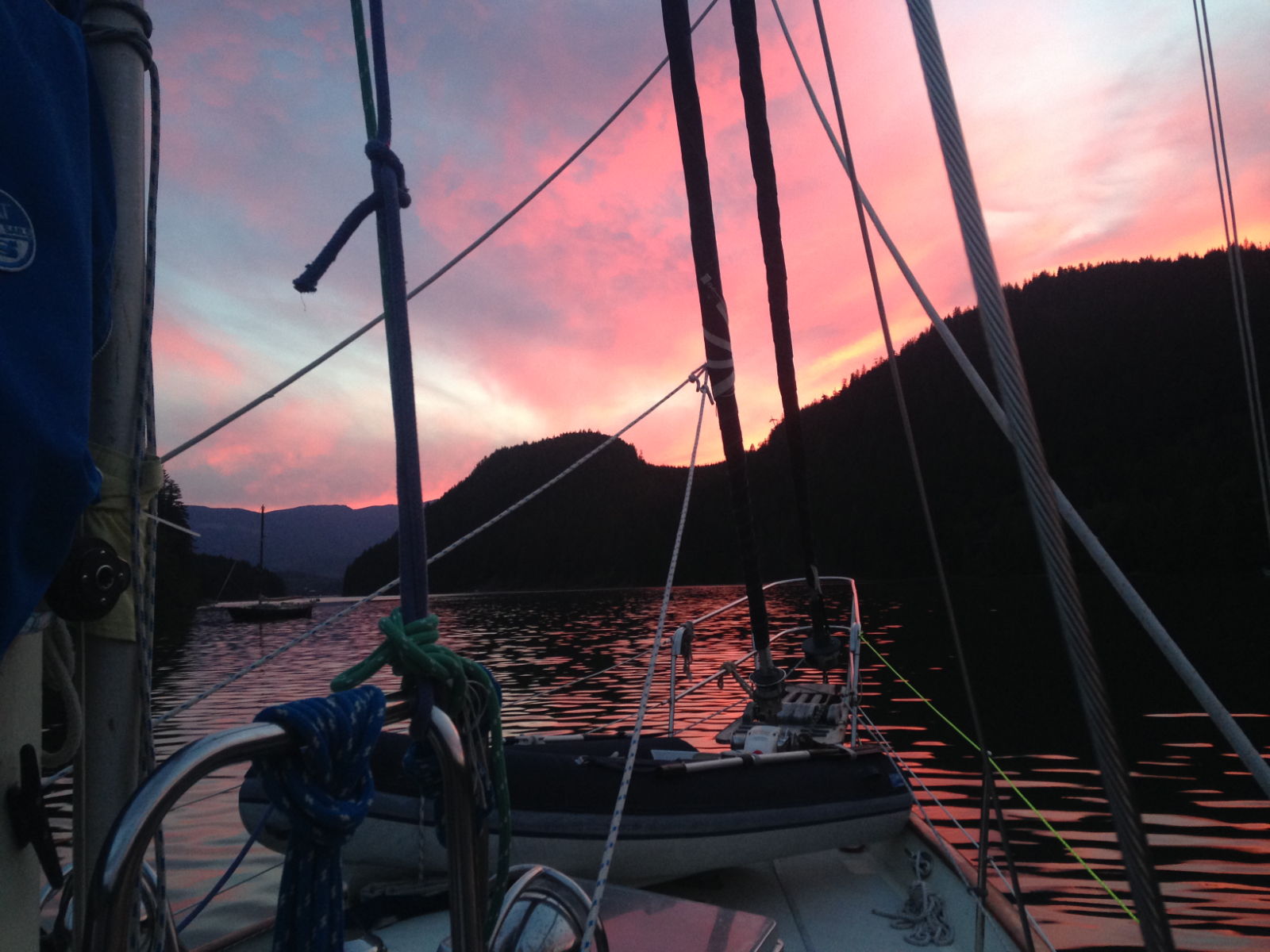
This was our last deadline, the Bob Perry Rendezvous, we have no more deadlines other than a desire to fly home mid October. The Perry rendezvous happens every year and is a getting together of all boats and/or owners that were designed by Robert Perry. These are Tayanas, Babas, Pandas, Tashibas, some Hans Christians, Passport Yachts, and a gang of others. Boats mostly arrived on Friday and we spent Friday night walking the docks and meeting the owners, swapping tales and checking out the differences in our boats. I met some lovely people here. Saturday Bob had organised talks by two people, a professional boat delivery skipper, and a Rigger from Port Townsend Rigging. That was fun, later we had a big potluck dinner in the pavilion here, followed by a performance from the ‘Perry Rendezvous All Star Band’ which was six guys in the form of Crosby/stills/nash&young/Eagles/Stones with Bob Perry himself playing Bass guitar. They were pretty good I must say, not my kind of music, I was born just a little too late for that, but Kathy loved it. Bob is on the far left of the pictures.
I got chatting to one of the guys sitting on our table during the meal, he was very friendly and keen to offer me tips on moorage. He, like many there was a friend of Bob’s and he also had a boat, but not a Perry one. But he also had a truck, which was quite a beast. I was keen to see his boat, which turned out to be just as impressive, and had me thinking of what kind of boat I would like next. Something small, fast and maneuverable, but mostly, something that looks great.Finally I’m in a cold place, at night here with clear skies the temperature drops. The waters here are quite cold and consequently the sea breezes are very chilling, so at long last, after many years I was able to put my Irish sweater into service. It’s doing a great job, thanks to Tim and Asta who bought it for me as a present, some time ago. Tomorrow (Monday morning), we leave around 8am for Seattle propper, we are booked into Shilsole Marina, just north of Ballard, once there we will have to find somewhere affordable to stay for the next four weeks as the daily rates are too much for us. Thankfully the people at the rendezvous have been really helpful with tips and suggestions, and a few have offered to meet up with us in town and show us around.
I met a couple of guys who had boats next to us in French Cove, one was from Nanaimo and suggested we try to get a space at the Yacht club there, so I phoned and found out that we could stay there as we were members of another yacht club (RYA & CA), but because we didn’t have a reciprocal agreement we would have to pay $30 a night, which was pretty good, and only a little more expensive than a mooring buoy.
So we untied and headed out of the government harbour to make the short 4 hour passage to Nanaimo. as we turned the dog leg at the exit I shouted to Kathy to get the revs right up, I could see the big waves crashing into the marina entrance and our gentle motoring wasn’t going to get through them. A few minutes later it was like being back in the ocean, 15 knot headwinds with big waves and the bowsprit getting soaked by the waves. I knew the forecast was for strong winds, but this was more than expected and from the wrong direction. We motored south for a while but the wind was building as were the waves and as soon as our speed through water dropped to 3 knots I put up the mainsail with a double reef and 75% staysail and we started to tack our way towards our destination. Now I dropped the revs on the engine right back and we sailed close hauled for the next 5 hours until we reached Nanaimo.The sky turned black and it started to rain, but just before we arrived the weather moved on, the wind dropped, the sea calmed and into Nanaimo we motored to look for our berth. by the time we tied up the sun was out and I was pleased to be there, but had quite enjoyed the sail.
You can see our planned route in blue, our actual track is in red, not a bad angle on the wind really. There is a dotted/dashed trapezoid shaped box on the chart known as “Area Golf Whisky” This is a military exclusion zone, you can see I tacked over the western end, then across the middle. I could see the Patrol ships on the AIS but they didn’t bother me. I had read somewhere that they only use it on weekdays. It’s used for testing torpedoes, apparently they launch them at one end of the zone towards the other. All along the seabed of the zone they have sensors to record the progress of the torpedos, data is fed back to the base on Ballena island, which we tacked around.
Arriving into the marina down the narrow newcastle strait we had to watch out for seaplanes and ferries that use the area a lot. The seaplanes are very common around here.
The next day (Today Sunday) we took a short ferry ride over to newcastle island, and walked along the nature trails. No sooner had we started the walk than we saw a couple of lovely racoons staring at us.
Next we saw a deer just off the track, which was a releif to me, as I figured the cougar would much prefer deer to human.
The rest of the island was trees and beach, No real sign of it’s industrial past as a big coal mine.
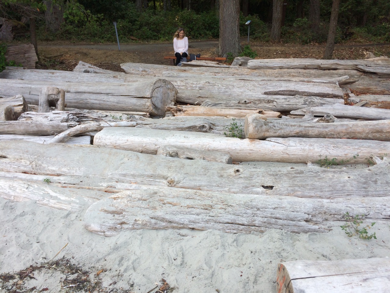
It is amazing the driftwood you get here on the beach! In the morning we head south, we need to leave about 09:30 to reach Dodd Narrows with plenty of time before slack water.
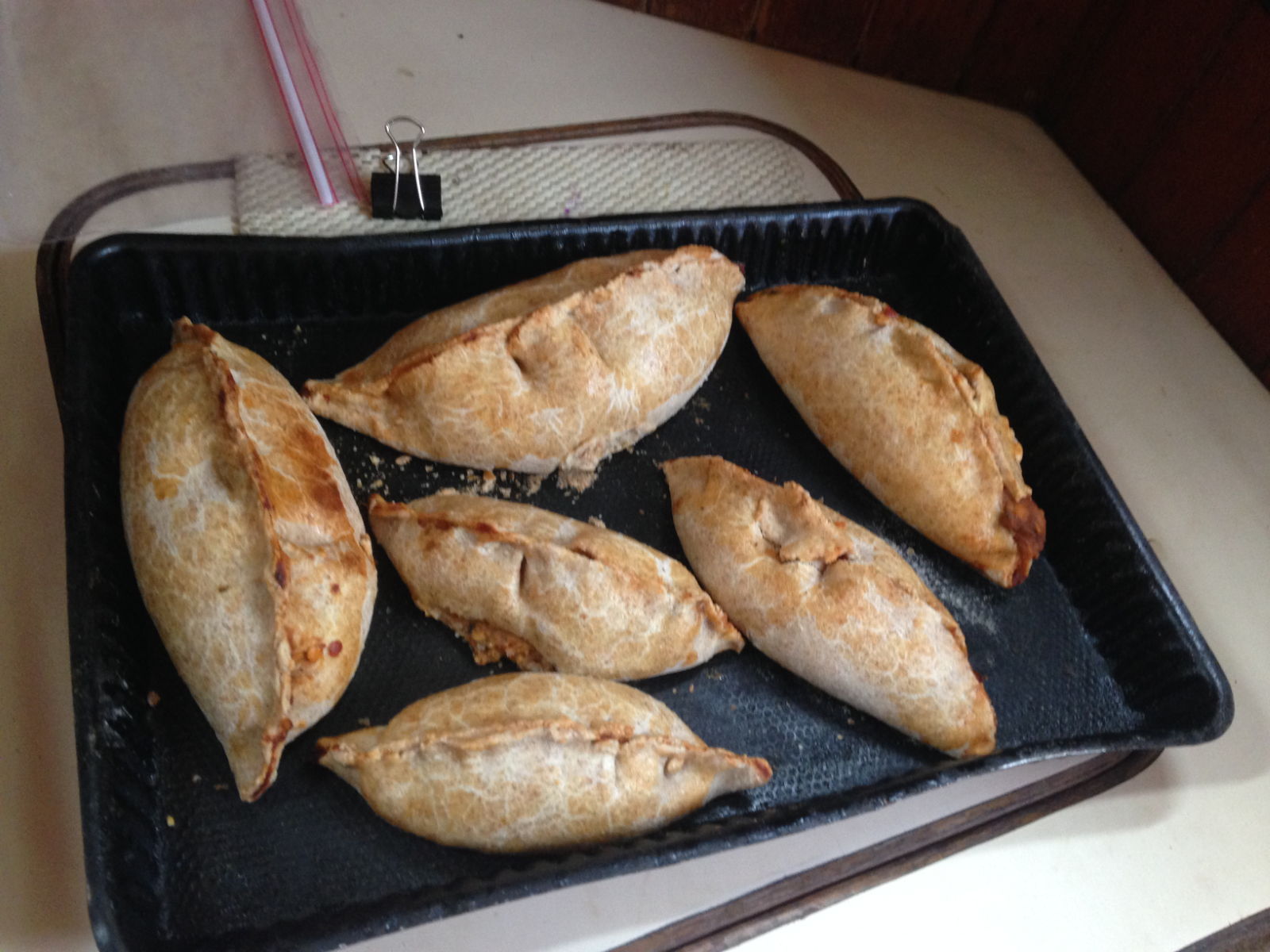
Before reporting the delights of this lovely part of Canada, here are a couple of pictures I didn’t get a chance to put on the blog during the passage – my veggie pasties and one of the better loaves of bread I baked. There was little else to photograph, with the outside being a uniform grey or off-white for most of the weeks.
After five weeks at sea, we had the best of all welcomes as we drew closer to land. It was exciting enough to see such things as trees (and there are lots of those here) and hills and buildings emerging through the fog, but when Paul described seeing ‘bear-like’ creatures lying on their backs with ‘scrunched up old man’ faces, as he put it, I knew they would be sea otters. There were lots of them, and they could be seen clearly through the binoculars in distinct little groups –diving and surfacing with their little front paws drawn together on their chests. It seems we were privileged because we haven’t seen a single one since then. Closer in, I spotted spurts of water rising some distance away near the coastline on the starboard side, like bursts of steam. Paul said it would be a whale, and sure enough, a huge black and white hulk broke the surface, then disappeared under the water, its distinct fanned tail showing for a few seconds before repeating the process. It was fascinating, especially after so long at sea without seeing any sign of life apart from birds. I wasn’t quick enough to photograph it but thankfully Paul managed to film it before it disappeared.
The outskirts of Port Hardy emerging through the fogFisherman’s Wharf, Port Hardy
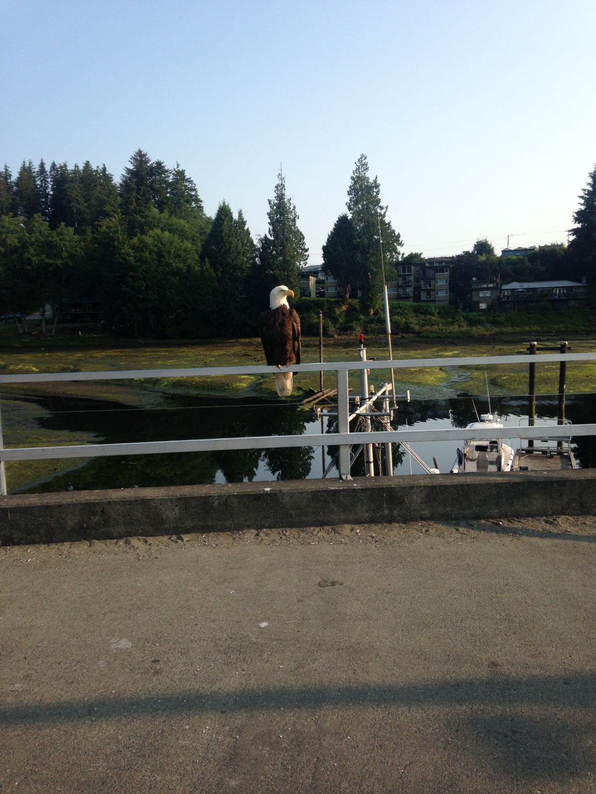
As we were looking for a pontoon, I spotted this impressive-looking bird.
We spent a fabulous week at Fisherman’s Wharf in Port Hardy, named as I’d guessed, after Nelson’s Vice Admiral on The Victory, Thomas Masterman Hardy. The marina was full but this turned out to be a bonus because the pontoons at the wharf had a great community atmosphere. The place couldn’t be described as streamlined and neat but its chaotic, higgledy piggledy layout served to make it informal and welcoming. Lots of people stopped to chat. Our courtesy flag, the only one flying, indicated our visitor status and we had the story of our passage off pat after several times of repeating it to curious passers-by. People were always impressed and had lots of questions about the trip from Japan and our future plans. Karl, a solo sailor from Latvia who befriended us, expressed alarm on learning our intention to traverse the Inside Passage down to Seattle. He told us he would be far too nervous to do it. I wondered why but Paul said he was just being over cautious. It seems all that is needed is to get the timings right for when you enter each strait, passage and river along the route. I could understand Karl’s anxiety once Paul explained about the intricacies involved with the planning and tide times in order to avoid hazards. It would be akin to getting on a roller coaster, which once underway, had you committed until the ride ended. Karl was also travelling to Seattle but would be taking the Pacific Ocean route. We hope to meet up with him in Seattle and swap journey notes.
The forested landscape and coastal mountain range surrounding Port Hardy makes it ideal for outdoor pursuits and nature trails. Information in the harbour office, advertised hikes, wildlife tours, fishing trips and great surfing spots to name but a few. For our first evening back on land, all I wanted was a glass of wine and a bowl of chips. We’d had to wait on the boat for hours after arriving because of a mix up over customs, who thought we were in the city of Vancouver as opposed to Vancouver Island. By the time this was sorted out it was fairly late and the local pub had stopped serving food (last orders were at 9 30). The Inn further down the road had a 30 minute longer time limit and we sat at a table overlooking Hardy Bay watching the sun set enjoying the first meal someone else had cooked in weeks. The drink was most welcome too.
Naturally there were a lot of jobs to be done to get the boat looking shipshape, both inside and out, but we made time to walk and cycle around the area and got to know it quite well. One of our first excursions, to get mobile phone data led us to a popular café, which is also a bookshop and has local crafts and paintings for sale. Café Guido offers free wifi to customers and after learning of the extraordinary high prices for phone packages in Canada, we opted to use public places for internet use. A visit to the supermarket later on revealed that it wasn’t only data packages that were expensive here. Despite the gloriously wide range of choice and the intriguing products on offer there, I had to curb my enthusiasm due to the steep prices even for basic things like bread and fruit and vegetables. Still, it was nice to be able to read the ingredients on the labels and of course, to find ‘real’ bread on display.
Paul tackling one of the more precarious jobsOne of several bear statues we’ve seen in Canada – no real ones yet though.
We had to continue sleeping on the bunks in the cabin for a couple of nights because water had found its way onto the mattress during the passage. That, along with the usual clothes, bedding and towels had to be cleaned and dried. The weather was perfect for this. One of the first things I noticed on land was the contrast from the Asian climate. When it’s hot and sunny here, it’s dry and clear. There’s no humidity, and in the evenings after the sun has gone down, it’s positively chilly instead of sultry and sweaty. During one early morning walk up to the office to use the wifi, I spotted the biggest bird I have ever seen outside of a wildlife centre perched on the railings. I didn’t know it then but it was a bald eagle and it was attracting quite a bit of attention so I guessed it wasn’t that common an occurrence. People were gathering to photograph and film it, for which it just remained still, occasionally turning its head from side to side, completely unfazed. One boy of about ten, told me he’d always wanted to see one this close. It seemed all the local wildlife was coming out in force for us then. I wondered when we’d see our first bear! Black bears live in the area, as well as Grizzlies and brown ones apparently. Not very au fait with the differences, a glimpse of any one of them would thrill me to bits – from a safe distance obviously.
A magnificent bald eagle
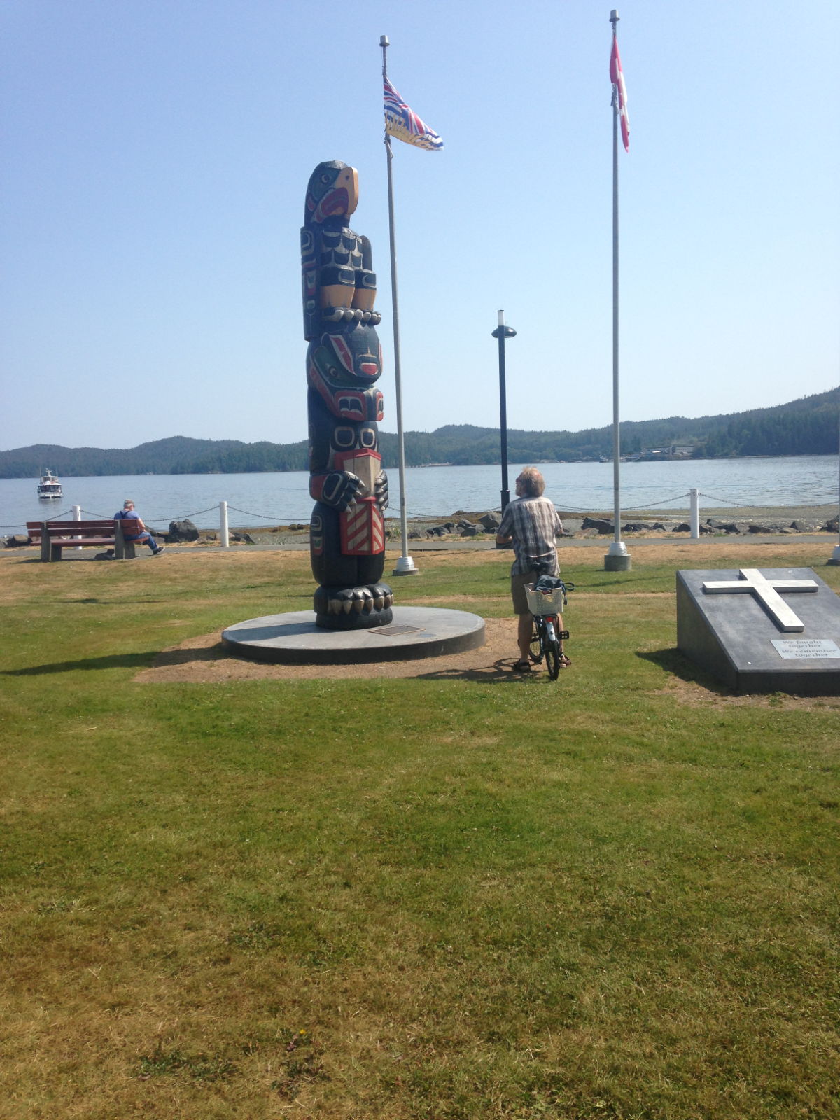
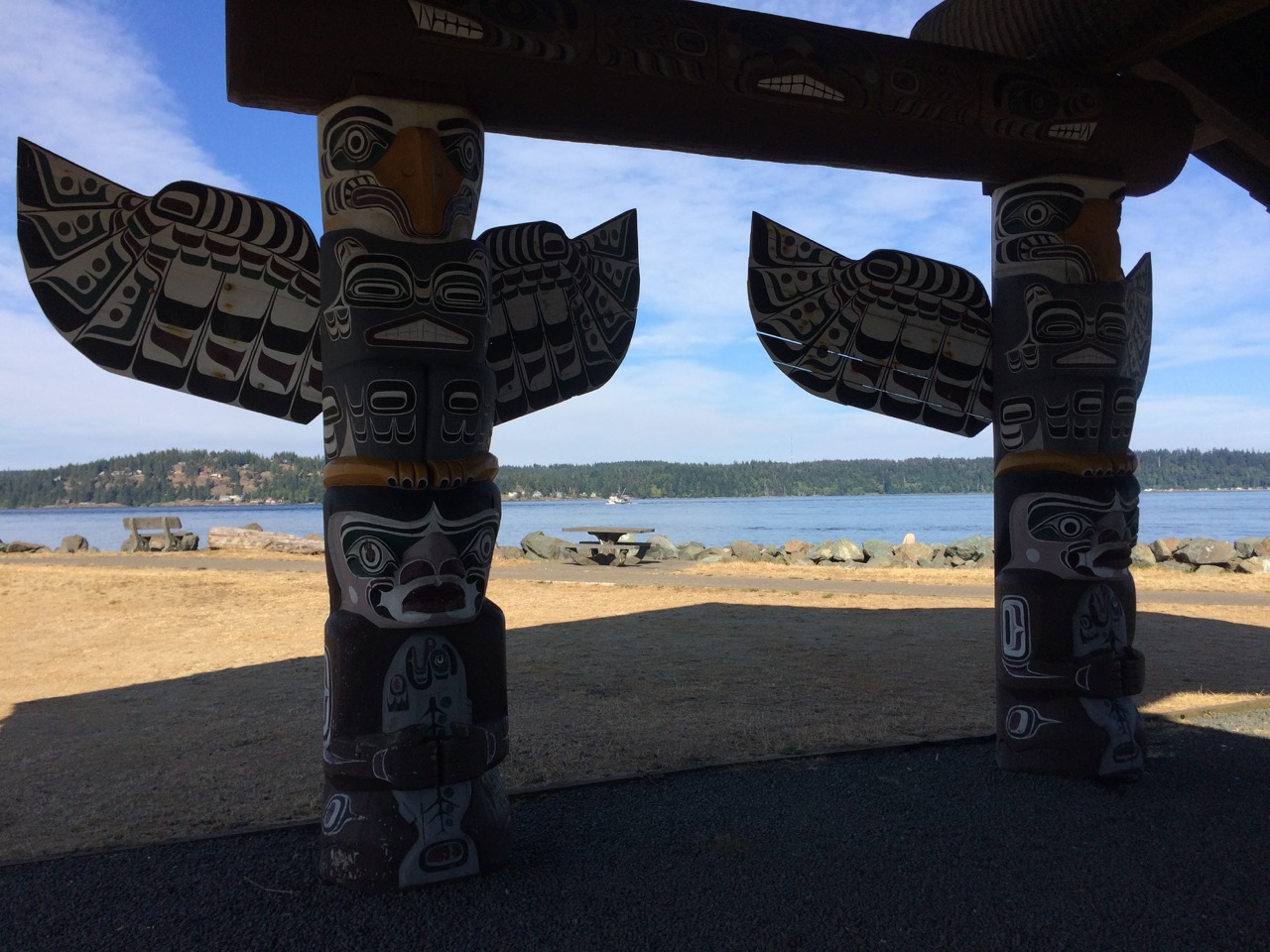
We had a wonderful cycle ride along the Quatse Loop and Estuary Trail one afternoon. Info on the leaflet we had stated that resident black bears are often seen ascending from the forest to look for a salmon meal. All we saw were the gorgeous pine forests, clear babbling brooks and stunning views across the bay as we rode through its rural lanes and paths. Like most of Vancouver Island, Port Hardy was home to ‘First Nations’ indigenous communities before the coming of European explorers. The culture and history of the Kwakiutl First Nation are celebrated and told of throughout the town, in the museum, on signs along the boardwalk and trails, and in sculptures and totems on the promenade. There were countless books on sale in the shop relating the stories and histories of First Nation tribes, and much as I’d like to know more about it, it’s too vast a subject to delve into on a visit such as this. I contented myself with a guide to the Inside Passage, just to check out the experiences of others on its whirlpools, rapids and tide rips (for a ‘what could possibly go wrong’ scenario). More than anything, it will be thrilling to be passing by the locations that Captain George Vancouver encountered in his quest to find the Northwest Passage in 1792.
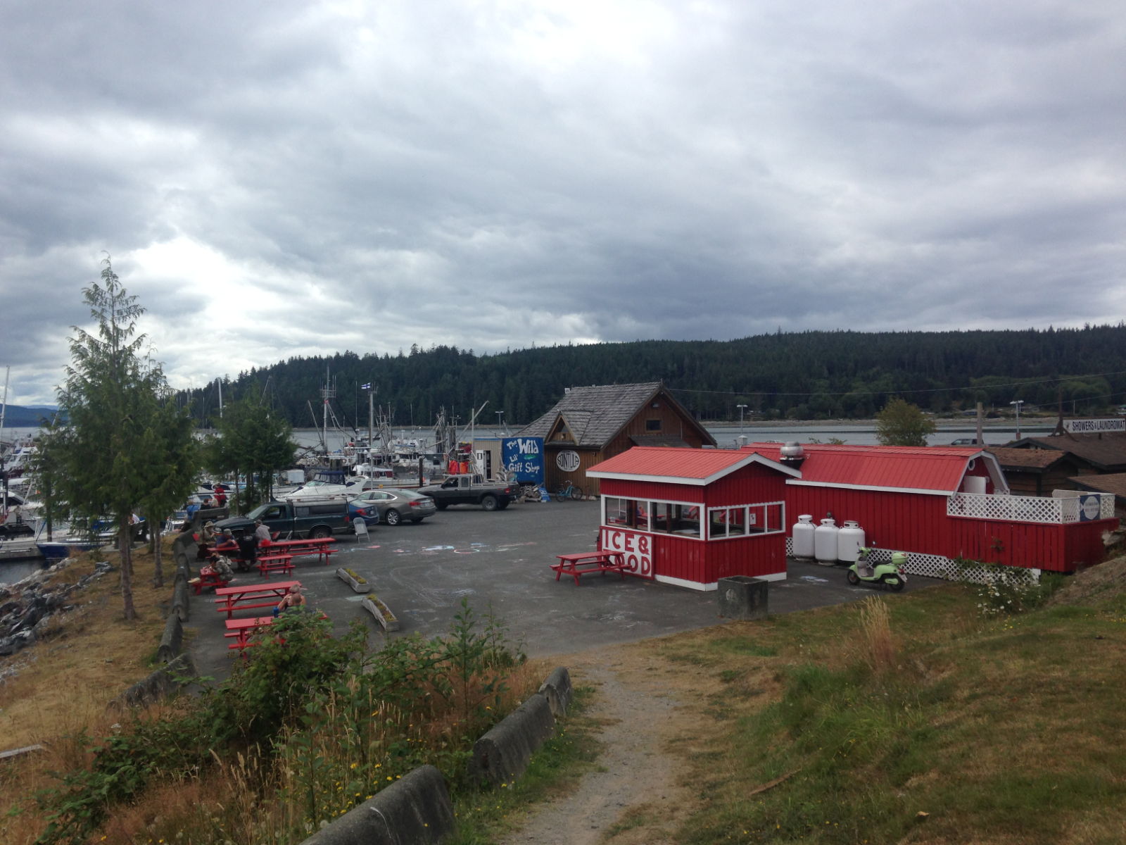
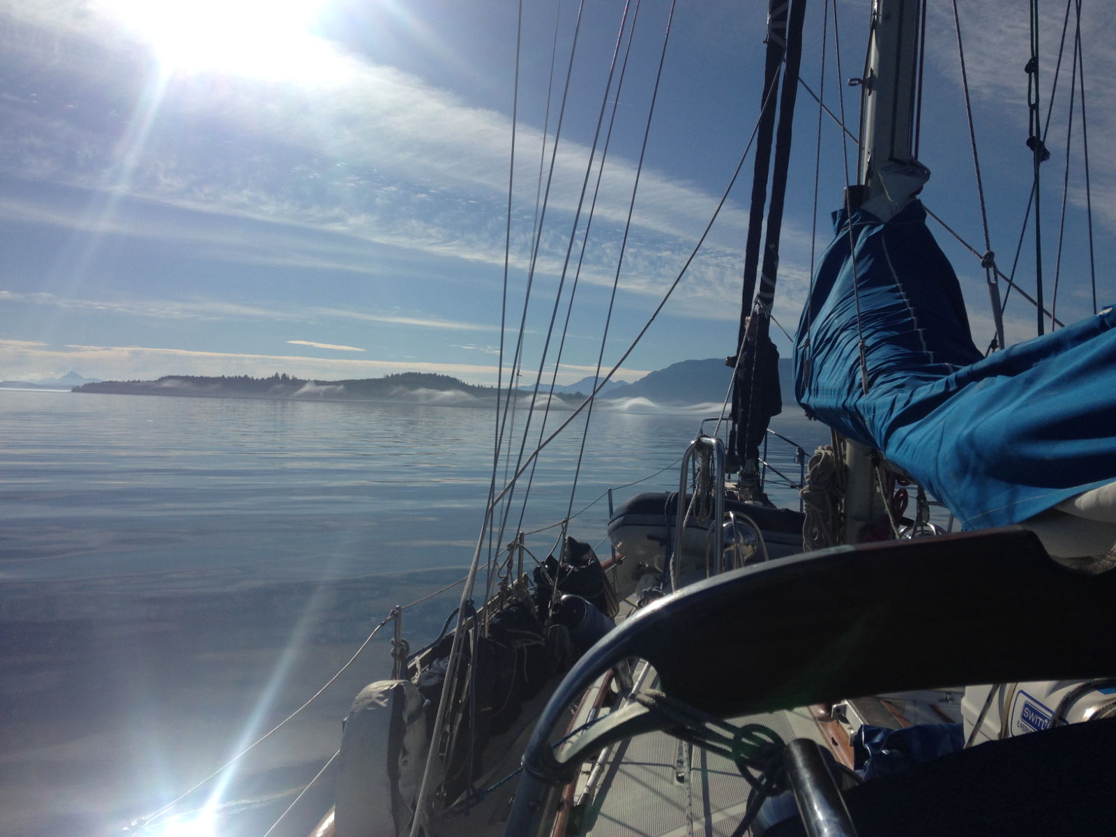
Our first destination along the infamous route was to be Siontula on Malcolm Island in The Queen Charlotte Strait. Before setting off we had to wait to be separated from the boat that had rafted up next to us the day before, and then headed over to the fuel dock to restock. A somewhat chillier trip than the day trips we were accustomed to in Asia, it did at least give me the chance to try out my new hot water bottle up in the cockpit. I didn’t want to miss the stunning views on either side of us by huddling down in the cabin. The sea was flat calm and we motored for all of the five hour journey.
En route to Siontula
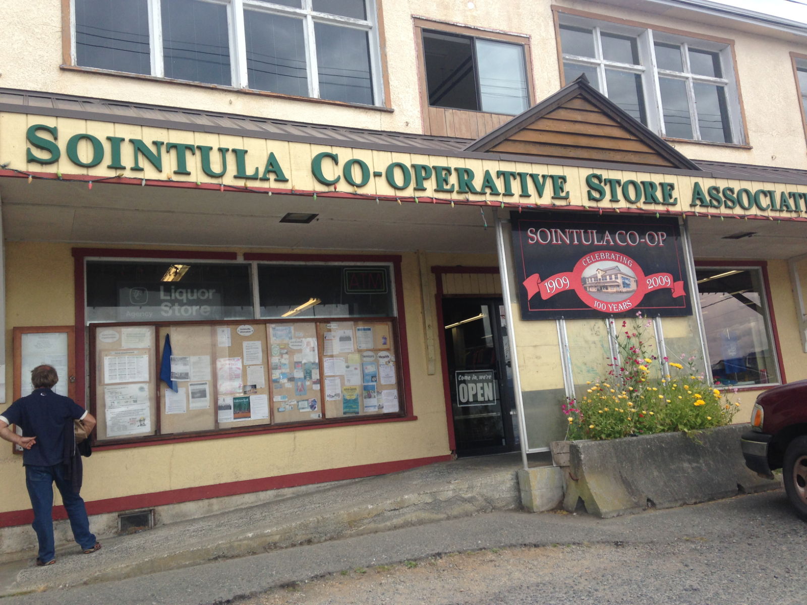
We rafted next to a fishing boat in the small harbour, checked in and set off to check out the town. It had warmed up by then and the walk was a lot longer than I expected. We passed some quaint looking houses on the uphill road to town. One of them had a sign proclaiming the road was called ‘Raggedy Ass’! The tiny town is proud of its eccentric status. Siontula means ‘place of harmony’ in Finnish and was set up by Finnish immigrants at the end of the 19th century. Its aim was to ‘create a society where property was communal; everyone shared; everyone participated and everyone was equal, including women’ – quite a revolutionary concept for the times. Their belief in ‘sound body, sound mind’ included the banning of alcohol and the failure of this first community is apparently due to its leader being more idealistic than practical. There may be a link there ;-). Another leader took the reins and lasted for four years but financial constraints forced the island to be returned to British Colombia’s government.
Siontula
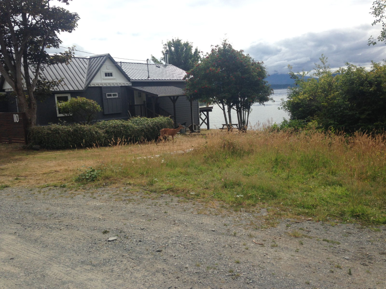
The few remaining residents in Siontula formed a community with their own vision. They purchased land and turned to commercial fishing and logging by hand. Pride of place was the Co-Operative Store, built in 1909, a fascinating building which we came upon as we entered the main street. The posters and flyers attached to the walls indicate the ethos of the town is still aiming for the ‘hippy’ ideal of freedom and cooperation. It reminded me a little of Glastonbury. The focus is on green issues, protecting the environment, organic locally made produce and bringing residents together with seasonal events such as an annual Spring Bird Count, Mother’s Day Plant Sale, a Pet ‘Pawrade’ and Winter Bazaar. Here, local dogs and cats have right-of-way, so if you see one lying in the road you must let it sleep and go around it. Everyone we came across greeted us with a cheery hello or smile. There was a little deer nibbling at a hedge in one of the well-kept gardens overlooking the coast. The place was certainly living up to its Utopian goal. I couldn’t help noticing that one of the signs was for the next meeting of Alcoholics Anonymous. Another, was from an outraged dog owner appealing for information about the driver who had knocked over and killed her beloved pet. She’d managed to get a detailed description of his van, but he must have been a visitor because it’s the sort of town where everyone knows each other – and he clearly wasn’t aware of the ‘pets having right of way’ rule. We (ok, I) wanted to go to the local pub which had a grand view of the bay, but as we tried the door, a lady cycling by told us it didn’t open until 4 30. It was too long to hang around, as we’d pretty much done the town by then, and a 30 minute return walk lay ahead of us. I liked Siontula.
Port Neville the following day was a tinier version of Siontula. A Norwegian man named Hansen had settled there in the 1890s. Thanks to his building log cabins there the port became a stop for Union Steamships and Hansen began trading with the local tribes and soon other settlers and loggers arrived. In 1895 he became the first postmaster there and the post office/general store carried on trading until 2010. It was this abandoned building that caught my eye from our anchorage, although I didn’t know it was deserted then. The trip there had been great, with stunningly beautiful snow-capped mountainous landscapes on either side of us. I sat on the sunny coach roof or deck-sides for the whole time watching it all. We’d hoped to spot whales on Robson Bight, an ecological preserve where orcas go to rub their bellies on the flat stones in the summer (no one knows why) but it was sadly empty.
Heading for Port NevillePort Neville from anchorageBears are in those woods somewhere!
We dinghied over to the still-standing government dock and tied up underneath it. As we got out, a lady on an American yacht that was tied to the jetty warned us that if we were walking in far, to watch out for black bears and for Grizzlies because sightings of both had been reported nearby. I wasn’t sure if I felt elated or scared! I just wanted to have a look at the empty store, which looked so much like the one from the TV programme The Waltons, it was uncanny. There were a few other dwellings but they seemed to be holiday lets. I think the area is uninhabited since the Hansen family left a few years ago. After peering in the windows of the store, which serves as a museum for pre-booked guides, we walked into the wooded area and bravely on to the spot where the woman said the bears had been seen. It was deathly silent and a bit eerie – easy to imagine one springing out from the trees. Apparently you’re supposed to make yourself look bigger, and yell loudly if confronted. I didn’t fancy putting this to the test. We returned to the dinghy to head for our next ‘must see’, the curiously-named Robber’s Nob. This is a cape where the Hansen children through generations used to go to picnic and play and is a notable beauty spot. It took ages to get there but there was plenty to see on the way. The sea was littered with huge triffid-like seaweed plants that we had to be wary of getting caught in the propeller. The buildings on this shore were more like those in teenage horror films set in summer camps, like Friday the 13th rather than the wholesome Waltons. It was decidedly creepy. Very quiet, still, empty and with an abandoned atmosphere, despite one of the buildings looking well kept up. I declined Paul’s offer to stop and explore. Looking it up later, we discovered it became something of a hippy community in the 60s, hence the deserted buildings. I guess the newer one is a holiday let or summer retreat. Ideal for an away-from-it-all break, or if you enjoy complete silence and solitude in the dark woods.
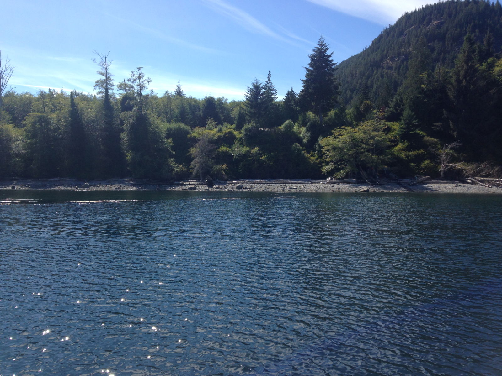
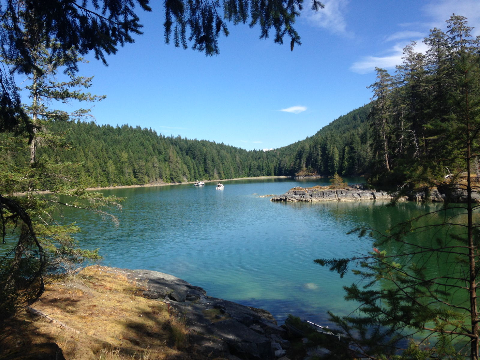
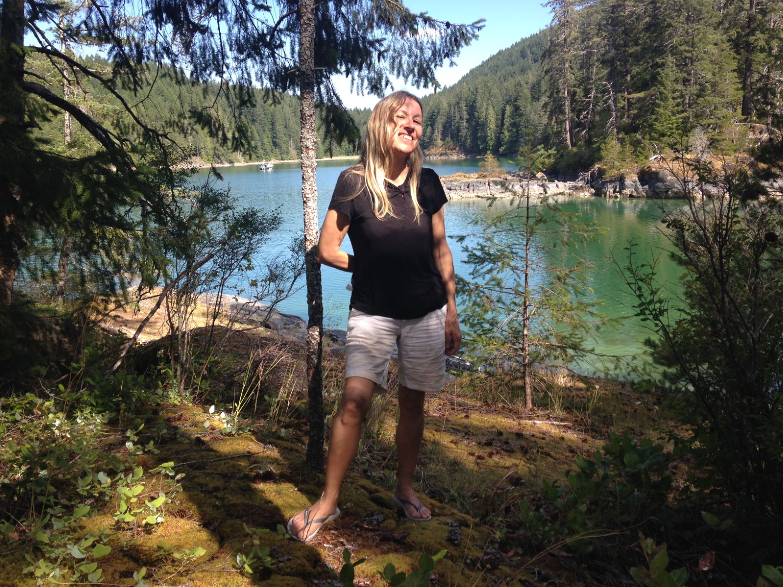
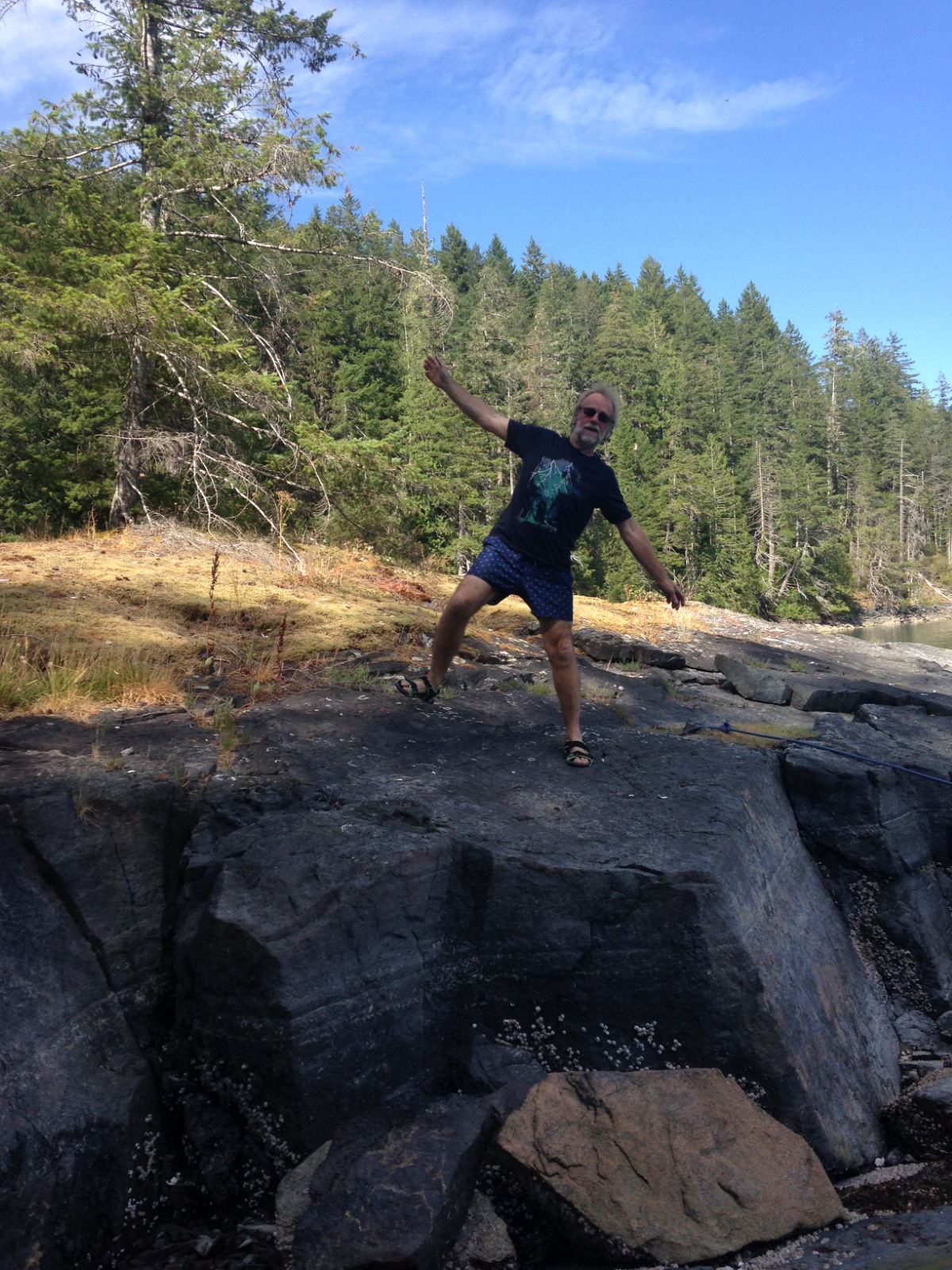
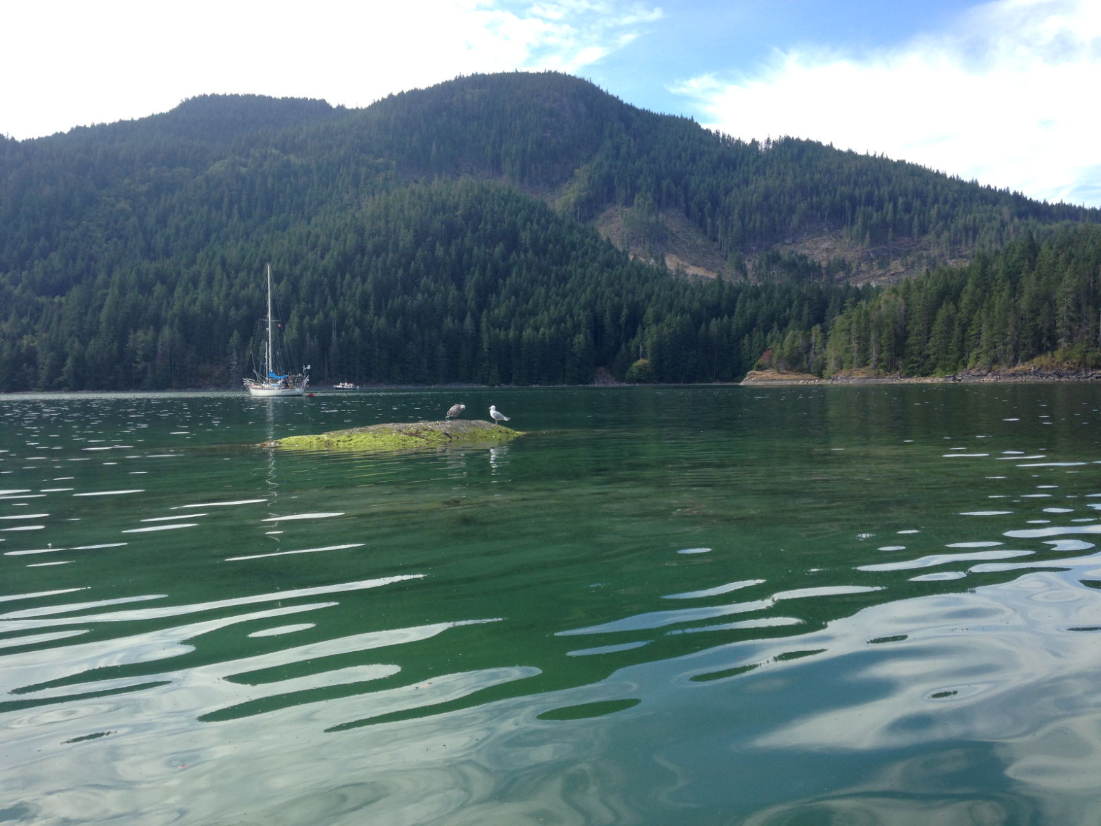
From there we journeyed on to one of the best anchorages I’ve seen so far. Called Small Inlet in Kanish Bay on Quadra Island, it was breathtakingly gorgeous. There was something to delight most of the senses: the aroma of pine and cedar, the sight of the timeless wilderness all around us (and we saw a seal here), the cries of birds and cicadas, and the fish jumping. Once we were anchored at about 2pm, it was gloriously sunny and there were only three other boats in the area. The pictures speak for themselves – it’s going to be hard to beat the tranquillity and sheer beauty of Kanish Bay. It was so still it was hard to tell we were at anchor. We enjoyed a dinghy trip and obviously took lots of pictures. The forest around us looked to me like the ideal habitat for bears, but if they were in there we didn’t see any.
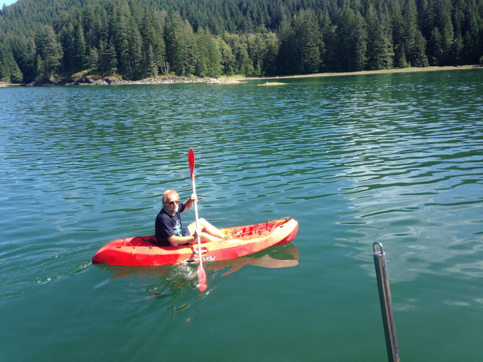
Kayaking in Kanish Bay
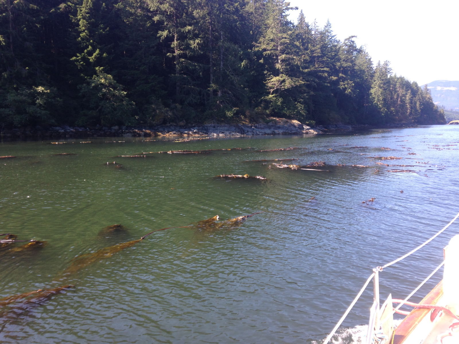
Debris in the water as we leave Kanish Bay
We moved on to Campbell River the next day (Monday 6th August). To get there we had to cross the infamous Seymour Narrows. It’s this location that makes so many mariners anxious, but as Paul has said, it was a bit of an anti-climax when we crossed it. Not that I’m complaining. At full flood it would have been like being on a fairground log flume from his description, and I was happy enough to forego that experience! It’s safe to say I’ve fallen for British Colombia in a big way, despite the steep cost of things. Our next stop on the journey to Seattle, Prevost Island, takes in another notoriously tricky crossing; this one is called Dodd Narrows and it’s imperative to get the tide times right when going into it. Jonathan Raban describes trying to make it ‘before the flood tide turned it into a breakneck slalom run’!
We had a great time in Campbell River Marina, despite catching a bit of a cold and being laid up in bed for a bit.
The town had a great museum, with a lot on the history of logging. Around here you would have either been a fisherman or a logger, or if you were really wise, someone who sold fishing and logging tackle. There’s also a lot of information on First Nations (which is what the aboriginal indigenous population like to be known as) and their history.
Campbell harbour had a great chandlery, however I’m not rich enough to take advantage of it, Also everything I saw in there that I was familiar with, I knew was cheaper on the net and could at least wait until I reached Seattle to see what it cost there. They had Sealant at $50, I normally pay £15, so it was quite a hike. However it’s great to see stuff you can’t get elsewhere, and also being in Asia for so long, where outside of Singapore and Hong Kong, there aren’t really any chandlers makes these places seem amazing.
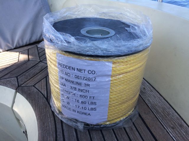
However further down into town there was a more mom and pop type chandler, catering more to the fishing fleet, they had great stuff, and I picked up a roll of polypropylene rope, 600ft for just $70 (CAD) This will be used for long stern ties, when we need to take a line ashore.
My cold caused us to stay an extra day there, before we departed on Thursday for Tribune Bay Marine Park on Hornby Island. Another beautiful location, however we were not alone in this large sandy bay, I counted about 40 Sailboats and even more powerboats plus a few mega yachts. We decided not to go ashore, as it was very crowded, and instead I cooked some halibut I had bought on the dock in Campbell River, on the barbecue here and we had a lazy day.
The passage there was easy except for the first hour, after leaving the marina in still winds, and flat calm water we hit Discovery Passage fighting a flood tide, at maximum flood. I hadn’t paid much attention to it, perhaps I was a bit smug about it all after waltzing through Seymour Narrows, and all the warnings I had read about this pass were minor in comparison. Also the weather was calm, and the tides were small, so what could go wrong, well I think I picked the wrong course as well as the wrong time, I was heading down the centre of the strait, the sides might have been better, but Cape Mudge, which is famous for causing rapids and rip tides was on the far side and I wanted to avoid that, and staying close to the Main Island would add a bit of distance. So it was that I found myself at first being driven off course, then headed by 3 knots of current, which quickly rose to 5 knots. Looking at the track I recorded below you can see what a mad course we made, the distance was less than a mile, but took more than an hour. All the time I thought I was steering a straight course. I suppose the waters had the last laugh with me.
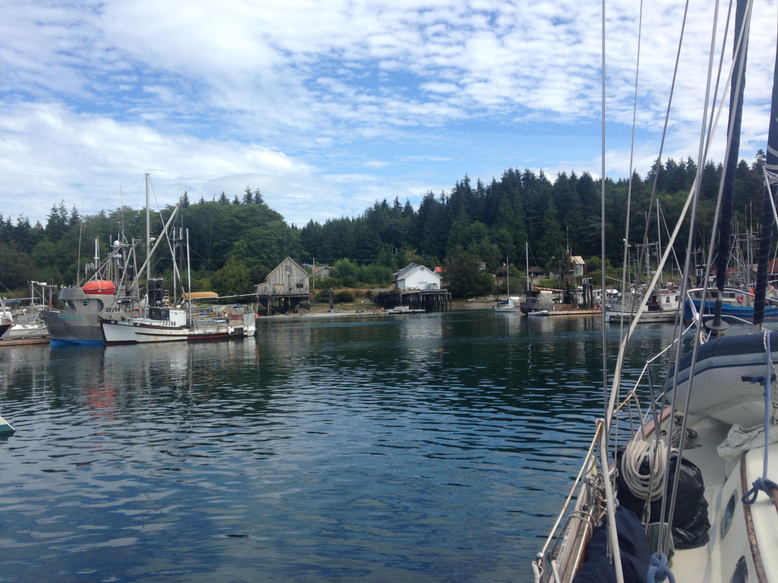
Today we left the quickly emptying bay on Hornby Island after a very restful night and headed for the public harbour at French Creek. I phoned ahead to see if they would be full, and typically I was told, no problem, they are always full but just turn up and raft to another boat, there’s loads of room for rafting. Rafting is tying alongside another boat, In this case, I expect all the berths are in use by fishing boats which can’t get out until the fisheries are opened, so they basically form a wider dock for us. I like the way people here aren’t so precious about their boats/space and rafting is normal.
We are now tied up alongside another yacht in French Creek harbour, There’s lots of old sailboats dumped here, and lots of rough looking power boats, along with a stack of fishing boats. It’s pleasant enough, and we are only here for one night. My neighbours, locals, have taken a great interest in us and I have spent ages now explaining to all and sundry in the vicinity what it’s like to sail across the pacific. Everybody seems to be in awe, yet they all have big boats capable of doing the passage, yet they are afraid of leaving the inside passage in their yachts and even going up the west / Pacific side of this island.
Tomorrow we leave early for the 4-5 hour passage to Nanaimo, which is quite a big town, the harbour is protected by two islands, one is called Newcastle island after the UK place, and was the location of a coal mine, just like it’s UK origins.I’m hoping we can pick up a parks mooring buoy off the island for a small charge and dinghy into town. the island is now a national park and apparently is well worth a visit.
Port Neville wasn’t really a port, there was a pier with room for a couple of boats, there was a store, but it was long closed down.
However leaving Port Neville we headed into morning fog and took some amazing pictures.
The inter-island ferry
We dinghied ashore and were going for a walk when we were warned about bears that had just been spotted close to the pier, so we kept our walk brief before we dinghied back to our anchorage. We left early the next morning to arrive at the race passage in time for slack water. However I now realise I applied the secondary port time difference for tide height to the slack water time, instead of the slack water time difference, so I got slack water wrong by an hour or so. It didn’t matter, we had 0.5 knots against us through the passage and really couldn’t understand what all the fuss was about.
We continued to the end of Johnstone passage, still not seeing a gillnetter, and turned south into Discovery Passage. A few miles further south and we turned to port and into Kanish Bay, where at the very end there is a small channel, about 40 meters wide that leads to a little hidden gem of a pool.We spent the night here, and this must have been our most peaceful night in many months.
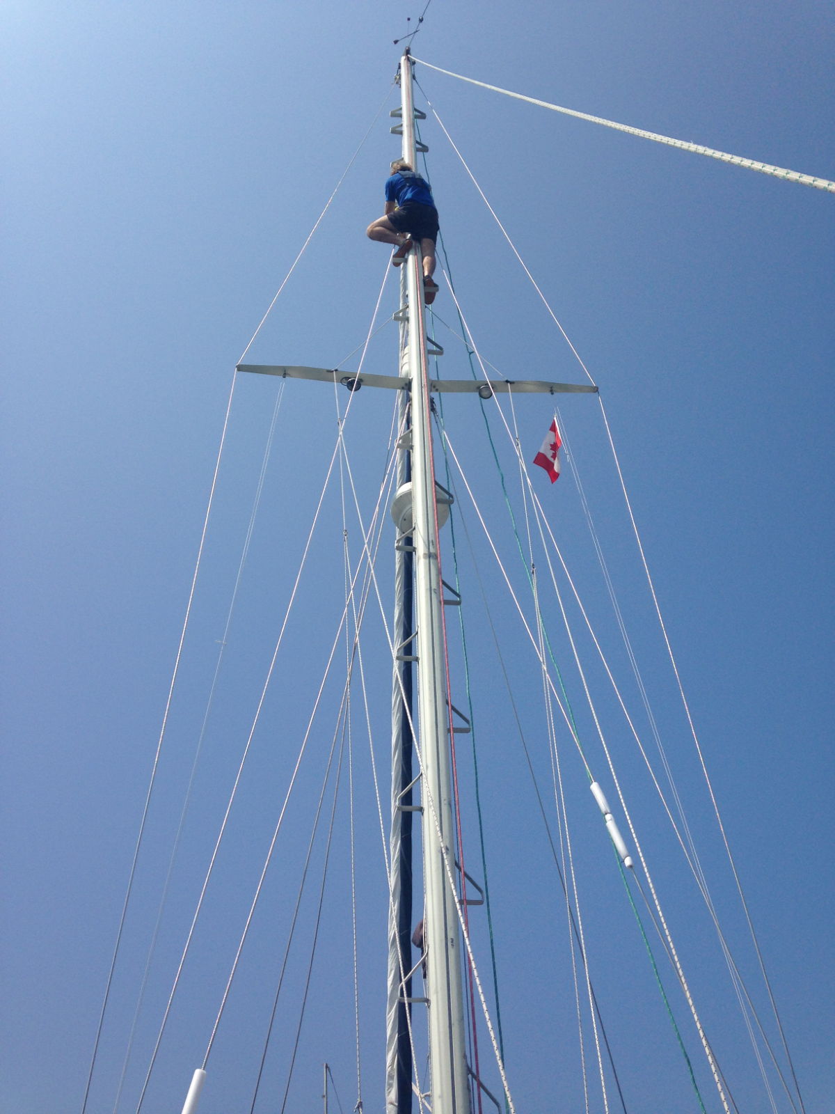
I even managed to get the Kayak outThe next day we had to pass through one of the most dangerous passes in Canada, the Seymour Narrows
This short stretch of water has claimed many lives over the years, at worst the current can run to over 15 knots, with surges of a couple more knots added by the rips, it’s very dangerous if you don’t get your timing right, which is what I spent an hour checking last night. I now understand the government books on tides and currents better. It turned out we had to be there around 13:22, that is just before the start of the narrows and we could go through at slack water. At full flood the current would be around 8 knots, and the current comes on quick after slack, it doesn’t follow the 1/12ths rule at all. The 12ths rule is a way of working out the height/speed of tide where you can approximate a sine wave, which is normally how tides move. The other big thing about this pass is that besides being quite narrow for the amount of water that has to get through it, it also had a rock, ‘Ripple rock’, in the middle which ships were constantly being driven onto by the whirlpools it created. Many attempts to destroy this rock had been made, but all failed, many with the loss of lives when their barges were ripped away from mooring lines by the fierce currents. In the end, in 1958, a tunnel was dug under the pass, and then up into the rock and explosives detonated. It’s claimed to be the largest bomb/explosion other than the atom bombs ever. Read more about it here
So it was with some trepidation we headed off to the Seymour Narrows, I was a little bit worried as we left our lovely secluded inlet, and turned into the main channel to see we were alongside a tug and tow, he was obviously heading for slack water too, Pleased that my calculations were probably confirmed, but worried that the tow might be all over the show, as it was I couldn’t keep up with him anyway, and he would pass through the narrows 30 minutes early, silly man I thought, he can’t have done his homework!
There are 4 big trucks top left, and a motor cruiser on the top near the stern, some tow.
We did however run into a few gillnetters as we hit the main strait, but they were easy to avoid, our Asian experience with fishermen has set us up for life in that area.
So we all headed down to the narrows and I was very disappointed to find nothing happened, Nada, a little wobble in course at one point, not even as bad as Race passage the day before. What an anticlimax. we went through, with about 2 knots extra current, and out of boredom, I headed over to the top of Ripple rock just to be able to say I motored over it, but even then there was no real current, the odd whirlpool, but anything bigger than a leaf was safe. Oh well, at least I must have got the timing right.
It got harder later as we picked up a headwind of 15 knots and had some current against us so we were crawling along to our destination at Campbell river town, which is where we are now. A small town, but the biggest supermarket we have seen since leaving Malaysia,huge, with so much variety, Kathy is spending tomorrow there 😉
It’s a big marina here, and quite an expensive area, I think the houses on the riverfront are all very expensive luxury pads. I read that hollywood stars would often take vacations here, so I put on my less oily pants for our stroll tonight.
We are having a day off here tomorrow before we push on south towards the San Juan Islands to check into America.
Today we left Port Hardy after a lovely week of relaxation and a lot of cleaning. We are now rafted up to a Gill-Netter in a port at Sointula.
A Gill-Netter is a certain type of fishing boat/style where a long net, about 1/4 mile, is let out from the stern of the boat from a large drum and then the boat and the net drifts. The boat can be pointing at the net or away from it, or anywhere in-between, meaning that spotting the boat doesn’t give us a clue as to where the net might be. I have just had a good chat with the skipper of the boat and he told me that tomorrow the fisheries open for a three day window, and that he, and hundreds like him will be rushing to the water, in particular the straits and passages we are going through, and there will be Gill-Netters everywhere. His advise to me is to stay 1/4 mile away from every fishing boat, which is easier said than done.
Kathy will no doubt write about Sointula, but it’s a small town, the only town on Malcolm Island. It was setup as a Finnish community back in 1909, and populated with a few hundred Fins fleeing their country. It was to be based on Hippy like ideas, with community ownership of everything and equal rights for everyone, including women. It started off well, but fell apart after a while, however what remains now is a hard core of Finnish people who dominate Island life here in a very tight nit community.
The harbour we are in is small, but I think there may be more people here than in the town itself. It’s a very peaceful beautiful spot, we can look out over the mountains of British Columbia on the mainland, or across the inside passage over to Vancouver Island. The main reason for coming here is to check out the facilities, I may bring the boat back her in 8 weeks to leave her here for the winter. It’s a very safe and secure place, and very cheap too.The Inside passage is a maze of waterways, rivers, straits, passes etc that run from Seattle all the way up to Alaska, about 1000 miles in total, most of it is protected from the Pacific gales and provide a safer route along the coast in rough weather. We joined the passage at the top of Vancouver Island and we are now working our way south, hoping to be in Seattle for the 17th when there is a rally/meet up of boats & owners of boats designed by Bob Perry, the designer of our boat. It’s an annual event, and it seems daft not to attend as we are so close. However it does mean we need to rush a little to get there.
One of the big problems of the inside passage is that the Pacific Ocean sea level rises and falls by about 4 metres every 12 hours, and it rushes into, then out of the Inside passage. The water races through the myriad of waterways, and where it is narrow, and especially where it is shallow, or there are underwater features like mini mountains, it can get quite crazy. It’s not a gentle river by any means, in some places it’s very deep, I’m not sure exactly, but when Captain Vancouver on Discovery first surveyed it for our Queen back in 1792, while looking for a north west passage, they would swing the lead deep into the water and his crew would often shout ‘No Bottom Found’, presumably relating to the water depth.
Tomorrow we motor on down to Port Neville, and from that point onwards we are heading through lots of rapids, overfalls and challenging currents/rips. I’m looking forward to it. Fortunately the one after port Neville, which is called race passage, we will pass through on neap tides, with the current and wind in our favour. Captain Vancouver had big tides, and strong winds against him, and with his sturdy square rigger he took 4 days to cover about 40 miles, we should do it in 8 hours. Our obstacles will more likely be dodging the fishing boats and the cruise ships that will be transiting as well. Some other other place names we have to navigate over/past are, Alert Bay, Ripple Shoal, Whirlpool Rapids, Green Pt Rapids, Surge Narrows, Beware Passage, Blind Channel, Cape Caution and of course, who could forget Desolation Sound.
 The ultrasound revealed no serious issues, just inflammation, most probably caused by an infection. The actual diagnosis was Epididymitis, and the treatment was to be a course of antibiotics, rest and loads of painkillers.
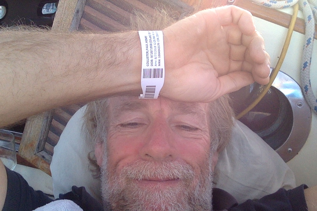
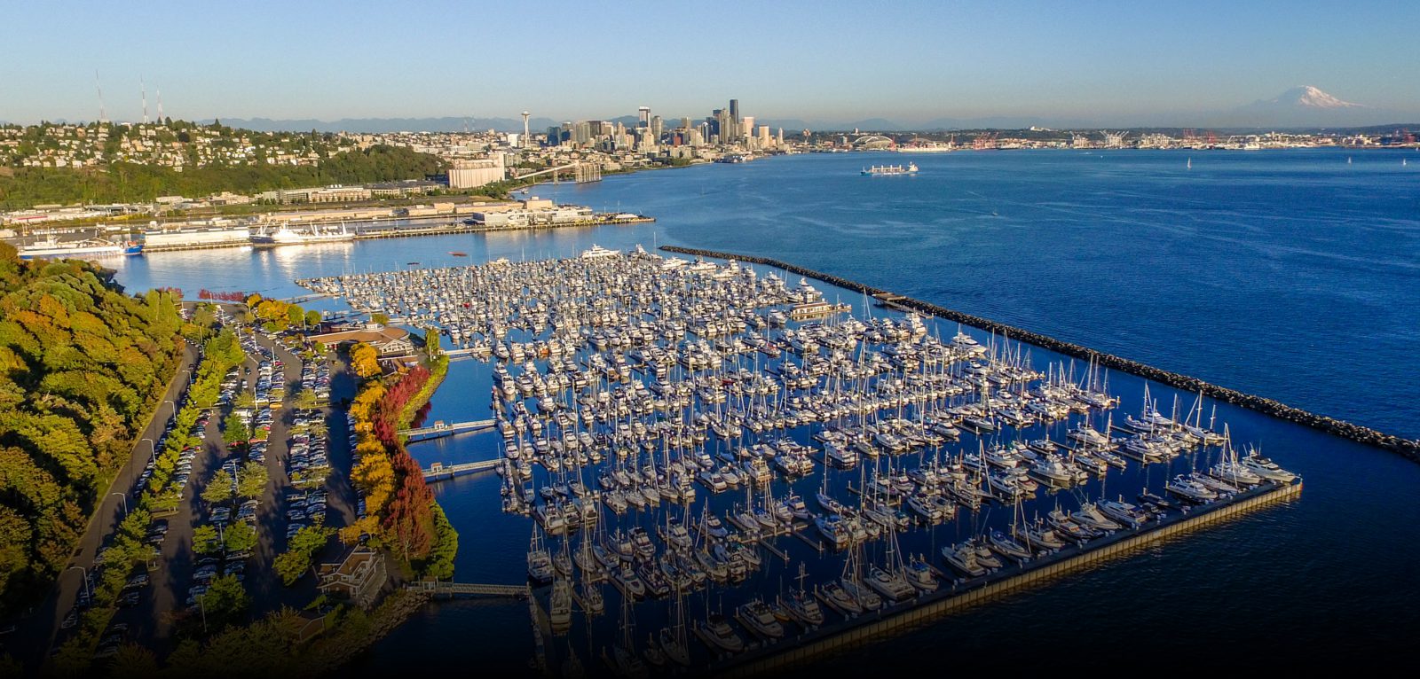

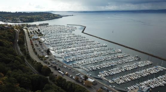 It’s a huge marina, hundreds of berths with some interesting boats
 and is next to the entrance to Lake Union and Lake Washington, which you access via the Washington Ship Canal after passing up the Ballard Locks.
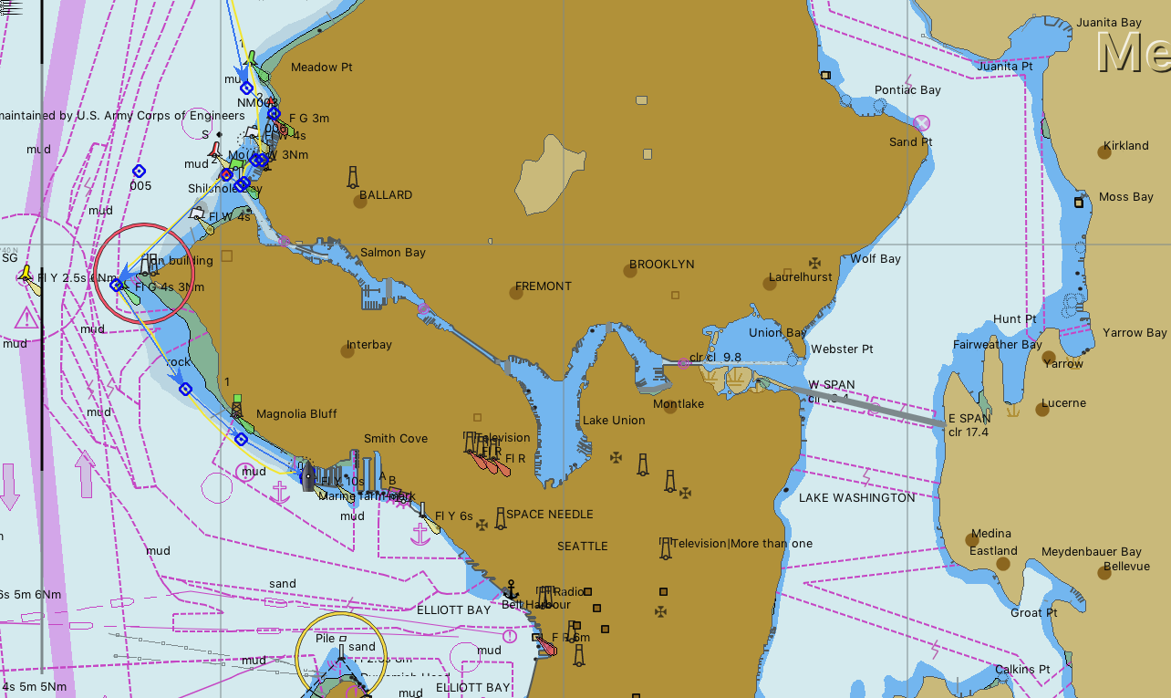
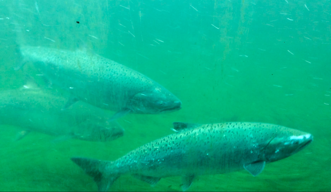 You can also see outside the locks, many salmon waiting to enter the passage with the steps. This is a man made version of the rocky rivers and waterfalls they would normally be tackling, all built by the US Army when the canal was first created.
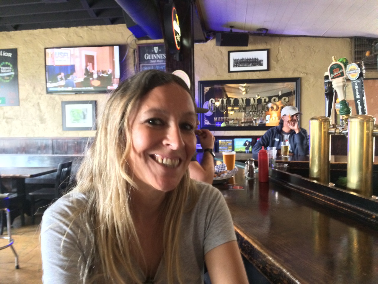
 However once there we signed up for 2 weeks berthing. We cycled onto the space needle area, as we planned to spend a few hours in the Pop Music Museum there, however when we arrived it was getting late and I was surprised to see the admission fee was nearly $30 each, and I don’t even like grunge. $30 buys a lot of shackles! So we decided that Kathy would come back later in the week and spend the whole day there to get her moneys worth while I took my $30 down to the docks to see what I could find (In the chandleries).
 Once again I find myself in a place where I think I need a year or more to fully get to know the geography and a bit of the culture.
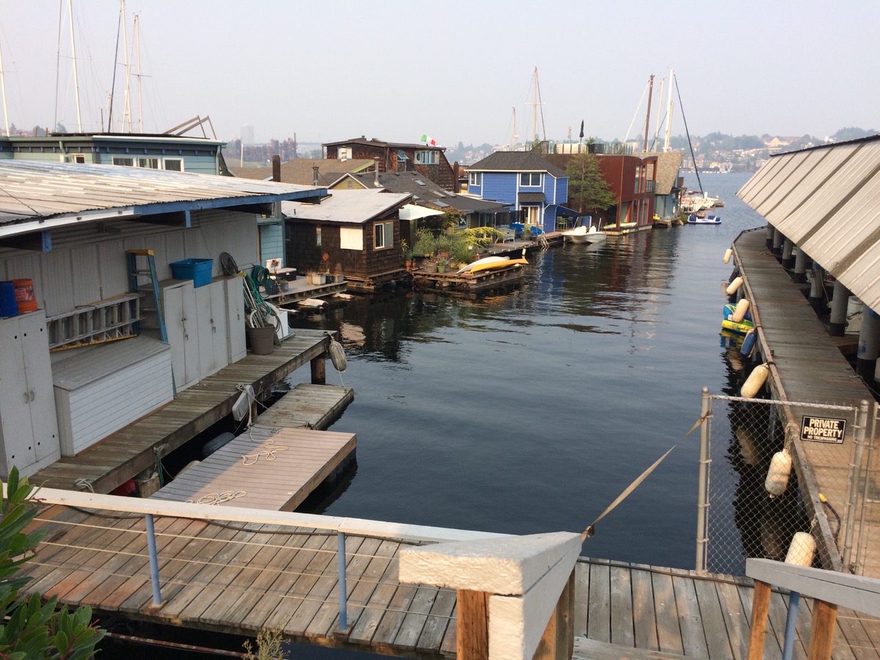
 Later in the day the tide turned and we got to see a different aspect of the house. For the people sitting on the deck in their loungers it must be great for the view to be changing all the time.
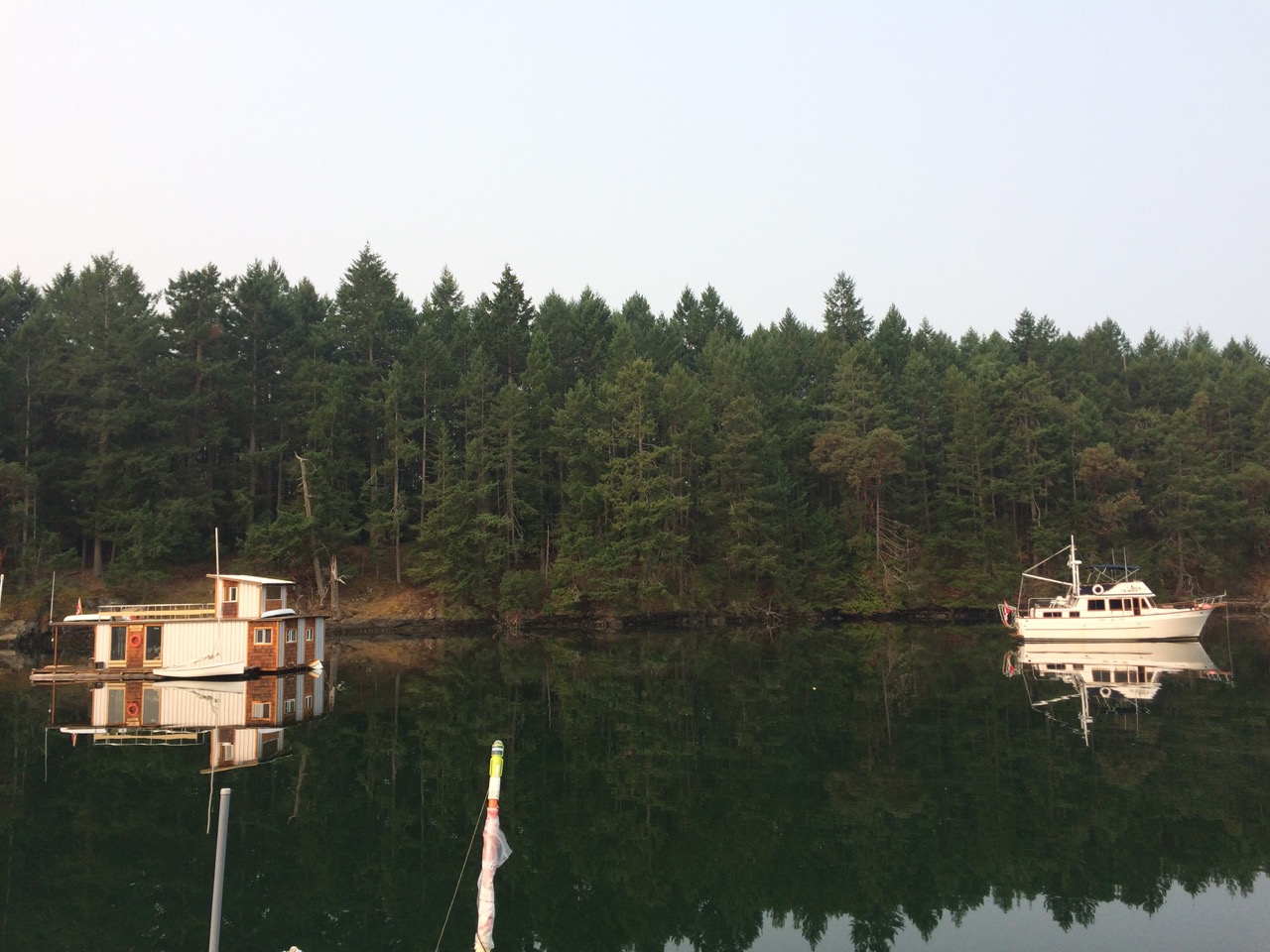 It was a very peaceful evening there and early the next day we were up and off to Sidney spit, a small nature reserve just of Sidney, Vancouver Is.
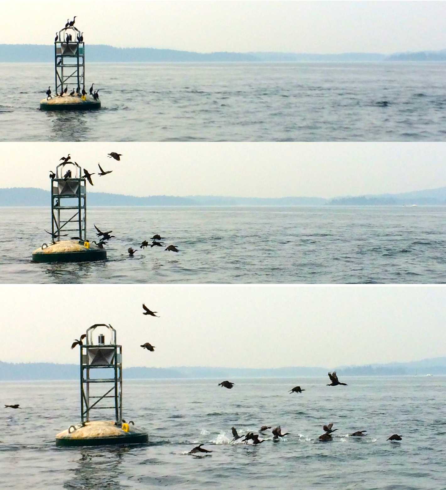
 Port of Friday Harbour is a massive place, with a great range of vessels berthed here
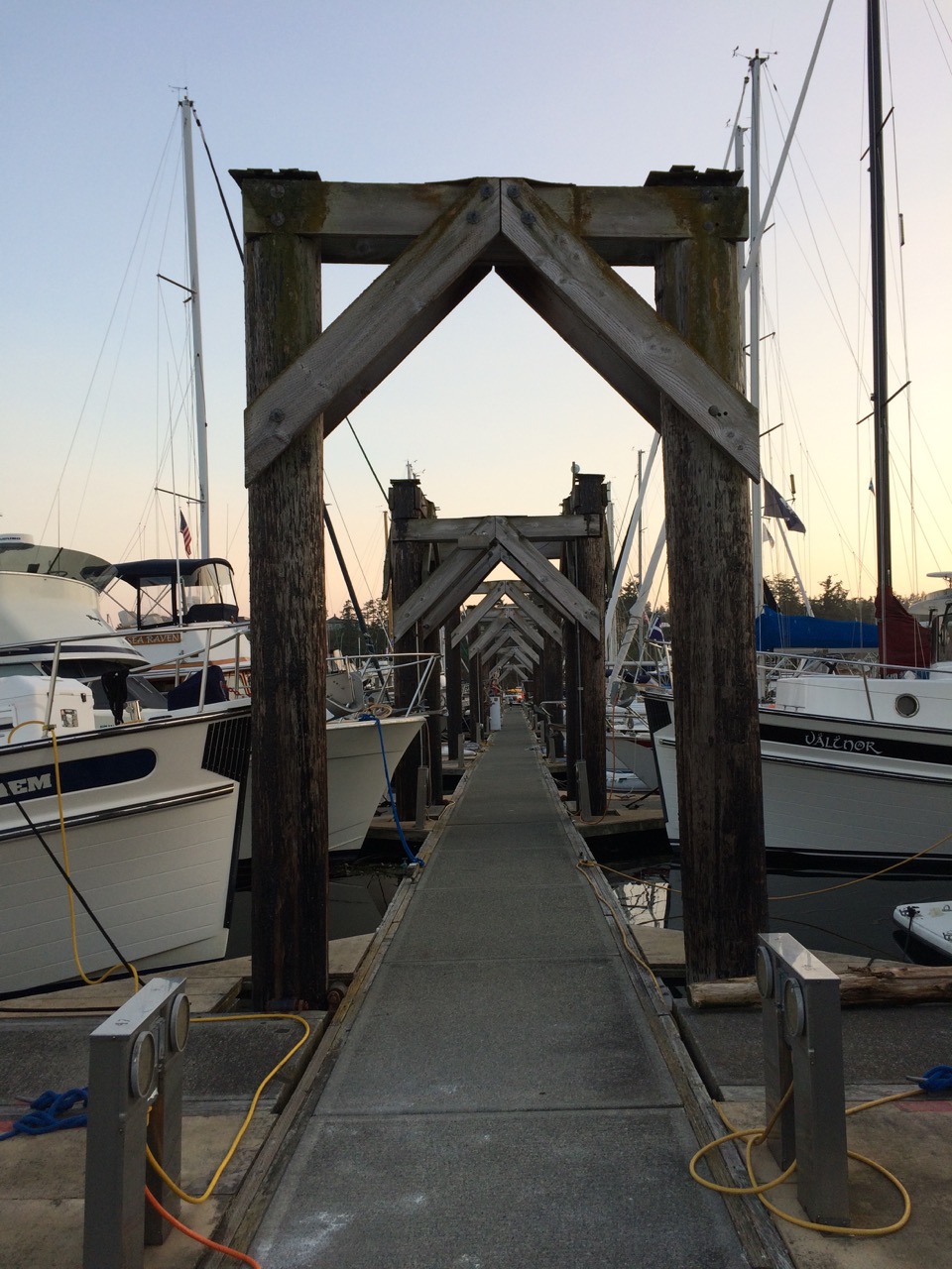
 On the way we saw many luxury houses set back in the trees along the coast. They looked wonderful and I mused on the fact that I might have had one if I had been born in Seattle. I was writing software for a word processor, much like Microsoft Word , back in the 80’s. Had I been in Seattle, I might have been on the Microsoft team writing Word, and by now be head of word processor hyphenation and line wrapping, or some other wonderful title. My small allotment of company stock might have bought me one of these waterfront mansions, and as I said to Kathy that I might also be on my third young blonde leggy wife by now too. She pointed out that if that was the case, I probably would be broke and have lost the house by then!
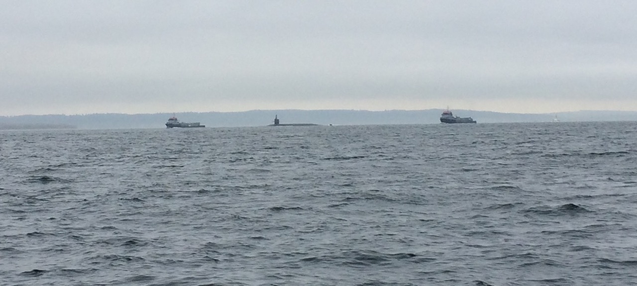 Arriving into Port Ludlow saw the wind drop to zero, and the sun come out, the fog left and it became a glorious day. Port Ludlow is a small community town, with a few shops, a marina which is part of a Golf course resort, and a few holiday homes and ‘condos’.
 I got chatting to one of the guys sitting on our table during the meal, he was very friendly and keen to offer me tips on moorage. He, like many there was a friend of Bob’s and he also had a boat, but not a Perry one. But he also had a truck, which was quite a beast.
  I was keen to see his boat, which turned out to be just as impressive, and had me thinking of what kind of boat I would like next. Something small, fast and maneuverable, but mostly, something that looks great.
 Finally I’m in a cold place, at night here with clear skies the temperature drops. The waters here are quite cold and consequently the sea breezes are very chilling, so at long last, after many years I was able to put my Irish sweater into service. It’s doing a great job, thanks to Tim and Asta who bought it for me as a present, some time ago.
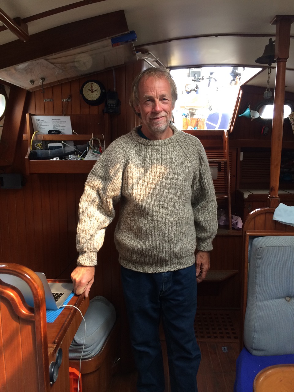 Tomorrow (Monday morning), we leave around 8am for Seattle propper, we are booked into Shilsole Marina, just north of Ballard, once there we will have to find somewhere affordable to stay for the next four weeks as the daily rates are too much for us. Thankfully the people at the rendezvous have been really helpful with tips and suggestions, and a few have offered to meet up with us in town and show us around.
 The sky turned black and it started to rain, but just before we arrived the weather moved on, the wind dropped, the sea calmed and into Nanaimo we motored to look for our berth. by the time we tied up the sun was out and I was pleased to be there, but had quite enjoyed the sail.
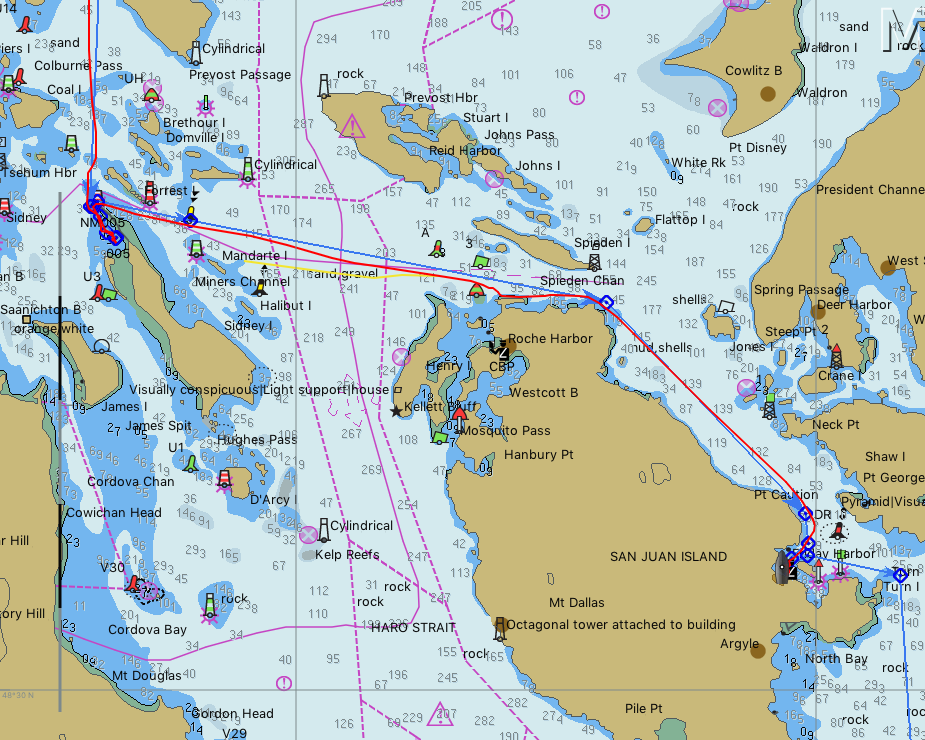
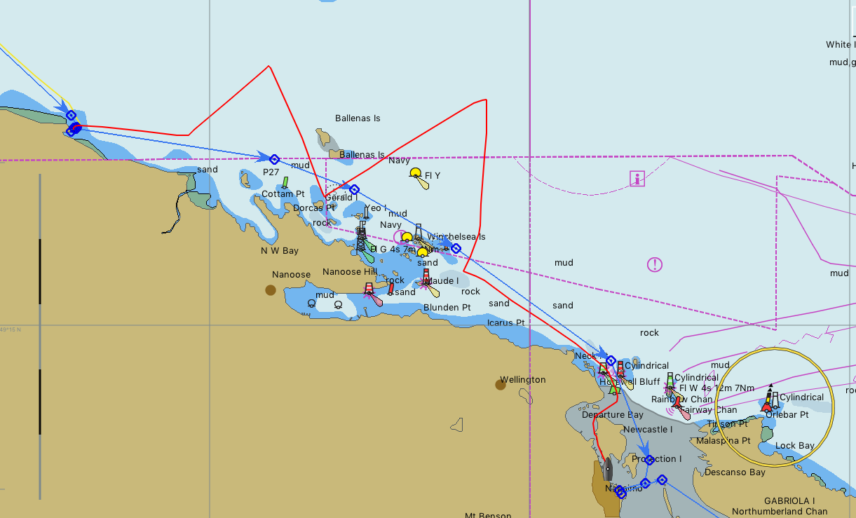 You can see our planned route in blue, our actual track is in red, not a bad angle on the wind really. There is a dotted/dashed trapezoid shaped box on the chart known as “Area Golf Whisky” This is a military exclusion zone, you can see I tacked over the western end, then across the middle. I could see the Patrol ships on the AIS but they didn’t bother me. I had read somewhere that they only use it on weekdays. It’s used for testing torpedoes, apparently they launch them at one end of the zone towards the other. All along the seabed of the zone they have sensors to record the progress of the torpedos, data is fed back to the base on Ballena island, which we tacked around.
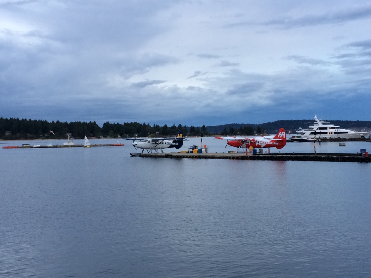
 In the morning we head south, we need to leave about 09:30 to reach Dodd Narrows with plenty of time before slack water.
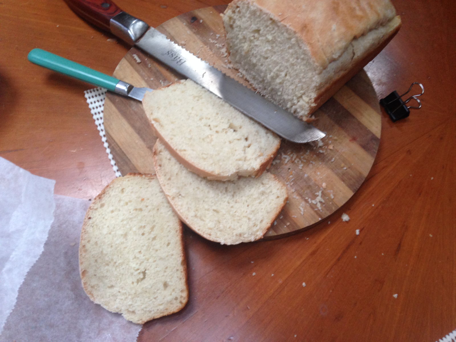
 My cold caused us to stay an extra day there, before we departed on Thursday for Tribune Bay Marine Park on Hornby Island. Another beautiful location, however we were not alone in this large sandy bay, I counted about 40 Sailboats and even more powerboats plus a few mega yachts. We decided not to go ashore, as it was very crowded, and instead I cooked some halibut I had bought on the dock in Campbell River, on the barbecue here and we had a lazy day.
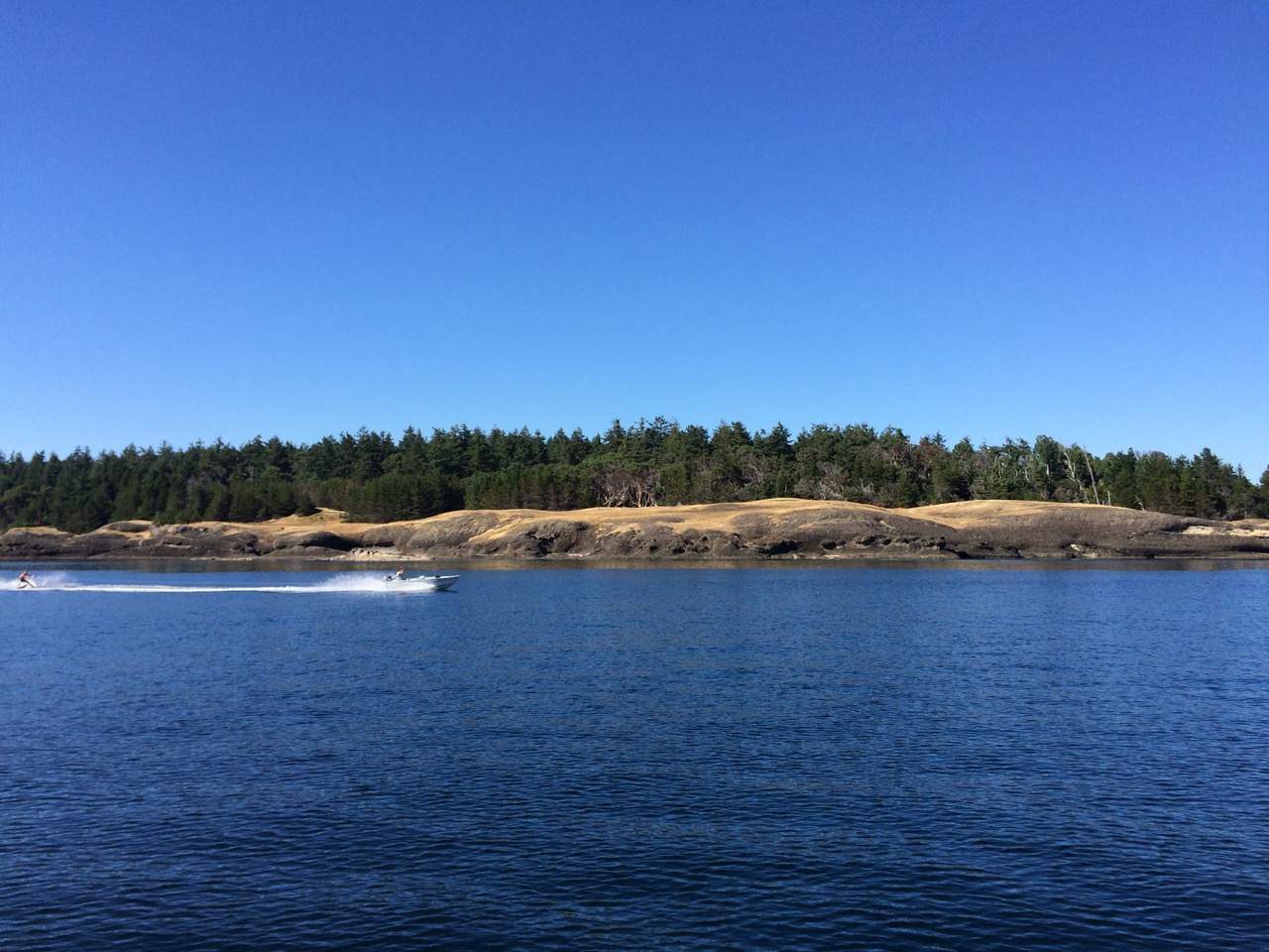 The passage there was easy except for the first hour, after leaving the marina in still winds, and flat calm water we hit Discovery Passage fighting a flood tide, at maximum flood. I hadn’t paid much attention to it, perhaps I was a bit smug about it all after waltzing through Seymour Narrows, and all the warnings I had read about this pass were minor in comparison. Also the weather was calm, and the tides were small, so what could go wrong, well I think I picked the wrong course as well as the wrong time, I was heading down the centre of the strait, the sides might have been better, but Cape Mudge, which is famous for causing rapids and rip tides was on the far side and I wanted to avoid that, and staying close to the Main Island would add a bit of distance. So it was that I found myself at first being driven off course, then headed by 3 knots of current, which quickly rose to 5 knots. Looking at the track I recorded below you can see what a mad course we made, the distance was less than a mile, but took more than an hour. All the time I thought I was steering a straight course. I suppose the waters had the last laugh with me.
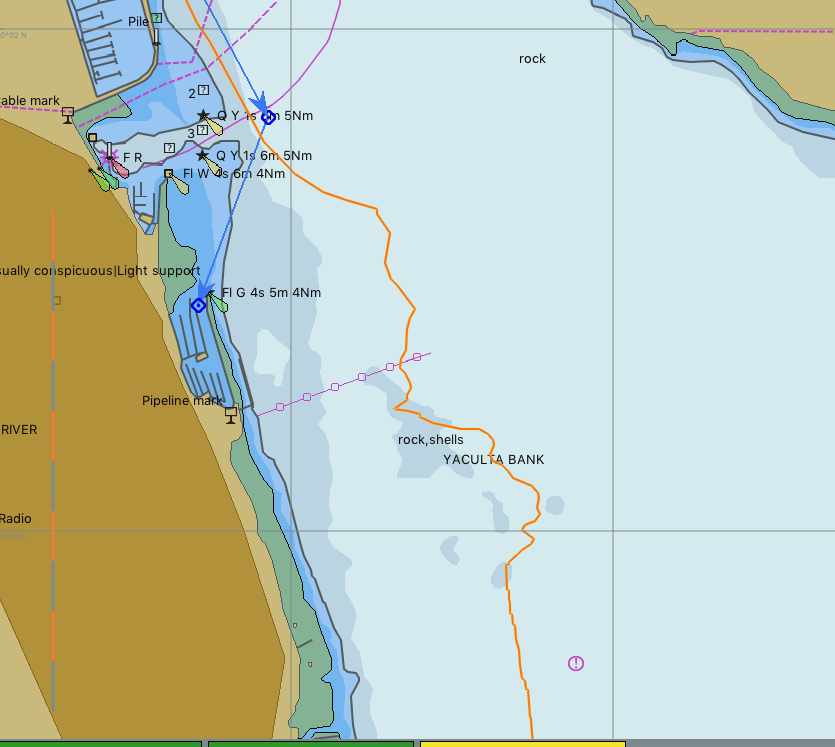
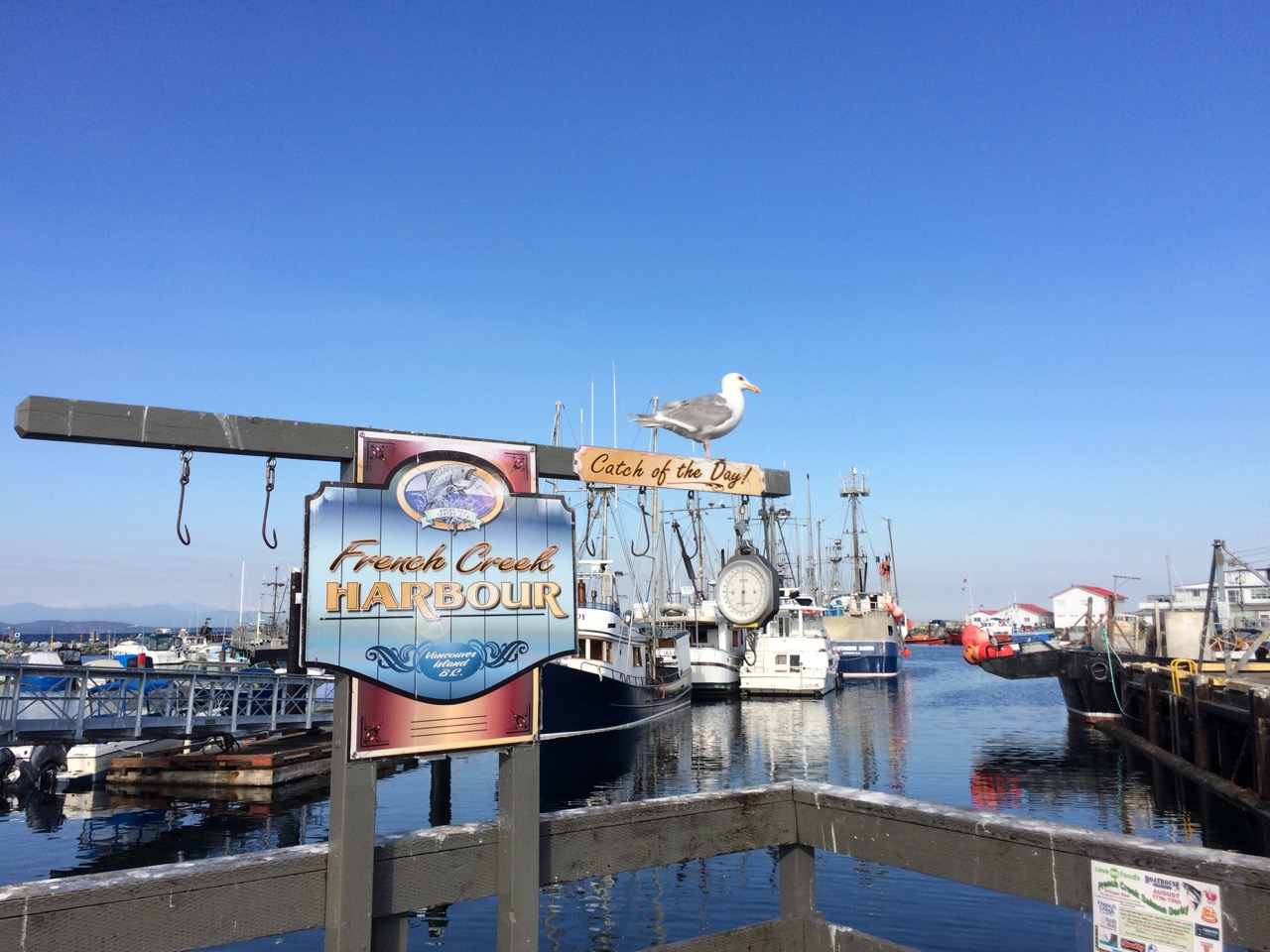 We are now tied up alongside another yacht in French Creek harbour, There’s lots of old sailboats dumped here, and lots of rough looking power boats, along with a stack of fishing boats. It’s pleasant enough, and we are only here for one night. My neighbours, locals, have taken a great interest in us and I have spent ages now explaining to all and sundry in the vicinity what it’s like to sail across the pacific. Everybody seems to be in awe, yet they all have big boats capable of doing the passage, yet they are afraid of leaving the inside passage in their yachts and even going up the west / Pacific side of this island.
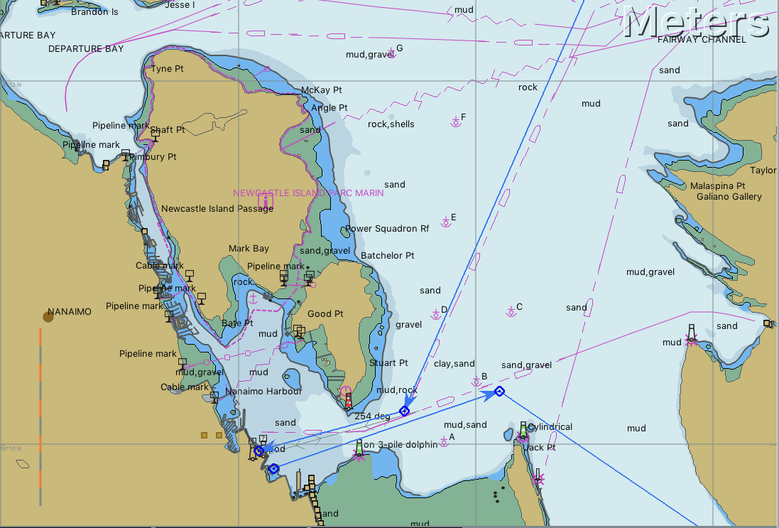 I’m hoping we can pick up a parks mooring buoy off the island for a small charge and dinghy into town. the island is now a national park and apparently is well worth a visit.
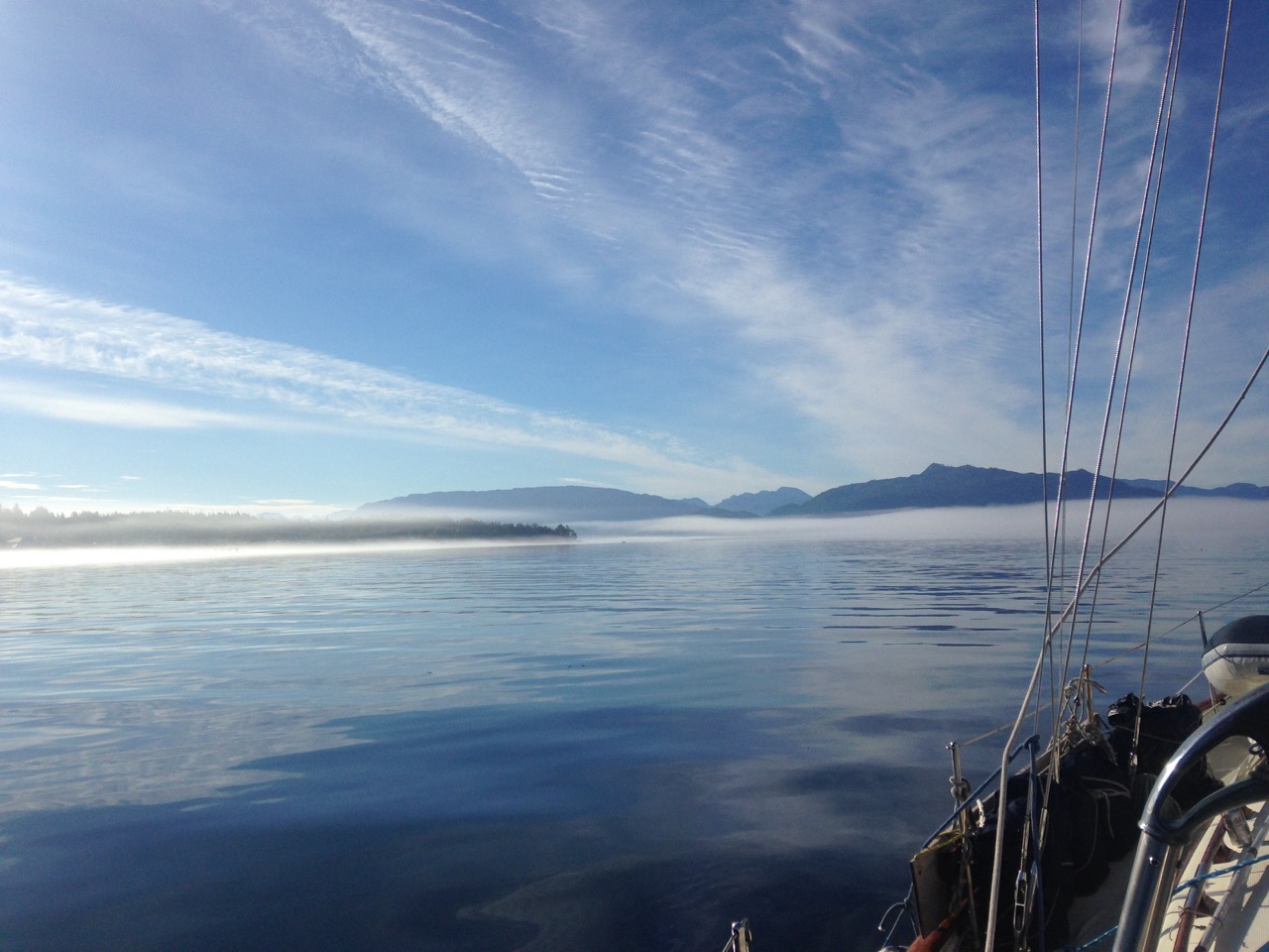
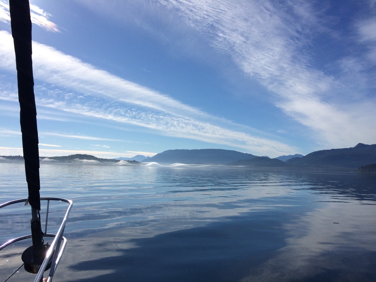 The inter-island ferry
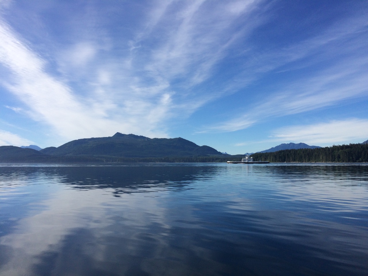
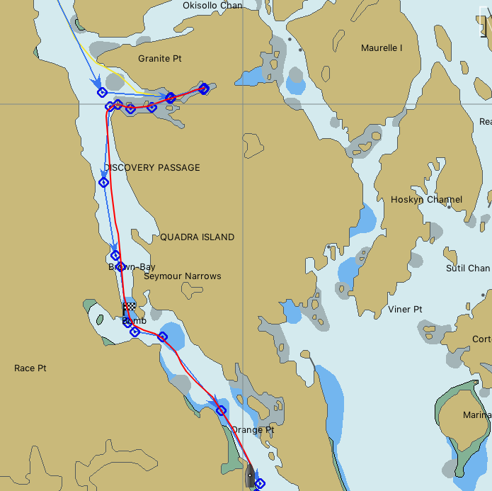
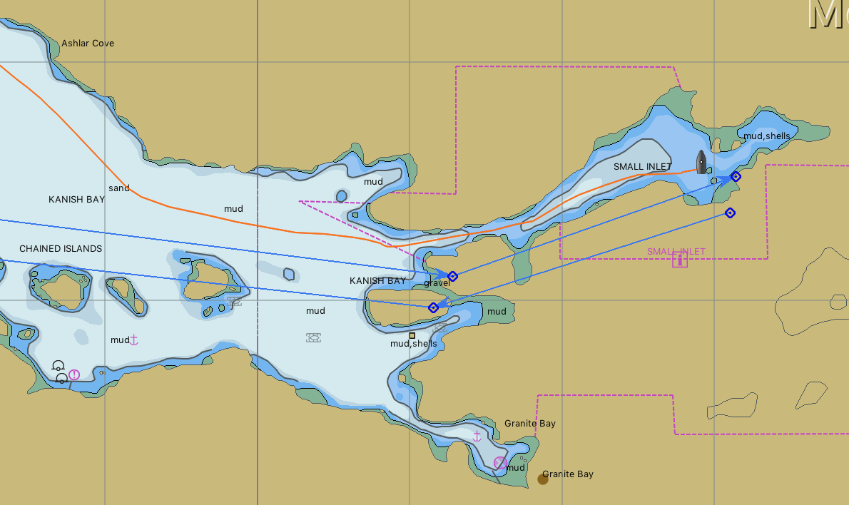 We spent the night here, and this must have been our most peaceful night in many months.
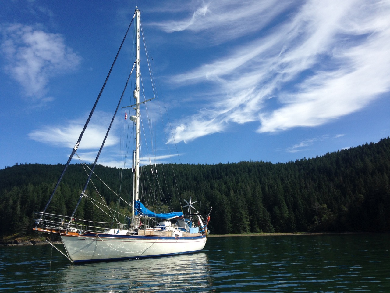
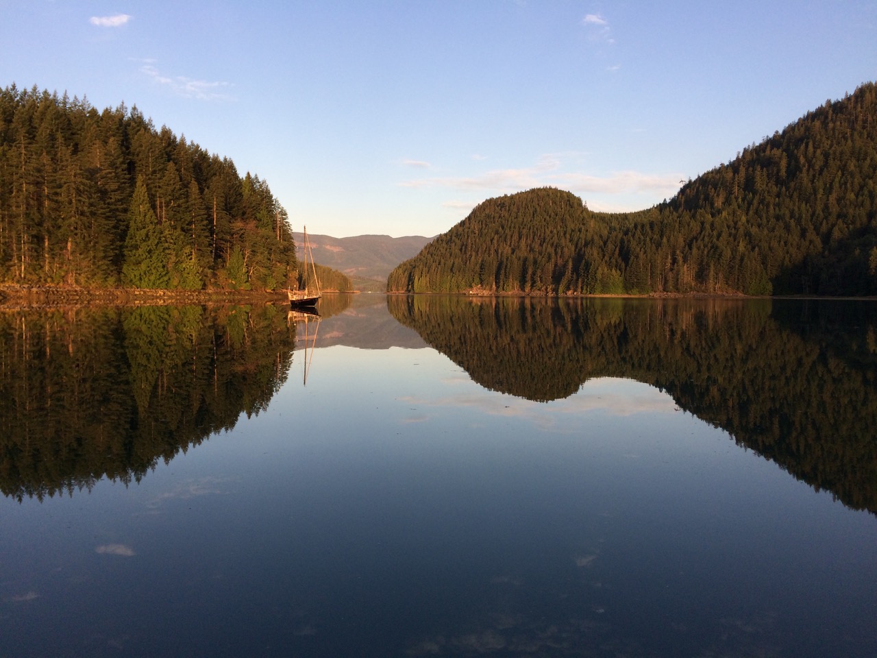

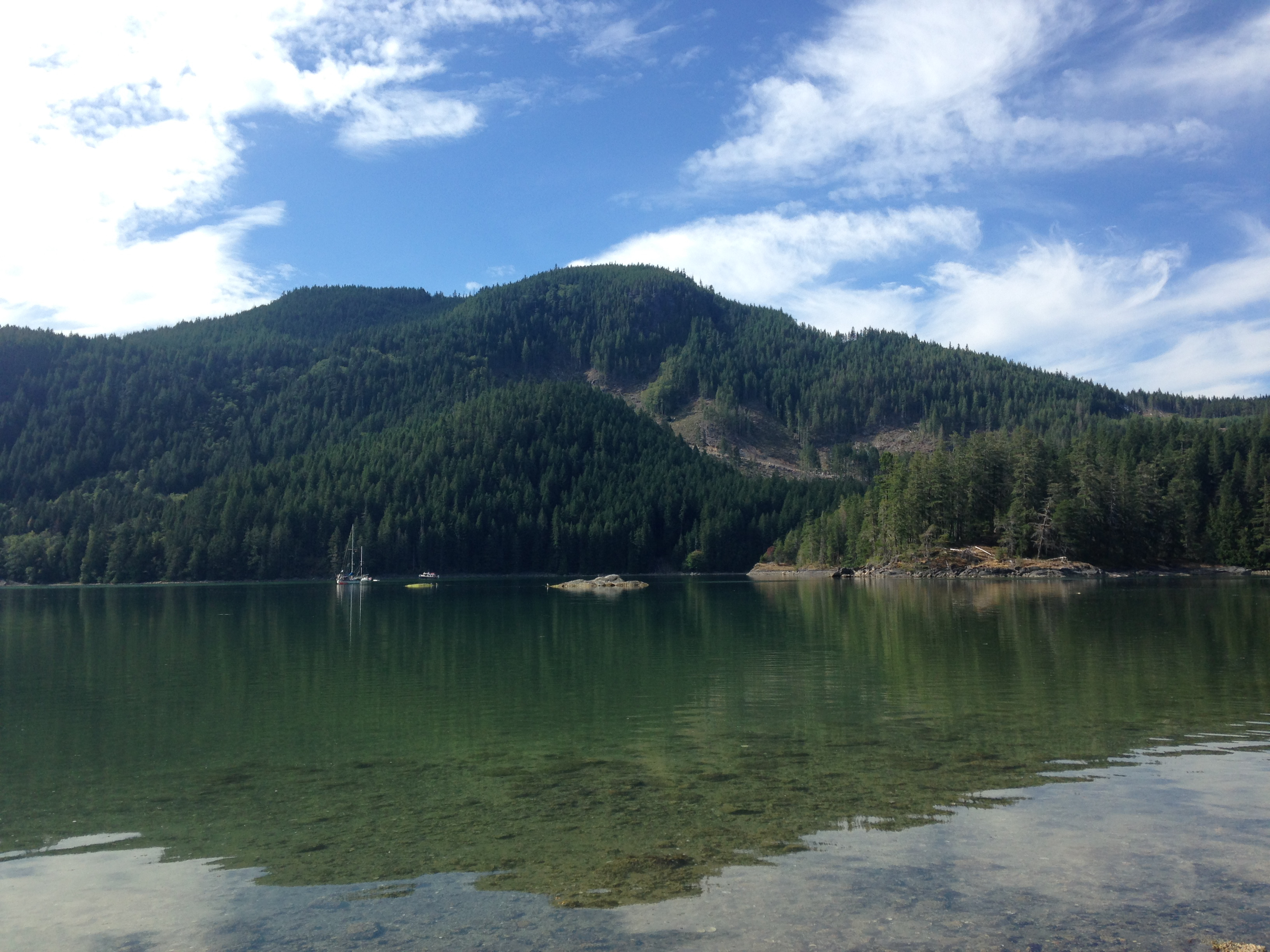
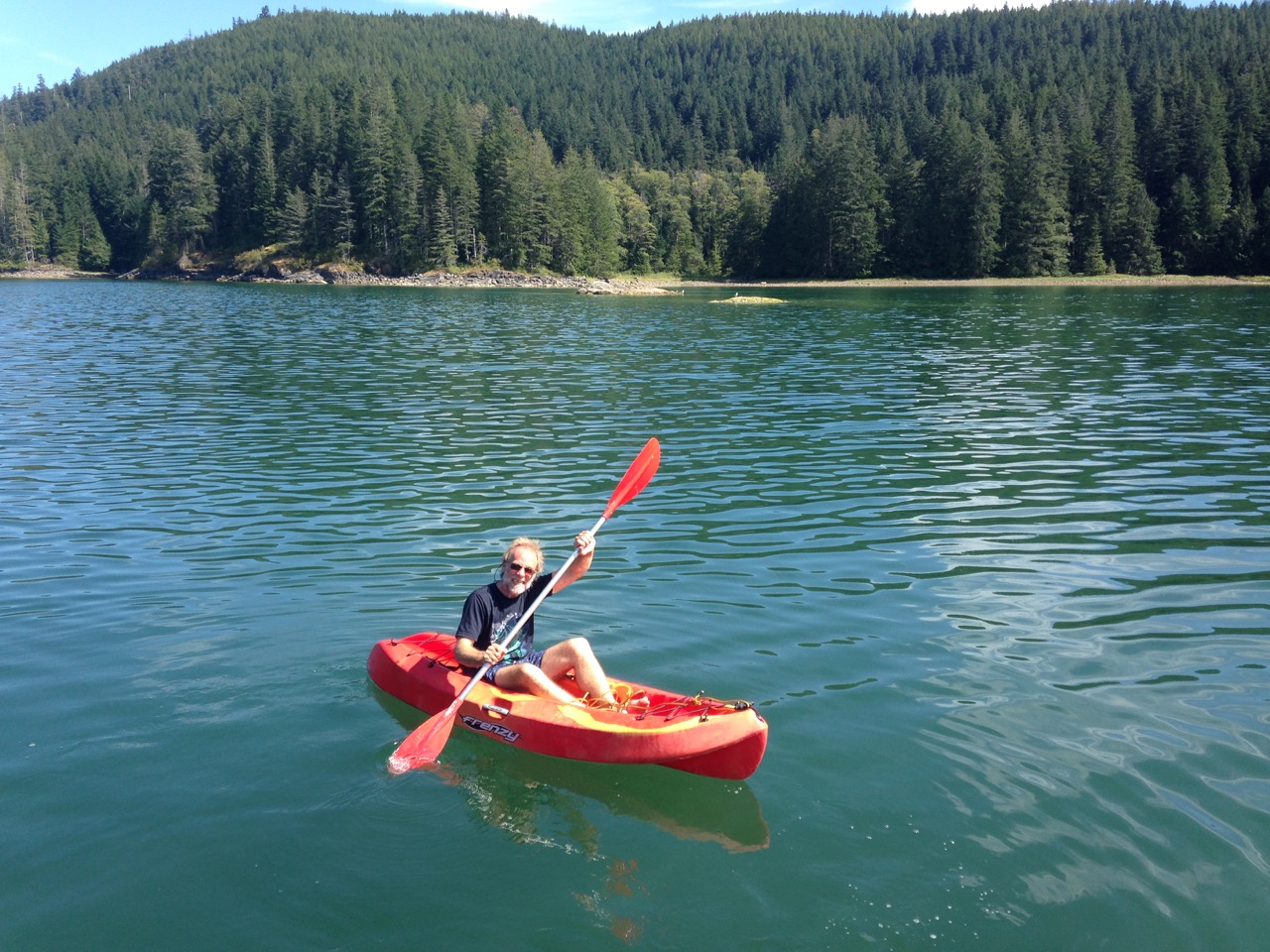 The next day we had to pass through one of the most dangerous passes in Canada, the Seymour Narrows
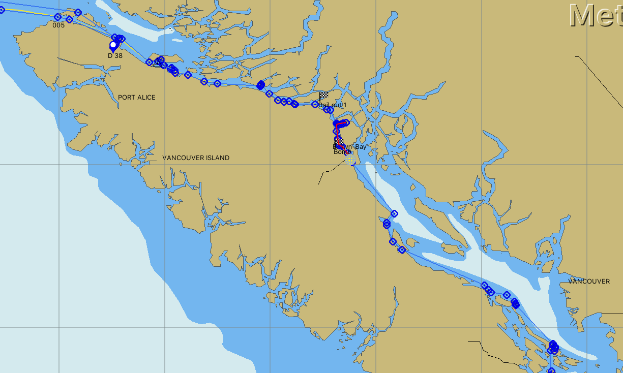
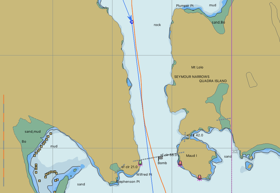
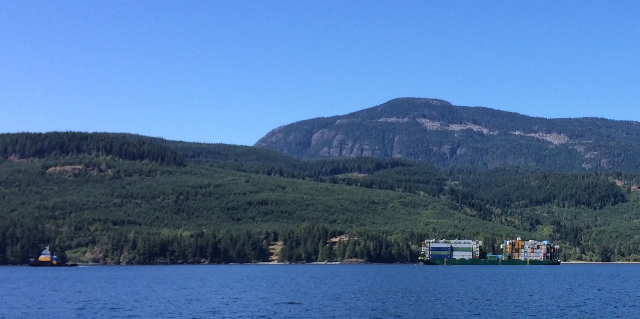
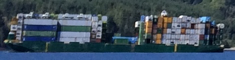
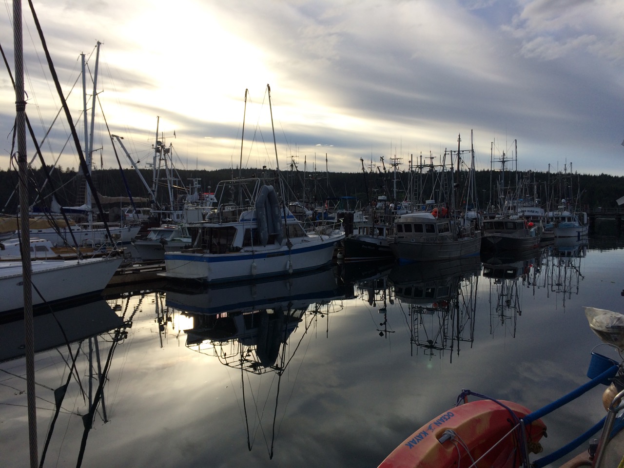 A Gill-Netter is a certain type of fishing boat/style where a long net, about 1/4 mile, is let out from the stern of the boat from a large drum and then the boat and the net drifts. The boat can be pointing at the net or away from it, or anywhere in-between, meaning that spotting the boat doesn’t give us a clue as to where the net might be. I have just had a good chat with the skipper of the boat and he told me that tomorrow the fisheries open for a three day window, and that he, and hundreds like him will be rushing to the water, in particular the straits and passages we are going through, and there will be Gill-Netters everywhere. His advise to me is to stay 1/4 mile away from every fishing boat, which is easier said than done.
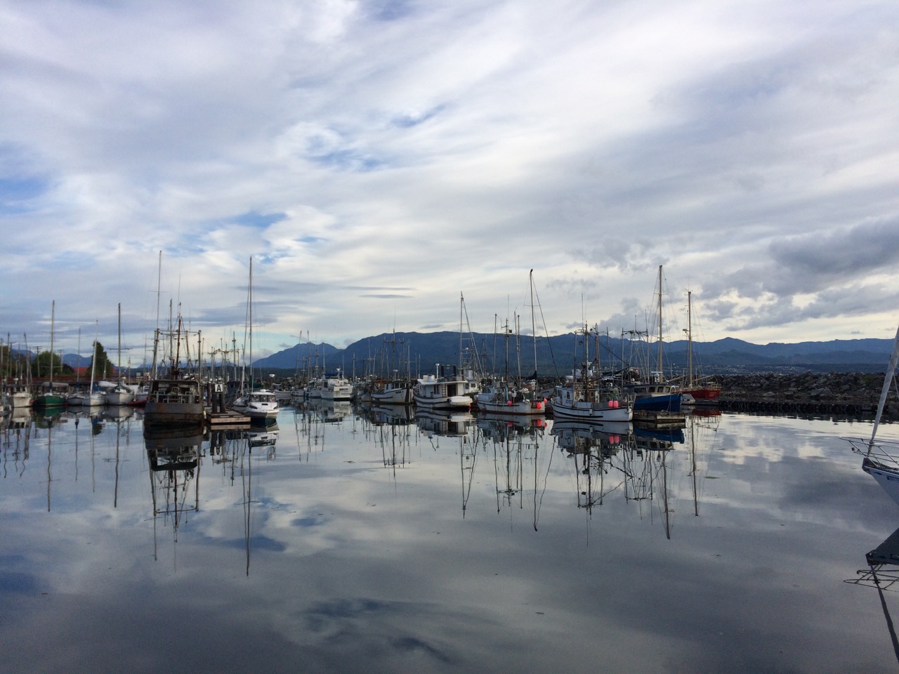 The Inside passage is a maze of waterways, rivers, straits, passes etc that run from Seattle all the way up to Alaska, about 1000 miles in total, most of it is protected from the Pacific gales and provide a safer route along the coast in rough weather. We joined the passage at the top of Vancouver Island and we are now working our way south, hoping to be in Seattle for the 17th when there is a rally/meet up of boats & owners of boats designed by Bob Perry, the designer of our boat. It’s an annual event, and it seems daft not to attend as we are so close. However it does mean we need to rush a little to get there.
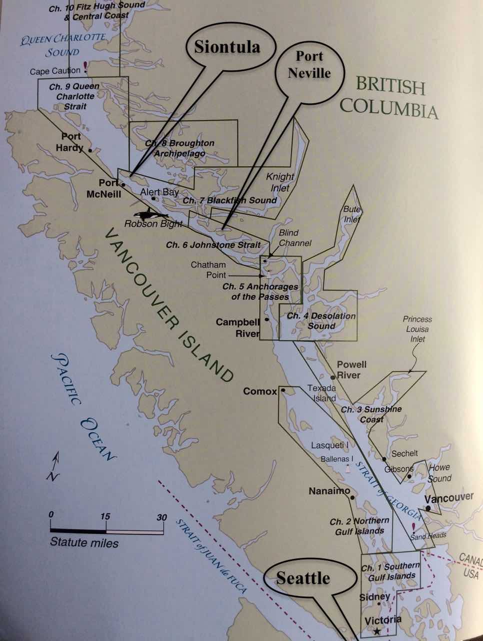 One of the big problems of the inside passage is that the Pacific Ocean sea level rises and falls by about 4 metres every 12 hours, and it rushes into, then out of the Inside passage. The water races through the myriad of waterways, and where it is narrow, and especially where it is shallow, or there are underwater features like mini mountains, it can get quite crazy. It’s not a gentle river by any means, in some places it’s very deep, I’m not sure exactly, but when Captain Vancouver on Discovery first surveyed it for our Queen back in 1792, while looking for a north west passage, they would swing the lead deep into the water and his crew would often shout ‘No Bottom Found’, presumably relating to the water depth.