Fogust: Bears Black and Grizzly, Sea Otters, Dolphins and beautiful anchorages (Pt1)

Sointula

:  

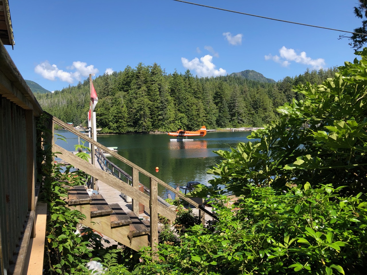
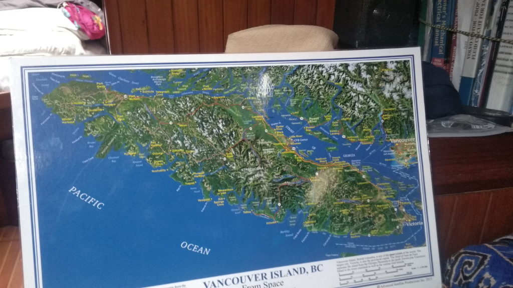
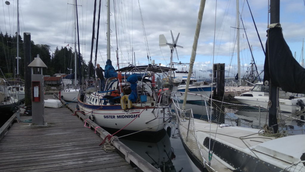
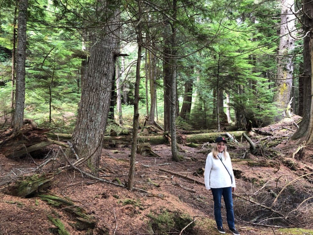
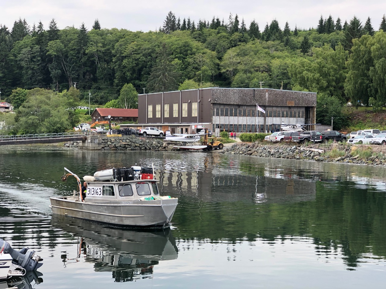
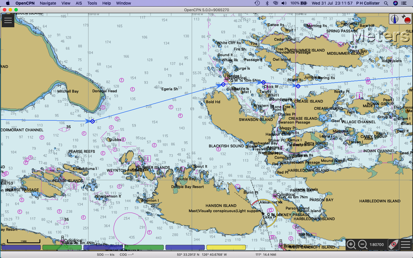
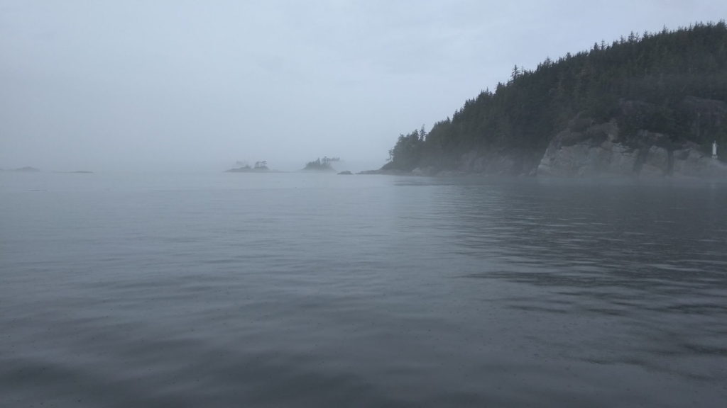
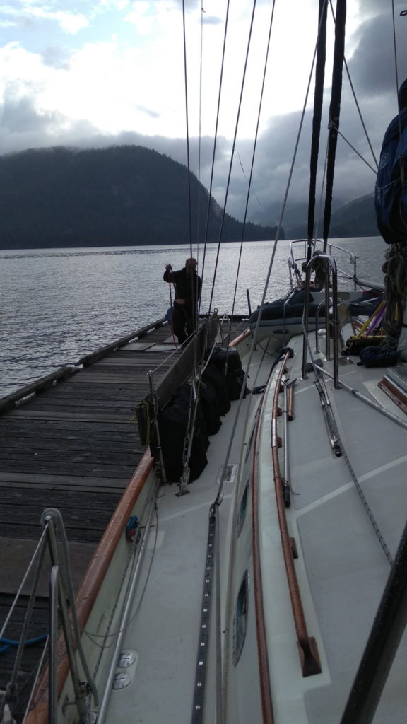
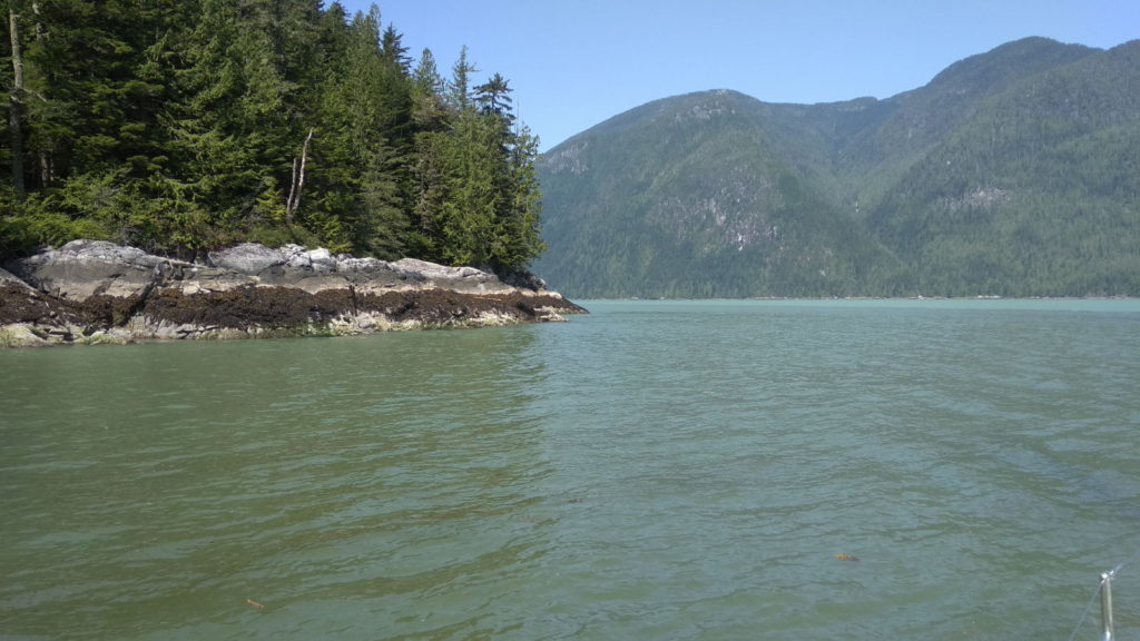
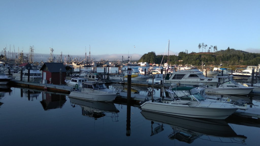
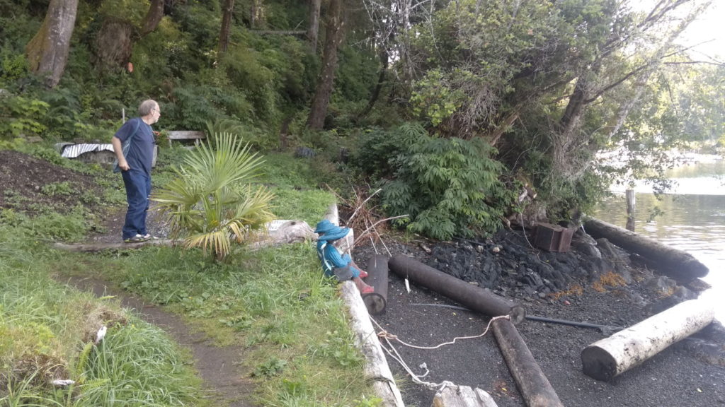
Fogust is the term used by Canadians for this time of year when fog is guaranteed most days. As if to prove this, the air around us was milky white when we got up on the first morning of August. It had rained heavily through the night and the temperature had dropped. After a short discussion about whether to set off or not, we came to the conclusion that we would only be hanging around the harbour on a damp, chilly day, and might just as well be going somewhere. There was every chance the fog could clear as the day went on anyway. We left Sointula at 9 30 for the 5 or 6 hour passage to Minstrel Island, a place where Grizzlies had been spotted lots of times according to reports in our nautical guides.

Leaving Sointula

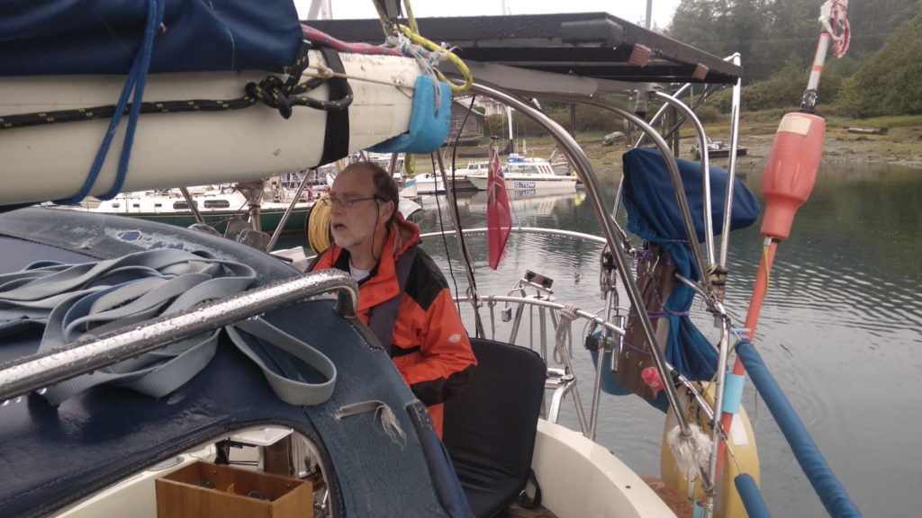
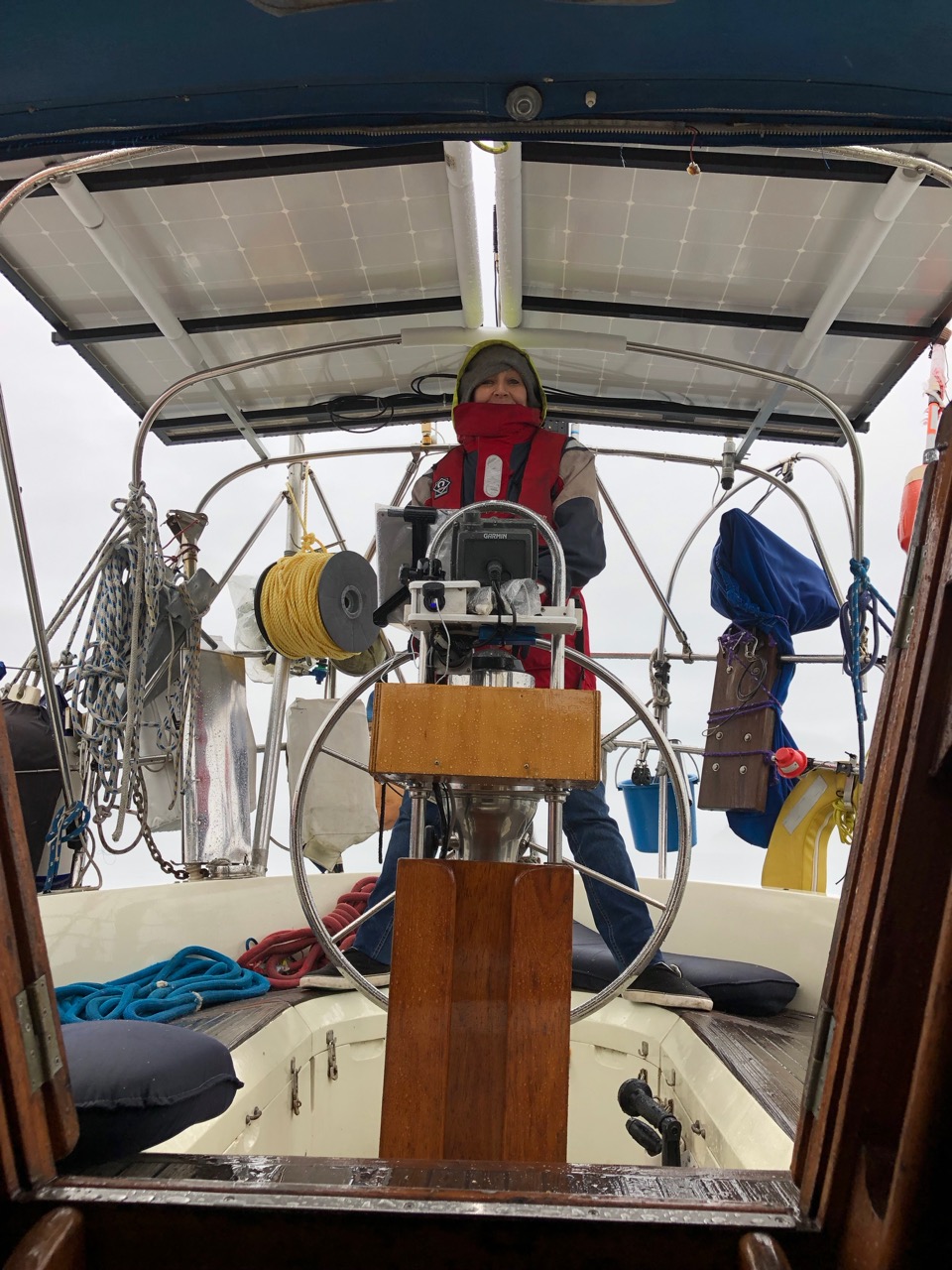
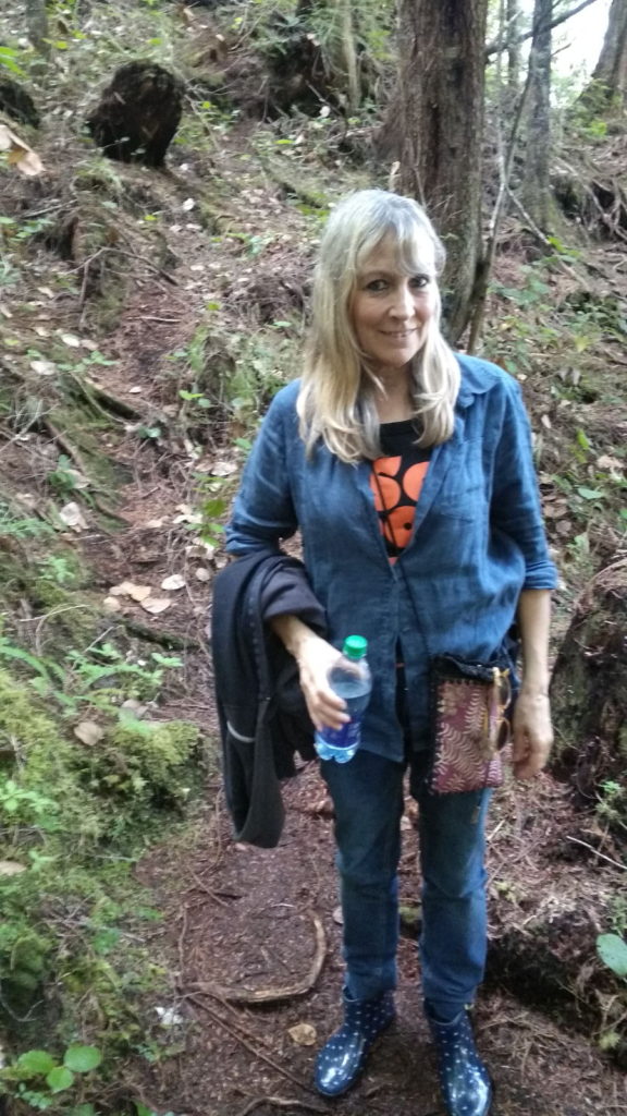
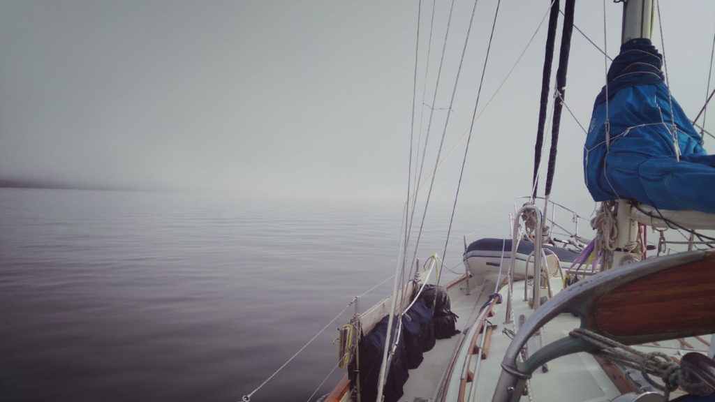
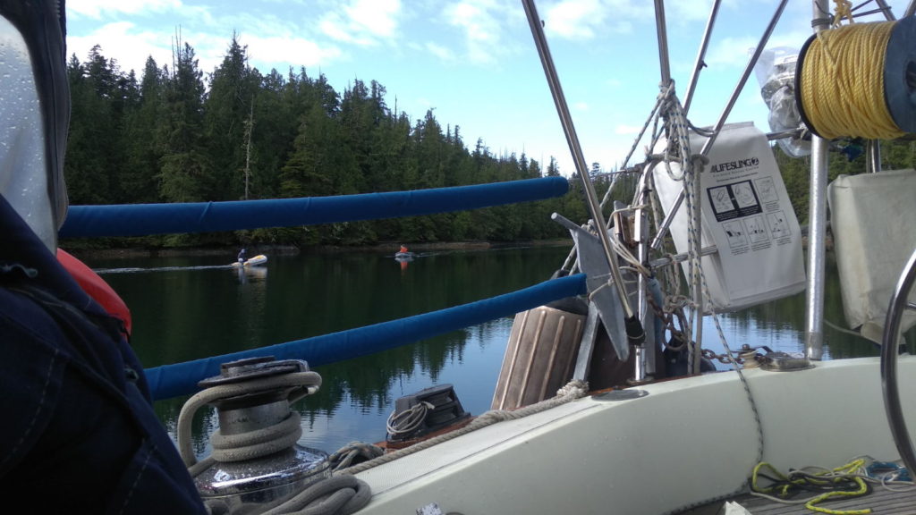
We hadn’t gone far when we discovered the autohelm wasn’t working. I knew Paul could fix it but he wasn’t going to be able to do that during this passage. The fog was fairly thick around us and it got steadily colder and wetter as drizzly rain began to fall as we progressed further out. We would need both pairs of hands and eyes in these conditions, faced as we were with hours of hand steering. This brought home to me how much I have come to take the autohelm for granted. Invariably we untie from marinas, weigh anchor or slip a mooring buoy, motor out for 5 or 10 minutes, and then switch over to autohelm and relax (most of the time). It frees us up to get on with other things. I remembered a night not long after Paul had acquired Lady Stardust in 2005 on a night passage returning to Liverpool from The Isle of Mann. It was freezing cold, pitch dark, and the sea was rough enough to lurch us from side to side. We didn’t have autohelm then and took turns hand steering for four hours each throughout the night. I can still feel how chilled through I felt, and how cold my hands and feet got, despite being encased in layers of thermal gear, a full set of oilies, woollen hats and gloves etc. Staring out at the fog and rain this morning, I comforted myself with the fact that at least it wouldn’t be that bad. Such poor visibility does make you feel vulnerable, though: it was only possible to see a couple of feet ahead. This wasn’t quite how I imagined my first day back at sea would be after nine months away from the boat.

Fogust!

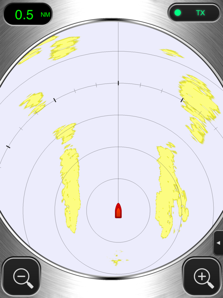
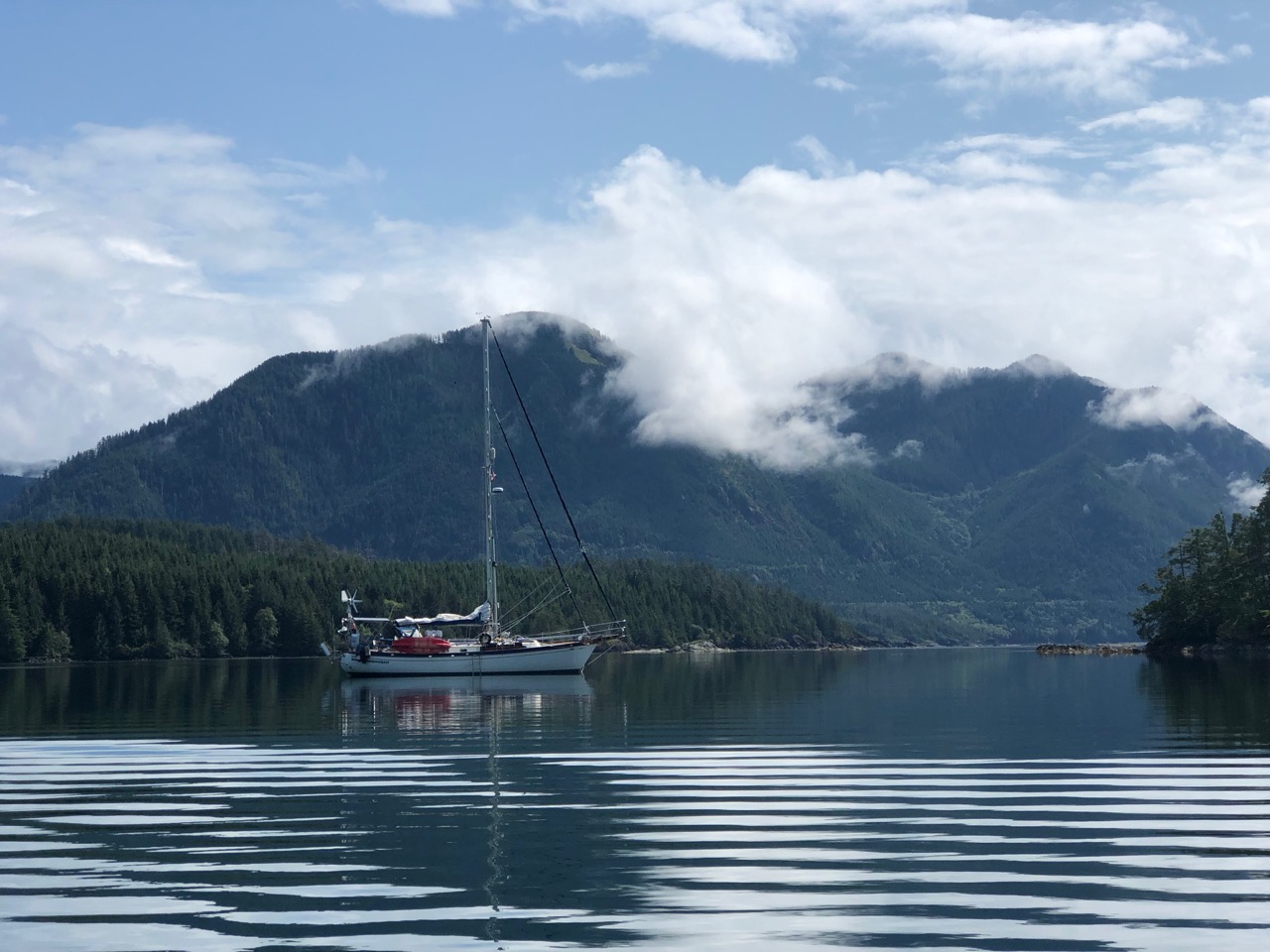
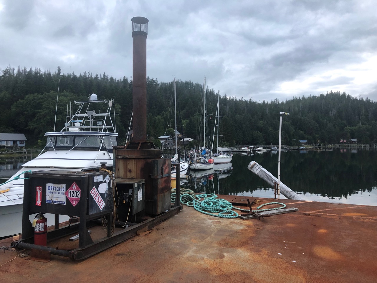
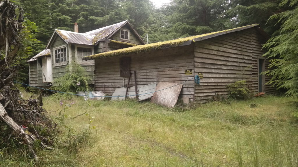
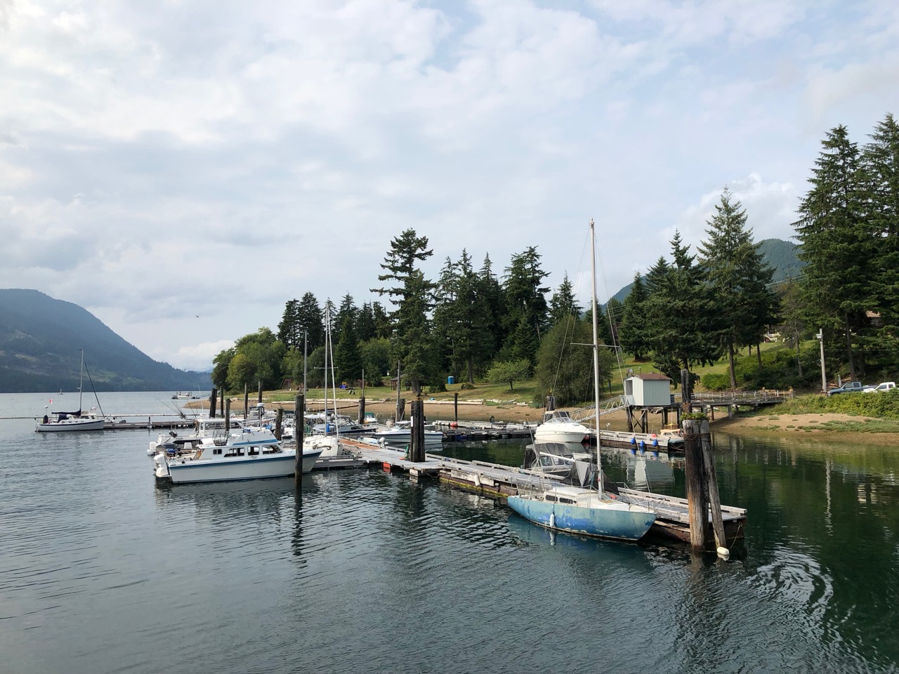
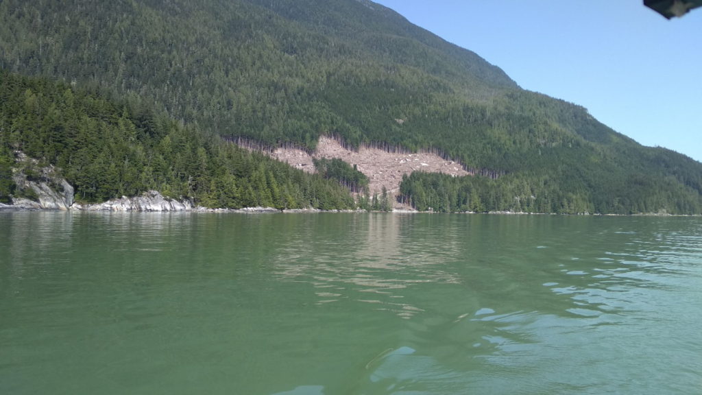
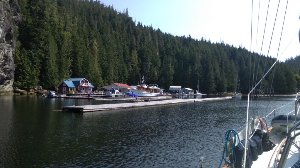
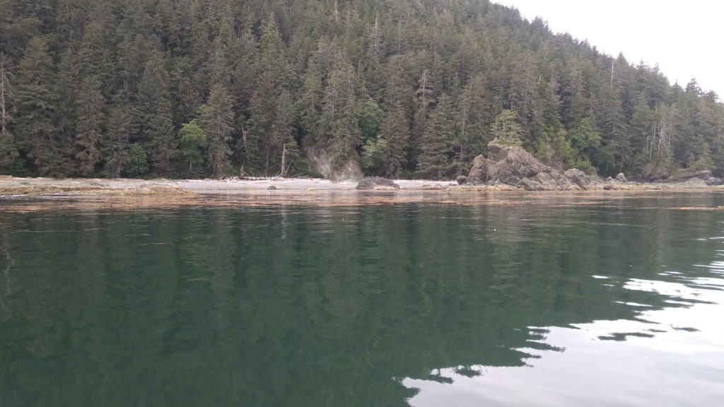
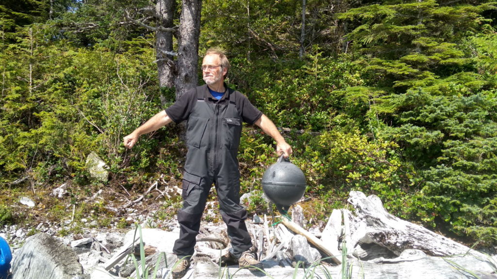
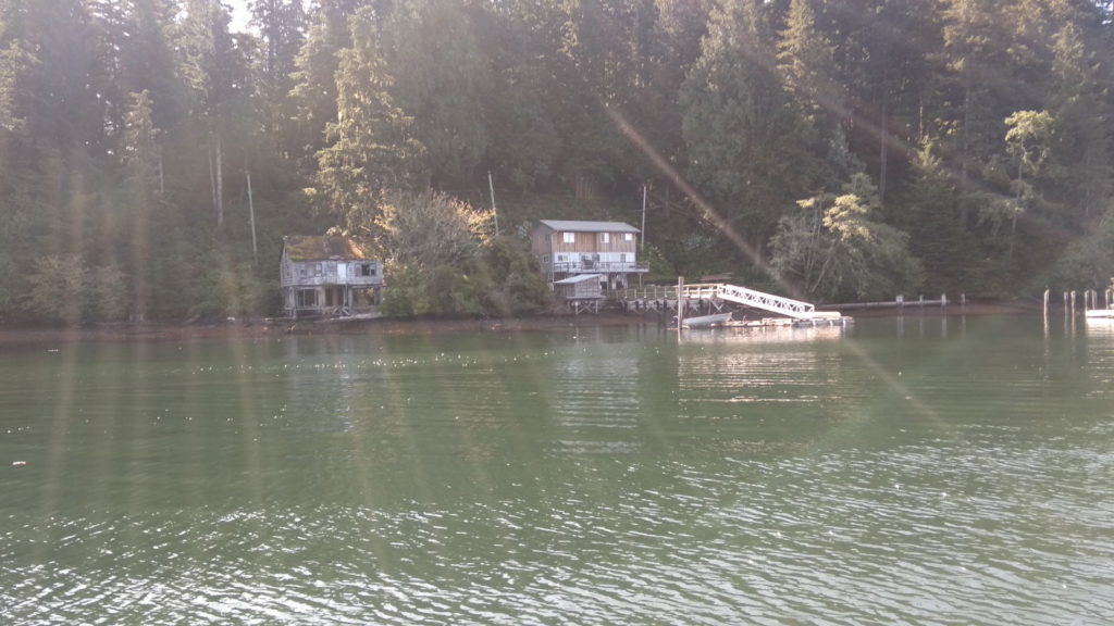
It did at least provide us with an opportunity to test out the new radar, and for me to re-familiarise myself with the AIS. I positioned myself at the chart table and studied both screens until I got the hang of how the information on the radar was displayed. Paul told me to watch for consistent shapes as opposed to ones that faded off after a couple of appearances, since that was the difference between a vessel and large pieces of debris or logs that the radar picks up.  We did 90 minute alternate stints on the steering but the cold got through to me after only half an hour and I realised I’d been hasty in thinking I didn’t need to clad myself in full weatherproof gear. Being so constantly occupied and vigilant made the 5 hour journey go very fast, however, and the fog had lifted a bit by the time we approached our destination. We tied up to a pontoon that had once been part of a thriving marina but which was now abandoned. It was an eerie looking place, with only a couple of other boats taking advantage of the free berthing. Nature has already begun to claim back part of the constructions, and Paul had heard that the place was scheduled for complete demolition sometime soon. For now, though it was a welcome break from the fog and cold. We wasted no time in putting the heater on and shutting the hatches against the wind. The rain got heavier an hour or so later.

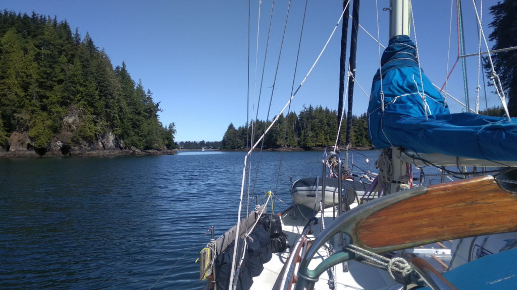
It rained heavily all night again, and a couple of times when I woke during the night I could see flashes of lightning through the V-berth’s hatch, but we slept well despite this. It was dark and peaceful and most importantly, warm in the morning. The air didn’t feel quite as icy when I stepped out into the cockpit, and the rain had stopped. I was particularly pleased by the lack of fog. Only a few wispy strands clung to the tree tops when we motored off at 9am.

Leaving the anchorage

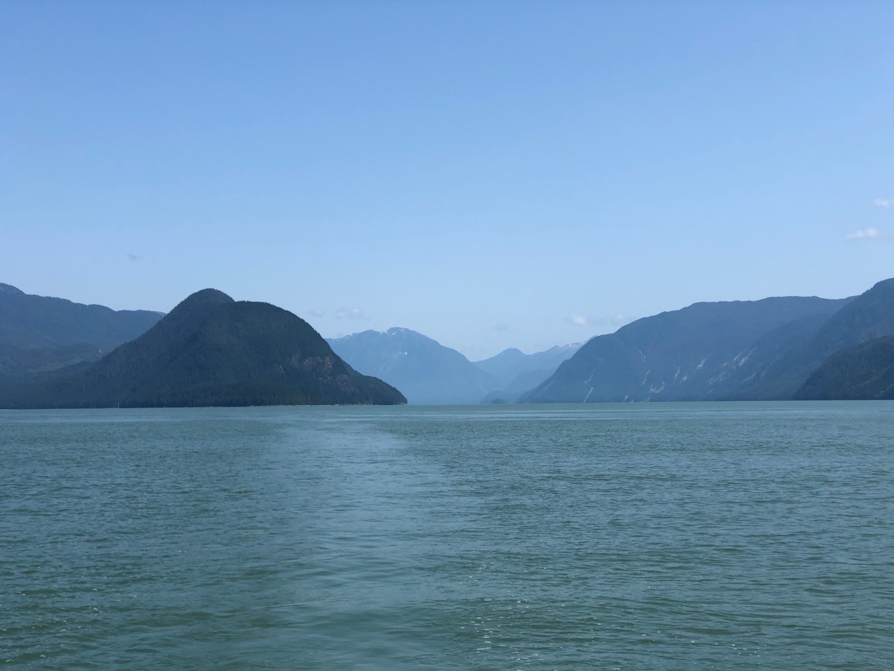
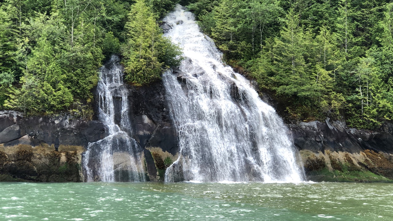
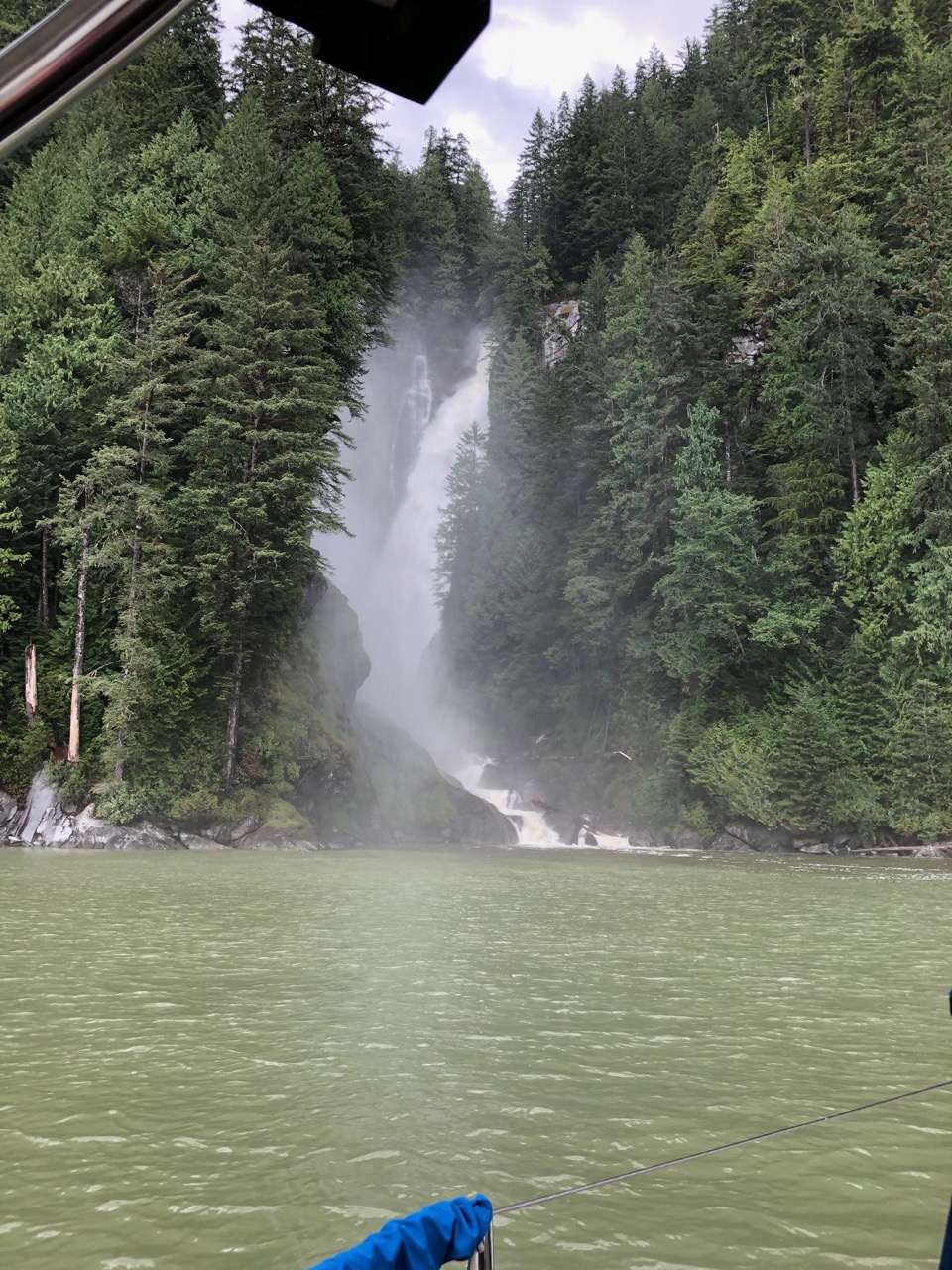
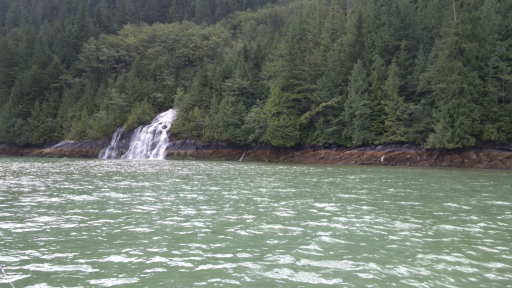
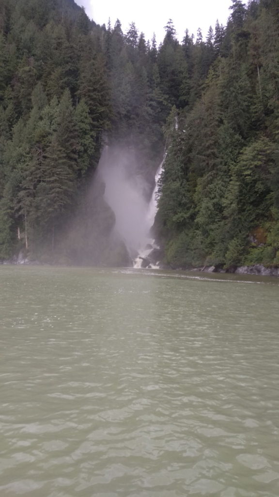
A couple of hours later it was clear, calm and dry enough for Paul to get on with the task of fixing the autohelm. Once that was working it was pleasantly mild enough to stand on deck and scour the shore for signs of life. Very few other boats were around and by 2pm we’d made such good progress Paul decided we’d motor on past our intended stop at Glendale Cove and carry on further into British Columbia’s longest fjord (70 miles long and two miles wide). This was in order to see the waterfalls that had been recommended to us. They were indeed a sight worth seeing, cascading down into the sea from mountain heights of up to 6,000 feet; a truly mesmerising sight and sound. The environment on either side of us looked ideal for bear-sightings but all we saw were hawks and eagles soaring above the water ready to pounce on their prey – a magnificent sight in itself, but I desperately wanted to see a bear.

We doubled back and returned to the anchorage at Glendale. There is a lodge and accommodation on shore specifically for Grizzly bear tours so we were definitely in the right place: our nautical guide, Waggoners, the authority for cruisers in this area, claims it has the highest concentration of Grizzly bears on BC’s west coast.  After anchoring we continued to scour the shore until evening fell but it remained disappointingly empty of life.

Glendale

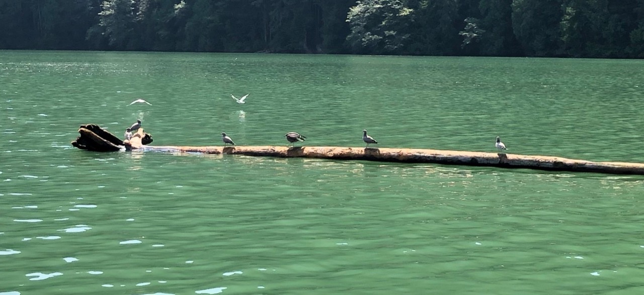
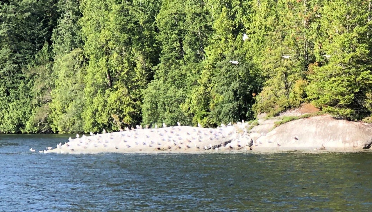
On Saturday 3rd August we were up early to check on the depth as there had been a concern about our position in the shallow part. Boats and kayaks from the lodge were out and we tuned into their radio frequency, knowing they would probably communicate sightings and locations amongst each other. One passing kayaker told Paul he’d seen three bears the previous day, and if we waited long enough we were sure to spot one. Meanwhile, there was plenty around to keep us entertained as sea birds descended for the morsels to be found in the mud from the receded tide. Gulls, herons and lots of other birds that we didn’t know the names of, flew down pecking on the beach and getting aggressive with those who tried to get too close to them. They all seemed to fear the mighty eagle, though – flying off en masse whenever it swooped near them.  

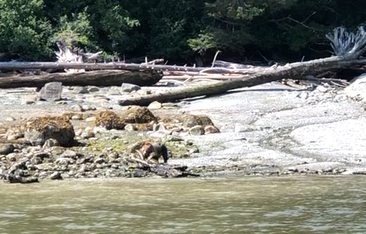
Once the tide had risen again, it was time for us to be moving on. Several of the lodge boats were gathered near the shore of a beach as we began to motor out into the bay. It became clear they were watching something, so still and focused were the passengers. Paul was the first to spot that it was a bear. Grabbing the other binoculars, I could hardly contain my excitement when I saw it too. A Grizzly bear, foraging only feet from us, and not at all fazed by so many pairs of eyes staring at it. I’m not ashamed to say it brought tears to my eyes. I’ve always loved bears, and have long lamented the rough deal some of them get at the hands of humans. This one was living as it should be, going about its business undisturbed, and with cameras, not guns, aiming at it. We watched for half an hour before I could tear my eyes away. Paul got a fairly good video clip of it but mine didn’t come out as well as I’d hoped. Still, there would be more to see (hopefully).

There’s a bear in the distance!

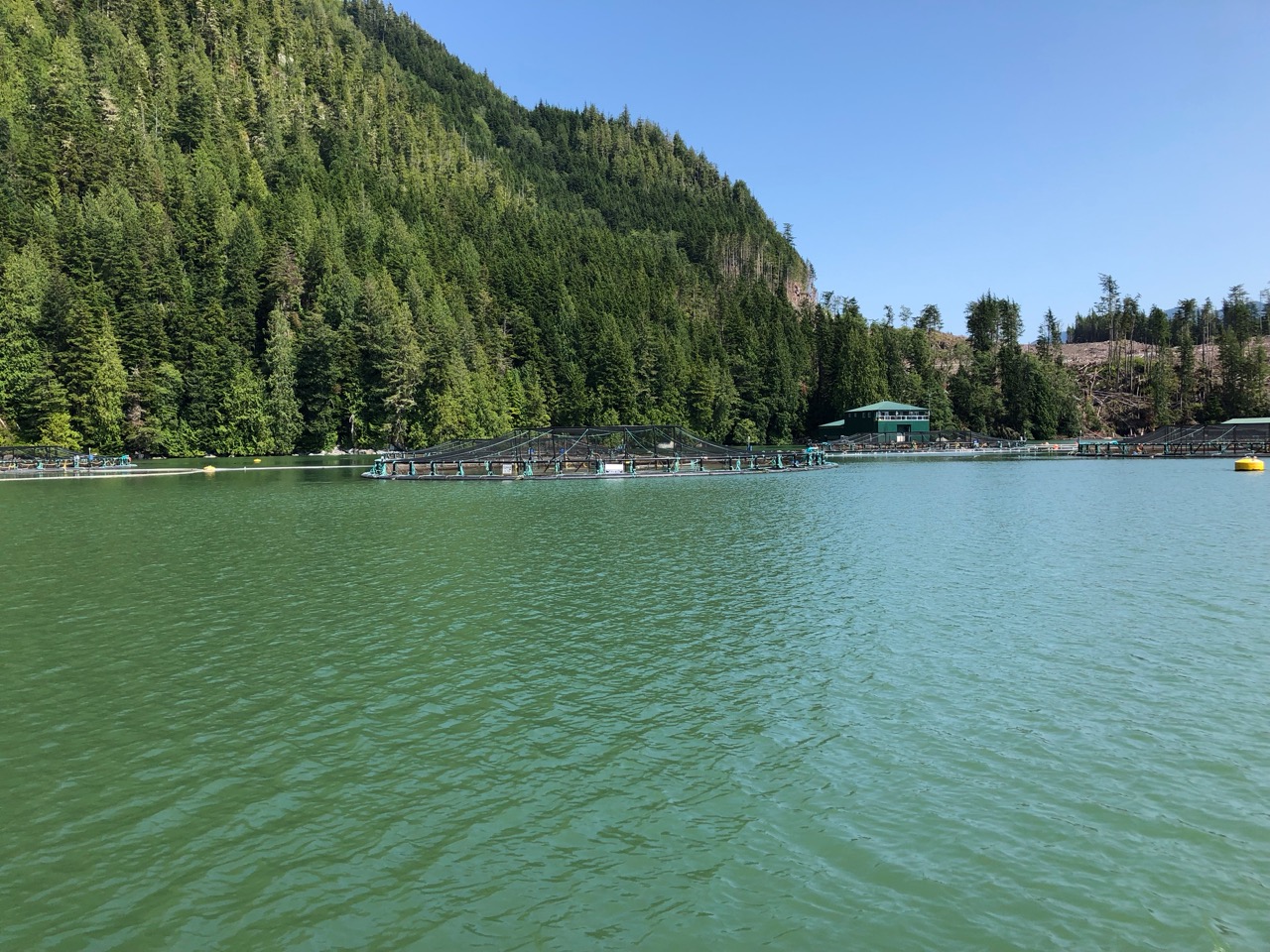
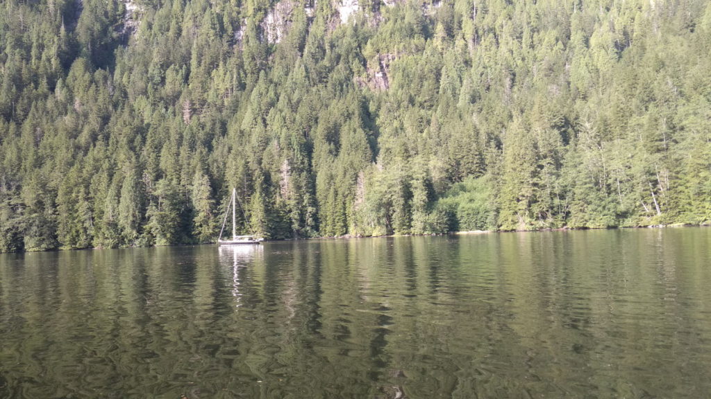
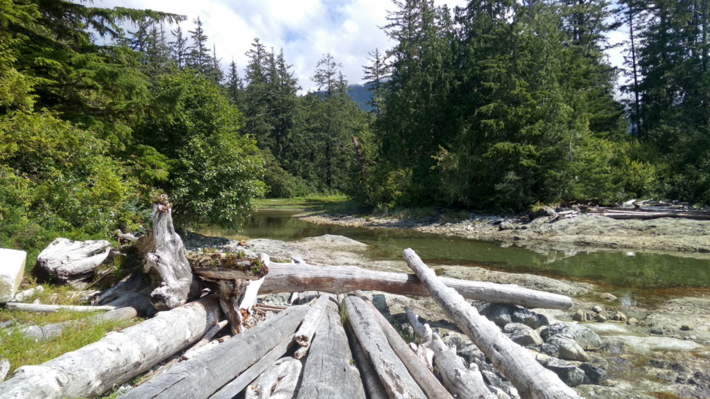
We journeyed on through steep, thickly-forested hills on calm blue water as the day grew warmer. The whole area is uninhabited by humans. We saw a solitary fish farm with two workers busy tending the huge operation, and maybe a couple of other boats but we were largely on our own for the entire passage to Kwatsi Bay. Paul had gallantly chosen this place in preference to the other option, Echo Bay, which he’d discovered holds a pig roast every Saturday evening. He thought correctly that I’d want to give that event a miss. We arrived at 5 30 and anchored in a beautiful location.

There was only one other boat nearby, but best of all there was a black bear on the beach opposite. We sat in the cockpit with binoculars practically glued to our eyes – another amazing sight to marvel at. We heard splashing close by as we watched; dolphins were diving near the bow as if to catch our attention and pull our stare towards them instead of the bear. Every time we looked back at the bear, the splashing would start up again. It was such a peaceful place; we had eagles soaring above us and the calls and squawks of other birds coming from the forest while we sat taking it all in. I kept thinking that we were only feet away from a bear when every other time I’ve been that close to one has been in a wildlife park. It was a humbling thought and I felt privileged to witness it.

Black bear territory

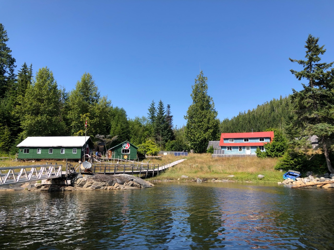
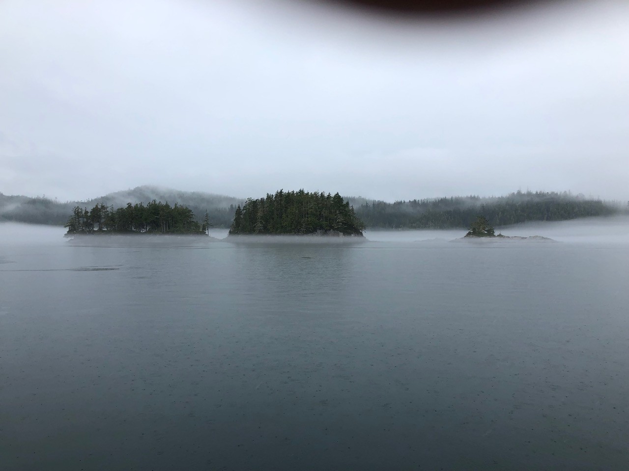
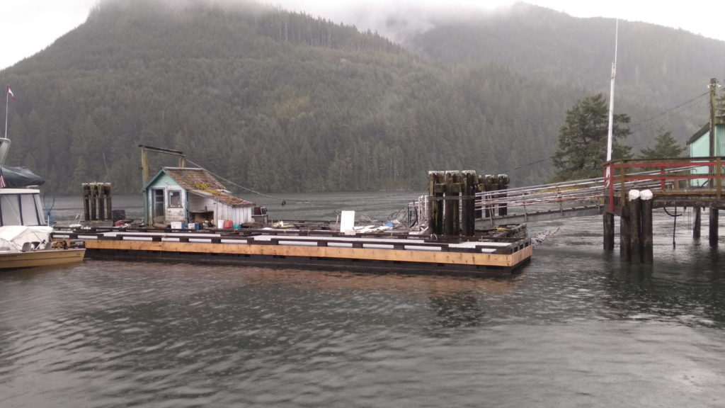
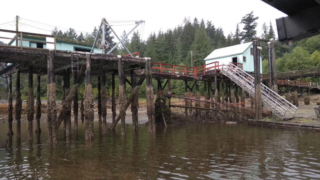
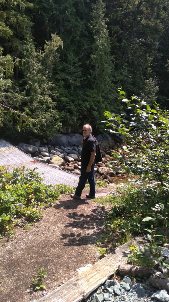
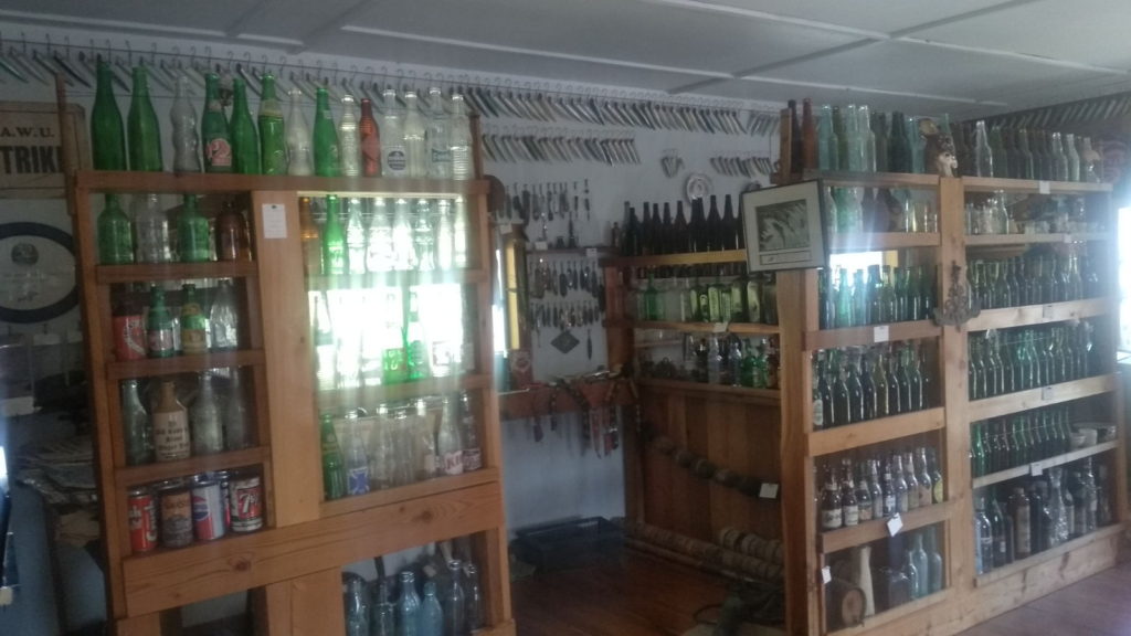
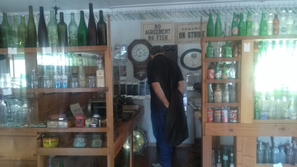
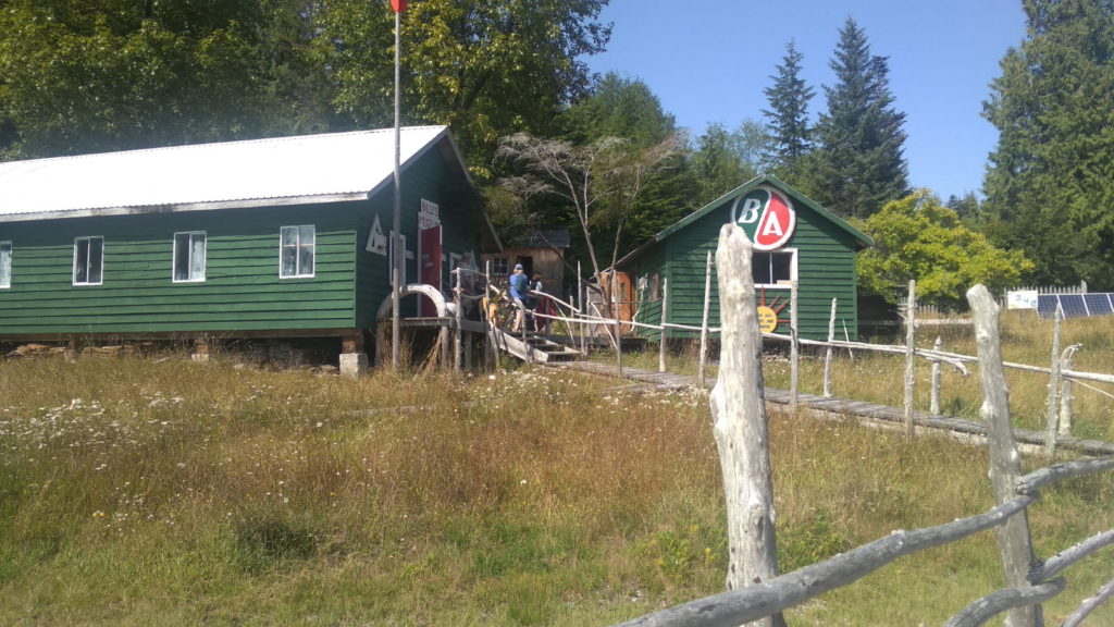
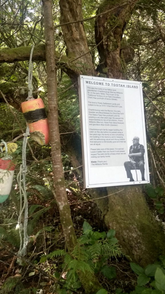
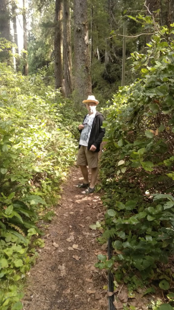
Pig roast over in Echo Bay for another week, we set off for it on Sunday 4th. It had been misty earlier in the morning creating a picturesque image as it swirled around the trees. The skies were clear by 11, leaving us with a chilly wind but calm waters for the short hop to Echo Bay. We secured a berth there and were tied up in a charming little marina by 1 30. Keen not to miss the museum we’d come to see, we checked in at the office cum shop and asked for directions to it. Billy Proctor is a well-known character around these parts. Well into his 80s, he has filled the museum with artefacts from a lifetime in the islands. The 20 minute walk took us through a steep woodland trail which brought back memories of millipede-laden paths in Asia that had rendered me rigid with fear. No millipedes here. Instead, there were huge green slugs that looked like snakes! Despite this and the heat from the afternoon sun it was a nice walk to Billy’s dwelling.

Echo Bay
On the way to Billy Proctor’s

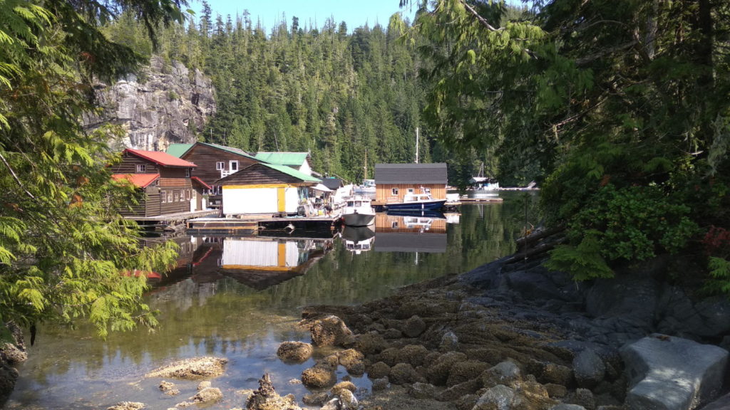
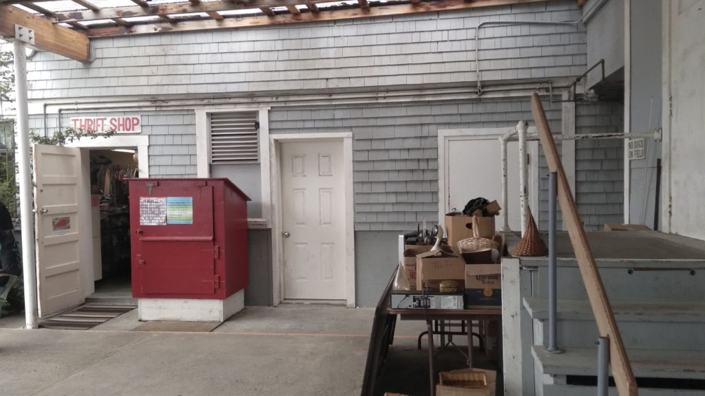
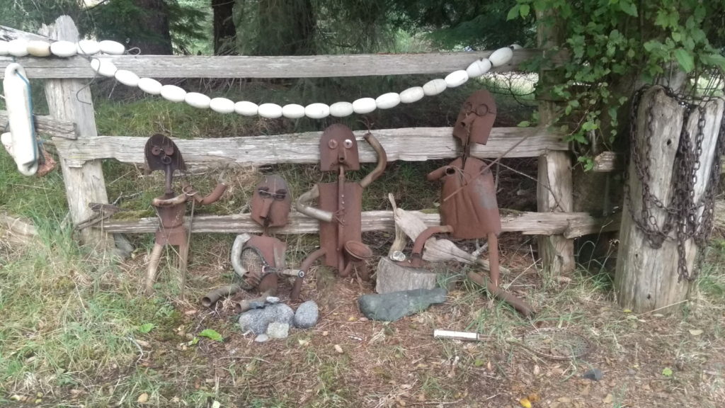
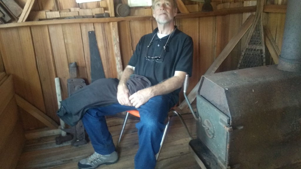
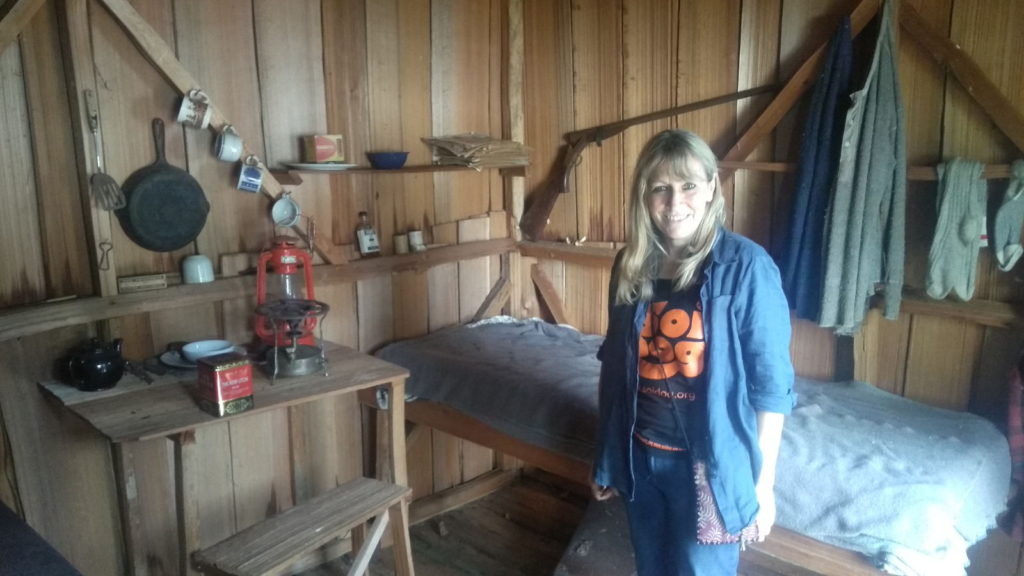
The man himself was sitting on a bench outside chatting with two other guys when we got there. The exhibits were contained in a large shed-like building which Billy had built from lumber he’d milled himself. It seemed he had kept pretty much every item he’d grown fond of over the years from his childhood onwards. I spotted several things familiar to me from the 60s and 70s, such as egg cups, picture books and old kitchen appliances. There were hundreds of coca cola and other soft drink bottles and cans, fishing equipment, old sporting programmes, cameras, toys and far too many other miscellaneous items to mention. Billy ambled in to inform us that he’d collected a lot of stuff over the years. We nodded our agreement and praised his preservation and arrangement of so many things. He told us he’d built a log cabin out of just one whole tree, and to be sure to visit the small replica school house he’d built next to the museum which he’d filled with items from the original Echo bay schoolhouse that had closed in 2008. It was a fascinating place, a real out-of-the-way sanctuary overlooking a small dock where his and other boats were tied.

Billy Proctor

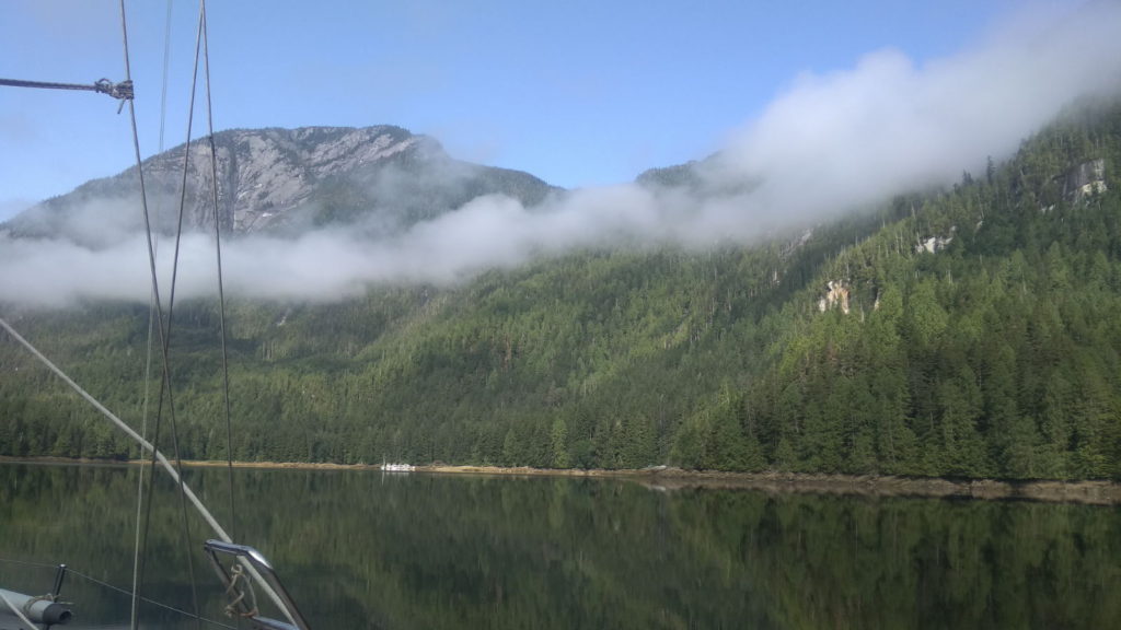
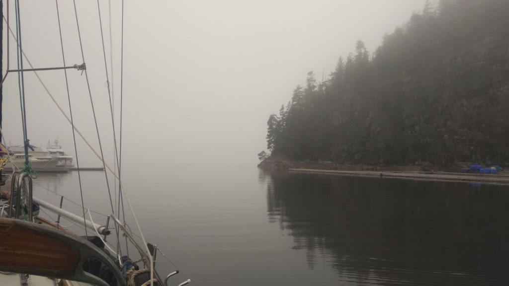
More thick fog greeted us early in the morning as we prepared to depart for the trip to Port Hardy. This would be a longer passage and we began it surrounded by swirling white mist – like being surrounded by steam in a hot bathroom, but more eerie. We had to set forth into it hoping we were not too near other vessels, rocks or logs. Once out of the marina it grew ever more disconcerting. I likened it to driving with a blindfold on and felt happier sitting at the chart table scrutinising the radar and AIS screens while Paul hand steered in the chilly cockpit.

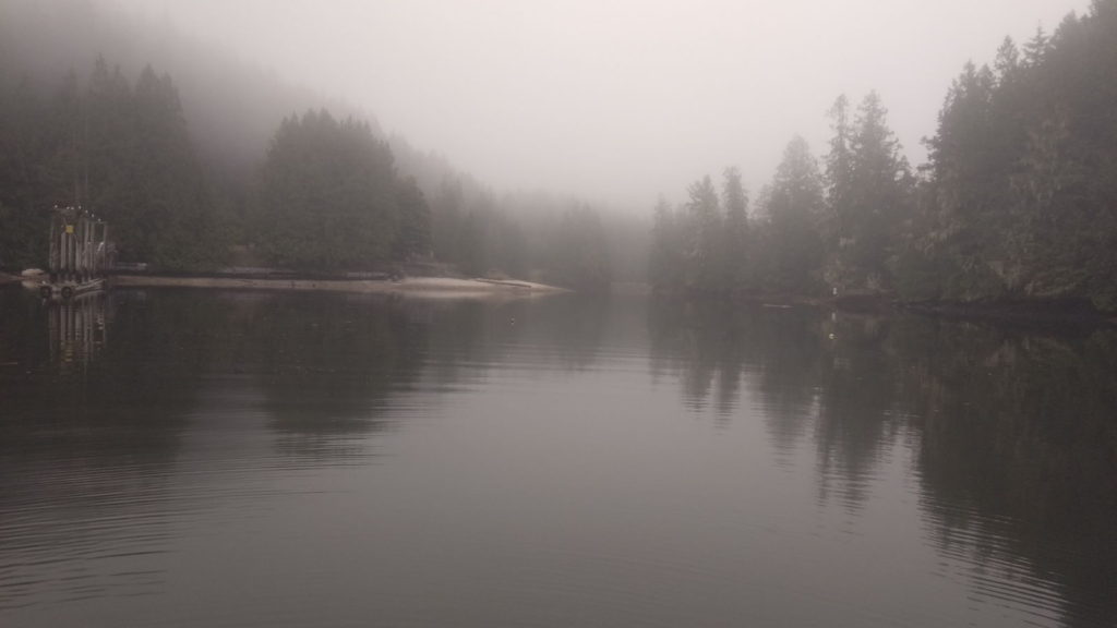
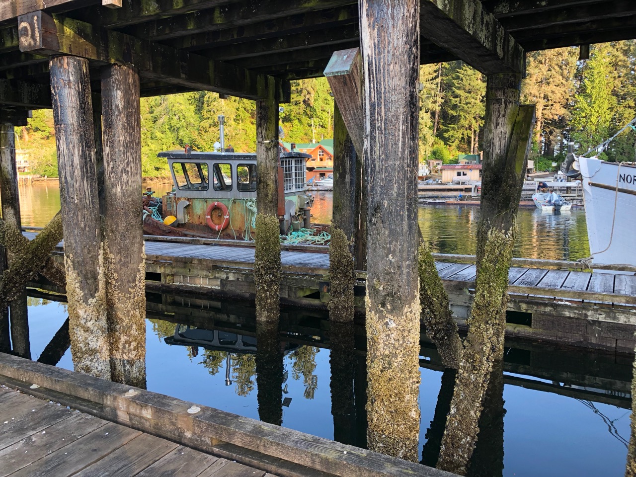
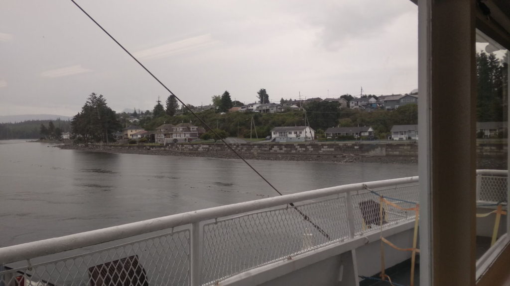
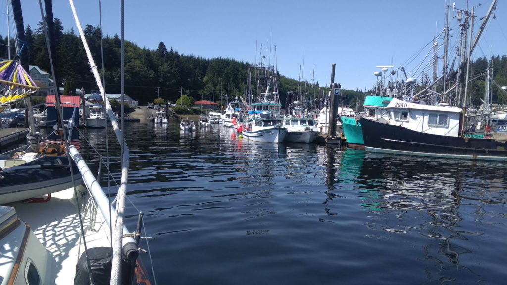
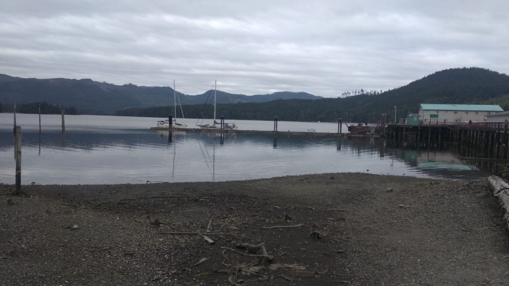
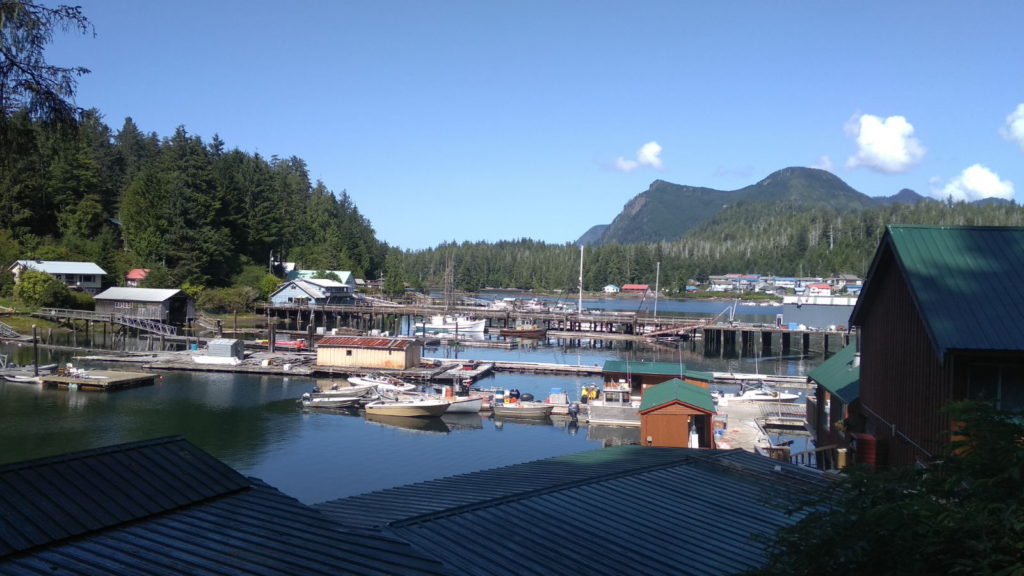
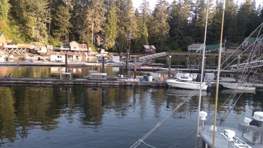
As soon as we had cleared all the land masses the autohelm took over and I prepared some vegetables for soup that evening. The fog lingered until well after lunchtime, only clearing as we tied up in Port Hardy at 2pm. This was where we had begun our Canadian travels ten months earlier after our five week crossing from Japan. It felt good to be back in the familiar and friendly Fisherman’s Wharf. We rafted up to a boat that looked as if it had been there a while – space is always tight here – and took a walk into the centre to provision for the next week or more, as shops were likely to be scarce from now on.

Port Hardy

After spending a lazy day in Port Hardy catching up on various tasks and internet stuff we untied from the boat we’d rafted on to early on Wednesday 7th August. The fog had cleared by 10 o’clock and it looked like a warm day ahead. Bull Harbour was our destination and we arrived there at 12 30. Only First Nation people are permitted ashore here unless you have special permission. There were two motor boats tied on to the visitor pontoon but we chose to anchor further out in 5 metres of water. No phone coverage or internet here, and it was too chilly to be outside so we stayed in with the heating on listening to classical music while I made pastry for vegetable pasties.

Bull Harbour

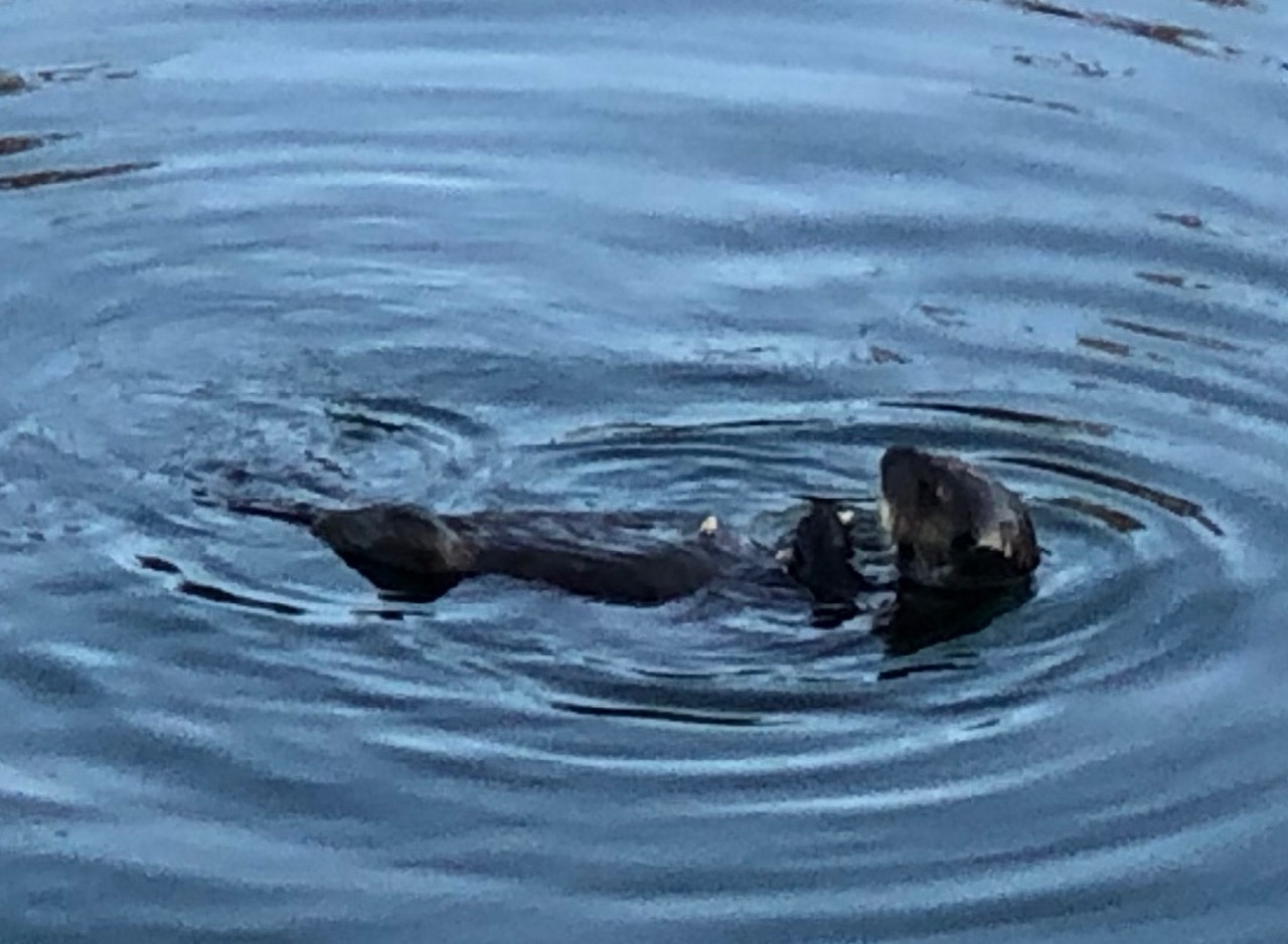
I hoped Sea Otter Cove, our next port of call would live up to its name, unlike Bull Harbour where I didn’t even spot one bull. I saw a sea otter as we drifted away next overcast morning – convinced it was the same one who’d popped its head up when we arrived. The boat seems to startle them – they stare at it momentarily before flipping over to display their seal-like body and diving under the water. This passage would take us round Cape Scott. Waggoners was full of dire warnings about it, devoting almost a full page to its hazards and historical tales of disaster. It ends with this grave statement; ‘a careful skipper, fully aware that the safety of his vessel and crew truly are at risk at Cape Scott, must judge conditions and make the right choices’. Sister Midnight’s skipper insisted it would be ‘no big deal’. He did say we would be exposed to the elements once we had cleared it as we’d be in The Pacific with no shelter from islands. I set about stowing things safely, just in case.

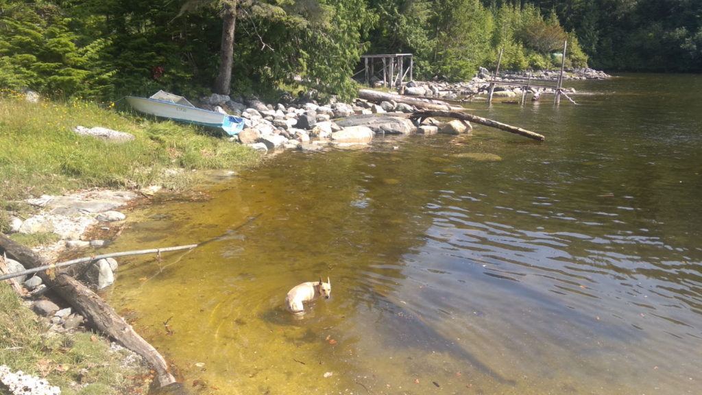
When we arrived in Canada just over a year ago, sea otters were the first living things we’d seen for five weeks. They were in huge groups off the coast of Port Hardy and we were only able to view them through binoculars. The ones we’d spotted so far on this trip were lone, or in couples, and much closer to the boat. I soon learned to discern between them and birds or debris on the water. Their distinctive black flippers poking up are often the first thing I see, and a huge fluffy head bobbing opposite their feet as they lie in repose, looking for all the world like someone relaxing on an air bed. I don’t think I will ever tire of looking at them.  Once we were safely anchored in the cove I sat with the binoculars staring out to my heart’s content. I told Paul I’d been watching a sea otter and a seal playing together. He said they were more likely to have been fighting over a fish – such is the difference in our perception of things ;-). Later that evening, Rob and Vanessa came over in their dinghy from ‘For Good’ for a drink and a chat. They are on a worthwhile mission to spread awareness about environmental and conservation issues while sailing and living aboard their boat.

Sea Otter Cove

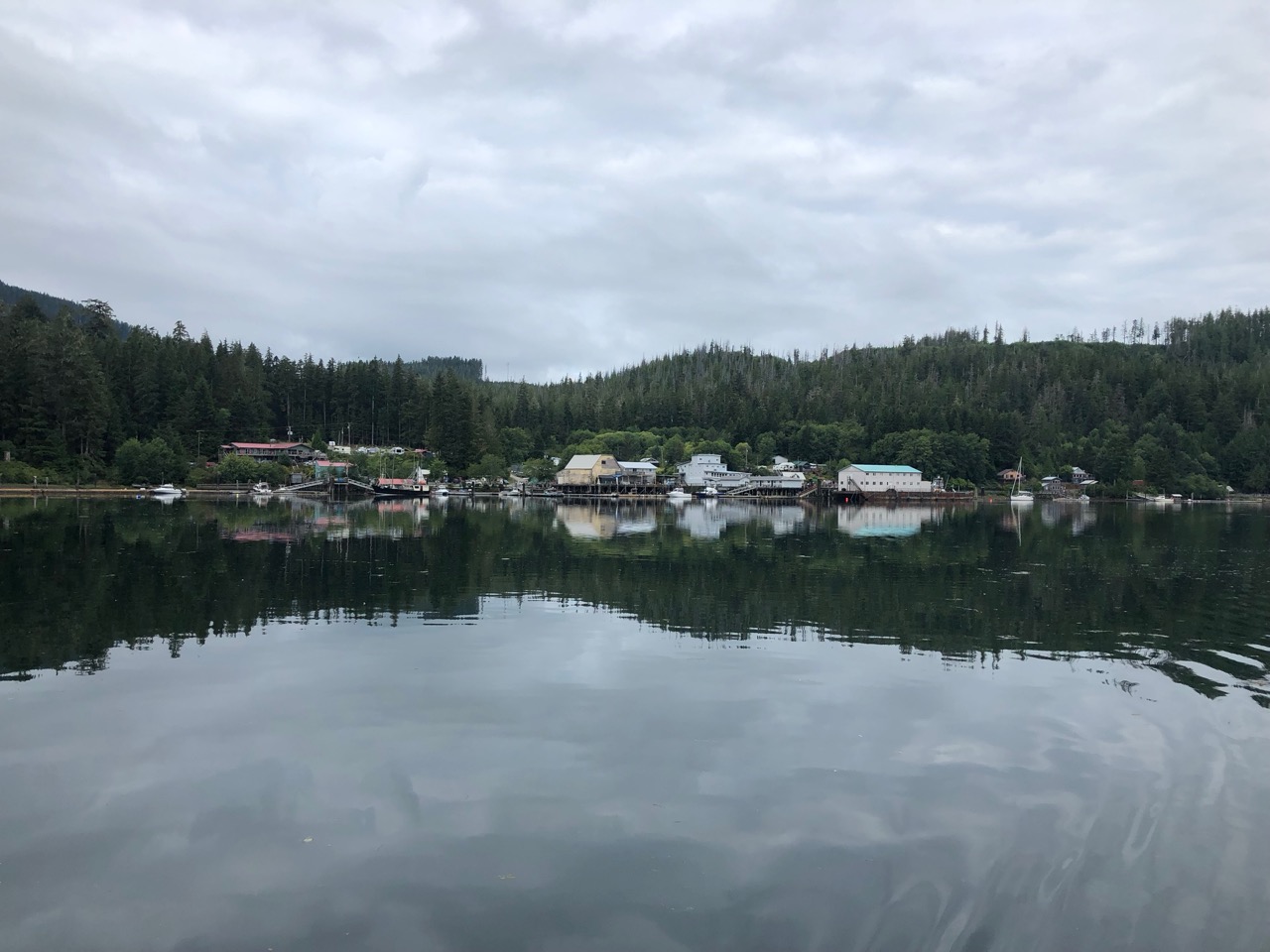
Winter Harbour, where we tied on to the public dock on Friday 9th August is a small, friendly place which was formerly a commercial fishing outpost. When that closed, the docks and fuel facility were taken over by the main general store, ‘The Outpost’ and that’s where we headed to replenish our supplies of soda water and bread.

Winter Harbour

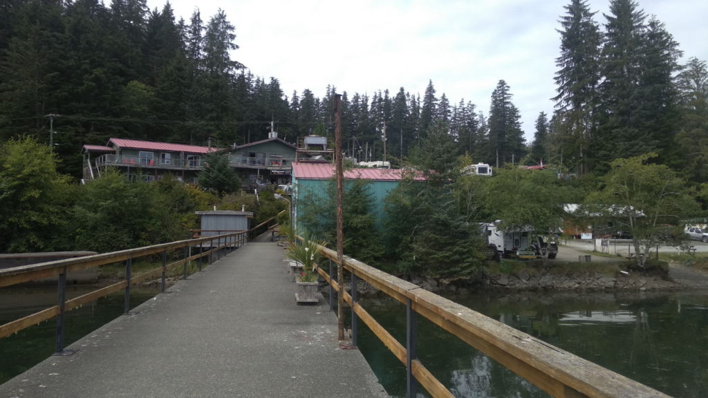
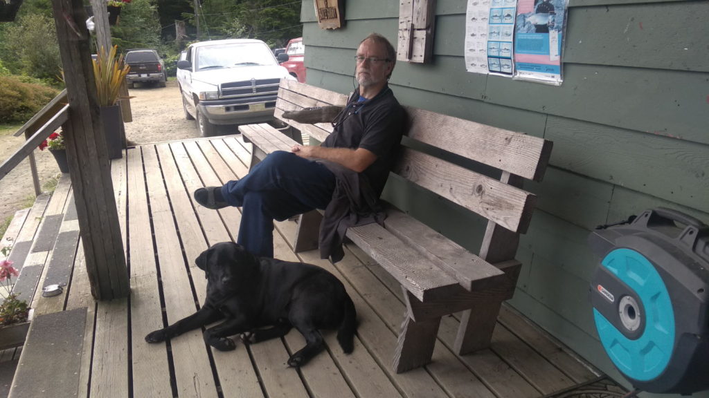
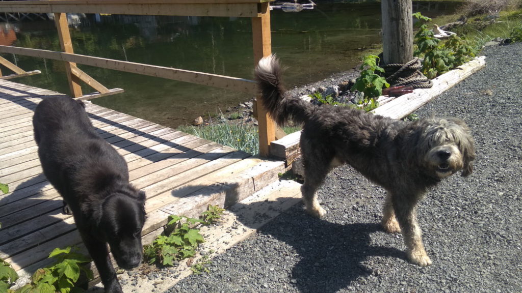
We also bought some internet, choosing the ‘48 hour for two devices’ option. Unfortunately, my phone greedily sucked up a good deal of the allowance by updating apps as soon as it connected until Paul found out how to turn it off. We sat outside the shop on the steps catching up on internet things enjoying the sun and making a fuss of the friendly black Labrador, Keeper (pictured below with Paul).

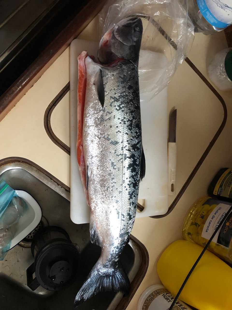
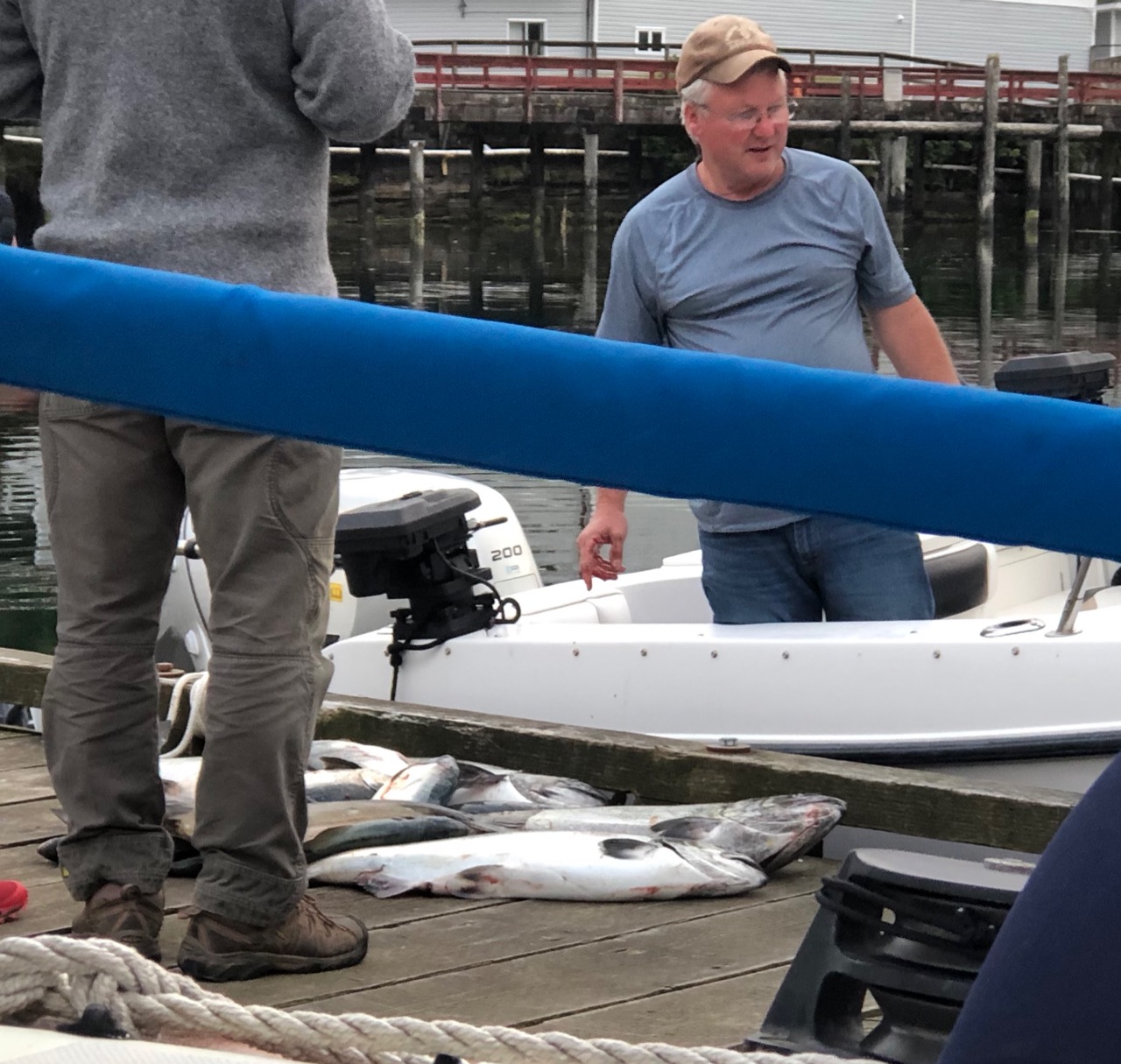
Back on the boat, we discovered that some huge mosquitoes had taken up residence in the cabin, so though I hate to kill anything, they had to be disposed of if we wanted to avoid irritating itchy bites. Out on the pontoon, Paul got chatting with two police officers who were interested in our plans and about where we had been. Learning that we would probably go to Hot Springs Cove later in the month, one of them recommended a restaurant run by his sister. Even more productive was his chat with two fishermen who had just returned from a successful afternoon’s fishing. Not only did they present him with a huge salmon that would provide him with five meals, they also gave him some fishing equipment and tips on how to catch them (watch this space ;-).

We spent another full day at Winter Harbour just taking it easy, going for short walks and taking some pictures and planning future stops along the coast. There were some great-looking dwellings on the outskirts of the forest behind the harbour. They had the look of holiday caravans and chalets but could possibly have been permanent. Just imagine spending the winter away from it all in one of those…

Robert and Vanessa arrived and berthed behind us. Their knowledge and tips about spotting wildlife is proving to be invaluable. Robert spotted a black bear on the shore opposite to us and after a while looking through the binoculars, Paul and I got in the dinghy and went over for a closer look. To my excitement and delight, two cubs came into view along with what was obviously the mother bear. I almost squealed but we let the dinghy drift closer so as not to disturb them. I was waiting for the best opportunity to take a picture but before that could happen, a fishing boat that must have spotted us staring at the spot, motored over downwind of the bears and the mother caught their scent immediately. She stood up straight, an amazing sight in itself, and the trio rushed back into the foliage behind them. They didn’t reappear unfortunately. Robert told us afterwards that the trick is to not make it too obvious that you are looking at a certain spot as it’s likely to attract attention from others.

Sea Otter!

The weather finally had finally begun to feel more summer-like so early in the morning of Sunday 11th August, as I was making coffee, I heard loud splashing near the boat and ventured out into the cockpit to see what it was. A sea otter was just behind the stern crunching and munching on shellfish. It sounded like somebody noisily eating a packet of crisps. I tried to video it on my phone but it didn’t come out – hopefully there will be other chances. By 9am we had untied and were on our way to Klaskish in the sunshine and with fewer layers of clothing on. There was enough breeze to put the mainsail up so for a short while we were able to enjoy the silence without the drone of the engine. We were both thrilled further along to see a baby sea otter on the tummy of its mum.

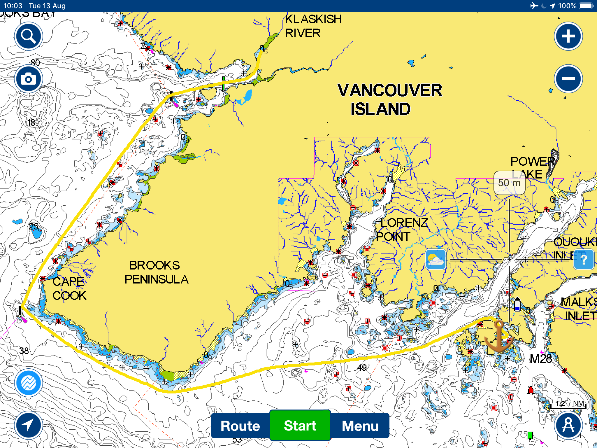
Klaskish Basin is reached, in the words of Waggoners, ‘through a knockout, must-see narrow gorge with vertical rock sides overhung with dense forest’ and ‘you will be separated from the rest of the world’ once you are through.  It felt like a pretty accurate description once we were safely anchored: very peaceful and unspoilt with wild nature all around us. ‘For Good’ was anchored not too far from us and although the weather had been a bit unsettled, we took the dinghies over to the shore in the early evening sun and anchored them together to sit and share a bottle of wine. They had spotted a bear in the area earlier in the day but unfortunately none came out to show themselves. It was great to sit chatting and drinking in such a stunning setting until rain and a chilly wind after an hour or so forced us back into our respective cosy cabins.

View from anchorage

It rained throughout the night. I heard it battering the roof at various times when I woke up and that continued until 8am. It was very foggy too and we debated what to do, since we would have to navigate round the notorious Brooks Peninsula on the next leg. It was decided we would leave at 10 and stick together as boat buddies. Waggoners doesn’t mince words describing Brooks Peninsula; it is, along with Cape Scott and the waters off Cape Cook, the most hostile area on the west coast of Vancouver Island, and marks a milestone in circumnavigation. Here is their take on it:

The peninsula itself is a mountainous, rectangular promontory that extends 6 miles out from Vancouver Island, like a growth on the side of an otherwise handsome face. Rocks and reefs guard much of the shoreline. Tangles of driftwood make beaches impassable. Cliffs rise from the beaches. At the tops of the cliffs is wilderness. (Waggoners, p. 366)

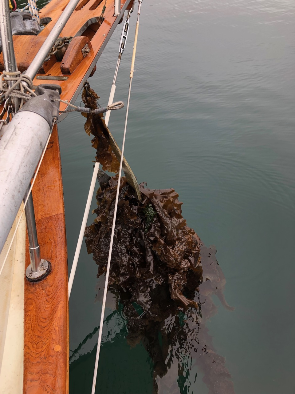
More alarmingly, its cape (Cape Cook) and the Solander Island area have been known to sink boats when conflicting currents meet accelerating wind and the cape ‘should be given the greatest respect’. Paul’s response to such caution was to state that it would be no problem on a day like today. So off we went. It looked fairly innocuous as we drew nearer to it. We were keen to see the puffins and sea lions that are reported to inhabit the rocks around the area but we only saw one as we were moving away from one of the huge rocks. It was so camouflaged by the rock and so huge, that it was only as it moved its massive head that I could tell it was a sea lion. The sea was getting rougher now and with ‘For Good’ still behind we ploughed on through the choppy waters for the next headland, Clerke Point. Waggoners reported that the pyramid-shaped waves that had been battled at Solander disappeared at Clerke Point. I hoped this would be the case as it was getting decidedly bouncy down below and I did a quick check on the stowing. It didn’t exactly get calm as the afternoon wore on but thankfully it got no worse than bouncy. Paul hand steered for a bit and then put the sails up to give us more balance.

As we approached the anchorage, (having gone through the snigger-inducing ‘Gay Passage), more rocky islands and solitary rocks appeared and I watched the numbers displayed on the depth sounder carefully. Robert and Vanessa went off to anchor in a cove between two islands while we scouted around for a suitable spot some distance away in a larger bay. We should have followed them. With Paul joking about ‘any advance on 2 metres’ as my voice grew more panicked about the rapidly dropping depth, the awful noise of ‘keel scraping bottom’ reached our ears and indeed jolted us sideways. It was so loud I was convinced it had broken through and we would see water flooding the floor. I don’t think I will ever hear that sound and think all will be well. It was of course. We tried to get off the rock by using the bow thruster and even putting our joint weight on the other side of the boat by leaning over but we ended up having to wait an hour or so for the tide to float us off.  Then we anchored properly and all was well 🙂

Where we went aground!

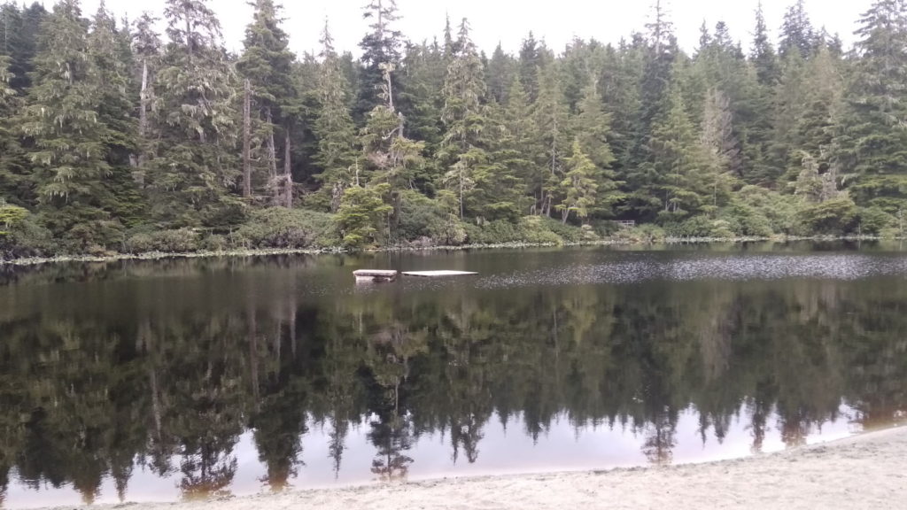
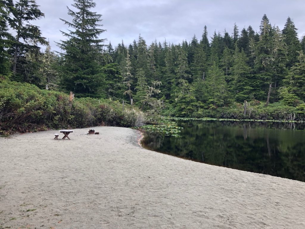
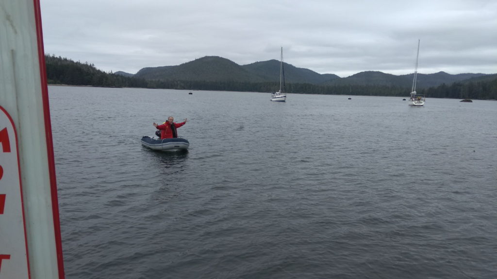
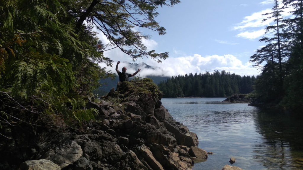
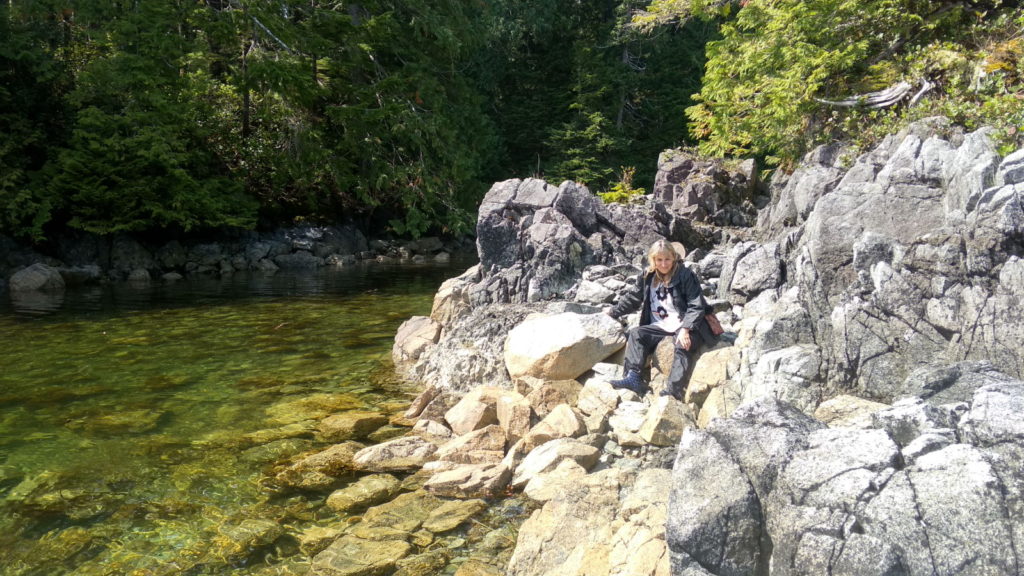
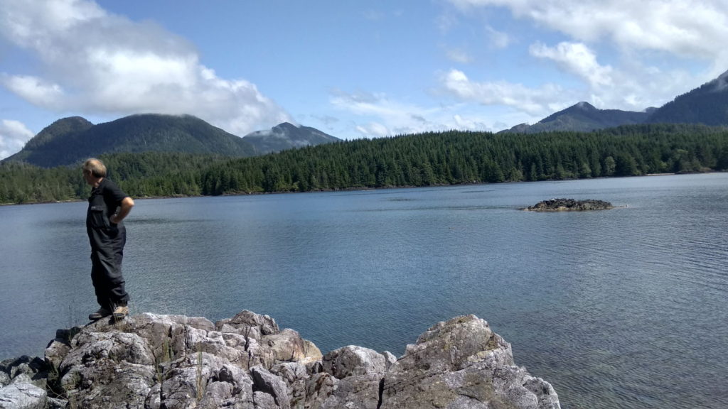
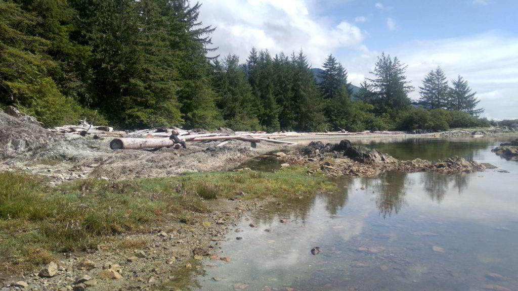
We were in The Bunsby islands, or more specifically, West Nook. It had been grey and drizzly when we arrived and the following morning dawned with a promise of much the same. We planned to stay for another day before moving on and were faced with a whole day to kill; the heavy showers threatening to curtail any exploring. Paul decided not to let the rain put him off and set out for a row in the dinghy. He was soon joined by Robert and while they were chatting the weather changed into a warm and sunny early afternoon, bringing out the true beauty of the place.  The pictures below show this, taken when Paul and I went for a dinghy ride that lasted for two hours. We parked the dinghy a few times to beachcomb and to go for short exploratory walks inland. It’s my favourite part of anchoring, doing this when the weather allows.

Late in the afternoon we dinghied over to see Robert and Vanessa at their anchorage and while we were chatting a sailing couple from Austria came over from their boat to chat and swap journey experiences. Turns out they are making their way to Mexico too so we will see quite a few familiar faces once we get there I hope.

Wednesday 14th August. This morning I watched the sun come up behind the mountains after a peaceful and rain-free night. We would be setting off for Walters Cove today, a place that might have some welcome wifi for us but no chance of replenishing wine supplies because it is a ‘dry’ town. The Kyuquot Native community voted for it to be so and even the hotel and resort complexes do not sell liquor. It was only a short distance away from West Nook which was just as well because the autohelm failed again. There were lots of shallow areas and rocks to watch out for so we would have probably hand steered the whole way anyway. This time, we saw several black fins gliding slowly through the water. I’m guessing they were sharks from the speed they were going but I know some fish resemble them. The weather continued to be gorgeous; warm and clear, enhancing the stunning rugged scenes around us. We followed ‘For Good’ all the way and tied up behind them on the free pontoons. We had an hour to wait until the shop opened so followed the 10 minute woodland path to ‘Java the Hut’ restaurant for a drink and some internet catch-ups on a balcony overlooking the bay.

Walters Cove
Walking to Java the Hut
More sea otters

Walters Cove is a picturesque little village and the people we met were welcoming and friendly. It also has sea otters and we finally got to observe them up close. They tend to gather shellfish from the bottom of the sea around the pontoons and then surface to smash them open and eat the contents. Paul got some great video footage of them doing this, and later in the day they have grooming sessions. We watched them meticulously combing and cleaning their fur, diving down and coming up for another wash and brush up time after time – so close I could almost have touched them.

Grooming session

Safely around Brooks

Wed 7th Aug 2019
Sitting at anchor in Bull Harbour, a very safe little bay on the southern side of Hope Island. 

It’s quite weedy out here

The Tlatalsikwala band a First Nation group own this island and we can’t go ashore without first getting permission. It’s a pretty place, but we are only here as it’s a convenient place to wait for the tides and weather to get round the top of Vancouver Island, in particular, Cape Scott. Tomorrow we leave at 09:30 am in order to reach cape Scott at slack water, around 13:30, The forecast so far is for decent weather, so I’m not the least concerned, despite lots of doom and gloom mentioned in the pilot book. Talk of the infamous Cape Scott and lives lost, ships wrecked or sunk, strong currents and steep waves. I sometimes think they over emphasise these things, they are certainly terrifying to those just setting out on a life of cruising. I have found you can usually get a good feel for if the weather is going to get bad from the forecasts, experience and local knowledge, also as soon as the weather starts to deteriorate, you can generally find somewhere safe to wait it out. The other thing is, you should be able to handle extremely bad weather anyway, as it can happen at anytime, and the boat should be up to it. The main thing is to get away from dangerous shorelines and reefs as quickly as possible if the weather looks like it’s going to get bad, and you can’t get into a safe place.

Brooks Peninsula

Once we round Cape Scott we will head into a little cove called Sea Otter Cove, which should be well protected while we wait for the next opportunity to carry on down the coast. This is the Pacific side of Vancouver Island and we are exposed to the waves and sea swell coming across over a few thousand miles of open ocean. Things will need to be stowed properly. 

The new radar worked well in the fog

Technical Update:
I used the trip to Knight Inlet to test out the boats systems, often referred to as a shakedown cruise. As soon as we left Sointula it became apparent that the Autopilot didn’t work. I expected the fault to be in the wiring or rudder angle sensor, which is buried deep in the aft locker and as it was pouring with rain I decided not to empty the locker contents out, instead we hand steered and the next day I fixed the coupling to the rudder angle sensor. It works now, but I’m not impressed with its ability to steer a straight line, it’s path steered is closer to how I used to walk home from the pub, when I was a big brandy drinker.

Looking at the Forward looking Sonar sensor that lies on the deck on the end of a long pole I hang over the side of the boat, I noticed it was smashed and hanging off the bracket. I epoxied it all back together in a somewhat creative way and it seems to be working fine.
Not so lucky when I got the new iPad out to fire up the Navionics prog. This is the iPad with the faulty screen that was replaced in Japan. I had just paid £80 in Birkenhead to get a new screen (Screen number 2) and looking at it I couldn’t believe there was a crack running diagonally across the display. I have no idea how that happened, it’s been sitting on the cabin table minding its own business, then suddenly it’s cracked. I give up. At least it still works, but probably not for long. I bought a recon iPad before I left so we have a backup. Currently I use one iPad at the wheel and can flick between chart plotter and radar on it, and down below we have the MacBook running OpenCPN on the chart table with the radar running on the iPad next to it, so one o us can study the radar in detail from below.

We have a little iCom handheld VHF which is great for monitoring Ch16 in the cockpit, however it’s a bit rough, chipped and the antenna is falling apart, I’d love to buy a shiny new one, but that’s a few hundred pounds, so when it jumped out of my hand and disassembled itself on the cockpit sole, with plastic shards heading in every direction, I wondered if this would be my chance, sadly my miserly side took control and I have managed to tape it all back together, it works fine, in fact better than before now the antenna is taped up. It looks a state. I will have to keep an eye out for Black Friday type offers at West Marine.

The 65lb CQR now sits on the bow platform alongside the Spade anchor. 

The USB charger outlet I installed at the wheel pedestal doesn’t have enough woomph to keep the iPad charged, but I can get about 20 hours I think,  I can bring it below for a full charge if needed. On long passages we would steer using the Garmin chart plotter anyway.

The windlass thing that grips the chain, it’s not called a gypsy is it? should freewheel when the clutch is loosened, I took the whole thing apart in Malaysia and cleaned/greased it and it worked great, however it seems seized now, so I took it all apart, gave it another clean, but when I reassembled it the chain gypsy clutch was binding near the area where the key goes, so that was not going to solve the problem. I suspect something has changed shape in the last couple of years, very odd. I had to file a few thou off the inside surface of the clutch and it went back together well, in fact I was able to let the chain roll out at exactly the speed Kathy was reversing today, and we set the anchor in record time.

Altogether I’m delighted with the boat and its systems. I’d love to replace all the electronics with the latest Multifunction displays, but we get by with the mishmash we have. The main worry now is how to get a new spray dodger for the cockpit, the current one will depart the boat with the next strong wind. I tried to order one in Canada at Cambell River, however they didn’t seem keen to have my business. Possible in Mexico I can find someone to knit me a new one, or maybe San Diego.

Thursday 8th 
We left Bull Harbour around 9AM in order to round Cape Scott at slack/low water at 13:30. The sea was calm, light winds, but as we entered the Goletas channel, a good 15 knots popped up from the south, I unfurled the headsail to see if it would drive us along, and we were making 5 knots without any mainsail. I couldn’t be bothered to furl up the headsail, turn into the wind and raise the mainsail, so we chugged along with the engine off until we had crossed the channel.  Then the wind dropped and we motored the rest of the way to Sea Otter Cove. Passing around the dreaded Cape Scott at slack water. Cape Scott was calm, but as we rounded it a southerly wind of 10-15 knots appeared and slowed us down a little. Soon we motored into our destination to see our new friends Robert & Vanessa anchored in the cove.
Robert & Vanessa have a boat called ‘For Good’ as they are on a mission to help raise environmental awareness. They are filmmakers and have given up life on land to sail away and make films about the changing world. You can found out more about them at www.sailingforgood.tv or on facebook as facebook.com/sailingforgood  They bought their sailboat, a Cal 34, sold up their home and moved aboard before they had even learnt to sail, much braver than anything I have ever done. However they are finding the rapid learning curve a challenge, and when they arrived in the cove, they had gone aground trying to reach a mooring buoy. We tried to reassure them that it was no big deal, they had re-floated and anchored closer to us and where fine. We explained that it’s all about learning by mistakes, and they would be masters soon enough. Having rounded the ‘treacherous Cape Scott’ without incident gave them a boost I think. They are hoping to sail down the coast, as we are, to the Sea of Cortez, but are rather nervous about the passage. We are hoping to bump into them along the way again.

Sea Otter cove has provided a couple of Sea Otters for our entertainment, but no bears yet. Still we are waiting for low water 

Friday 9th 
Left sea otter cove for winter harbour. This was a shortish hop along the west coast of the Island. Not long after we arrived Robert & Vanessa arrived and tied up behind us on the public wharf. I have found a new easier way to catch fish, basically I walk along the dock until I see a fisherman who has a load of fish, then I hang around complimenting him on his skills until he realises the best way to get rid of me is to offer me some fish. Today my neighbour, two elderly gents from further south down the island offered me a small Coho Salmon, When I say small, After I had sliced it into a load of steaks, I had 6 meals stowed away in my freezer and a large fillet for my dinner that night. They were lovely gents, and went on to explain what I needed to do to be sure of catching my own salmon, and one of the gents disappeared below and returned with a load of spinners, hooks and spoon things, which he gave to me. This would ensure I would catch fish. We will see.


Winter Harbour is a lovely quiet resort. While sitting in the boat, two policemen came to visit me, RCMP guys, and asked me a few questions, once satisfied we had a god natter about boating on the west coast. They have a rib they trailer to various location and are responsible for enforcing the law on the water here.

A good days catch for some sports fishermen.

Saturday 10th
Had a second day in Winter Harbour, just lazing around. It’s an interesting place with plots of land being sold off for around £20k which were big enough to house a large caravan and have a small garden area.  Later that day we scooted over to the far side of the harbour to get close to a black bear and her two cubs that were walking along the beach. 

IMG_20190730_173708

Sunday 11th
Left winter harbour for the 4 hour trip to Klaskish Basin, approached through a very narrow opening in the hills, about 50m wide at the narrow part, it was fun navigating through the gap. Robert and Vanessa on ‘For Good’ where there and later we all headed to the beach at the end of the basin in our dinghy, dropped our little dinghy anchor and sat drinking wine and chatting in a glorious surrounding. We had hoped to see bears but we didn’t, Robert spotted some earlier on his way in to the basin, but he’s an expert at that, we are getting better. Soon the rain returned, then fog descended and we retired to our respective boats for the night. 


Monday 12th
We left around 10AM to pass around the famously dangerous Brooks peninsula, another doom and gloom voyage according to the pilot book we had. The forecast was for 20knt winds from the south on exposed headlands, but I didn’t mention this to Robert as I didn’t want to put them off, and I was confident we wouldn’t have any issues, as we approached Solander Island, just of cape cook at the NW end of the peninsula I could see some waves just starting to break, but nothing too serious so we pushed on. Passing between the headland and the Island, in order to see the seal colonies, we turned into 15 knot headwinds and seas of about 2-3ft. The boat was slamming into the waves occasionally, and I wondered how Robert and Vanessa were fareing, being a smaller and lighter boat they had it a bit worse but they coped well. We slowed down a little not to get too far ahead of them. We saw just one seal on the rocks, but boy was it huge, and really well camouflaged. Once we rounded the SW corner of the peninsula we had the waves on the beam (Side on) this causes an uncomfortable roll on the boat, and I think the others struggled a bit with that, we hoisted our staysail and that steadied the boat a little. After about 7 hours total of lumpy sailing we were in the Bunsby Islands, and nestled in-between the islands are a few little coves which are very pretty and well protected from the pacific waves and wind. 

Heading into West Nook, we were motoring around looking for a spot to anchor away from the centre, partly to leave room for ‘For Good’ to fit, but also to get as far away from the entrance as possible in case the wind shifted when we had that horrible experience of hearing the keel bounce along some rock and the boat rapidly come to a halt. All the reversing, turning, pushing and pulling that ensued wouldn’t budge us, however we had gone aground 15 minutes before low water. It had been a relatively soft grounding, and I just went below and got on with other things, confident that in the next hour we would float off. I called Robert on CH16 to let him know, he had chosen to anchor in another cove, and I explained we had gone aground, he offered to dinghy over to help, but I explained we were fine. Really I shouldn’t have been chatting on CH16, but I didn’t expect anyone to hear our low power signals, unfortunately the coastguard was on quickly calling,”Vessel that has gone aground, this is Prince Rupert Coastguard” . What followed then was a bit of discussion about how I didn’t need to be rescued, everything was fine but he would still notify the search and rescue team. I was happy an hour later to call him back and let him now we re-floated and where at anchor now without any issues. I expect there’s a bit more gel coating to repair on the bottom of the keel again. Looking at the chart, the rock we hit is marked but not where it is, the avionics chart is wrong.

Rock on the left at 0.9m is where I have put the pin, also our spot on the said rock. Anchor Sign is our end destination, and House is where Sue and Andy recommended we anchor!.
Moonrise in Bunsby Islands

Tuesday
We spent the day dinghying around the islands exploring the many little coves and beaches, I was looking for debris washed up from the Atlantic, and there were certainly lots of floats and buoys around, but I wanted to find a Japanese glass float, I was always fascinated by the ones my grandmother had as ornaments when I was a kid. Debris from Japan washes up here, a while back a small fishing boat from Japan washed up, it and it’s captain had been missing in Japan for many months, sadly the captain wasn’t found. I didn’t find the glass float, which isn’t surprising as I couldn’t find one in Japan, I think they stopped using them just as soon as plastic was invented. Later we sat in the cockpit of ‘For Good” and discussed how to get to Mexico easily. Robert and Vanessa want to ‘boat buddy’ with us on the trip south, especially the first overnight passage from Canada to the USA. While chatting another couple from Austria pulled up in a RIB, they had arrived earlier and were in a 40ft Aluminum Ovni sailboat. They had arrived here from Alaska via the NorthWest passage, a treacherous sailing route that very few yachts had traversed. They had been sailing around the world since the 80’s so instantly any seafaring wisdom I felt I had evaporated in their presence. They are heading back to the Pacific via Mexico so I hope we meet up with them again on the way.

Wednesday 14th
Departing from the Bundsby islands at 09:30 we made the short passage to Walters island about 10 miles away in about 2 hours. We hugged the coast dodging many rocks along the way. The entrance to the cove that sits between the island and the main Island is quite a twisted zig zag of a route and you have to follow the red and green poles that guide you in. Once in you are in a safe settled area that is full of pretty fishing lodges, the general store has a few basic supplies and limited fresh produce, but I did restock on bananas. Later we had pis and ice cream at the cafe/restaurant called Java the Hut, another lovely spot, with great food on offer.

Video of sea otter antics next to our boat

Later I worked on correcting the problems with the autopilot. It doesn’t follow course properly, and the error code 67 keeps popping up, first off I aligned the rudder feedback sensor so the when the rudder is midships the sensor also says midships. When I tested it it said the rudder was off by 11 degree, so I wondered if that might be the issue. My problem is that with the rudder aligned centre, checked by climbing under the stern from the dinghy, then the rudder stock and quadrant are not dead canter. But off by 11 degrees. Also when we motor along, the wheel is marked for midships, and this is the position that keeps us going straight, however this is the same 11 degrees off.  None of this makes sense, it appears that the rudder stock (The pole from the rudder into the boat, isn’t in line with the rudder, and that the rudder has to be 11 degrees to port to go straight ahead. SO I resigned the rudder sensor so it says 0 deg offset when the rudder is actually midships, and we will see how that affects things. Is this 11 deg needed to offset the transverse thrust when going ahead?

Thursday 15th

A lazy day dinghying around the cove, we visited the shop across the bay in the First Nation village, but they didn’t have much. They did have a second hand bread maker for sale for $50 which is very tempting, we plan to buy one soon for the boat, but I need to wire up the big inverter first. 

WiFi is rare out here and cellphone / 3g/4g non existent for us on our AT&T phones as their Canadian partner ‘Rogers’ doesnt have any coverage on the west coast of the island until we get far south.

We are past the most tricky parts of the west coast passage now, and it’s going to be gentle sailing the rest of the way we hope. Saying that the forecast is for 35 knots this afternoon which would be too much for us to be setting off in. We will spend the next two days in sheltered inland inlets until it’s safe to go back out into the Pacific.

North Northwest to Pacific Northwest: Sointula Again

Laden down with bags containing our maximum allowance of 23kg each, we journeyed from West Kirby, Merseyside to Manchester Airport for a 10 30 am flight bound for Vancouver, Canada. Eight hours later we touched down at around 11 30 am on the same day, effectively avoiding any hours of darkness, or indeed, sleep! The short amount of time that we were outside before being shunted into the arrivals terminal felt warm, with clear skies and the promise of a hot day ahead. This was Vancouver, however and temperatures tend to be lower on Vancouver Island, which would be our next port of call. Before that next leg, though, we had to ‘walk the walk’. By this I mean getting in line with hundreds of other passengers to join their zombie-like shuffling, while adhering to the queue-controlling elasticated barriers that are ubiquitous at airports nowadays. They had been set out in such a convoluted, zigzagging route that it was difficult to tell where we would end up but trusted we were going towards the customs and immigration area. It took almost two hours (including descending a flight of steps to a lower floor) of inching along in this way, with the occasional command from nearby airport staff positioned along the route reminding nationals to go in one direction and foreigners in another.  We had arrived at the start of the holiday season and there was a huge amount of people to process through the building, with flights from all over the world arriving at regular intervals.

As we got nearer to the automated passport/anything to declare machines, more staff were around to direct us to vacant screens and to assist with any difficulties scanning passports or answering the series of questions on the immigration screen. The trickiest part was posing for the required photograph (well, it is tricky when you need glasses to read the instructions and then have to remove them to pose). This picture is then presented to border control officers who ask a few questions before allowing you to proceed onto baggage collection. I’m sure the staff see several comical images of bemused and confused expressions on the printouts, similar to my frowning, peering one.

We had a couple of hours to wait before our hour long flight to Port Hardy, so as it was an appropriate time on both sides of the Atlantic, I suggested we head for a bar to sit and wait once we had checked our bags in at Vancouver South, the terminal for local flights. It’s a little way out from the International Airport, and this plane was considerably smaller and noisier when we took off. Once in the air, the views below were stunning. Vancouver Island, complete with inlets, small islands and straits looked just like the ’from space’ map we have of it on the boat. Unfortunately, clouds gathered and blocked the view as we approached our destination.

The temperature was indeed a good deal cooler than Vancouver when we stepped out onto the tarmac in the early evening. Paul had booked a taxi to collect us and take us to Port McNeill, and from there we boarded the ferry for the 20 minute crossing to Sointula where our good friend Jim was waiting to drive us on the final part of the journey to the marina and Sister Midnight. On board, surrounded by our bags of stuff waiting to be unpacked and sorted, I marvelled at the fact that it was still fairly early in the evening of 24th July.

Approaching Sointula from the ferry
Sister Midnight in Sointula

Naturally, it took a few days to get ourselves sorted physically and mentally. There’s always lots to do on boats, and each trip to ours seems to add more ‘stuff’ to find space for on board. I’m guiltier than Paul in this regard and I could see that I would need to ‘lose’ some things in order to make room for others. Luckily there is a thrift store and a book swap facility on the island so I made good use of those during my sorting. It felt great to be back in Sointula and to become reacquainted with Jim and Ivana. They kindly invited us to dinner where we enjoyed a delicious three course meal, good wine and great conversation which was most welcome after a day of unpacking, cleaning and stowing. It was also good to meet Paul’s friends John and Fay who have a house near the marina and were kind enough to send me some ginger beer and a rose picked from their garden when they heard I was feeling under the weather with a tummy bug.

Sointula’s delightful Thrift Store
View from Jim and Ivana’s house – we watched humming birds from here.

We had a week in Sointula before we planned to go bear hunting in Knight Inlet, so once I had recovered we made the most of the few days remaining by going on bike rides and for short beach and forest walks. We visited the museum and library and gradually got the boat looking ship shape, sea-worthy and stocked with provisions.  I was thrilled when I spotted the wild mink Paul had told me about. They have beautiful deep brown fur and resemble weasels as they scurry busily along the pebbly shore looking for food. Often, they venture onto the pontoons and have been known to get inside boats, so they’re obviously not very popular with boat owners. One day, noticing the guy next to us looking despondently at several parts from the interior of his mum’s boat that were laid out on the pontoon, he told us he needed to clean every item thoroughly after one such uninvited visit. Seals are frequent visitors in the harbour waters. Their grey heads, sporting huge, soulful eyes remind me of dogs’ faces when their ears are flattened. There have been lots of dogs around the marina to make a fuss of, which has been lovely for me. One of them paid me a welcome visit while I was feeling unwell. He scampered on board sporting a lime green life jacket and tentatively made his way down the cabin steps for me to stroke him. He was a bit like a Jack Russell but larger. Thankfully he wasn’t too large or heavy for me to lift up when he was ready to leave, because he was unable to negotiate climbing the steps to get out.

The museum provided a wealth of information on the development of Sointula as a community. The Finnish immigrants who settled there in 1901 wanted to create a utopian community on Malcolm Island based on the principles of equality and freedom. Their leader was a man named Matti Kurikka, described as charismatic and visionary, who along with his friend A.B. Makela gave Sointula (the location selected for their permanent settlement) its name – the word in Finnish means ‘place of harmony’. Four years later a fire, which killed eleven people, caused half the population to leave the island. Despite this and other setbacks, the community gradually realised the life the pioneers had dreamed of. Fishing was their main livelihood, and they also learned to cut and mill timber, establishing a logging company in the 1930s. To all these endeavours, the museum informed us, they brought a spirit of cooperation and a tough determination that the Finns call ‘sisu’. I like that. Today, the Co-Operative store, founded in 1909 advertises lots of events such as plays and musical performances. There is a thriving arts and crafts movement, with several galleries and studios to visit on the island…most importantly though local dogs and cats still have right-of-way here: if one happens to be sleeping in the middle of the road, drivers must go around it.

The charismatic founder, Matti Kurikka
Around this piano, back in the day, many a courtship began
Love the fact that there are always dolls in museums

Just before we left we took up Jim and Ivana on their offer of using their car so that we could explore more of the island and venture further afield to places we’d heard were worth seeing. We took a drive along Kaleva Rd to Mitchell Bay, hoping to see the imaginatively-named Big Lake. Mitchell Bay is a lot smaller than Sointula and was very quiet and deserted the afternoon we visited. It seems the whole of Malcolm Island has been creative with their roadside sculptures, models and signs. We saw several on this road. Big Lake was almost missed as we drove back, but Paul spotted the edge of it behind the trees and we got out to take a look. According to Sointula’s tourist leaflet it’s the local swimming hole. There was a float in the centre and it was easy to imagine it full of bathers on a hot day; a very picturesque setting. Pics from the drive below.

Big Lake
Big Lake

The following day we got the late morning ferry to Port MacNeill. Once you drive on to the ferry you stay in the car for the 20 minute journey…and you only ever pay to go to Sointula – it’s free to leave. We drove to Port Hardy first to provision for our passage to Knight Inlet and I was reminded how much more expensive a supermarket shop is here than in the UK. Our pounds are worth even less than last time we were here thanks to the current fiasco taking place in UK politics.  Coal Harbour was our next stop, about 8 miles from Port Hardy. During World War 2 it was a Royal Canadian Air Force seaplane base, and the waterfront still has the large hangar, which was subsequently used as the base for busy whaling station until 1967. Now, the hangar houses the tourist seaplanes and the adjacent land is used for launching facilities and water taxis. In all, it had an industrialised, yet deserted feel to it – nothing to make us want to linger for long.

Coal Harbour
Paul in Coal Harbour

We set off for Port Alice. A sign I had noticed on the way to Coal Harbour proclaimed the route to Port Alice as the most scenic drive in the area (or something like that). Once on the road, we were surrounded on both sides of it by thick, high forest which was certainly striking, especially when the trees bowed from either side to form arches. It reminded us of roads in The Lake District. The waterfront village was charming; pretty and quiet. So far, however, Sointula has been by far the loveliest place we’ve spent time in. If we wanted to see bears and explore The Broughtons, however, we needed to bid it a fond farewell.

Kathy    

Port Alice


Back in Port Hardy

Thursday 1st August 2019
We left Sointula on the 1st, but first we borrowed Jim & Ivana’s car and took the ferry over to Vancouver Island for a bit of shopping and to explore a bit further inland.
First we hit Coal Harbour, The air force had a big base here once, and it looks like the hangers are still here along with a busy float plane operation. Below you can see a plane docked, then being taxied to its resting place on the forks of a forklift truck. That’s another first for me, a plane on a fork lift truck!. Many years ago we used to play a game of ‘first to see’ when touring Europe, my friend Dave Hughes always came up with bizare things, like a fire engine towing a fire engine, or a car in a tree, the weird thing was he always saw them within a few hours. I reckon a plane on a forklift would be a good one.

I think Coal Harbour is a mainly First Nation settlement. It was set in a great location, but had a slightly run down feeling about it.
From there we drove onto Port Alice, which is on the same inlet from the Pacific side as Coal Harbour. I read that Port Alice was struggling since the main employer, a local mill, shutdown recently. It looked very tidy, and in a wonderful setting.

So with a sad heart we left Sointula on the 1st, heading for Knight inlet. The day started cold and wet, I was hoping it might clear up, but in fact the rain got worse as the day progressed. We had to deploy full oilies (wet weather gear) on the way. We stopped at an old marina on Minstrel Island, the place had been deserted and some rotting pontoons remained, to which we tied up. We didn’t need any facilities, it was just easier to go there than to anchor. Knight inlet is exposed to the prevailing winds from the west and secure anchorages are hard to find. The marina was decaying and the pontoons were slowing breaking up with plants growing through the planks. However it was so wet we only popped out to tie up then remained indoors while it poured down.

The following day the weather cleared up a bit and we motored up Knight Inlet towards Glendale, a renowned place for spotting Grizzly bears.

Knight Inlet

An advantage of 24 hours of heavy rain was evident in the waterfalls we saw along the route. We continued past the turn for Glendale up to a spectacular waterfall at Millerd Creek.

Heading back we anchored in Glendale cove in the SE Corner in 25 metres but by the time we backed up on the anchor to set it we were in 6 meters of water with the tide dropping by 3 mteres that evening. That was ok, but at 9am the tide would drop again, but this time by 4 meters, so we would probably go aground. I set an alarm for 7AM to check and pull in the chain a bit if needed. Later at low water we were reading 3.5 metres on the depth sounder, but I chucked my lead weighted sounding line over the stern to find only 2 metres, so we were on a very steep shoal and about to go aground. Hauling in 5 metres on the chain, brought us into deeper water and I went to bed happy.
In the morning I had to haul in a bit more chain at low water.
We searched up and down the coast for Grizzly bears, but didn’t see anything.

Glendale has a resort, and people fly in daily to go bear watching here.

We saw lots of Eagles, and a deer walking across the mud flats. We decided to leave an hour after low water, and on the way out we spotted several of the resorts boats full of bear watchers grouped just off the beach on the NW side of the bay. As we approached we were delighted to see a grizzly walking along the beach and munching on a log covered in seaweed or similar.

It was difficult to get a good picture with an iPhone, you really need a zoom lens for this type of thing. We had to keep a good distance away, but through the binoculars we felt very close. Kathy was very excited by this encounter.

Leaving Knight Inlet we took a shortcut through Sargeant Passage which had a very modern looking fish farm were we could see salmon leaping out of the water in giant cages.

No matter what the weather, we see plenty of birds en route.

Kwatsi Bay

Our stop for the night was Kwatsi Bay, a secluded little marina and anchorage tucked away at the head of a river. It had been windy and cold getting here, but once in it was lovely and calm, and surprisingly warm, perhaps summer is coming to Canada. We anchored again in 20 meters, right next to a waterfall and drifted back almost to the shore, but still in 12 meters. Later that night I spotted a black bear walking along the beach. We watched him/her for ages through binoculars, and it never occurred to us to take a picture. I expect we will see more bears on Vancouver Island.
That night I noticed as I relaxed in the cockpit that we were swinging around and that the Marina in the far corner of the bay had passed us twice now. It seemed the outflow from the waterfall, and the tidal flow was creating a small whirlpool we were in. This bothered me a lot, presumably we would be twisting the chain all night and like an elastic band powered airplane we might suddenly unwind in a flurry with the anchor ripping out and us drifting of into oblivion. I figured in the end it probably wouldn’t happen, and went to bed.

In the morning we were still there, with no obvious twist in the chain. I don’t have a swivel connection so I guess we must have untwisted. Up came the anchor and off we headed for the short trip to Echo bay to visit Billy Proctors Museum.

Kathy on Pierres swings, Echo Bay
Billy Proctors Museum
Sister Midnight chilling in Echo Bay

Pierre’s Resort/Marina was lovely, the weather was stunning and the place was so peaceful and relaxing. We toyed with staying an extra day there, but at £45 / night we thought we would save the money for our time in America.

This morning we left at 7:30AM (5th aug) for Port Hardy, about 40 NM or 7-8 hours. We left in dense fog, which stayed with us for 39 NM. The radar I fitted a few weeks back worked flawlessly, even spotting some logs in the water. We passed through some narrow gaps, in particular around the fox group of islands, where we had a few hundred yards on either side of us to the shore, but couldnt see a thing. Between the chartplotter and the Radar, I felt completely safe.

I had worried the crossing over to Port Hardy might be difficult in dense fog, but again the AIS warned us of the big ships, the only problem might have been sports fishing boats going too fast, but we didn’t cross any of them.
We are on big tides now (Springs) so that might explain why we passed so many logs and debris floating around.

As we arrived into Port Hardy the fog lifted and left us with a glorious hot sunny day, we went straight to the ful dock and took on board 115 litres, which works out at 3.6ltr / Hour. A rate of consumption I’m quite happy with. Tomorrow we stock up for our voyage to America. and on Wednesday we set off, weather permitting. We are allowing three weeks to get from here to Astoria in Oregon, with most of that time being spent exploring the NW coast of Vancouver island. There will be very little chance of communication during that period, so see you In September.

Paul Collister.

Leaving Sointula :-(

Just a quick update.

Tomorrow (Thursday 1st Aug) we leave Sointula, It’s been by far the best spot we have visited on our travels so far, made very special by the lovely friends we have made here. In particular Jim and Ivana who made us feel so welcome, but also many others who helped out. The staff at the harbour have also been great. Sointula is going to be hard to beat, however we must push on, we still have a few more oceans and continents to visit yet.

Tomorrow we backtrack a bit so we can travel up Knight Inlet, in the hope of seeing some Grizzly bears, this will be our last chance before we head out around the main island. On our way back from there we will visit Echo Bay to see a famous museum created and managed by Billy Proctor, a local legend.

On our way to Knight Inlet, we pass Bold Head, Puzzle Is, Twist Is, Whirl Is, in between Jumble Is and Crease Is. Passing Rocky Point, North of Peal Is, we will pass Warr Bluff, Ripple Bluff and Dinner Pt. Then passing South of The Lady Islands onto Minstrel Island, with White Nob Point to the north.
They dont mess with place names here!

It’s unlikely we will get much wifi or 3G on these travels but should be able to pick up msgs at some point along the way. We expect to be back at Port Hardy in 6-7 days time, depending on weather, then we will be able to catch up on emails etc.

Paul Collister