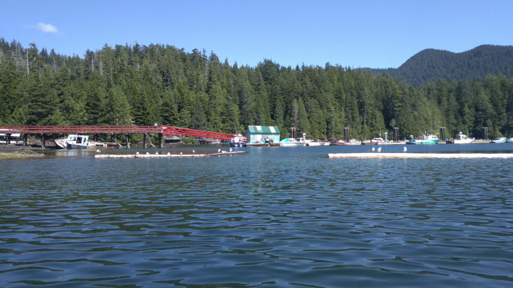
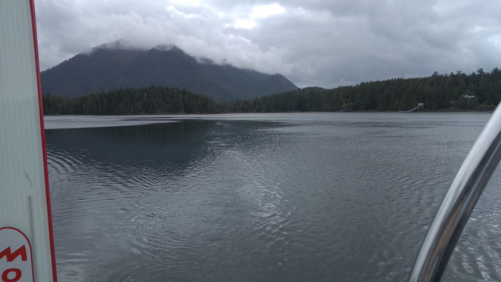
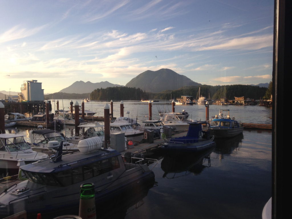
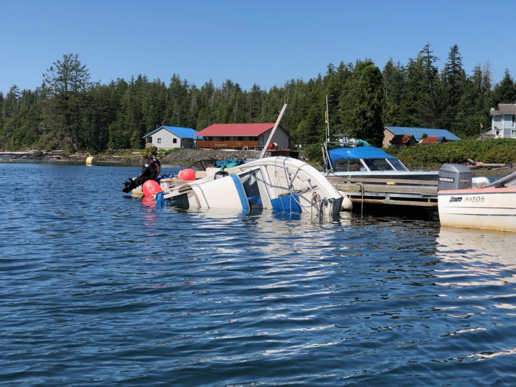
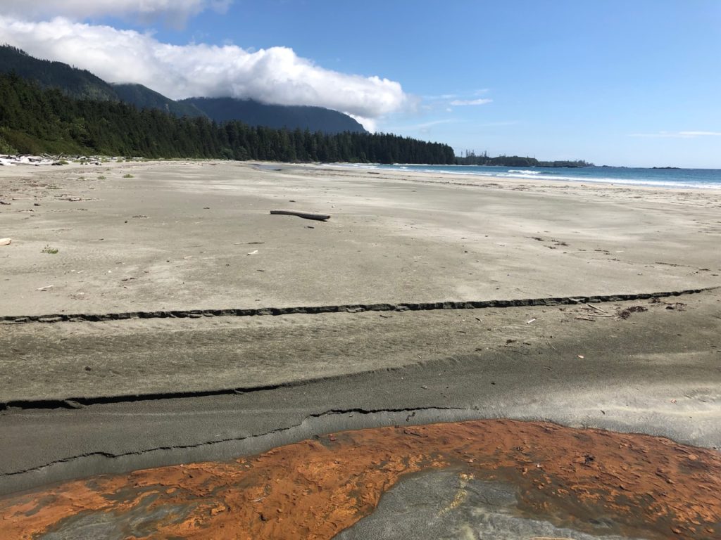
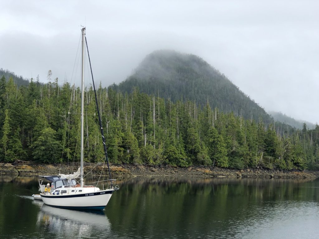
We left Noyo River ( Fort Bragg) on the afternoon flood tide, just before slack water and got through the bar without much effort, but the channel was quite narrow and there were quite big rollers just 20 metres either side of us. Once clear we got the sails up and enjoyed a sail south with NW winds of 15 knots. Sadly the further out we got the bigger the swell became, about 15-20 ft at times and they were often on our beam (side) or coming from behind. This caused the boat to roll quite wildly, something Kathy and I can handle just fine, but the poor old sails kept collapsing then filling with a loud ‘whack’ shaking the whole boat. I had a spinnaker pole out to try and tame the headsail, and a preventer on the main to stop it swinging around, but I couldn’t bear hearing the sails taking such a battering. This kind of stress really reduces the lifetime of the sails, so after a while I sheeted the main in tight, furled up the Yanke and we motored on. It was about to get dark, and I thought this would at least make Kathy’s watch (20:00-00:00) easier, and if possible I would get the sails out later. Strong winds had been forecast.
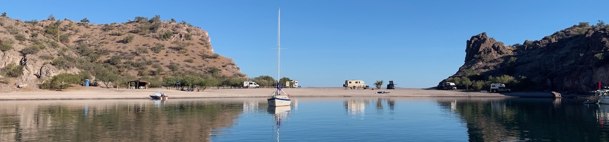
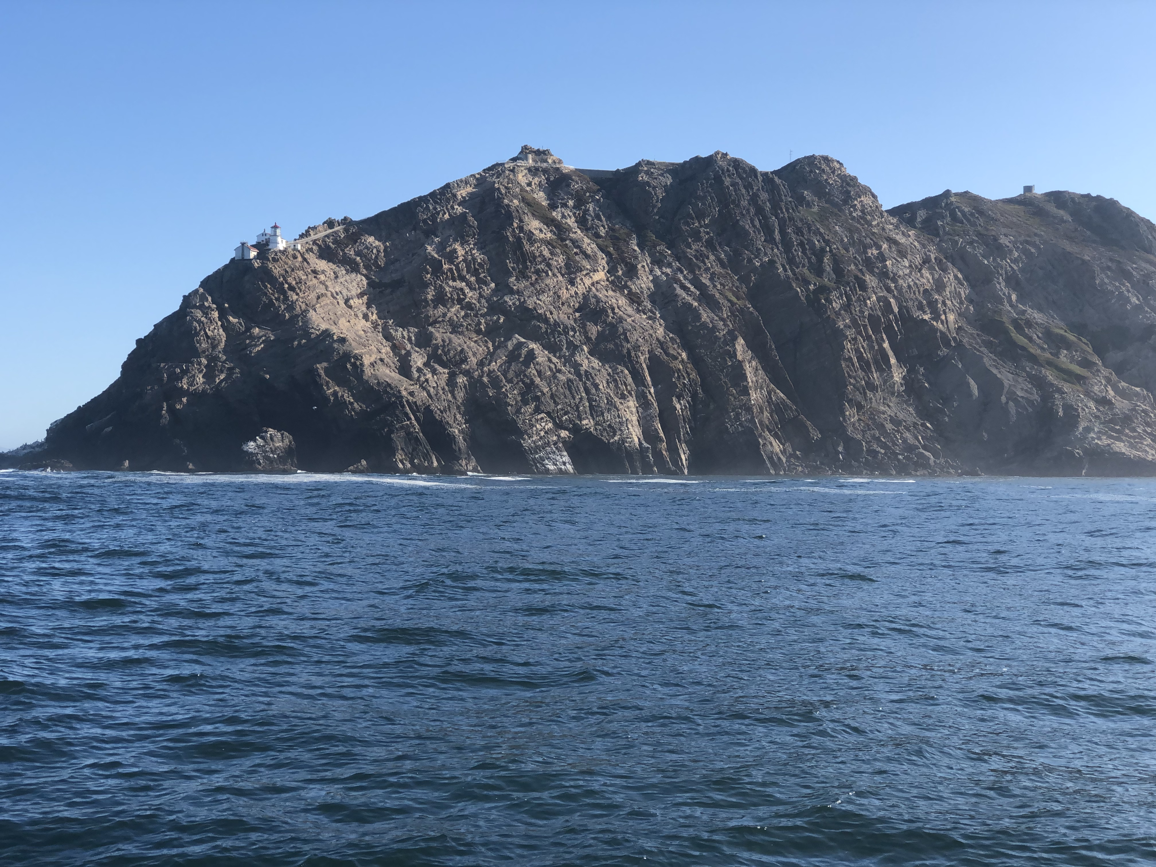
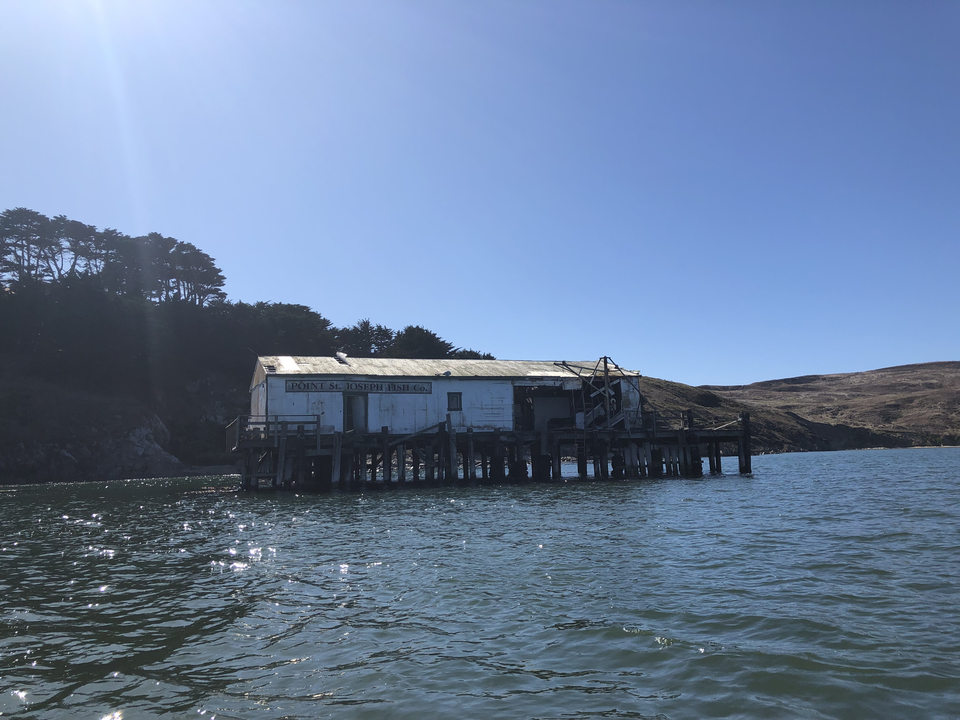
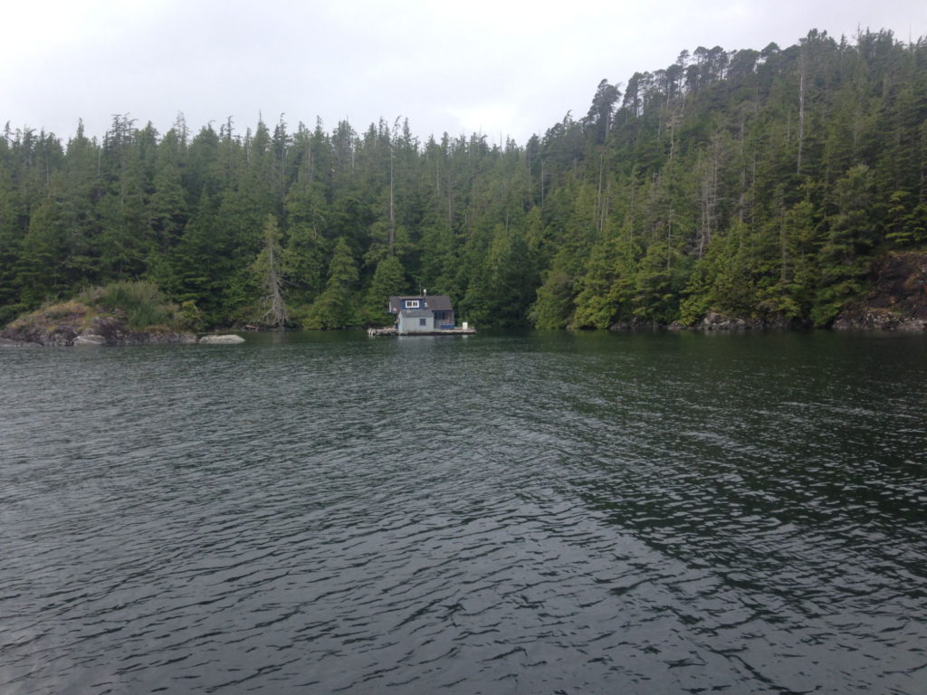
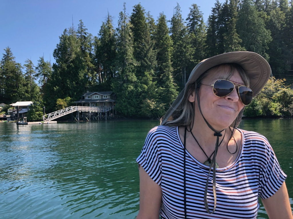
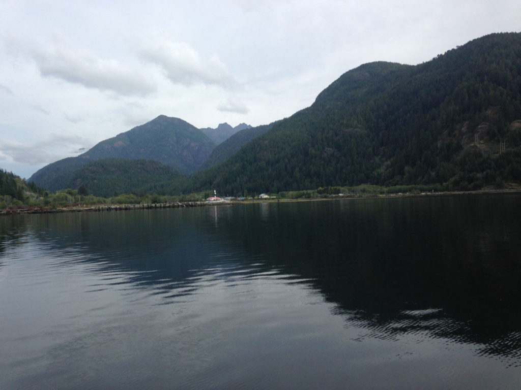
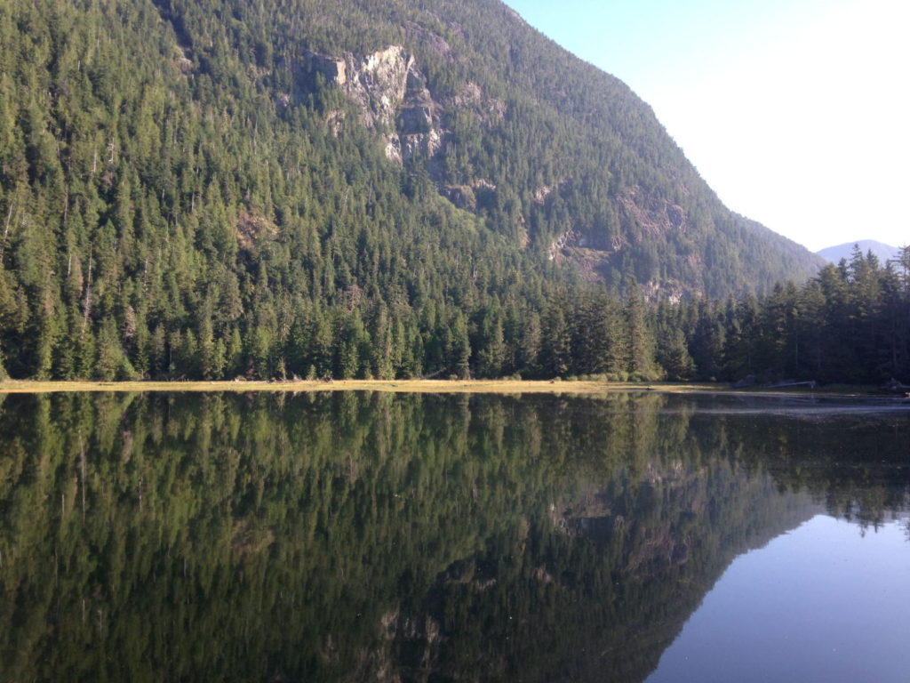
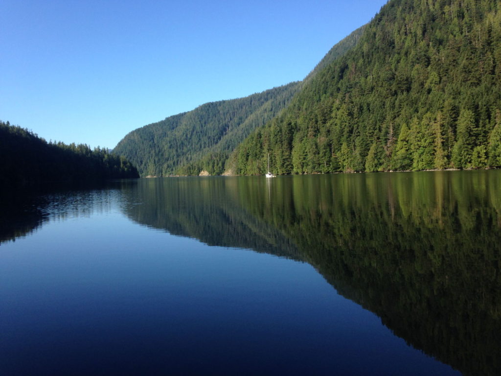
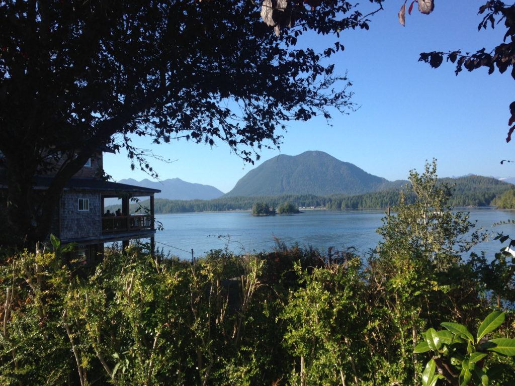
As it turned out the wind dropped and we motored all the way into Drakes Bay, just north of San Francisco. This was a sheltered anchorage and very pretty. It is located just behind Point Reyes, which is where the weather fax transmissions come from.
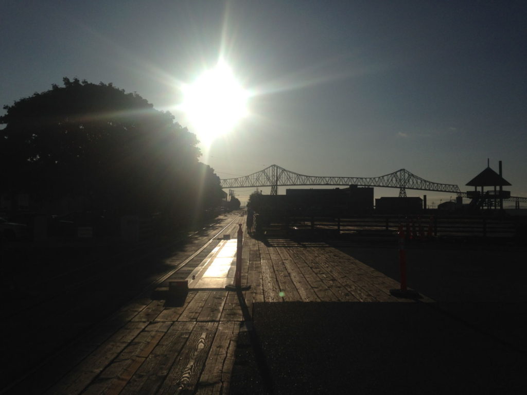
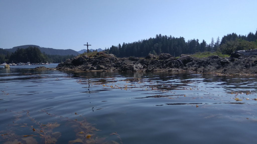
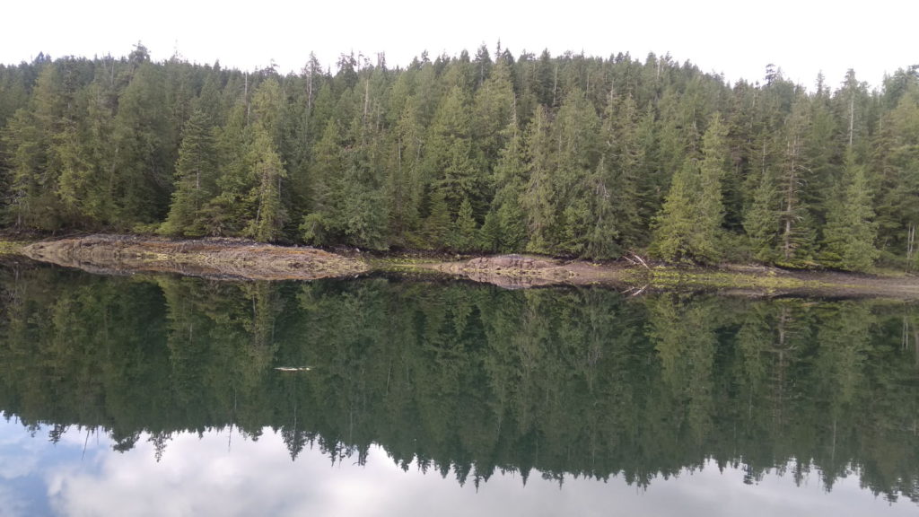
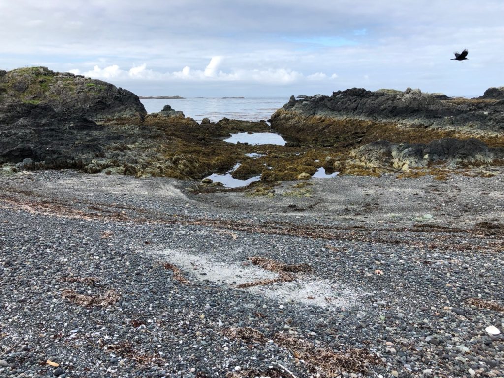
Point Reyes
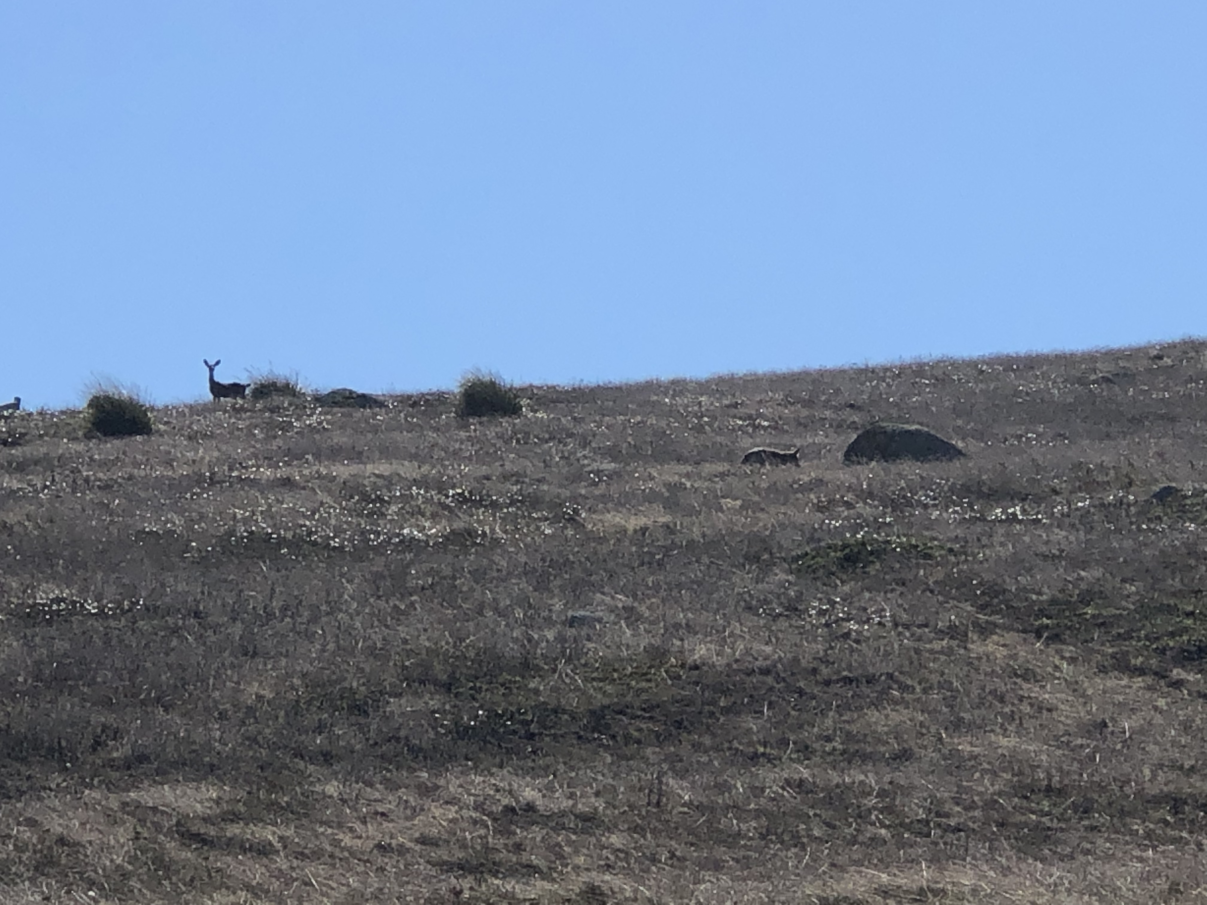
We went ashore for a walk and saw a coyote stalking a deer. There were more Sea Lions making a great deal of noise.
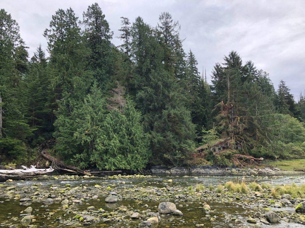
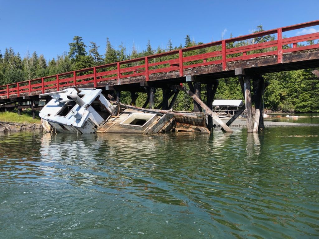
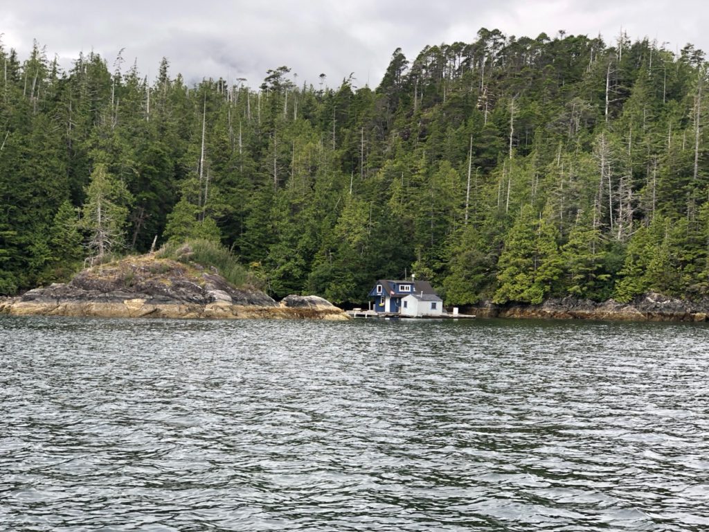
An old Fishing operation in Drakes Bay
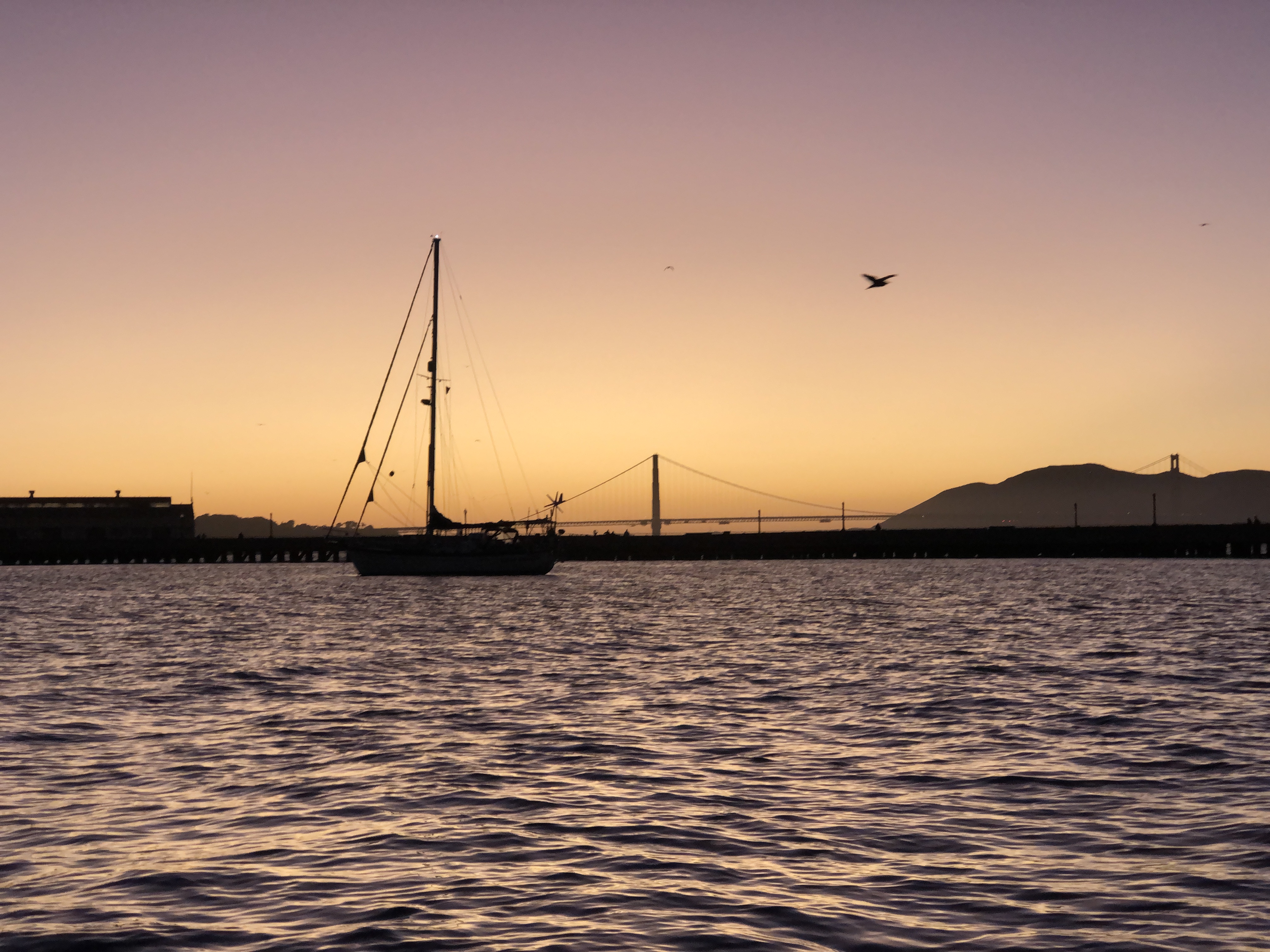
The next day, Saturday, we headed off at 08:30 to cross the San francisco bar just after slack on the flood tide. My daughter Yasmin suggested I periscope the trip under the Golden Gate bridge, this is an app that allows you to video stream over the internet from your phone. I had a play and it seemed to work, so I strapped the camera to the top of the solar panels where it would have a bit of a view looking forward.
The video is still there I think under paulcollister, approaching SF. however just before we passed under the bridge we had a slight problem. I went to the bow to film the bridge passing overhead and left Kathy on the helm, I was filming the bridge as we approached it when I looked back to see a sailboat ploughing directly at us, and only a few boat lengths away. He was bombing along under sail, and so had right of way. I think he was of the mind that we had to get out of his way. Looking at Kathy, she was a bit tied up with her messaging app on her phone and hadn’t seen this boat. I raced back to the cockpit, Threw the autopilot switch to manual, knowing in my mind that I wouldn’t have time to get out of the way, but I jumped back anyway, grabbed the wheel just as the other boat changed course and passed behind us. they didn’t wave back to me or even smile at me, in fact they looked decidedly unhappy! Oh well, we must try harder next time to ignore our phones and concentrate on the navigation side of things.
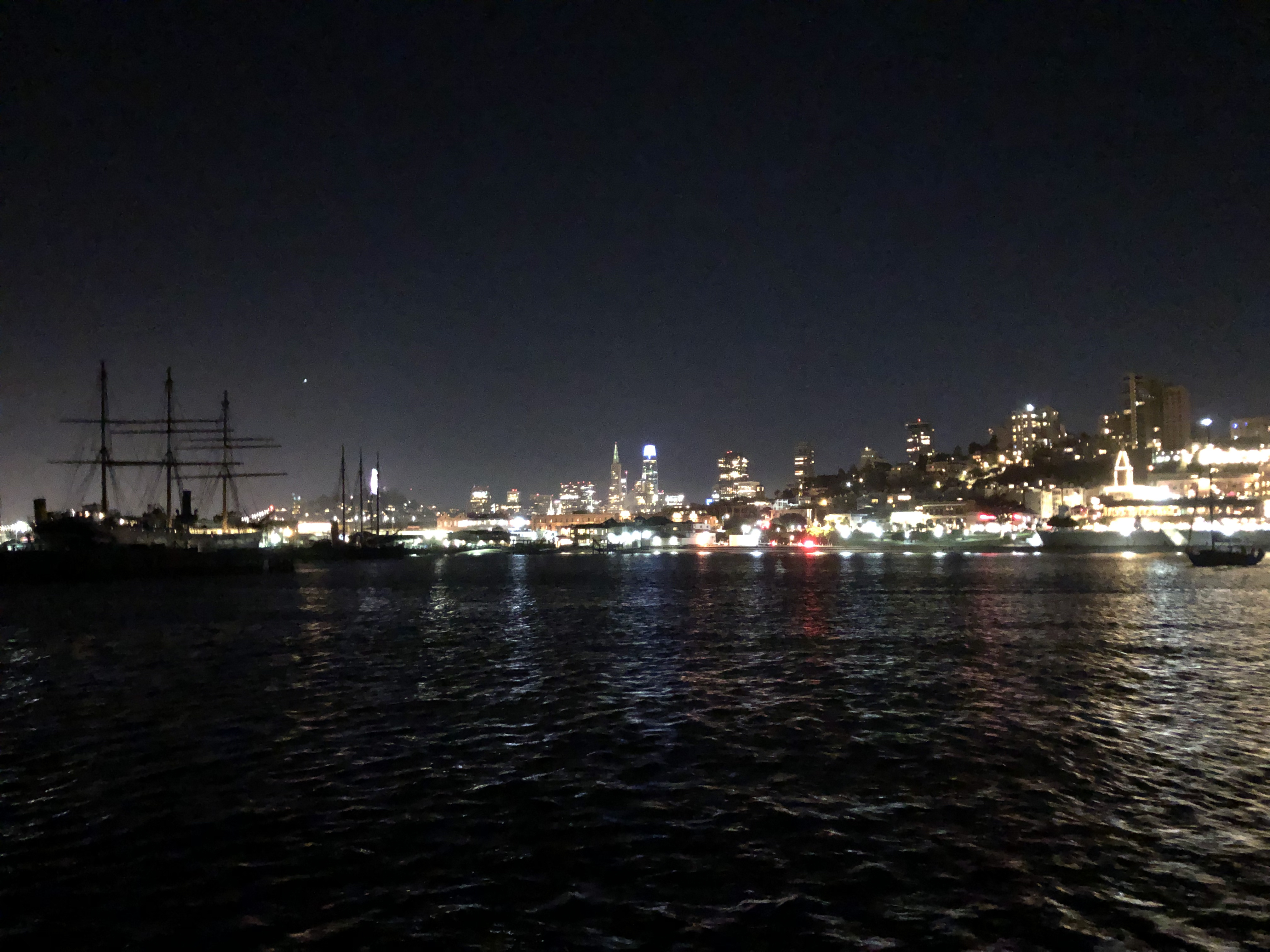
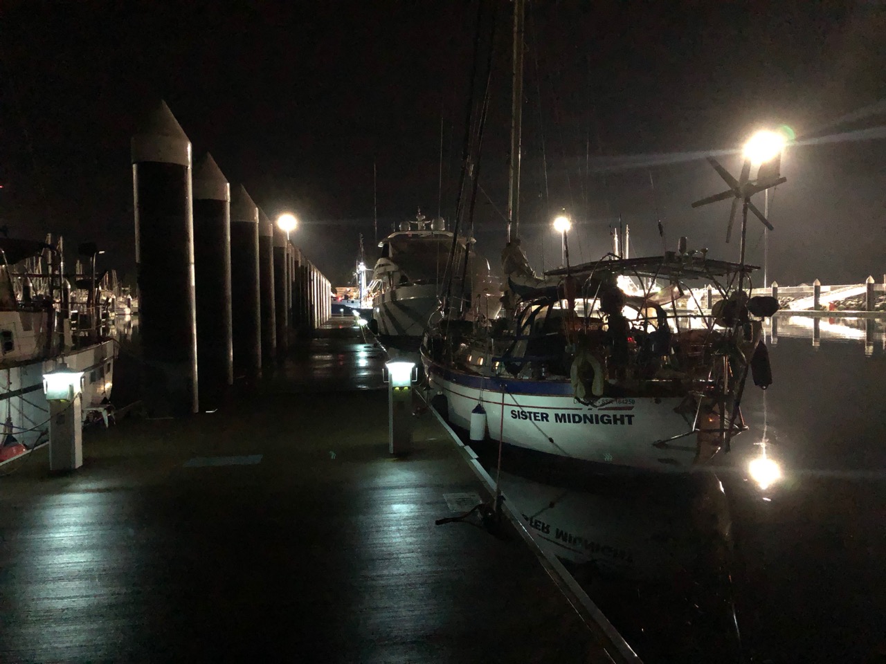
We both were a little shaken by how close the other boat had been, but pushed on, I carried on filming, but didn’t press the record button, so we didn’t actually get the bridge passing recorded. Once through the bridge we turned to starboard and headed for Aquatic cove, a little protected anchorage in downtown San Francisco. It’s a lovely spot, and only $10 / night to anchor.
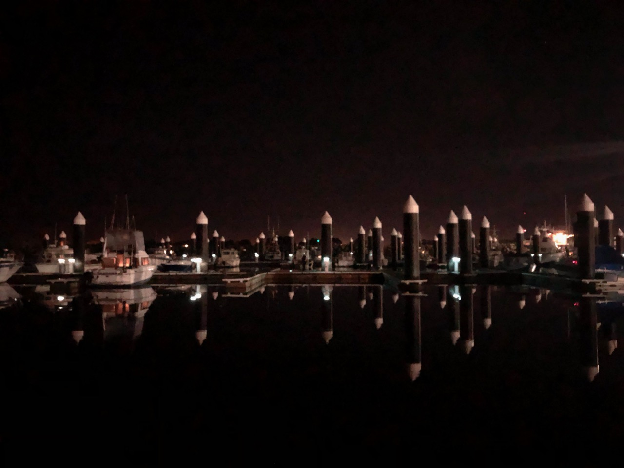
Sister Midnight behind Kathy in Aquatic Cove
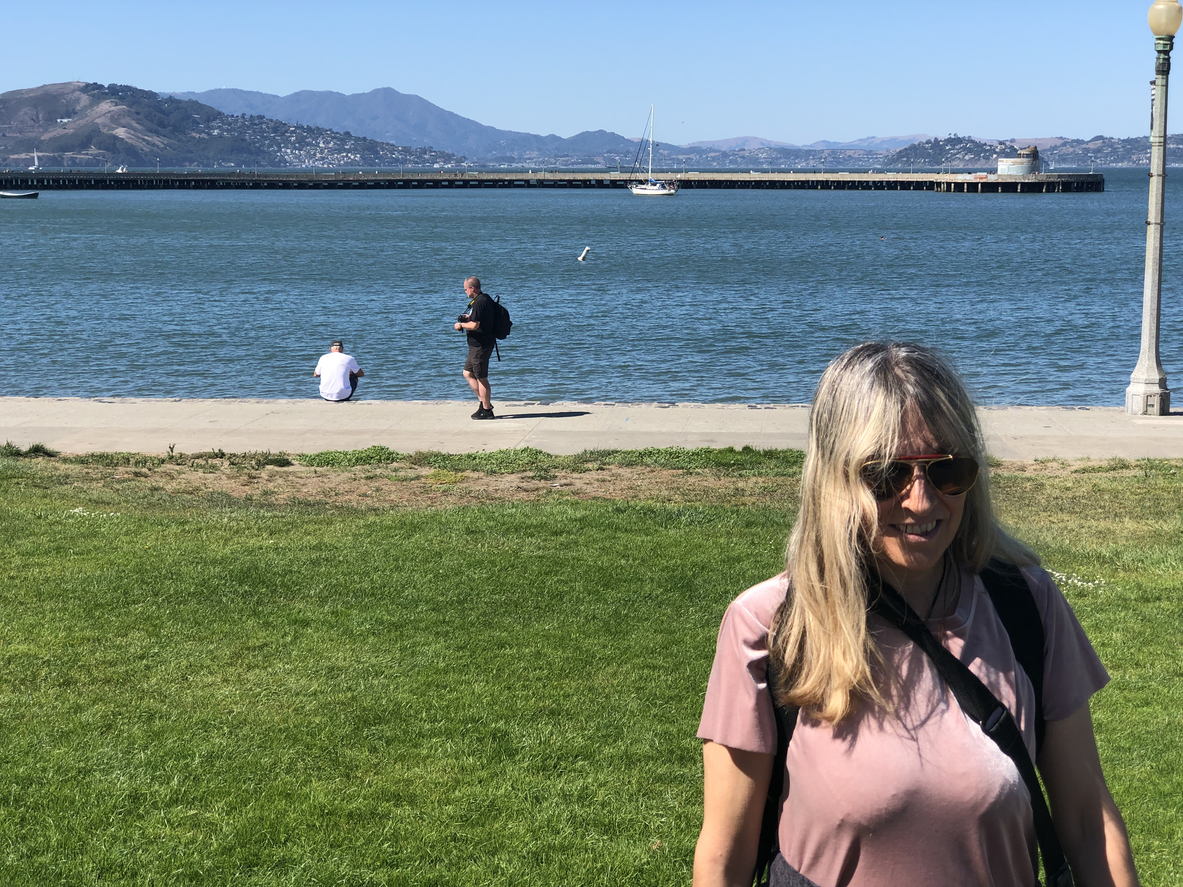
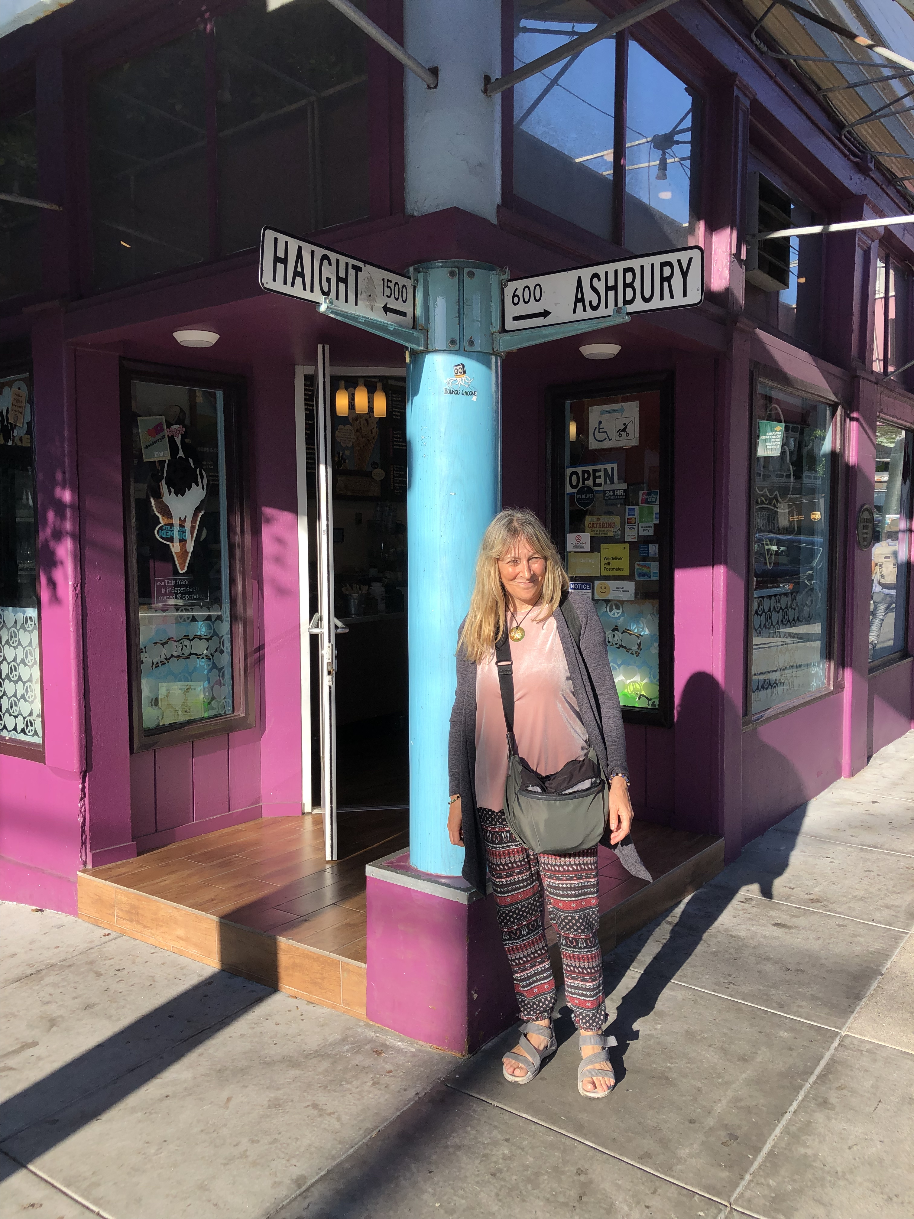
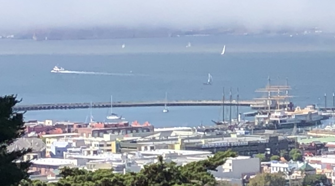
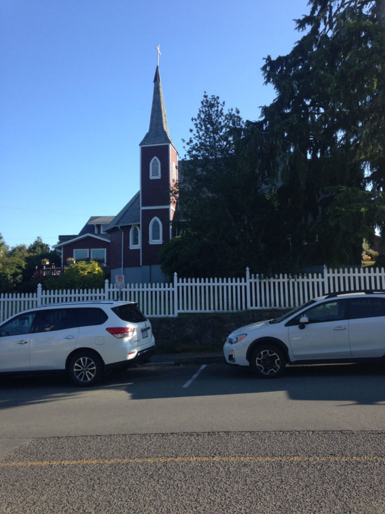
San Francisco is a great city, we have spent a couple of days walking the streets, and it has a great atmosphere. I will leave the details to Kathy as it’s much more exciting for her too be here. I’m hoping to see some science/tech/maritime technology in the varuious museums, plus I gather there are some great art galleries here.
Aquatic Bay with SM in the middleThe Cisco trademark in the background behind SMA blurry version of the view ashore at night.
We expect to be here for a few more weeks before we head on.
Sunday September the 1st saw us waving goodbye to Robert and Vanessa when they weighed anchor at 9 o’clock and motored off during a break in the rain, with Ucluelet as their intended destination.
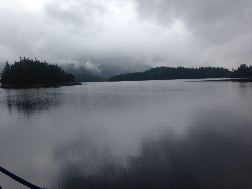
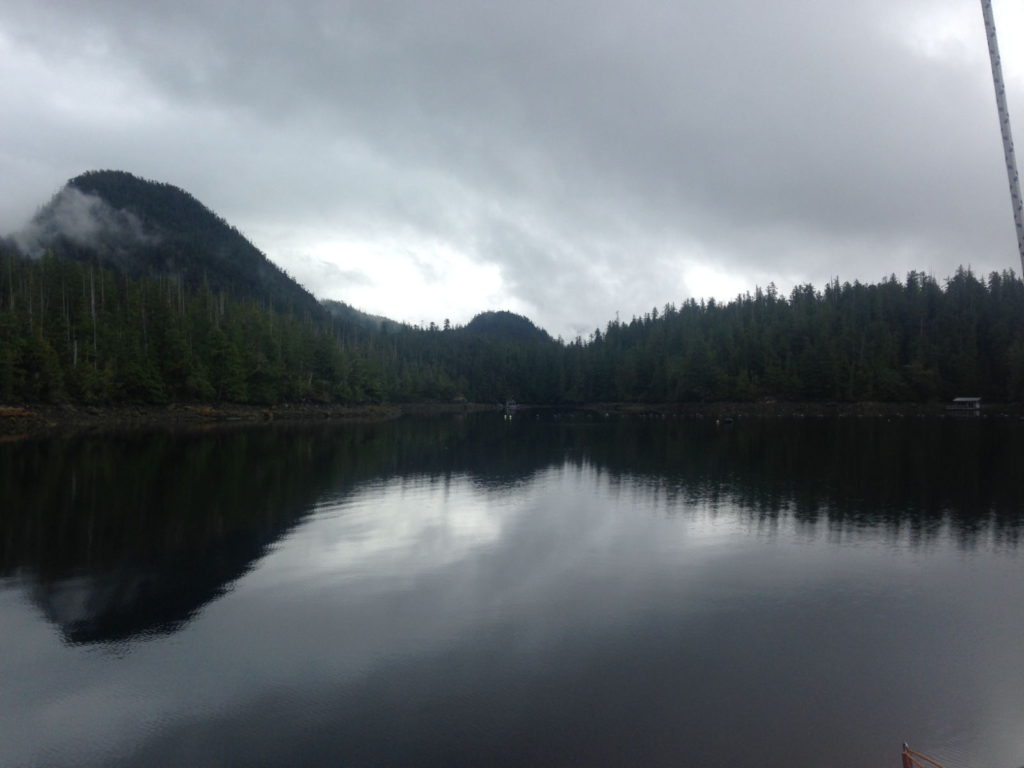
A grey morning in God’s Pocket
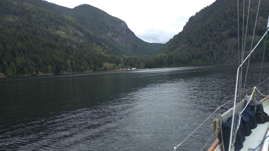
It had been a grey, drizzly start to the day but had brightened a little when we set off at 2 o’clock for the anchorage at Tofino. There, we would go ashore for provisions and begin our two day passage to America at around 8pm. God’s Pocket has no phone coverage so it wasn’t until we were well on our way to Tofino that afternoon that Paul got a message from Robert to say they’d had engine trouble and were back in the marina at Tofino, having been towed there by the nautical equivalent of the AA. It took us two attempts to anchor in the bay when we reached Tofino – the first time we inadvertently ended up alarmingly close to the location of a submarine cable on the sea bed. Naturally, our first call was to see how Robert and Vanessa were faring, so we dinghied straight over to For Good, almost running over the diver who had come to fix their problem. It turned out that the kelp that permeates the water in the area had clogged the water intake system. More expense for them, and yet another piece of boating equipment to add to the ‘to buy’ list. We commiserated, knowing only too well the frustration that accompanies broken parts and thwarted plans.
En route to Tofino
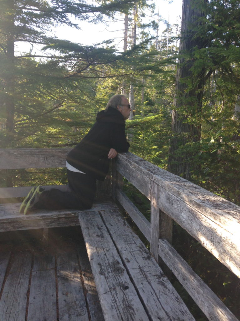
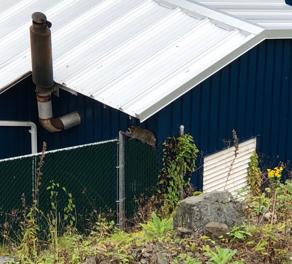
On our return from the Co-op we stopped at a viewing
platform to sit and look over the bay. I spotted movement just under the roof
of the huge fish processing plant near the marina which turned out to be four
raccoons on a ledge at the top of the wall. They were balanced precariously and
I thought they were getting ready to leap down on to the grass below, but instead
they disappeared one by one into the building through a gap between the roof
and the wall. They looked for all the world like a gang of robbers with their
natural black eye-masked faces and their furtive backward glances before they
entered the gap. It’s hard to imagine what they did in there but it seemed to
us that it wasn’t their first time. One of them emerged a few minutes later,
jumped down and scurried off towards the wooded area where I was heading to see
if I could spot any more in the trees there. Paul managed to get a picture of
it.
Robber Raccoon 😉
Before returning to Sister Midnight, we helped Robert and Vanessa turn their boat around to make it easier for them to motor off in the morning and then sat in the cockpit of For Good for a chat and another farewell drink. I could have happily stayed all evening, but time was getting on and we had to set off when the tide was best for us. Traversing shallow water on a foggy evening where rocks abound takes considerable skill and planning, not to mention nerve. Luckily, Paul possesses all of those qualities and he motored us over the initial tricky parts before I took the first watch. This was our first overnight passage for a long time, and with no moon and thick fog it was very dark. Visibility was so poor, there seemed little point in being in the cockpit much, apart from checking the engine temperature and the course. The combination of the AIS and radar for reassurance is such a boon at times like this. Even if other vessels don’t have AIS, the radar picks out anything around us. Without it, it would feel like hurtling blindly on at considerable speed at the mercy of anything that might be in our path. That is an incredibly unnerving feeling and yet I still felt compelled to go up at intervals to peer out at the darkness. The stern lights lit up the swirling fog, creating a pleasing atmospheric image and a feeling of being quite alone out there.
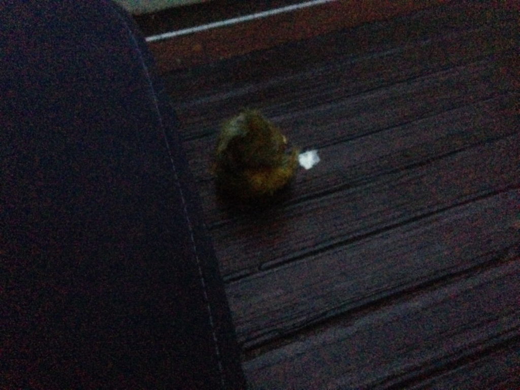
So began our four hours on, four hours off watch system. We tend to stick to the same pattern whereby I take the 8pm – midnight and 4 – 8am slots, mainly because I like to see the sunrise but also because it seems best suited to our sleep patterns. If we’re not sailing it’s just a case of keeping the course by tweaking the autohelm’s dials a few degrees to port or starboard, checking the screens and horizon for vessels and making sure the engine temperature is constant. During one of my trips up to the cockpit just before dawn, I noticed a small round object on the starboard seat. It was too dark to make out what it was so I shone the torch and saw that it was a tiny yellow bird, scrunched up with its feathers blowing in the breeze. The torch beam made it twitch but it didn’t fly off, and I wondered if it was cold or exhausted, especially if it was a young one. I fetched a warm cloth from the cupboard above the engine to place next to it but as soon as I got near, it flew off and could well have stayed with us for the rest of the morning somewhere else on the boat but I didn’t see it again. The picture isn’t very clear but you get the idea.
With the fog gone by 7am, the day passed with our sleeping and watching routine as we journeyed out into the big wide open of the North Pacific. We had crossed the border between Canada and America at some point during the night, and I thought not for the first time how strange it was to do that without all the kerfuffle that is usually involved at border crossings.
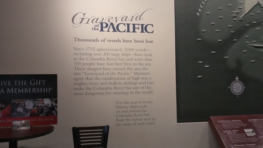
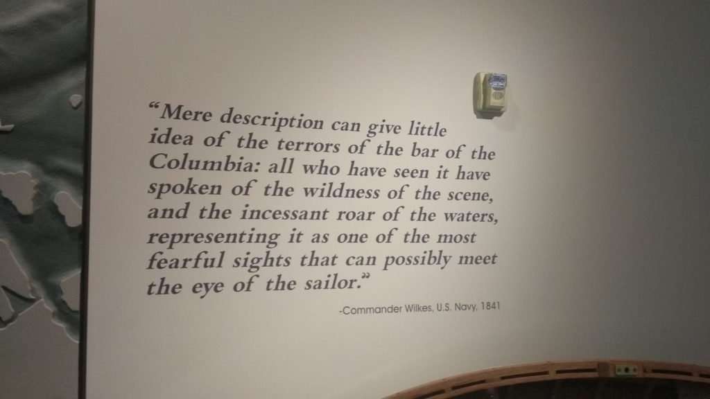
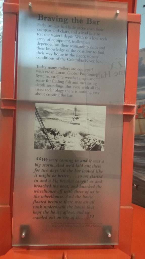
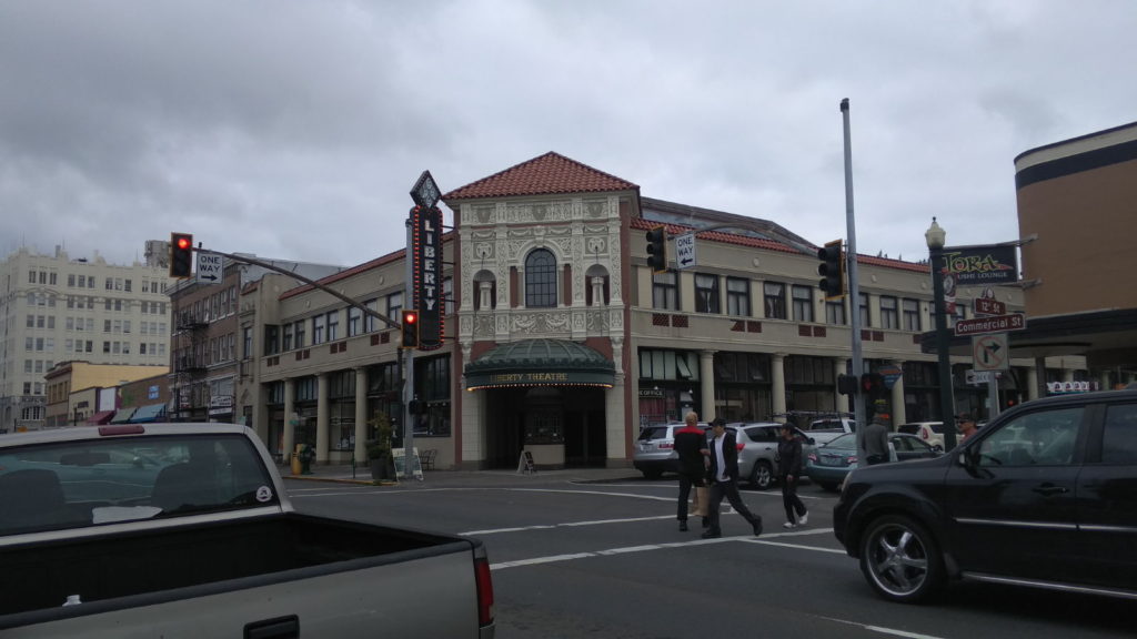
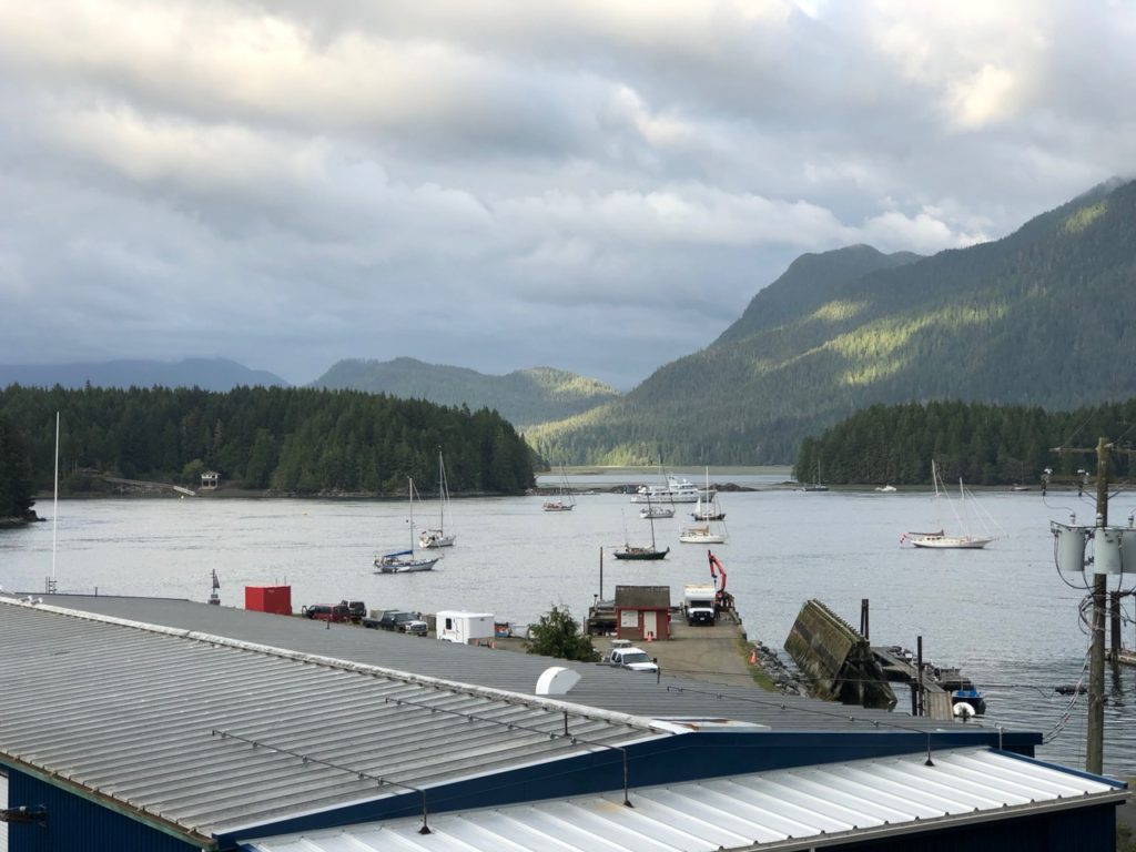
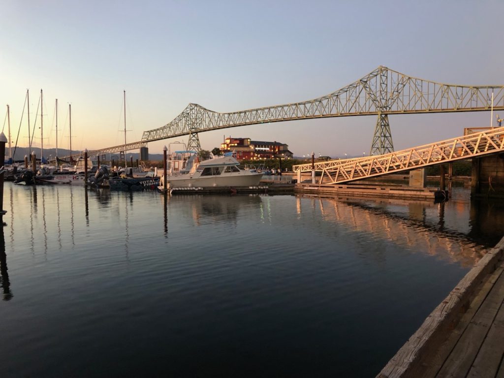
On the morning of Tuesday 3rd September more fishing boats began to appear as we neared the port of Astoria. This is where we would be clearing in and Paul had timed our arrival to ensure we crossed the Columbia River bar safely. Still slightly groggy from waking at around 10 30, I was only half listening to why it was so crucial to get the timing right for this bar. I heard him say that many boats had sunk there and how dangerous it could be but I assumed that was ‘in the old days’ or that they’d been the victims of historic pirates. All I knew was that it seemed to take ages to cross this bar. Paul was at the helm steering and I was looking out for the marker buoys and reporting their colours as well as keeping a close eye on the depth. I could see Astoria in the distance as we lurched from side to side in the swell but it didn’t seem to be getting any closer. A fishing boat contacted Paul on the VHF to chat with him about our boat, having admired it as he passed. I heard him remark that the bar shouldn’t present too much of a problem to us today, and then later he made a point of calling Paul again to compliment him on his skill at crossing the Astoria bar for the first time. It dawned on me then that there was more to this bar than I had thought. After declaring that we were through it, Paul told me it was known as ‘The Graveyard of The Pacific’, and that the unfortunate boats that had come a cropper there were in fact from recent and present times as well as from those ‘old days’. These posters from Astoria’s maritime museum convey information that I was blissfully ignorant of before we crossed it (but of course we would have to face it again when we left).
We filled up with fuel, Paul went to check us in with customs and then we tied up in our berth. I was amazed that my presence wasn’t even required for our entry to the US. Paul took my passport, answered a few questions and we were both cleared for a year’s stay in America. That’s my kind of border control.
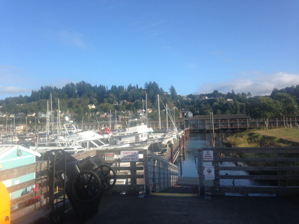
Astoria Marina
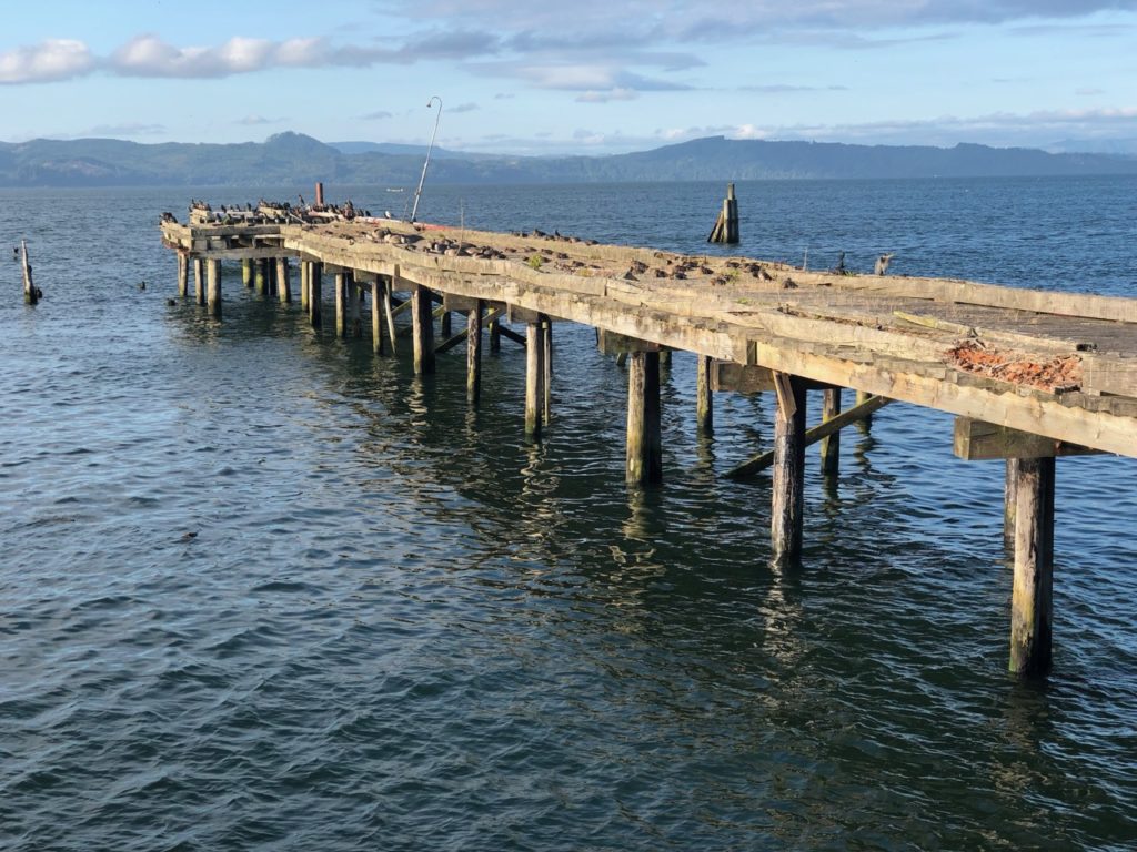
Despite being tired from the passage we were keen to check out our surroundings, so went for a walk along the Riverfront Walk, a coastal boardwalk complete with a railway track that runs a trolley service during the day in the summer months. It was a lovely evening, clear and bathed in the pink and orange hues of the sinking sun. There was plenty to admire along the boardwalk as the pictures show. My favourite was a disused pier which had been completely taken over by an assortment of seabirds. Iconic American images kept appearing, such as railway crossing signs, fire hydrants, mailboxes and box car carriages on the railway sidings. I felt happy to be back in America.
One of Astoria’s older buildings showing its Scandinavian associationThis pier becomes full of birds at dusk Megler Bridge, Astoria
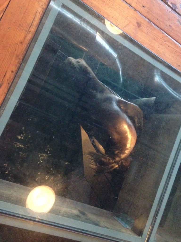
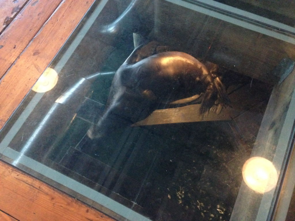
We stopped for food and drink at a waterside establishment called Buoy Beer which is next to the Buoy Brewery that produces a wide range of ales and beers. I felt it would be rude not to try one, especially as it helps animals (see below). A viewing floor with see-through plates allows customers to watch sea lions underneath them as they swim or rest on the underwater pillars. Little did I know this would be the first of many sea lions I would have the pleasure of looking at in America.
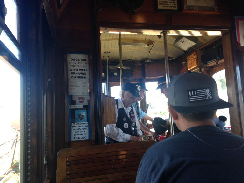
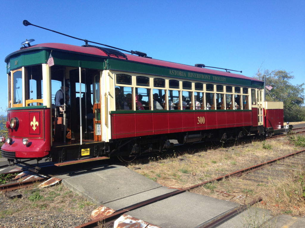
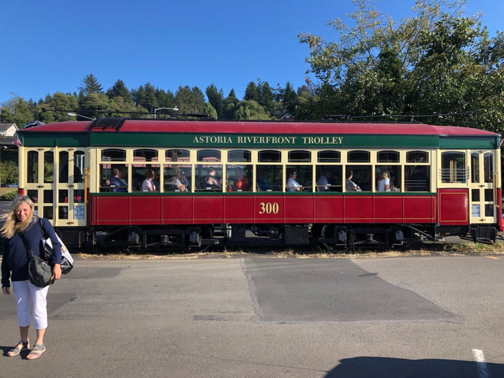
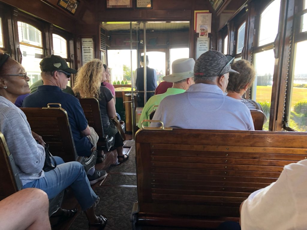
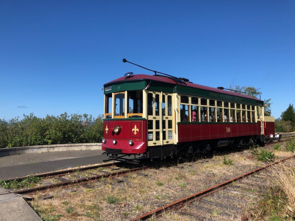
Next day we decided to take a ride on the ‘Old 300’
Riverfront historic trolley. We knew that it drops passengers off at the
Safeway supermarket, a couple of miles along the track. It turned out to be a
delightful experience. Run by volunteers, the trolley was built in 1913 and was
in service until 1933 when they were deemed too slow and streetcar services
ended. After time spent in various museums and several attempts at restoration,
an all-volunteer group in Astoria raised funds and arranged for expert manpower
to completely restore and preserve the car. It’s clear that the drivers and
conductors are passionate about her. They provide a humorous and informative
commentary and interact warmly with the passengers. The interior wooden
carriage is gorgeous, done out in the style of the 1930s, complete with
old-style adverts on the walls. Passengers get to contribute to the experience
when instructed by turning the seats around by use of a lever on the side so
that they face the direction of travel for the return trip. The views across
the bay were glorious and we were told about the birds on the disused pier (cormorants
mainly but we spotted herons and others…) as well as the sea lions who have
taken over pontoons further along the track. The commentary also informed us
about Astoria’s canneries and other landmarks of its fishing industry. They were
particularly proud of Astoria’s place in movie history, pointing out the places
that have been used as locations for several big films such as Free Willy, The
Goonies and Kindergarten Cop. At intervals, the trolley bell was rung, either
by the driver or anyone else who wanted to have a go, providing an iconic
American sound with its ‘clanging’ refrain.
On board the Old 300
We got off at the Safeway stop for our first US supermarket
shop in over a year. At least this time I knew what to expect regarding the
high prices but it was still hard not to flinch when converting dollars to
pounds (especially in this current political climate). The wide range of
products and superior quality is just as captivating though. Before waiting for
the trolley to go back we took a walk further along the track towards the sound
of honking coming from the sea lions we’d been told about. A little too far
away to see clearly, we could tell there were hundreds of them basking on the
empty pontoons, jostling and fighting and they are never quiet. Warning – there
will be a lot more sea lion reports and pictures in future blog posts.
Post shopping trip
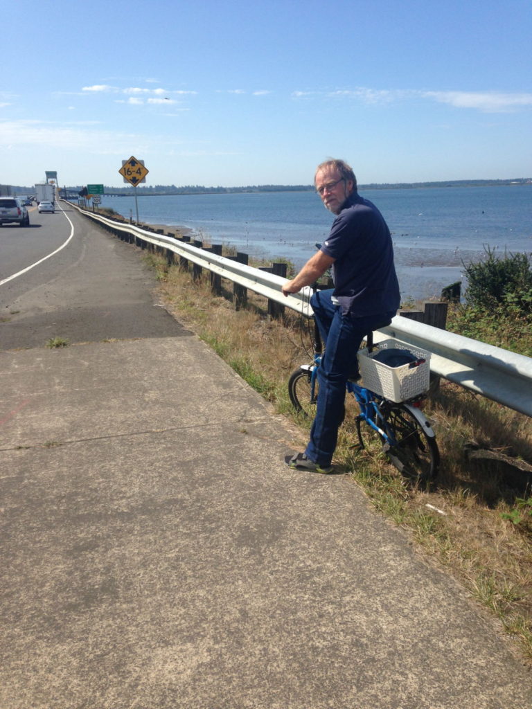
On Thursday 5th we got on our bikes and cycled
across a long and very busy bridge to the town of Warrenton about 5 miles west
of Astoria. We felt in need of the exercise after days on the boat. The bridge
spans Youngs Bay and is part of US Highway 101, the 1,540 mile north-south
Pacific coastal road that runs through the states of Washington, Oregon and
California. Road trips have been, and still are such a major part of American
culture, I hope we get to do at least one while we’re here (to Arizona and the
Grand Canyon would be an ideal one). Huge lorries and fast cars sped past us on
the rather narrow cycle track. It wouldn’t be a good idea to wobble or topple
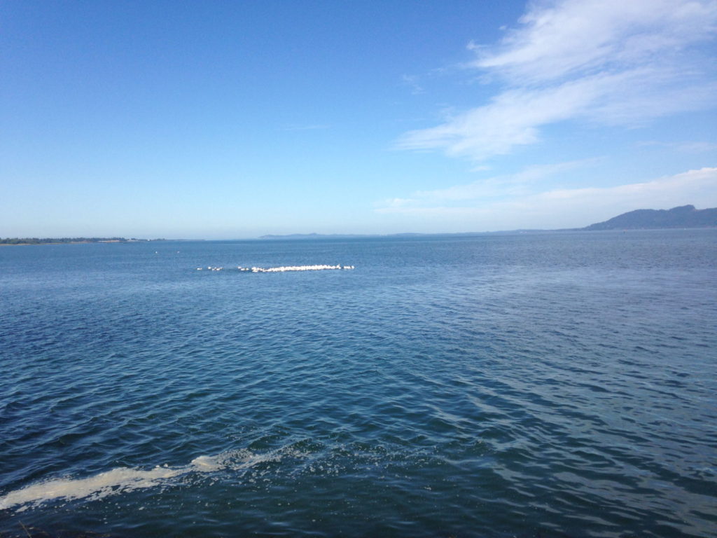
on this road! We stopped to look at a group of big white birds gliding across
the water as one, like they were forming a living raft. We guessed it might
have something to do with scooping up fish.
Birds on the water
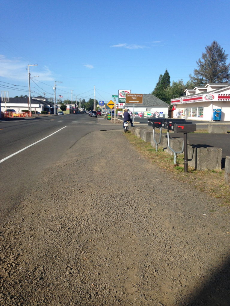
Our trip naturally took in a couple of shops (or stores) on
the outskirts, and then we cycled through the town of Warrenton itself (pop.
5,050). It’s mainly a fishing and logging town, fairly small and neat and
charming. It looked typically American to me. The ride back across the bridge
was even more hairy due to its being rush hour, and the noise from the speeding
traffic was literally deafening. By the time we got back we’d been out for over
five hours, most of which had been cycling. I felt saddle sore and heavy-legged
for a day or so afterwards.
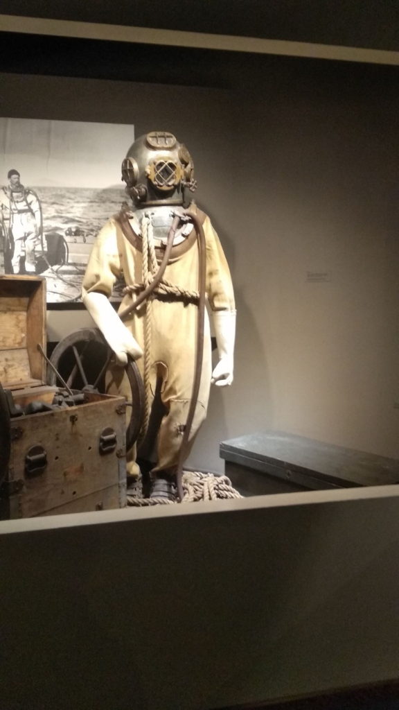
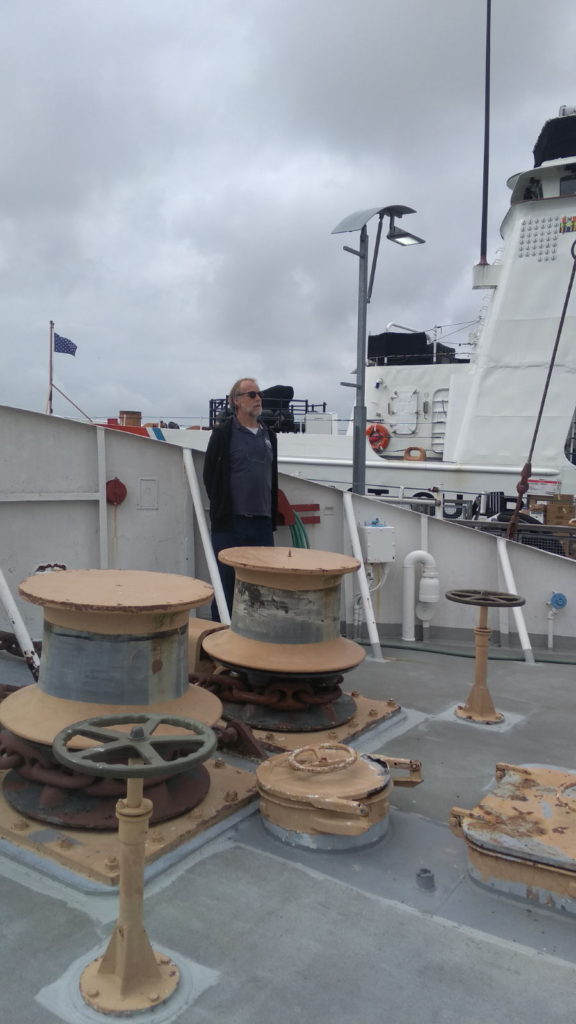
We had a cultural couple of days after all that exercise and took ourselves off to the Astoria Maritime Museum on the 6th. It had rained heavily during the night and was damp and chilly in the afternoon so a museum seemed the ideal place to go. Unlike in the UK, museums here charge admission fees but this one was well worth the money. It was here I learned more about the notorious Columbia River bar we had crossed. Films of it formed part of the exhibits and showed it at its worse, with waves of 30 feet causing chaos and distress. There was also an A-Z list of all the boats that have been lost or destroyed on it over the years. The admission fee included a walk around a decommissioned lightship. We got the chance to see what life was like for the crew on the Columbia lightship. They had to endure long stretches of boredom, monotony and rough weather in winter that prevented supplies reaching them, as well as having to ride frequent gale-force storms when they guided ships to the bar. She was replaced by a navigational buoy in 1979, and now there are only channel markers to guide us over it. They seem to do the job, though (thankfully).
On the Columbia Lightship
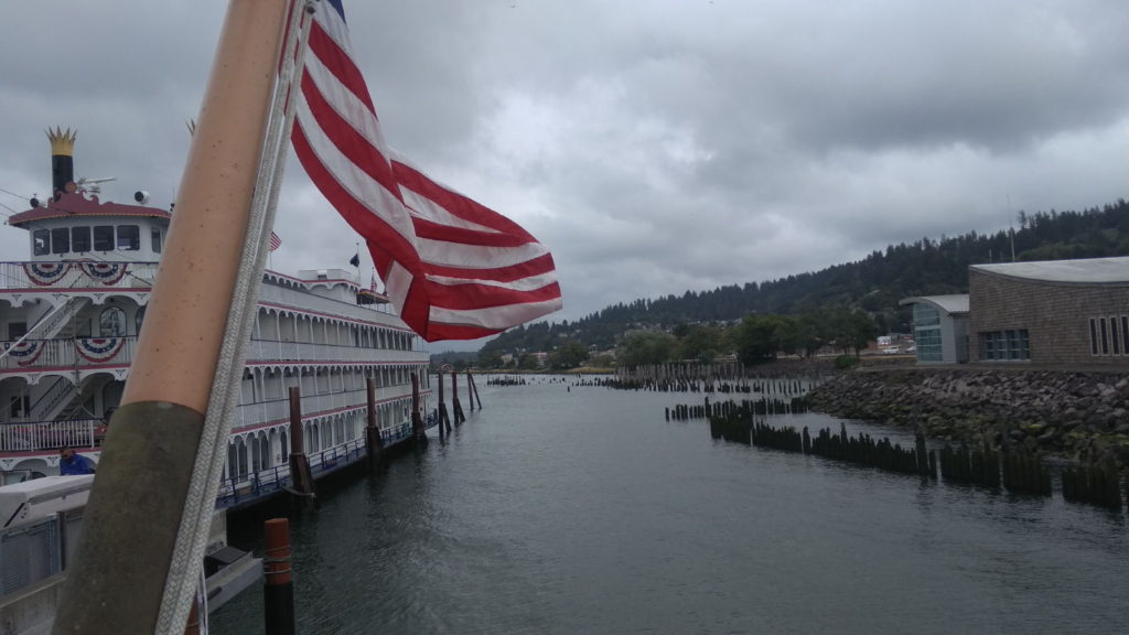
At the time of our visit there was a cruise ship docked opposite the museum which looked a lot more attractive than the typical huge cruise liners. This was the luxury paddle steamer Queen of the West and we stood to watch her being loaded with a staggering amount of provisions for her next voyage. The weather had improved when we came out so we cycled the length of the coastal track for another look at the sea lions and then into town via the inland main road to look at some of the architecture on the hilly streets there.
Queen of The WestFor Sale – needs a bit of attention!
The Heritage Museum was our visit for Saturday. Here we
spent an interesting couple of hours ambling around the exhibits reading about
the town’s history and its notable events. It was surprising to discover
Astoria had experienced some Ku Klux Klan intervention in the 1920s. I read
later that the museum used to have a mannequin dressed in the distinctive white,
hooded outfit but it’s no longer on display, presumably due to objections. We
finished the day with a drink at one of the waterside pubs adjacent to the
trolley track. Pics below of the day.
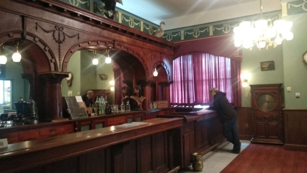
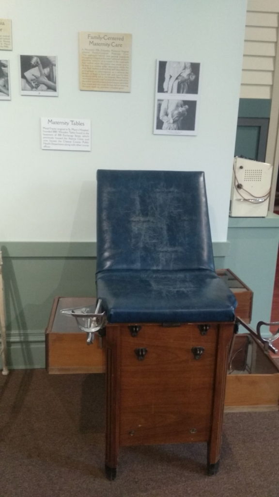
A reconstruction 0f Astoria’s old Saloon BarA birthing chair!Love this photo
Our stay in Astoria was stretching into a longer one than we
expected because of the need to consider tides and weather for the journey to
San Francisco. It would be a 5 day passage from there, and the forecast was for
lots of rain over the next few days which wasn’t a very attractive option. We
decided to visit the Sunday street market and think about it later. As soon as
I saw the market I knew what Paul’s opinion would be. I wasn’t disappointed –
something along the lines of ‘overpriced tat and some muddy veg described as
organic’ ;-). Still, I bought some of those veg and browsed the tat before we
cycled to Safeway for provisions, having made the decision to leave for Newport
the following day. The promised rain showed itself as a heavy downpour just as
we began the ride back and it soaked through our clothes within minutes. That
evening our marina neighbours invited us aboard their boat for a drink and a
chat. They were going home to Portland by car in the morning and kindly gave us
all their leftover fruit and vegetables.
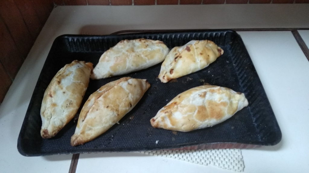
Monday 9th was another full day in Astoria due to the heavy rain which had continued throughout the night and didn’t stop until midday. I took the opportunity to do the laundry and make use of the marina’s drier while we had the chance. We finally left our mooring at 5pm on the 10th September on a clear, bright and sunny afternoon. This time when we crossed the bar, I didn’t even realise it. I was down below making vegetable pasties! There was a pretty strong swell too. I bet there aren’t many people who can say they were cutting out circular pastry shapes and spooning filling onto them while being lurched around on a notorious killer bar. Here are the finished results anyway. Left in the oven to stay warm, they made a tasty and convenient hand-held ‘at sea’ dinner.
Before I took the 8pm watch, Paul called me up to the cockpit because he thought he’d spotted whales in the twilight. By the time I got up there they had disappeared but what I did spot, which had us both laughing, was a group of brown heads. Some curious sea lions had come to look at us – four pairs of huge round eyes with long lashes were wide open as if in outrage at such an invasion. I kept an eye out for the whales during my watch. I had the benefit of a bright moonlight path to light up the surface but didn’t spot any. Newport would our next destination as we continue our southerly voyage down America’s west coast.
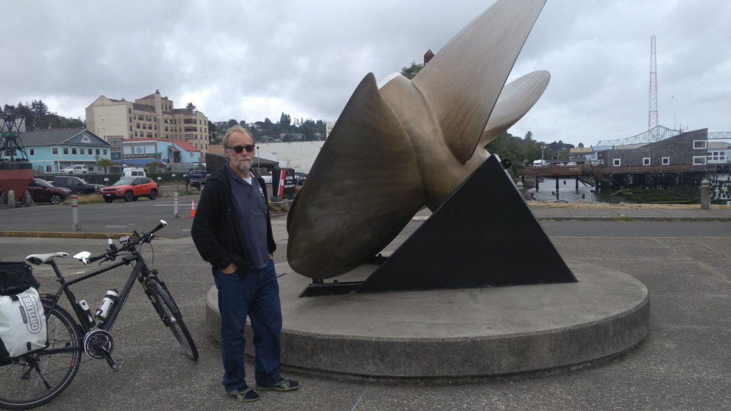
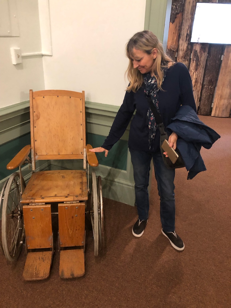
We left Astoria on the 10th September 2019 for Newport. Astoria was good, great shops and a lovely waterfront. The people there have been very friendly. Before we left we visited the heritage museum where Kathy checked out wheelchairs, she liked this model.
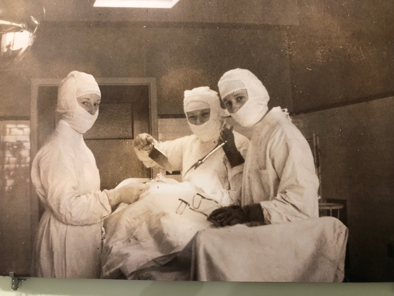
Also in the Museum they had pictures of the old hospital and below the hospital governors meet, this won’t mean much if you’re not from the UK, but Jeremy Paxman doesn’t seemed to have aged at all since then
The trip to Newport meant leaving in the late afternoon so we could cross the bar on a weak flood tide. Then an overnight sail to Newport, however the timings meant we had to cross the Newport Bar at the worst time. Thankfully the weather was mild and so although the waves looked scary it was fine in the middle of the channel. Once we were under the bridge it was a short hop to the marina.
Newport is a lovely town, with 2 lighthouses and a beach. We managed to fit in all the highlights in a day’s walk around town.
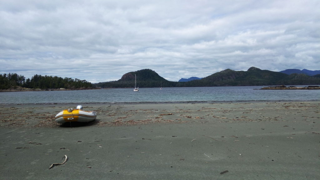
Boats come in many shapes and sizes !
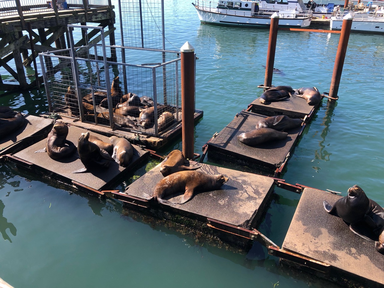
One of it’s main attractions is a group of concrete pontoons built for the sea lions. It’s a tourist draw alright, and quite amusing, however after 20 minutes we decided we should get ready for an early start to get out to Crescent City. The weather forecast wasn’t going our way.
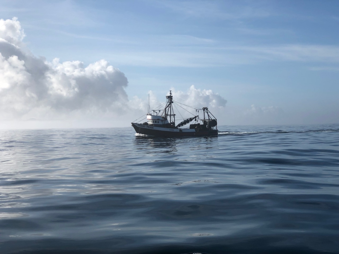
Our trip to Crescent city was uneventful, we sailed half way but the wind turned to the south and we ended up motoring the rest of the way. We saw very few boats on the way, but at night the fishing vessels seem to have very bright lights, I must find out why, but they are like football stadium lights pointing forward from the bow.
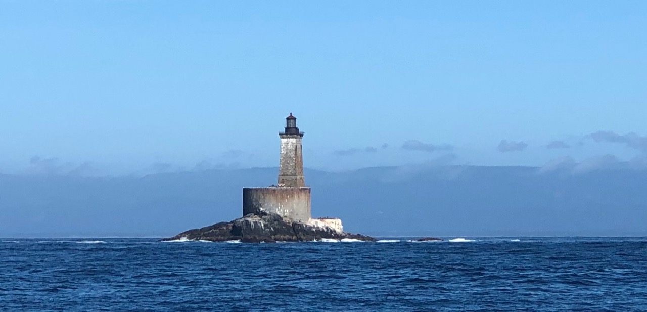
Crescent City is good, as there is no bar to worry about, but plenty of rocks all the same. The lighthouse below, as you approach the harbour isn’t on the Navionics chart, which is a bit worrying.
The marina was wiped out by a Tsunami from Japan in 2011 and has been rebuilt to be the strongest on the west coast. The piles and pontoons are very sturdy and twice the normal size.
Looks a bit like a clan gathering!Wide concrete pontoons
We arrived on Kathy’s birthday so went in hunt of a restaurant that might have a vegan offering, sadly Crescent City doesn’t excel in this area, and poor Kathy ended up with an ‘eat all you can’ Salad bar in a seafood cafe. She actually quite enjoyed it, she is going to have to wait until we get to San Francisco for a present from me.
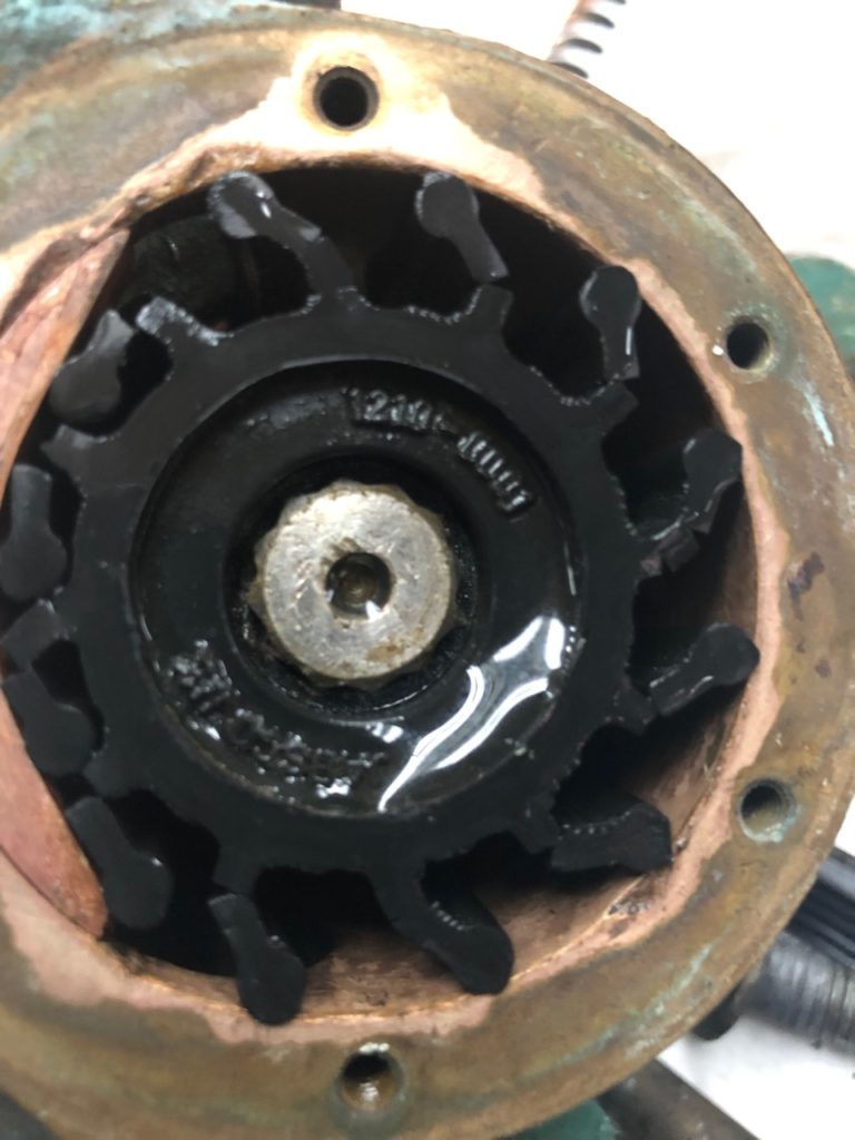
Well the pontoons at CC are great, but we didn’t get to sample any of its other delights (if they exist?), as we needed to head on early the next day in order to escape some strong southerly winds that were on the way. Also it was pouring down and the rain was predicted to last 3-5 days. I took the opportunity to check everything was ok at the back of the engine, gearbox oil and water pump, as they had had a good thrashing since I had them in bits in Sointula. I was very disappointed to find the water pump I rebuilt with the help of John in Sointula was pissing sea water out the back end. We couldn’t continue with this problem. I guessed the Lip Seal had broken, and as this was what we had just replaced, I guess the damaged shaft is the problem, so I need to buy a new pump, at around £300. Fortunately, due to me messing up on the last replacement pump kit order, I had another spare kit which included bearings and a lip seal, I just wasn’t sure if I had the tools to replace it on board. As it turned out it was quite easy and 4 hours later the pump was back on the engine and running fine without any leaks. The oil cooler I replaced also seemed good along with the gearbox oil level. However the Impeller hadn’t fared too well, I’m not sure why, as it was also new back in April, only 200 engine hours ago.
Yikes.
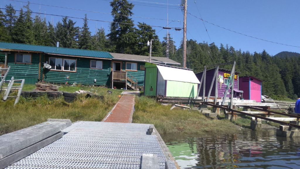
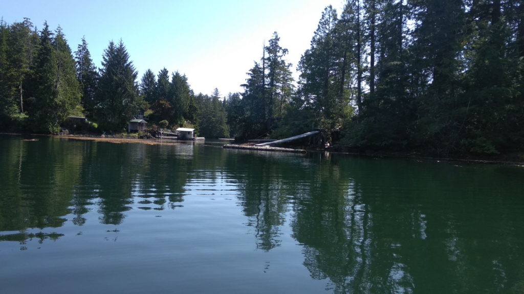
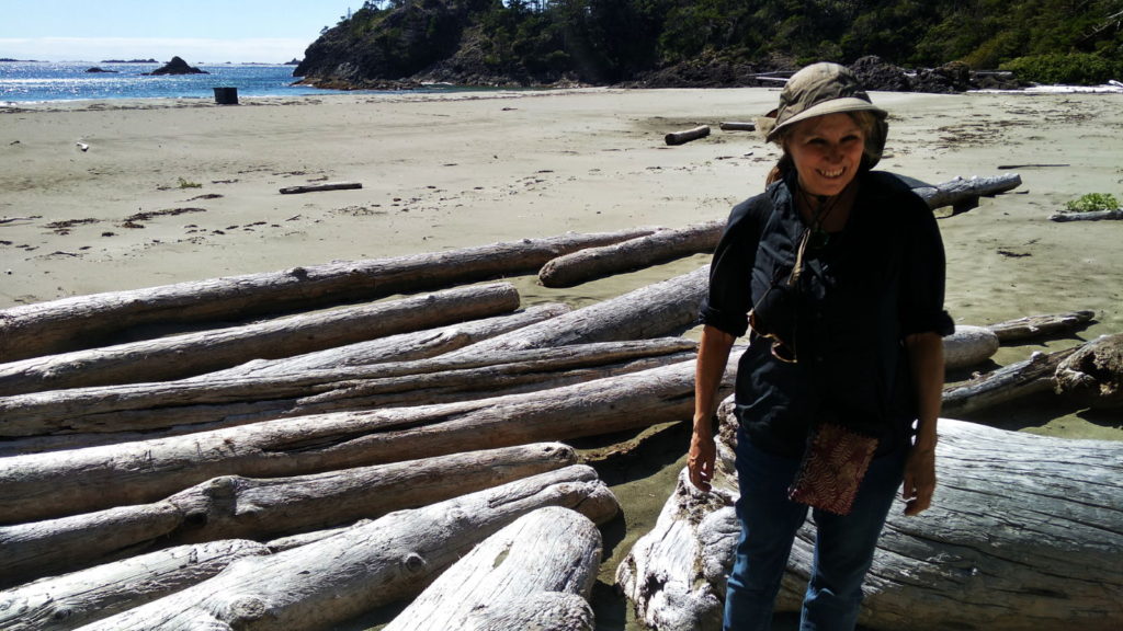
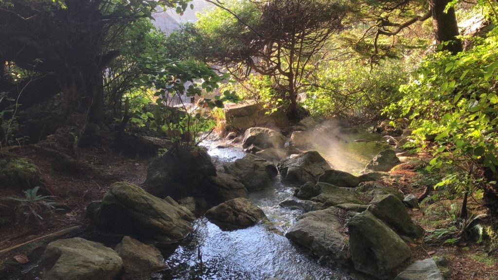
So at 7:30AM we left Crescent City for Fort Bragg / Noyo River. I kept a close eye on the water pump for the whole passage and it seems to be holding up. Hopefully it will get us to SF where I can get a new pump ordered and fitted. We had to motor the whole way, but once around Cape Mendocino the wind dropped and the sun shone bright, it really felt like we had arrived in a new country, suddenly for the first time in a long time it was t-shirt weather. We were assigned a berth, B5, by the harbour master, but ended up mooring three times before we found the correct berth. Mostly due to the complete lack of signage on the pontoons. There is no fuel available here, so I’m going up river in the dinghy to another harbour where I can get fuel tomorrow. We are only two days from San Francisco now, but it may be Sunday or Monday before we get there, as we are going to checkout the state park at Drakes Bay.
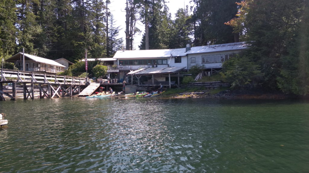
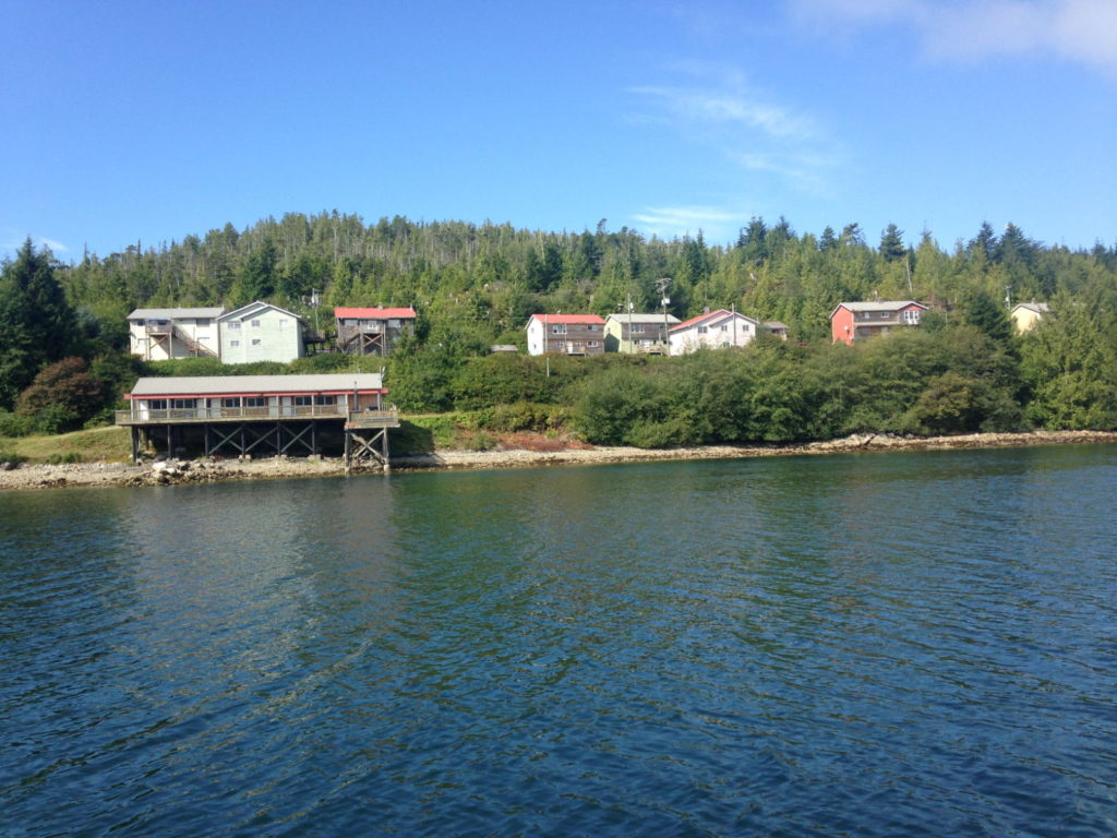
Thursday 15th August – Still in Walter’s Cove, halfway through the month and it seemed we were finally rid of Fogust’s fog. It was blisteringly hot by mid-morning when we got in the dinghy and motored over to the shore on the other side of the cove. Paul wanted to get an idea of the water’s depth for when we leave and also to have a look in the little store in the Kyuquot Native community village which we’d been looking at through the binoculars. The water is crammed with huge, sprawling seaweed plants (kelp) and I was afraid they would get tangled in the outboard’s propeller but at least the water was clear enough to see any large rocks. We tied up at the dock outside the store at the same time as a lone kayaker and had a chat with him. Hailing from The Netherlands, he had been kayaking his way around Vancouver Island for five weeks and had almost completed his journey. He told us that one night he had encountered a mother bear with cubs scarily near his tent while camping in the woods and that he often heard animal noises near him at night. We all went into the store, which was low on stock at that time but we bought cold drinks and chocolate bars and sat on the pontoon to chat some more with our new Dutch friend about our respective journeys.
From the dinghyPathway to the little shopSeagulls often form a line up on the logs
An hour or so later we tied up at Java the Hutt café to make use of their wifi. The owner lives up to his description in Waggoners Cruising Guide as one of the friendliest people on the coast, who makes a point of chatting with all his customers. He told us that the building used to operate as the village school house. Overhearing this, a First Nation lady sitting at a nearby table with her family looked across and informed us she used to attend the school back in the 70s and that she hailed from the village we’d just come from.
🙂 Java The HuttThe family we chatted with, Java the Hutt Cafe
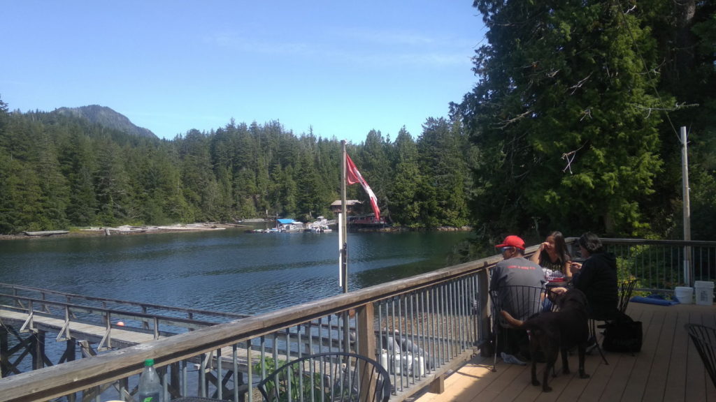
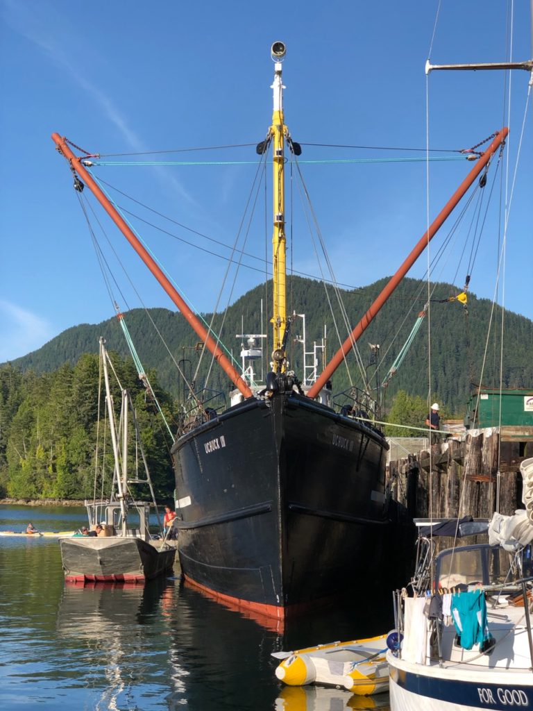
We also learned that everyone looks forward to Thursdays as it’s the day the Uchuck III arrives with supplies for local shops and businesses. For that reason the café would be closing early so we wouldn’t be able to have dinner there as planned. We opted for a late lunch at 4pm instead so that we would be back in time to watch the Uchuck dock just along from our berth. The boat also brings guests for the resort and fishing lodges and later on we sat in our cockpit watching the bustle and activity early in the evening as passengers were met, greeted and taken off to various lodges and boats, while cargo was unloaded onto skiffs and carts to be distributed around the island.
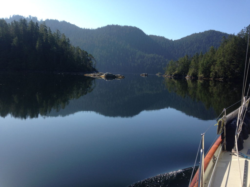
Next day we waited for the shop to open at 1pm and stocked up with a few more provisions before leaving, along with Robert and Vanessa, at 2pm for an anchorage at Dixie Cove. There was enough wind for Paul to get the headsail out, so I made the most of the peace and the gentle motion to sit at the bow enjoying the warmth and the stunning views all around me.
Leaving Walter’s Cove
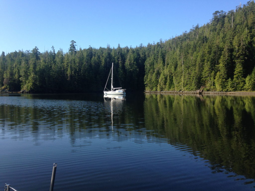
For Good took the lead on this trip and were already anchored in the outer cove when we arrived at 5 o’clock. We went further in to the inner cove and just as we were setting the anchor, a motor boat sped up alongside us to warn that they were logging in the forest opposite and not to be alarmed by loud explosions. I’m glad he told us because the noise when it came about 30 minutes later was extremely loud and seemed to me to shake the whole boat! Thankfully there were no more after that one. We dinghied over to For Good with some beer to discuss the trip for the following day, getting back to ours just before it got dark. Despite the warmer weather it gets very chilly once the sun goes down, and it seemed ages before we got back into the warmth of the boat.
A calm anchorage at Dixie Cove
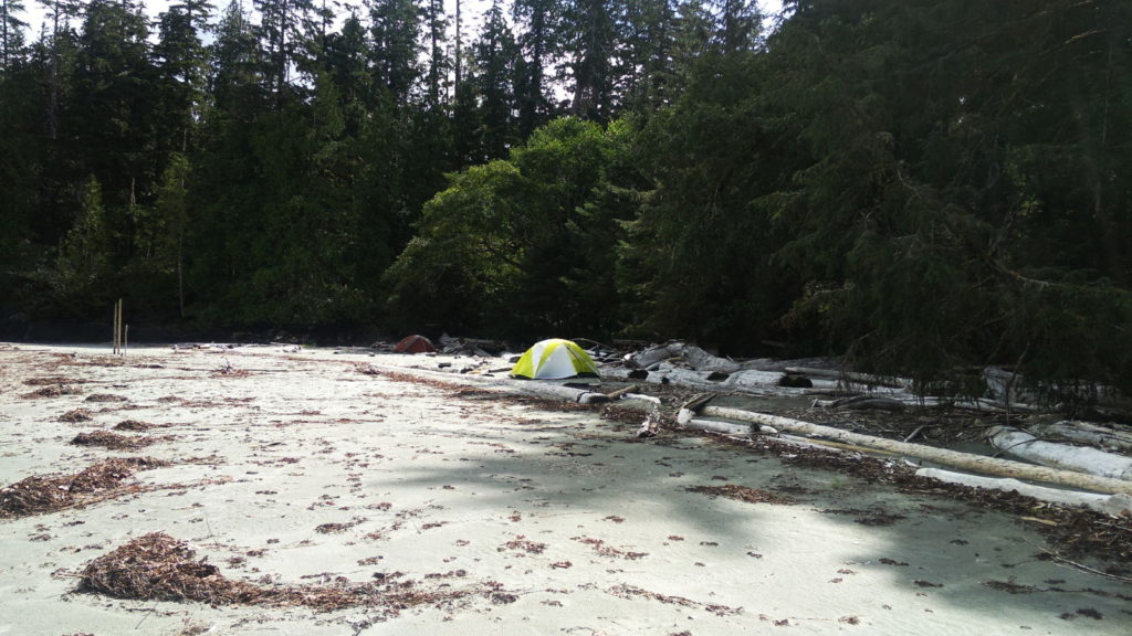
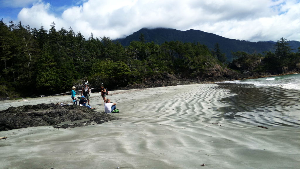
As discussed with Robert and Vanessa, we would be heading for Rugged Point at 10 on Saturday 17th, a short trip to a spot with some good beaches and recommended woodland trails. I was most interested to read in Waggoners that bear and cougar prints had been spotted on the beaches there. Luckily, since we planned to spend some time on these ‘spectacular’ beaches, the weather improved from cloudy to decidedly hot and sunny as the morning went on. At 11 o’clock we anchored opposite a beach with several tents pitched on it.
Tents belonging to a kayaking group
The four of us dinghied over to the long beach, greatly excited to see a black bear ambling along on the adjacent beach. After hauling the dinghies up the beach we discovered the trail entrances weren’t located on this particular one but I was thrilled to see that there were paw prints, which Robert and Vanessa were able to confirm were indeed bear and cougar prints. Before heading off to the next beach, they went back to their boat to pick up their bear spray!
Not dog prints!
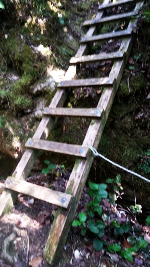
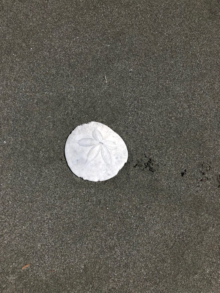
We enjoyed almost four hours of beachcombing, walking, sitting in the sun, chatting to other visitors and taking pictures. The trails involved pulling ourselves up by ropes on some of the steeper parts! Back on the beach we were keen to find a sand dollar. A lady we spoke to had informed us she had seen one nearby. Vanessa described them to us and not long after, she found one which she was kind enough to give to us as a souvenir. Hard to believe it’s actually the skeleton of a type of sea urchin; it looks so much like someone decorated a stone with an exquisite flower. Robert said he thought one of the animal prints looked like it might be a wolf; I marvelled at the fact that we had been walking in the same habitat of so many wild creatures.
One of the beaches at Rugged PointRobert and Vanessa, Rugged Point Paul taking a breakOne of the climbing aids on the trail
Early on Sunday morning, the fog I thought we had seen the last of, returned and caused some uncertainty about whether we should move on or not, especially as the coastguard had warned of gales in the area. Then it started to rain! Still, we concluded it was ok to go (despite Paul’s casual remark that in the worst case scenario we would just be blown onto some jagged rocks). The waves bounced us around immediately we left the shelter of the anchorage. From our skimpy beach clothes of the day before, we now had to pull on thermal layers, oilies and hats and gloves. Before long, the waves were pushing and pulling us in a side-to-side motion that was annoying but bearable and we’d certainly endured worse. I just hoped Robert and Vanessa weren’t finding it too uncomfortable. We listened to every weather forecast that came through (often too distorted to make out) and discovered it looked likely the rough conditions would continue for a few more days but would probably get no worse.
After negotiating our way through a narrow gap and avoiding the many rocks in the area, the shelter of the anchorage, as always, provided respite from the elements and by 1 30 we were settled and secure in Nuchalitz Provincial Park. It was too overcast and chilly to go exploring so once Paul had been over to see how For Good had fared on the journey, we shut the hatches and got on with the enjoyable pastime of relaxing.
Tahsis, the port of call for Monday 19th had a
very enticing description regarding facilities on offer in Waggoners. We could
expect wide ‘cell’ coverage (note how I have become used to using that word
instead of mobile), WiFi, shore power, water, fuel and a huge supermarket. All
things we take for granted during daily life in the UK, which although are not
missed terribly when they aren’t freely available, does make you appreciate
them after a period of doing without their benefits. Robert and Vanessa left
the anchorage at 9am but as Paul wanted to have a look at the abandoned First
Nation village referred to in the book, we said we’d meet them in Tahsis. I
hoped I hadn’t made a mistake electing to stay on board to catch up on other
things as he dinghied off to explore, especially as he was gone for quite a
while. It turned out the abandoned village wasn’t much to look at but he had
loved walking on the sand spit at low tide, observing the sea creatures, birds
and shells.
I offered to make some toast when he returned. We’d been doing this the old fashioned way, using the grill part of the oven: you know…it involves actually having to turn the bread over to brown the other side! Halfway through, however there was a small whoomph-like explosion which kept repeating after more attempts to light it. Paul concluded later that it was broken and a bit too risky to fix. We improvised and used an oven shelf atop the flames on the gas rings. Never mind, we said, at Tahsis we could bring the toaster back into use using the shore power. There was no wind so we motored all the way, passing tiny communities nestling at the bottom of steep-sided mountains.
Leaving NuchalitzOn the way to Tahsis
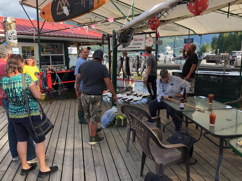
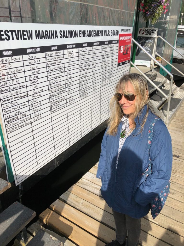
Just before two we could see Westview Marina in the distance and I thought then that it didn’t seem as big as I had expected. Paul called ahead to check they had room for us and they provided directions for the fuel dock. We had to look for a green building with a red roof, which to someone who is red/green colour blind isn’t a whole lot of use. Robert came to greet us as we were filling up to tell us we’d be berthing just behind them on the pontoon. It was only a short distance away. Robert took our lines and we tied up. Now for the chance to catch up on internet stuff, I thought, expecting to see the Rogers telephone signal displayed on my phone. It wasn’t there – in fact no provider was displayed, and for WiFi it seemed we’d have to go to the café, while connecting to shore power would prove too expensive just for the the luxury of toasting bread. Things didn’t improve much after that…
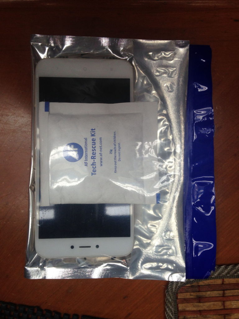
We arranged to go with Robert and Vanessa in the marina’s courtesy car to the supermarket at 4 30. Paul went on ahead to find the rubbish bins while I went to the restaurant to check out their menu for dinner later. Stepping out into the bright sunlight, I spotted Paul on the bridge leading to the car park and strode out to catch up. I didn’t notice the gap between the restaurant building and the pontoon and walked on assuming I was on solid ground. I must have stumbled through the gap with my right foot, tried to regain my balance and only succeeded in tumbling back so that my right side hit the restaurant wall and then all of me sank into the water. As often reported in such accidents, it seemed to happen in slow motion but was probably very fast to the onlookers, including Paul, who rushed to grab my hands and pull me up as soon as I resurfaced from the narrow gap. I still had my bag on my shoulder and could taste salt water in my mouth. My first thoughts were about what might be in the water and did I swallow any before wondering if my phone was in the bag. Once I was back on terra firma and had assured the small gathering of people that I was ok, Paul checked my bag to confirm my phone was indeed inside it. Restaurant staff appeared with two towels to wrap round me and Paul led me away from the scene of my mishap back to the boat. All I wanted to do was wash the water off me and rinse my mouth out, remembering with horror that a fish-gutting table had been fairly near the spot where I fell in. I was aware of a vague pain in my left leg which intensified as the evening went on but it felt good to be clean again. My phone was put into what I termed the ‘intensive care bag’ (pictured below) which someone had given Paul as a gift due to his propensity for dropping tech equipment in the water. I was surprised that it had come on at all, but time would tell if any permanent damage had occurred. (Update – Paul refused to give up on it and finally managed to fix it completely on September 5th.)
Scene of my tumble in the middle of the picture between the steps and the slope (fish gutting station on the far left)
A little later than planned, we met Robert and Vanessa in the car park and piled into the 4×4 car for the short drive to the centre of Tahsis. Despite my little accident I was looking forward to stocking up on provisions and maybe finding a bar to have a much needed drink. When we got there we were all disappointed to see that the ‘supermarket’ was little more than a store with the usual hiked up prices and limited stock. We picked up some basics anyway and decided to go back to the marina’s ‘Island Attitude Coffee Café’ for a drink and something to eat once the shopping had been put away. My leg was hurting pretty badly by then but I guessed it was just bruised or strained from the bashing it had taken. We all enjoyed the food and had a great evening chatting about the day’s events and future stops before I limped back to the boat. Paul managed to get us a bit of Wi-Fi so I was finally able to make contact with family and friends.
Next morning, waking at 4 45 I felt nauseous and immediately
wondered if it was due to anything I had inadvertently ingested from the sea
water but Paul laughed away my concerns about parasites and worms. He did tell
Robert and Vanessa we wouldn’t be leaving until I felt a bit better though and
recommended they go on ahead. By midday, still limping a bit but not as queasy,
we negotiated the boat out of a fairly tight spot and motored away from Tahsis,
en route to Ewin Inlet.
It was a cool and cloudy day and Paul said it was cold in
the cockpit. I stayed below still fighting off occasional waves of nausea. Robert
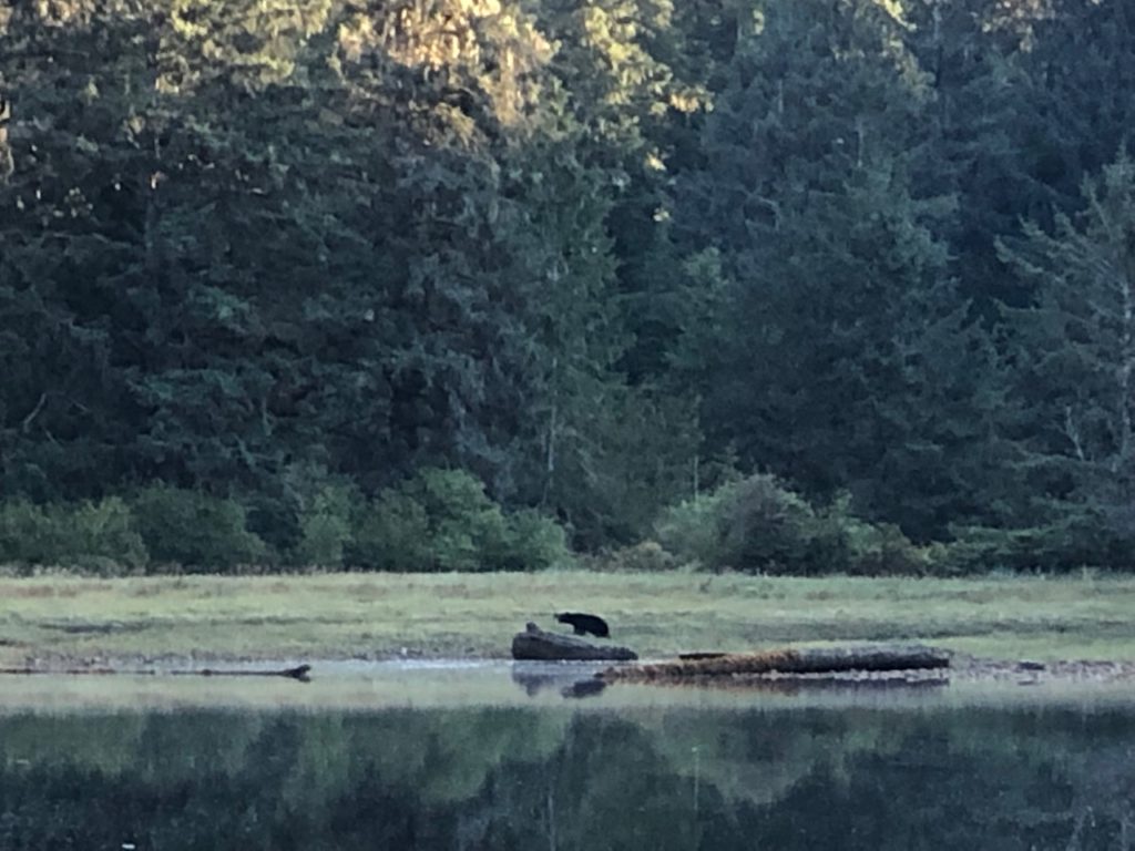
called on the radio to let us know there was a black bear on our port side. I
came up to look and could see it so clearly I was even able to make out the
wind blowing its thick fur. They came over in the dinghy once we were all
anchored and we sat in the cabin drinking and chatting late into the evening as
it rained heavily outside.
Anchored at Ewin InletFor Good, Ewin Inlet
We spent all of Wednesday 21st August at Ewin Inlet in order to sit out a spell of rough weather. Looking through the binoculars early in the afternoon, we spotted that the Beneteau anchored near to us had two cats on board, playing on top of the boat’s canopy. During his kayak trip, Paul had a chat with the co captains, Carla and Kevin and returned to tell me they had invited us, along with Rob and Vanessa for drinks later that afternoon. We hitched a ride with them for the short dinghy trip over and spent a pleasant evening on board their boat Gargoyle getting to know Carla and Kevin and their delightful Devon Rex cats, Sam and Dean. I wished I had taken my other phone across to get pictures of the cats, but I’m even more wary of damaging devices now. They had such striking eyes, and were very entertaining with their playful antics. They make great boat cats I’m told ;-)…
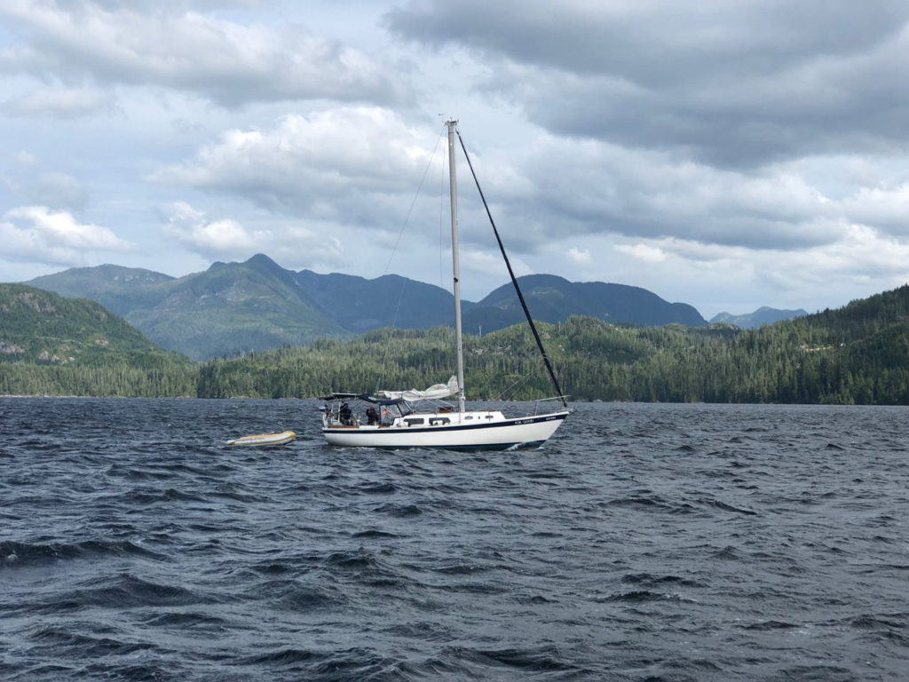
Four boats in the Ewin Inlet anchorage planned to journey to Hot Springs Cove the following morning. One of these had arrived late the previous afternoon. The guy on board told Paul he’d been having engine trouble and had had to return to the inlet to work on the problem. Paul spoke to him before we left to check he had got it sorted and to let him know we were all leaving shortly in case he needed help. It turned out he would be heading our way too, later in the day and it seemed likely we would all meet up there at some point. It was a beautiful sunny morning but we’d heard it was quite rough further out in the Pacific. Gargoyle left first and Kevin told Paul he would let him know if conditions were rough out there. For Good were next, and we weighed anchor just after 10.
And then there was one
We estimated it would be a 6 or 7 hour trip and Paul was keen to get sailing so the mainsail was hoisted as soon as we had cleared the inlet. As the day went on, nice as it was to be without the noise of the engine, the waves were high enough to be causing a ‘pitching and tossing’ motion and through radio chats with Robert, it became clear they weren’t having a very good time of it on For Good. Their engine had failed and it was too choppy for them to set their sails in the strong ocean swell. Noticing they were falling further behind, we turned around to check they were ok. It was decided the best course of action would be to abandon plans for Hot Springs Cove and make for the closer destination of Hesquiat Bay. At 6pm both we and For Good anchored there while under sail. That was a first for me and I hadn’t heard Paul tell me we’d be doing it so it caught me on the hop a little. It had been a long day for all of us and it felt good to be secured for the night. We agreed to see what conditions were like before making a decision about where and when to move on.
Hesquiat Bay
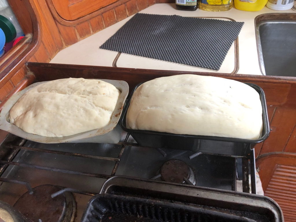
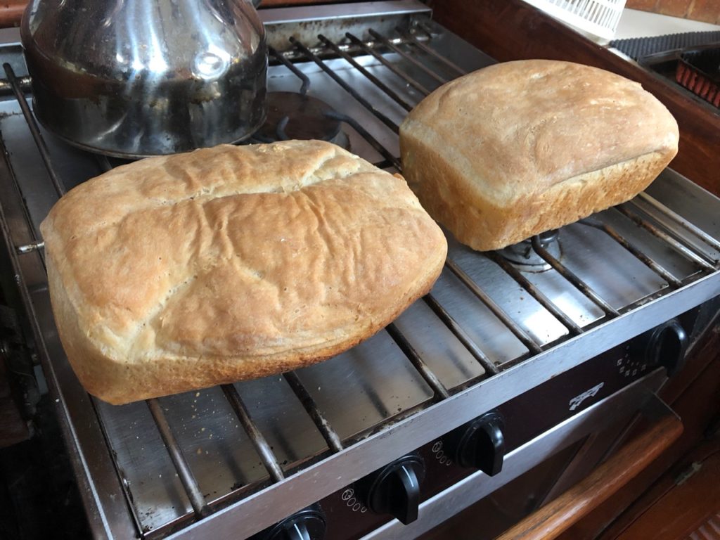
Friday 23rd August dawned with uncertainty about what to do. There was only a small window of opportunity weather-wise in which to leave for Hot Springs Cove even though it’s only a short distance away. Robert was still working on the engine problem so we thought it best to stay where we were for another day. We watched a black bear from the cockpit for a while but it was turning out to be a grey, chilly day. Paul took the dinghy out to explore the possibility of an alternative anchorage and I took the opportunity to make some bread as we were running low. Last time I had made bread it hadn’t turned out terribly well but we suspected it had something to do with the yeast not being fresh. This time, both loaves came out really well. We planned to give one to Robert and Vanessa that evening but they decided on an early night in preparation for the next day’s journey. We had a film night instead! Paul discovered he had downloaded Gandhi as well as a few other films we’d forgotten about. I only lasted an hour before falling asleep, and it’s a three hour film so it looks like we’ll have to watch in in ‘episodes’.
Bread dough ‘proving’
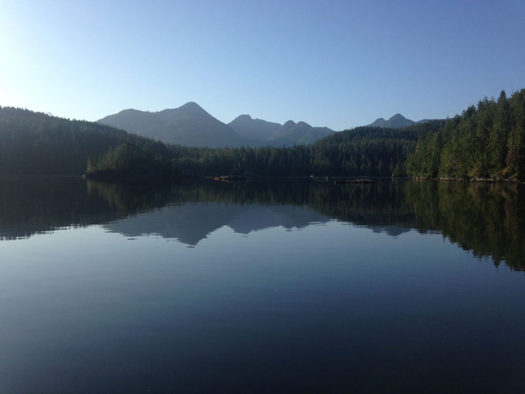
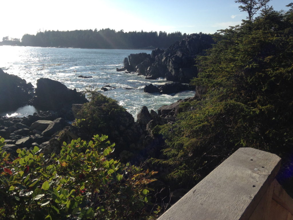
The weather didn’t look too promising the next day; chilly, foggy and wet. Robert called at 8 30 to say they were setting off for Hot Springs Cove and would see us there. We set off at 9 and the weather had improved by 10 with rays of sunlight making the waves sparkle and it got steadily sunnier and warmer from then on. Paul pointed out that we were now leaving the wilderness behind and were heading towards more built-up and populated areas. Hot Springs Cove, however, didn’t appear to be crowded despite its description as a popular tourist destination. We did see tour boats, float planes and a few other anchored yachts, but there was plenty of room for us in its picturesque cove. We anchored near to the shore on the First Nation village side. On the other side we could see the camp site and the entrance to the park with a boardwalk leading to the hot springs.
View from the anchorage at Hot Springs CoveA float plane landing near the entrance to the park
Although it was midday, we decided to wait until late afternoon to do the 1.25 mile long walk to the springs, following the advice in Waggoners that this would avoid the summer day tripper crowds. We were glad we did when Robert and Vanessa returned from their earlier trip and said it was hard to move freely at the springs for all the people gathered there. We set off at 5 30 when the temperature was pleasantly warm after the heat of the day and the light was beautiful from the sinking sun.
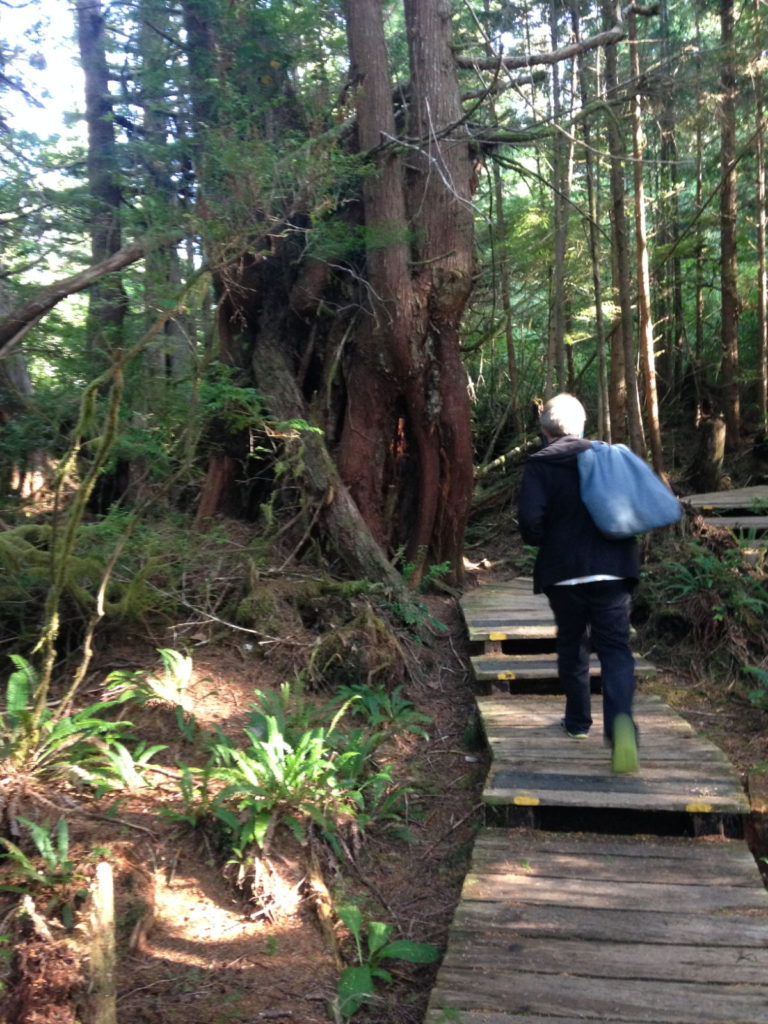
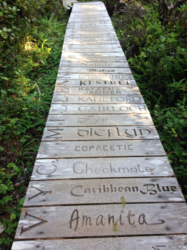
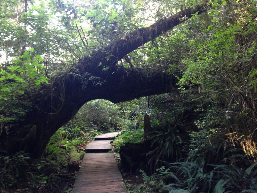
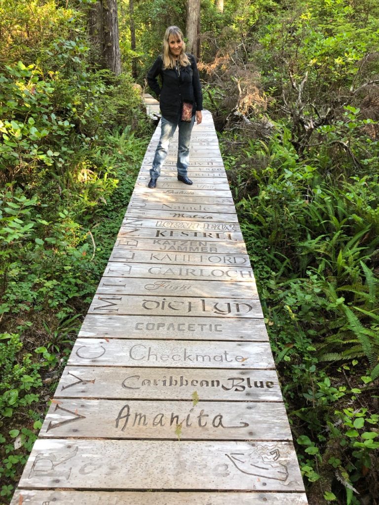
The boardwalk begins shortly after entering the forest. Waggoners provides the history of this useful and artistic path. Before its construction, the route to the springs was a muddy, difficult trek or accessible only by boat, so locals and visiting boaters began contributing individual planks to create a boardwalk, originally from sections of logs on-site. Inscribed on these were the names of boats along with dates and messages. In time the original pathway had to be replaced with brand new 2×6 wooden planks but the tradition of carving words remained. BC Parks allowed people to pre carve planks and leave them with park rangers for later installation and then sold bare planks for the same purpose. They make an impressive sight and it’s impossible to ignore the names and messages as you walk along. The boardwalk program is no longer in operation, however due to good old ubiquitous health and safety regulations.
When not scrutinising the planks, the rainforest around us
provided its own attractions. The trees were spectacular, as you’d expect in
Canada. Their roots were the stuff of fairy tales, spreading out far from the
base of the huge trunks to form intriguing shapes and hollows. The branches at
the lower part of the trunk were as big as some of the smaller trees, and they
too formed irregular and bendy shapes. In the early evening light it was truly
a magical setting, especially with the heavy covering of leaves only letting
chinks of light through above us – and all the better for having it mostly to
ourselves. Pics below.
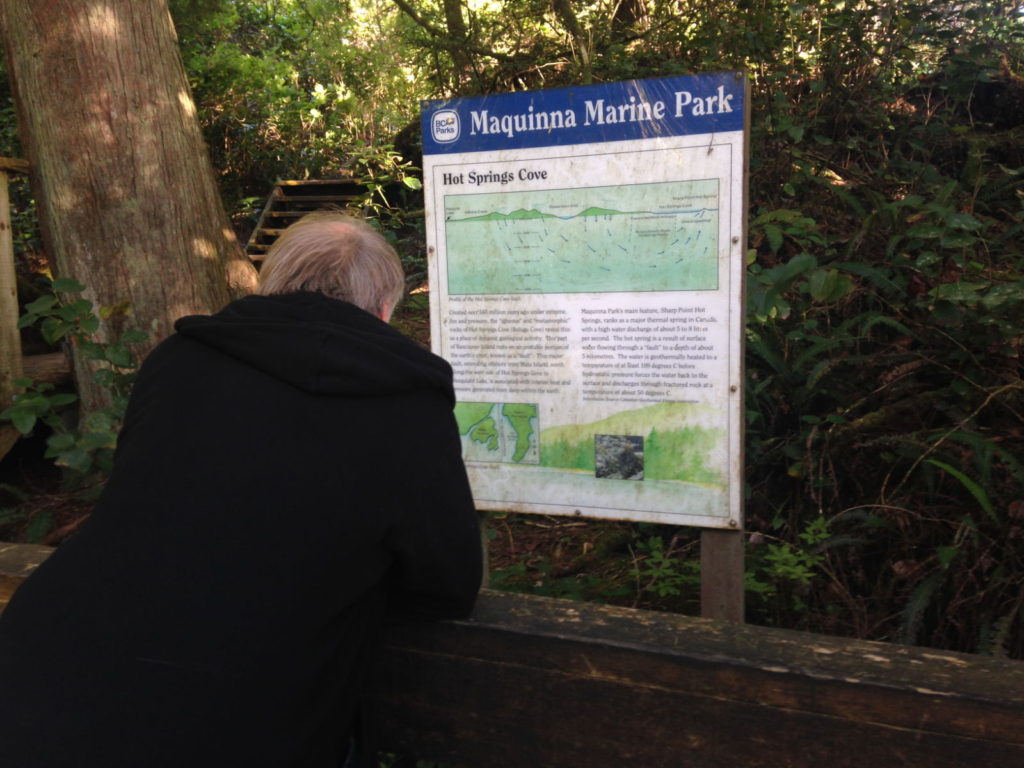
We knew we were near the springs when the smell of sulphur began to permeate the air and wisps of steam were visible a little way ahead. A few more people were around now, beginning to make their return trip along the boardwalk back to the camp site or hurrying to make the departure of the last tourist boat. We stopped to read a sign near the springs that explained they originate from a fault deep down in the plates, which made Paul think immediately of earthquakes.
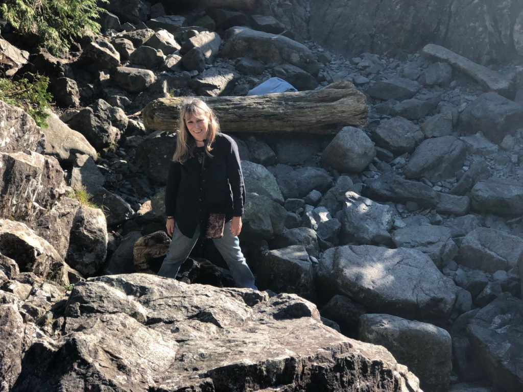
The way to the springs before the boardwalk was built
Undeterred by the prospect of earthquakes, however, he wasted no time in getting changed and stepping gingerly down into the hot, sulphurous steamy water. The pool itself is quite small, located amid a bed of jagged rocks, but at intervals waterfalls of hot water cascade down from the upper rocks to create a natural shower. Apparently people used to bathe nude in there and wash themselves with soap and shampoo but all this is now banned and swimming attire is required. Watching him sit there enjoying the force of the hot water on his head, back and shoulders so that it felt like a massage, I wished I’d mustered the courage to join him. Still, it was pleasant enough to sit in the evening sunlight and watch pretty blue birds with distinctive black mohican crests flying around, which I’ve since found out are called Stellar’s Jay. Try as I might though I could not get a good picture of them. Instead, here are some of Paul enjoying the springs.
Rest stop on the way back
There was no need for an early departure the following day. We hadn’t settled on anywhere to definitely head for next so popped over to For Good to discuss destinations. Bacchante Bay was the place we decided on, and little did I know it would prove to be one of the most stunningly beautiful location I had seen so far. The three hour passage began at midday, and the weather remained clear, bright and sunny. By 1 o’clock Paul had all three sails up and we sailed peacefully through beautiful steep forested hills, where the trees displayed every shade of green you could imagine. Even though we made slow progress when the wind dropped, it hardly mattered when we could drink in those exhilarating views. Added to this was the exciting prospect that at any moment we might spot a bear.
Beautiful Bacchante BayThere’s bears in them there woods!
For Good was sitting at anchor when we arrived at 3 30. Their dinghy was missing from behind the boat and we spotted it on the log-strewn beach opposite. Behind the beach was a grassy meadow, leading into lush forest – unmistakeable bear territory: Robert had clearly wasted little time in going ashore to explore the area. Looking around, once we’d secured the anchor it was easy to see why. In this secluded haven we were surrounded by thickly forested cliffs, the highest we’d seen yet. It was extremely quiet and still, with only the odd ‘plop’ of fish jumping to break the silence. A snow-capped mountain in the distance completed the breathtaking scenes. I was content to sit and stare, but for a closer view of the rocky inlets at the bottom of the cliffs, Paul got in the kayak and spent ages paddling round the shores.
Says it all, really
The four of us finished the day sitting in our cabin drinking and chatting and swapping the results of our homemade (or boatmade) baking sessions. Vanessa brought some delicious cookies and I gave them a loaf of another successful batch of freshly-baked bread.
Monday 26th August, a bank holiday in the UK, began for us with the delightful sight of a black bear ambling along the beach in the early morning sunlight. In such an enchanting location, with sights like that I think all of us were tempted to stay longer. We were all in need of replenishing various items for our store cupboards though so we stuck to our plan of leaving at 9 30 for Tofino so that we could hit the shops. Not long after departing, Paul took us on a short cut around an island that turned out to have some alarming shallow patches and rocks that looked a bit too close for comfort (‘we will be fine’, he said). It was worth it though because it turned out to be very pretty. Luckily we saw it before the fog descended around midday. I positioned myself at the bow to keep a lookout for buoys and boats.
Going through the short cut
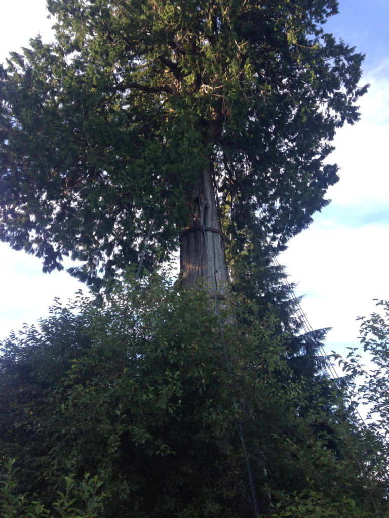
We knew it would be shallow water on the approach to Tofino so we all stuck rigidly to the route mapped out on the chart. Buoys near the marina were emblazoned with the word ‘shallow’ on a bright pink surface – perhaps for those who hadn’t researched the area. For Good had called ahead and booked us a place in the marina where would be rafting together on a pontoon fairly close to that pink buoy. We would go in first to tie up so that we’d be on hand to assist Robert and Vanessa with their first rafting. Despite the three of us (not Paul, naturally) being anxious about the decreasing depth the nearer we got to the pontoon, we rafted the boats together with no hassles. After checking in, we met at a bar in Tofino’s main street for some well-earned refreshment. The town wasn’t what I had expected at all. We’d heard it was a tourist town, prone to crowds and noise. Waggoners warn of experiencing culture shock from its commerce, loud engines, traffic and tourists. Maybe I was imagining somewhere like our busy UK seaside resorts, some of which can be garish, noisy and shabby – especially in high season. Tofino is none of these – it’s elegant, charming and picturesque, surrounded as it is by wild natural scenery and beaches; while its lakes, inlets and the ocean make it popular with surfers, kayakers and sea-life enthusiasts. Tasteful gift shops, shops selling sporting essentials and inviting cafes and bars line the main street along with art galleries and museums. It was busy and vibrant, yet even after the tranquillity we’d come from it was pleasant and definitely not loud and rowdy as I’d been dreading. I felt sure I was going to enjoy our few days in Tofino.
TofinoAn 800-year old tree in Tofino
We spent three days on the pontoon making the most of marina facilities, going for walks, replenishing provisions and trying out the restaurants. On the 29th we decided to move out into the anchoring area at Duffin Passage until conditions were favourable enough to move further along the coast. The current was very strong and it took us two attempts to set the anchor. The water all around us was choppy but it was just about cope-able, and even though noisy float planes regularly took off and flew closely overhead, I was content to stay put rather than go out in that current again. Robert and Vanessa bravely chose to weigh anchor and seek a more calm location to ensure a peaceful night.
Our anchorage in Tofino
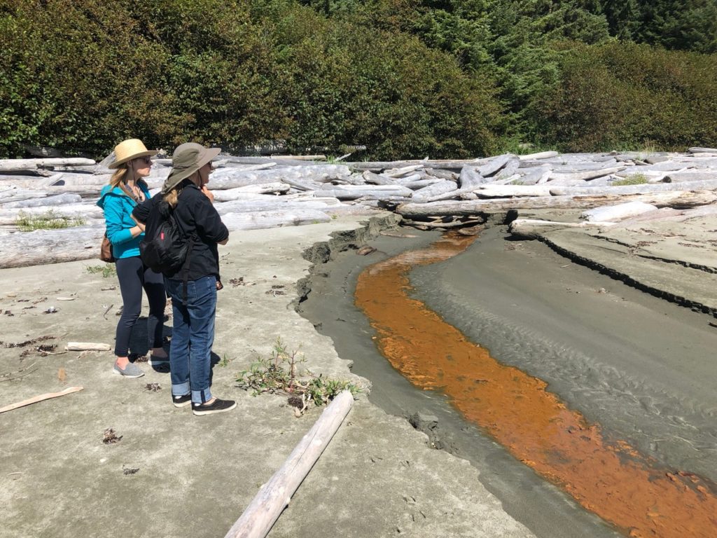
For Good ended up in a place called God’s Pocket and we met them there a couple of days later. The current was not as strong as when we anchored but we had a bit of a shock not long after we’d left the anchorage when a fisherman coming from the opposite direction warned us that there was a submerged rock to watch out for. Paul quickly located it on the chart and said we would have missed it anyway. The water was shallow and we were surrounded by whirlpools and eddies which made it impossible for the autohelm to steer so Paul had to take the helm while I kept an eye on the depth and looked out for crab pots for the hour long journey. The current got so strong at one point, that we were effectively not moving forward and Paul had to increase the revs to push us on. It was a relief to be in God’s Pocket (that’s a phrase I never though I would say) and spot For Good sitting on calm, still water in a pretty location. We spent an enjoyable last evening of August on their boat chatting for hours, since sadly they won’t be joining us on our trip down the west coast and we’d be heading off in different directions the next day. We will be keeping in touch, though and hopefully will meet up on future journeys. This turned out to be a lot sooner than we expected…
Thursday 15th August Walters Cove, Vancouver Is, West Coast
I hate seeing sights like thisAnd thisThe postman arrives
We went to the Cafe, ‘Java the Hut’ for some dinner early in Walters Cove, the reason being that the cafe closes early on a Thursday as the supply ship the Uchuck III arrives. The Uchuck is a converted minesweeper built in 1942 and is made from fir planking.
The Uchuck III (Actually the 4th Uchuck)
She now brings supplies and passengers to several of the remote coves and settlements along the west coast of the island. Passengers on board have to find accommodation ashore at each of its night stops and a few dozen people disembarked and were divided up amongst various locals who housed them for the night. Later they would all head to the ‘Java the Hut’ for their dinner, hence we had to be out early. It was fascinating watching the kayakers being ‘Wet Launched’ from the ship as I caught in the videos below.
We also had great fun watching a couple of sea otters, one looked like he was getting ready for a night on the pull!
One has to look one’s best
Friday 16th August
After watching the postman arrive we departed Walters Cove for Dixie Cove, it was fun navigating the many rocks on the way out, I tried to use the GPS to keep our position in between the rocks, but it wasn’t updating fast enough and I got quite confused. Once through we went to a cove within a cove, it was very quiet and peaceful, except for the distant sound of machinery coming from the logging operation on the other side of the hill. Just as soon as we had the hook dug in, a fast motor boat approached us to explain that they were blasting over the ridge, but that we were quite safe there, just not to be alarmed by the blast. About an hour later, poor Kathy nearly jumped out of her skin when the blast happened, it was huge! fortunately there was only one, they were blasting through rock for a new logging road.
Sat 17th August We headed over to Rugged Point beach, had a very nice walk, saw bear prints and possibly cougar prints, it was great walking along with Robert & Vanessa as they could point out what the various footprints were. I was reminded of how much grief I gave my father as a 7 year old when buying shoes. I wouldn’t have anything that didn’t have a compass in the sole, or made animal prints, I never imagined I would one day be walking along a beach seeing these impressions for real. Later we found a sand dollar and saw a real black bear.
Thanks to Vanessa for this great video shot from their boatA Sand Dollar
On Sunday 18th we headed over to Nulchitz, an abandoned First Nations village. There was little left of the village. Sailing into the various remote parts of the west coast has made me appreciate just how much of the coast was settled by the first nations and what a bad deal they got from the British invaders.
Later I walked across a shingle spit which connected to an island only accessible at low water.
The walk back to the dinghy
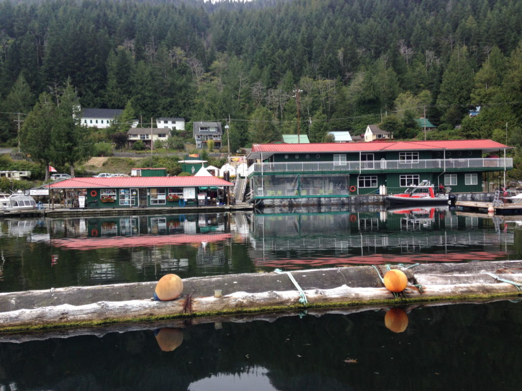
Mon 19th We motored to Tashis except for last hour where we managed to make 5 knots with the headsail out as we headed up the long inlet that leads to the old wood mill town of Tahsis. Once a thriving settlement with two big sawmills and a decent population, it is now rather sad with the mills closed down. The Westview marina has taken over as the centre of activity there. Waggoners guidebook to the area stated we would find a well stocked supermarket, a wine store, a bank/ATM, a cafe, cell phone service and internet. In reality there was poor wifi and no cellphone coverage. All the other delights were to be found in the one store. When I asked in the store for ‘No Alcohol beer’, the shop owner looked aghast and asked me to explain what I meant, when I did, he asked ‘why would anyone want that?’. The Marina mostly caters for Sports fishing and was rammed with little speedy fishing motorboats.
Back at the dock we enjoyed a nice dinner in the cafe, and I had a O’Douls non alcohol beer with it! (Obviously not sourced locally)
We watched them cleaning freshly caught fish at the gutting tables at the end of the cafe, and all the tourist fishermen stood proudly in front of their prize catches to be photographed.
Fishermen proudly pose in front of their catches hung up behind them.
Earlier Kathy had jumped into the sea to get some of the fish heads and guts floating around. It would have been better if she had left her handbag ashore but it seemed to be an impromptu event she hadn’t thought through fully. We all rushed to her aid and pulled her out back onto the dock. There’s a slim chance her mobile phone may have survived as her handbag seemed quite waterproof.
The gap behind Kathy under the sign is where she nearly met a watery fishy end
Tue 20th Bligh Island Ewin inlet
Left for Bligh Island in a building wind, eventually we saw up to 30 knots of wind, we also spotted a bear on the passage.
Spent the evening on Sister Midnight chatting with Rob & Vanessa. They were a bit surprised how big the seas had been crossing over to the island, I was surprised at how many rocks we had to navigate around to get into the inlet, I was reminded of cycling around cones as we did in our cycling proficiency test at school.
This is the area where captain cook re-masted his ship Resolution and just around the corner in Friendly Cove, Captain Vancouver tried to negotiate the ownership of Vancouver Island with the Spanish, failing at first, and almost bringing Britain and Spain into a war with each other. In the end, Britain gained total control.
Wed 21st August
Meet up with Kevin & Karla on Gargoyle, they have a Benateu Oceanis 50, very nice and are heading down to the sea of Cortez like ourselves.
Later meet up with another nice chappie on his Bristol Channel cutter, a classy looking sailboat, a bit like a baba but with a flat transom, but more traditional looking. He had tried to leave for Hot Spring Cove but his engine was playing up, so he sailed back and anchored near us under sail.
Thur 22nd
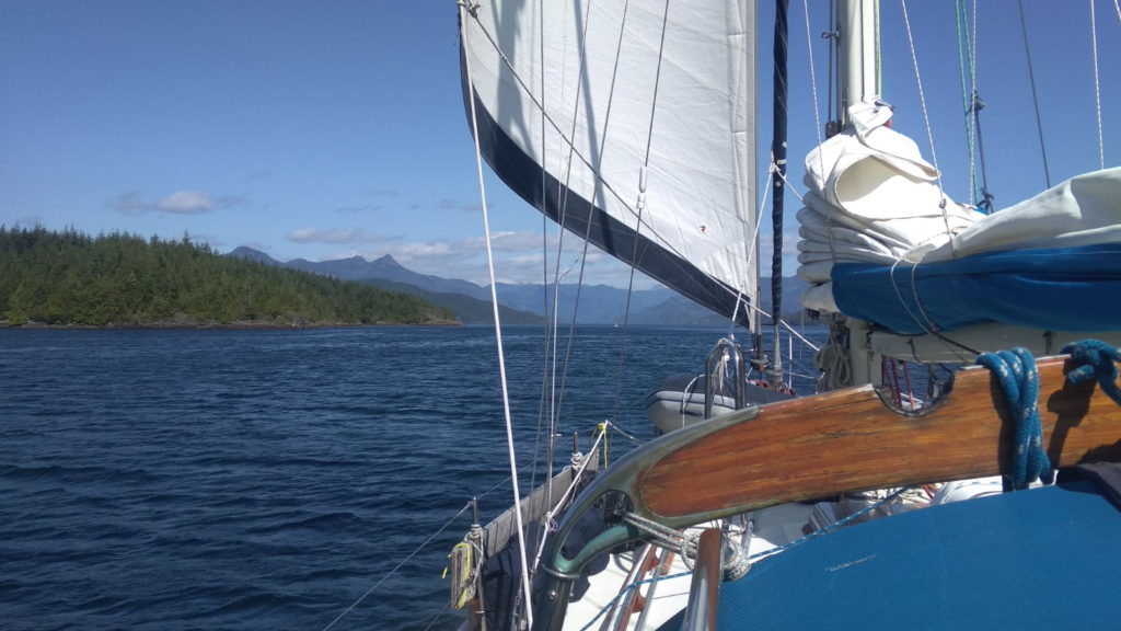
We depart for Hot Spring Cove, seas build as we pass out of the inlet and towards Estevan point, at one point the swell & waves are around 2 metres with the odd big wave of 3 meters or more roaring in, as we turn to head south towards our destination we are taking the waves on our beam/quarter. We have been travelling with Robert & Vanessa for a few days now and hopefully they will join us for the trip down to Mexico.
Sadly on ‘For Good’ they are having trouble with their sails and decide to motor sail the rest of the way, another 4 hours or so. Robert calls me on the VHF to say he has engine problems, he isn’t getting any sea water flowing through the engine to cool it. He wants to head for shore but I suggest he just sails the remainder of the route and if needed later I will tow him into the anchorage. Poor Robert and Vanessa are getting thrown around a bit in their boat and their speed is down to about 4 knots as they are having trouble keeping the sail full with all the wave motion. This is by far the worst conditions they have experienced to date. The wind is only about 10-15 knots, from behind, but they struggle with the main blocking the headsail and without safety lines to go forward on the boat they stay in the cockpit. I turn Sister Midnight around and head back to them as they have dropped back by 1/4 mile now. We are going head into the wind and waves, our bow is crashing down onto the waves. I’m pleased to see the new cedar bow platform is taking the waves fine. We reach them in about 15 minutes and I turn and follow them closely for a while. The wind backs slightly and I can see they change course slightly to keep the mainsail filled, however they won’t make the entrance to the cove on that course and will need to gybe both sails before we get there. I suggest we round up into the wind a bit and reach into Hesquiat Bay, which is well protected given the NW light winds, and has a bar (shallow sandbank at the entrance) that keeps the swell out. This bay is massive and around 9m deep throughout so they can drop the hook anywhere without risk. As we approach the entrance the wind moves closer to our bow so we haul in the sails, Robert hasn’t adjusted his sails so they flap a lot and he drops to 3-4 knots, I roll up 50% of my headsail so I don’t get too far ahead. Within an hour we are over the bar and drop the hook in a very settled area.
I had checked that Robert was ok to anchor under sail on the VHF radio, and he was happy. It was then that I realised I had never anchored this boat under sail alone, and as it was calm, in a big empty bay, I decided I would do the same too. I rolled up the headsail and asked Kathy to steer into the wind, she thought this was so I could drop the mainsail and was a bit freaked out to hear the anchor chain running out. I was also a bit freaked out as a small squall came through just as I let out 30 mtrs of chain, the bow blew down, the main filled and we took off at some speed. I legged it back to the cockpit, let out the main a bit, ran to the mast and dropped the mainsail rather quickly, then back to the bow to continue with the anchoring.
Fri 23rd
Robert gets engine going, but it’s too late to leave, they are still resting after their rough ride here. I dinghy into Rae Basin, an even safer spot at the head of the bay, a river flows into here and some impressive trees lie there. I hadn’t realised but it’s a very short walk to the huge Hesquiat lake that lies at the head of the river.
Huge logs lying at the mouth of the river
Sat 24th Depart Hesquiat Bay for Hot springs Cove.
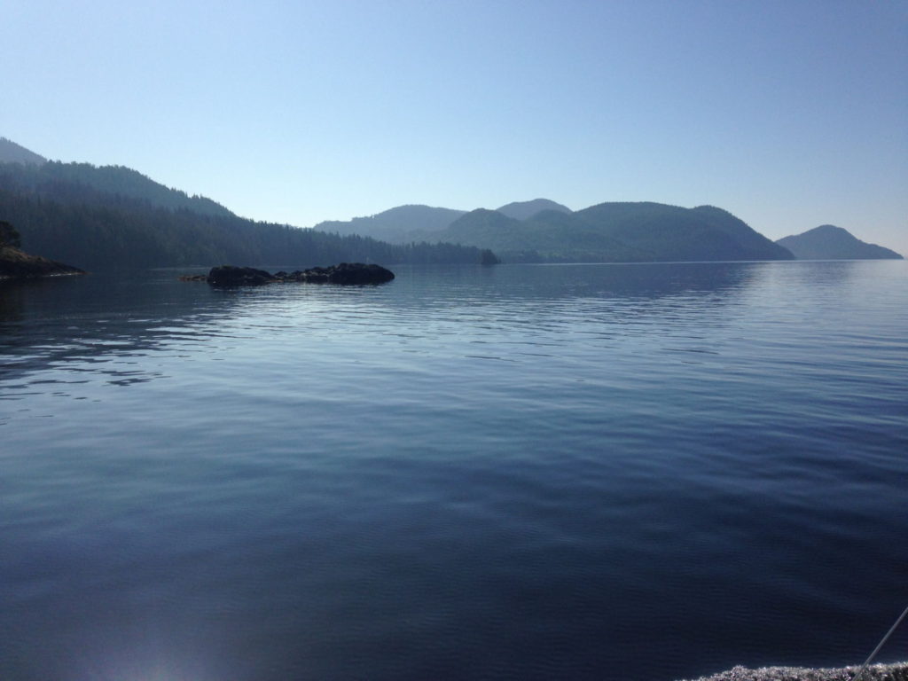
Lots of crab pots to watch out for here.
Nice motor, no wind, swell building
Forecast has swell dropping from 2-3m to 2m by Sunday but wind rising to NW 30, so now seems best
It takes just 3 hours before we are happily anchored in Hot Spring Cove
We head off to the springs, the custodians of the springs have built a wonderful walkway through the forest, it runs for 2km and there had been a tradition for visitors, mostly yachties to leave a plank with their boat name carved into it.
Once at the springs I spent a long time sitting in the hot water which gushed down the hillside then out into the Pacific Ocean. It was so relaxing sitting under a hot waterfall being pummelled by the water falling, just like a jacuzzi. However it might have saved a bit of time if I hadn’t gone in with my fancy sunglasses on, I became very intimate with all the various pools between me and the ocean before I found them. Kathy reviewed the pictures she had taken of me to determine when I had lost them and on searching that pool they turned up, Phew.
At some point Kathy baked a couple of top notch loaves.
From the Hot springs we took the inside route around Flores island and stopped in a lovely spot at the head of the Bacchante inlet. Here we spotted another big black bear prowling along the beach.
Bacchante was beautiful and we could easily have stopped there for several days, but Kathy was worried about not having had any wifi/cellular connections for a while, and we were running low on chocolate, so we headed off to the fleshpots of Tofino. Vanessa had called ahead and found there was room for two boats to raft at the hammerhead of the end pontoon. They rafted to us, a first for them, of course rafting, or ‘parking alongside’ is easy to do when the weather is fine and currents aren’t an issue, however when you have never done this before, I can remember, it’s quite a scary thing. As it turned out, Robert brought his boat alongside us perfectly and we were soon all sitting in the cockpit having a good natter.
After 2 days paying to be bounced around at the end of the pontoon by the constant stream of day tripper and whale watching boats we headed out to anchor. Currents run fast here, and a healthy sprinkling of rocks and shallows causes quite a few rapids and whirlpools. After a few hours, Robert & Vanessa decided to head off to God’s Pocket, a quiet cove just an hour or so to the north. We left them to it as the whirlpools, and planes taking off over us didn’t bother us much, we also had a lot of internet stuff to catch up with.
These guys arrived at night then dragged during the night.
Tofino is a lovely holiday resort town, it has a long beach famous with surfers, and it’s a bit of a young surfer kind of place, however I enjoyed the art galleries there and Kathy was made up to have a modern well stocked supermarket.
A project boat if ever I saw one.
After a few days we headed up to meet Robert and Vanessa in God’s pocket. another peaceful spot, we dinghied over to them and watched footage of movies Robert has made in the past and picked up videos and photos they had taken of us.
‘For Good’ heading off, hopefully not for good as far as we are concerned.
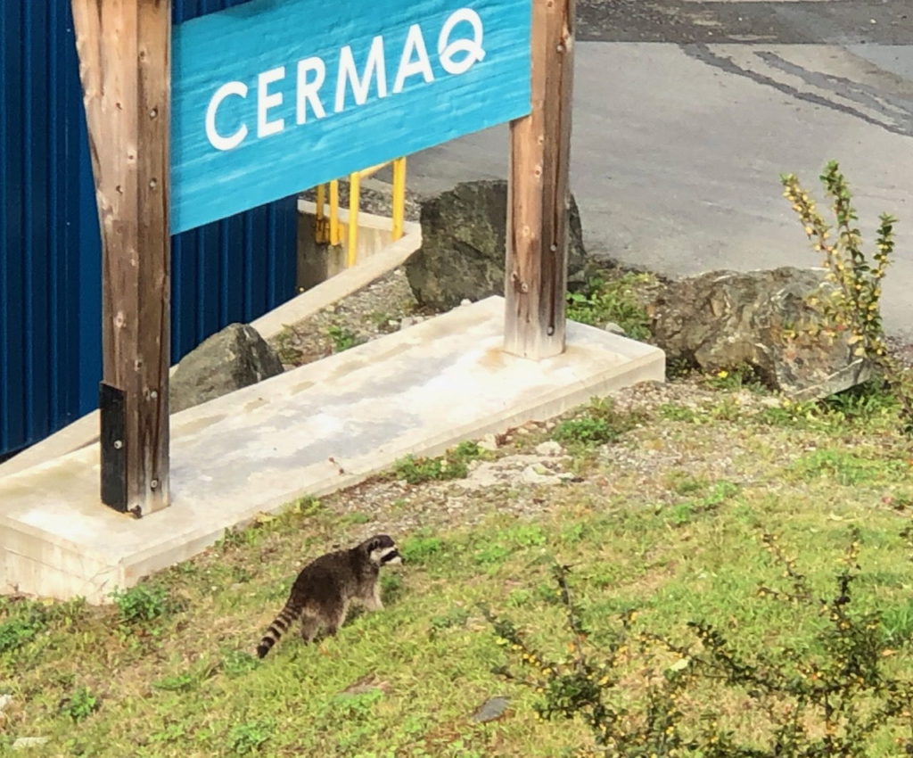
Sunday 1st September. We said our farewells, Robert & Vanessa had decided that they were going to postpone their trip to the Sea of Cortez, and would hopefully try to make it in 2020. We really hope we can meet up with them next year. They headed off to Ucluelet and we waited a few hours before we went back to Tofino to get a few supplies before we left for the USA. Our plan had always been to leave at the end of August, and the weather was now good, also Monday is Labor Day, a Public holiday in Canada and the USA, so being at sea all day suited us, we would arrive in Astoria on Monday. The plan was to leave Tofino at 22:00 in the dark in order to arrive at the Columbia river entrance around midday on Tuesday when the tide would be flooding and we could safely cross the bar. A bar is a big sandbank at the entrance to a river that can create dangerous conditions if the currents flow a certain way and the ocean swell opposes it. Until 22:00 we had a few hours to kill so we wandered around town, after picking up some supplies in the co-op.
We had some fun watching three racoons stage a break in at a fish processing plant, they seemed to be working as a well co-ordinated team, with one keeping a lookout while the others climbed in through a hole they had found in the wall. I presume the building had a lot of salmon in it.
This guy left the building, presumably well fed and was heading home.Watch out KathyPlanes taking off over our mastTofino Air’s operation
At 10PM we set off into the rapidly fading light, no sooner had we weighed anchor than the fog descended. We navigated our way out, I had already taken bearings on the only pot marker in the harbour in our way and we slipped past that into a grey foggy night. Soon we were bouncing up and down as we left Tofino and hit the Pacific swell. The fog stayed with us for about 20 hours, so Kathy and I kept a close eye on the AIS and Radar. The AIS gives us details on any big ships out there and how close we will get to them. Of course there were quite a few fishing boats without AIS we had to watch for on the Radar. Monday morning and the fog lifted, we could now see the ships out there.
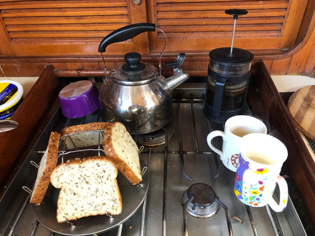
We were able to make coffee and with the new camping device I bought in the co-op hardware store, we could make toast on the stove.
Kathy in her ‘Off watch’ position
We rolled out the Yankee sail and turned off the engine. We were making 5 – 5.5 knots, which was just perfect for our planned arrival time. The weather forecast was good for a bar crossing and soon we were heading up the river Columbia using the rhyme ‘Red Right Returning’ to remember to keep the red buoys to starboard on our way in. This is the opposite to the European way of doing things. The bar is considered one of the worst in the world, it has a nickname of ‘The Graveyard of the Pacific’ with over two thousand shipwrecks to its name. Looking at the rollers crashing over the banks either side of the entrance one could understand why. As it was we were soon over the bar and fighting to avoid hundreds of sport fishing boats that seemed to be everywhere. Finally we could see the bridge that signalled the location of the marina.
A quick call to the marina got us a space on the fuel dock where we could register and check in with the USA authorities, primarily the CBP (Customs Border Patrol). The CBP have had a lot of bad press recently, but I was very impressed with the reception I received by the officer here, he was quick, helpful and sorted everything out in just 15 minutes. We now have a 1 year cruising permit and 1 year stamps in our passport. I recommend Astoria for clearing in, this is actually why we came.
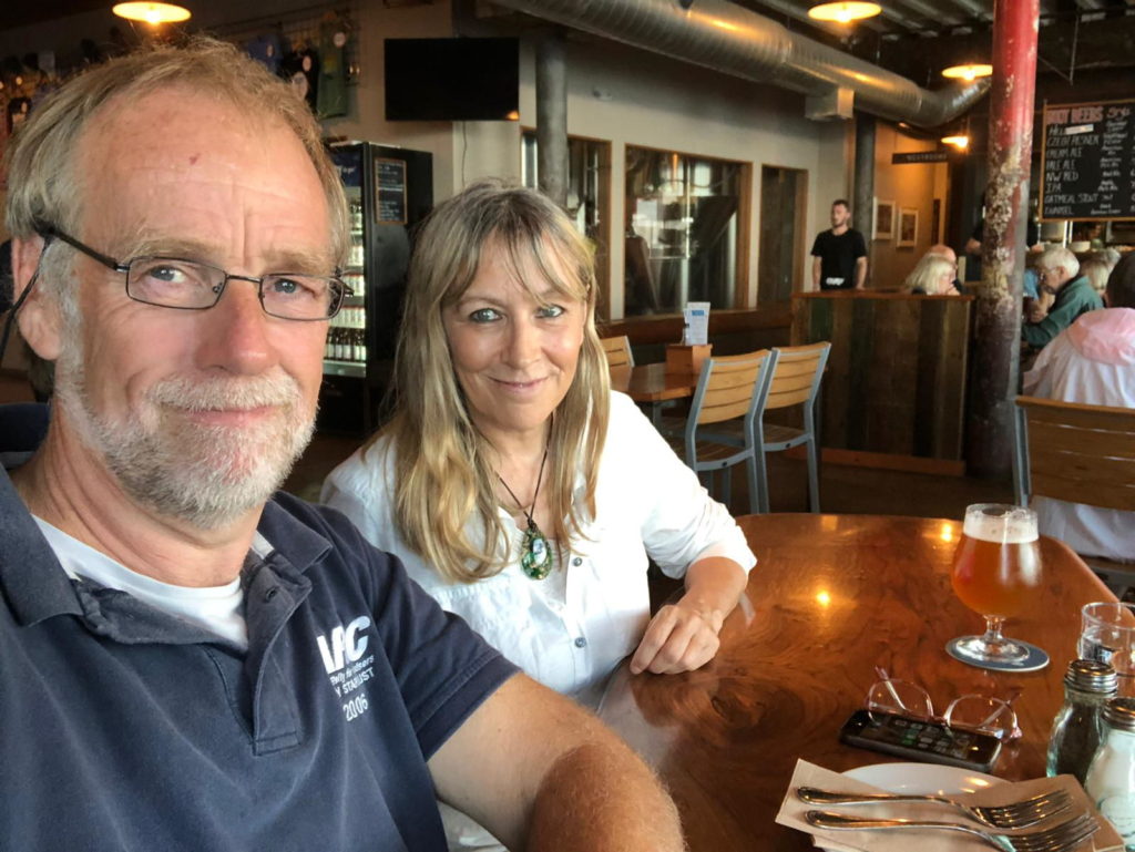
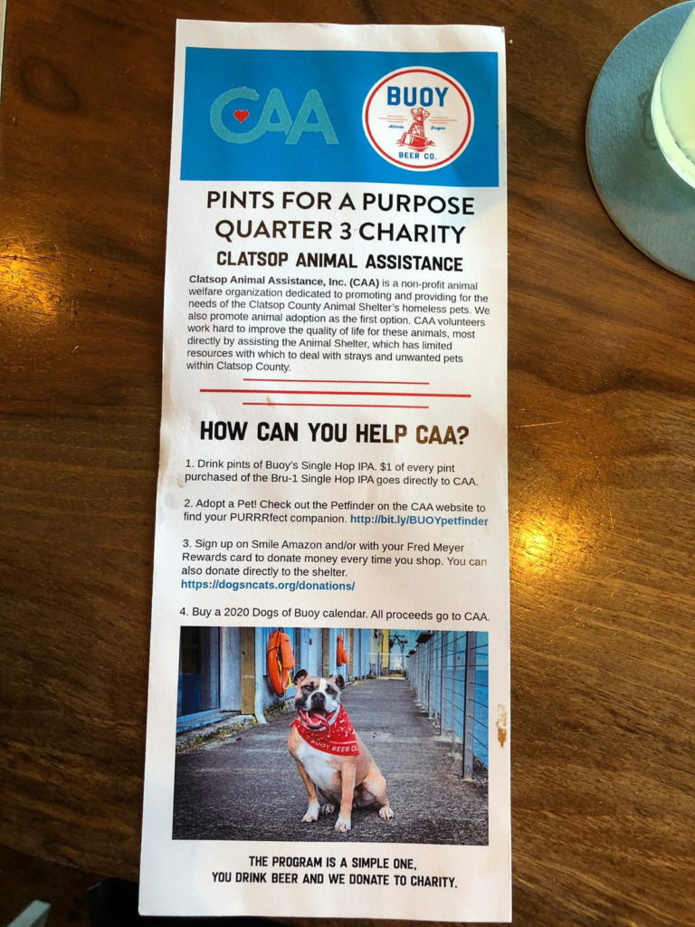
Tuesday evening and we headed out to find a restaurant, Buoys brewery hit the spot, it’s a micro brewery / restaurant on the waterfront. they have a section of the floor made of glass and you can look down to the piles supporting the building and see the resident sea lions chilling there.
Wednesday 4th September. We took the trolley car to Safeway to get some fresh fruit and veg as customs forbid us bringing any in from Canada. I had eaten a lot of fruit on the passage down!
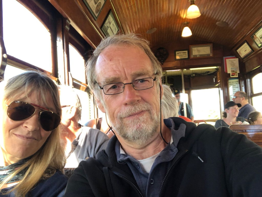
The trolly car is old, I expect Kathy will write more about it, but it’s a museum piece, literally, and plies the old railway track along the waterfront. It’s a wonderful ride, and only $1 each trip, or $2 for a day pass. It’s operated by volunteers who give a lively commentary along the route.
We will be in Astoria for a few more days before we probably head south to Newport.