Day 38 part 2, Friday 27th July. 50-42.804N, 127-29.44W. Daily Run: 111 NM. Weather: No Wind, Sunny,  0 NM to go

The last 25 hours of our passage turned out to be a lot different than I expected, having cleared the high pressure system we had a good 10 knots of wind and were making 6 knots easily. The wind was building and the forecast was for 20 – 25 knots as we approached Vancouver Island and the bar I was worried about. We reduced sail to bring our speed down to about 5 knots, if we maintained 5 knots we would make the bar at slack water around 7AM and the rising tide would woosh us along providing an extra 4 knots of speed to get us into the Marina by midday at the latest.
That was the plan, as it turned out the wind dropped and after a nap, Kathy pointed out that our ETA was getting later and later, We had winds of 7 knots, so up went all the sail and I managed to get about 5 knots ok, but then the tide was taking 2 knots off that so only 3 over ground. At this rate we would miss slack water by a couple of hours. The wind continued to drop and so I had to put the engine on and hope that we had enough fuel left.

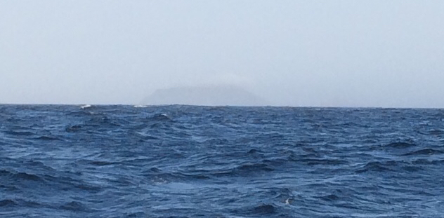
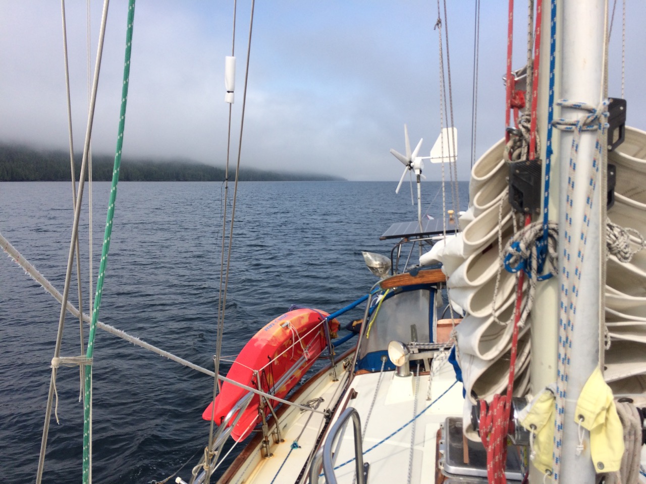
One of the nice things was the sea calmed and we made good speed, however fog descended upon us before the bar and even though we had land within a mile on each side after the bar, we could only just faintly make out the coast.

Passing over the bar occurred exactly at slack water according to my tables, and despite dropping from 500

metres deep to 9 metres in 1/10 of a mile, there was no drama, in fact you wouldn’t know there was a risk if you didn’t look at the chart. Once in the channel, the wind dropped to zero, the sea was flat calm, surrounded by fog, but with small fishing boats appearing from nowhere and zooming past us.
Kathy had been quite on edge up to this point, I was also confused as the coastguard was making VHF announcements about the fact that we were in an area with a gale warning in force. However the fog lifted a bit and the glorious wooded coastline came into view, a bit of sunshine broke through and everything seemed just fine now. We only had a few more hours to go, and despite the fact that the current that was meant to be flowing our way hadn’t materialised, the fuel level in the tank hadn’t gone down noticeably, so I knew everything would be simple for the last few hours.

A large log had just hit us before we went over the bank, but it just bounced off us, so we were keeping a vigilant watch out now, and I saw a load of small logs rolling around in the water, but they seemed to be flapping a bit, looking through the binoculars I realised they were creatures, at first I thought they were baby bears lying on their backs, but that would be silly, Kathy recognised them as Sea Otters, and soon there were scores of them drifting past us, quite a sight. Next Kathy asked why was the water spurting out of the sea, I explained that that would be a whale, and as we looked to the side of the boat, not that far away at all, a whale surfaces, blew it’s spout and dived again, we watched it do this several times, and saw it’s huge tail clear the water before it did a deep dive and disappeared. Soon after a sea lion appeared and watched us for a while. More sea life in 30 minutes than we had had in the last 5 weeks of ocean passage.

At this point the tide charts said we would have 4 knots with us, however the SOG (speed over ground) and SOW (speed over water) were the same. Not to worry, the entrance to Port Hardy soon came into view, and as we swung into the inner harbour I called the Marina on the VHF to find a space, only to hear they were full. So we called the fisherman’s Wharf office and they told us to come in and if we couldn’t find a space to raft up. A very laid back attitude that suited me, we found a space, tied up then realised it was 3 hours waiting only, to be used for loading and unloading, so I looked around and found a new recently vacated spot at the other end, we fired up the engine and raced around, it was a tight squeeze, and my first attempt didn’t make it, so I had another go, I was confused as to why I couldn’t get the stern to tuck in neatly, and we had to pull it in after getting a midships line ashore. The reason I discovered later is that going in Starboard side too, is much harder than port too, which is my usual method. This is all to do with the kick I get from the propellor.

As soon as we tied up, we checked into the office here, they took a few dollars off me and confessed they had no clue about customs or immigration as nobody ever arrives there from another country! I called customs on a freephone number from a payphone and had a very helpful officer take my details, I told him I was at Fisherman’s Wharf in Port hardy, Vancouver Island. He told me to stay there and he would send an officer over to check me, 2 hours later I called back, they were sorry and someone would be right over, 3 hours later I called again and they were very apologetic, they had been looking for me in fisherman’s wharf, Vancouver City, which is not the same place by a good few hundred miles. I was asked to call again in the morning and they would clear me in over the phone, which is what they did. A daft mistake, but they were ever so nice and helpful about the whole thing.

So the place we are in is like a marina in the sense there are lots of pontoons with boats on, and some basic services, but it’s a state run affair, cheap and cheerful, you arrive and motor around until you find a space, if there isn’t one you raft up, as someone did on us last night, most of the boats here are pleasure motor cruisers people go fishing on, but there are quite a few serious fishing boats too. It’s quite ramshackle, but we have met a load of lovely people here so far, and most everyone is friendly as says hello as they walk past the boat. We might stay here a while. The biggest problem is no wifi on the pontoons, only up by the office.

Today we were drying stuff out, we found some more leaks on the passage and the clothes in one of the lockers got wet, I think it’s from a stanchion leaking. Also the Deck Prism in the V-Berth leaked making the bed unusable right now. We haven’t had problems before, but the side decks and the foredeck were mostly under water for many hours on end when the waves were big.


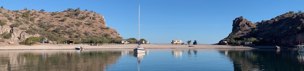
The boat after a bit of cleaning


Some of the big waves, see coffee video later 😉

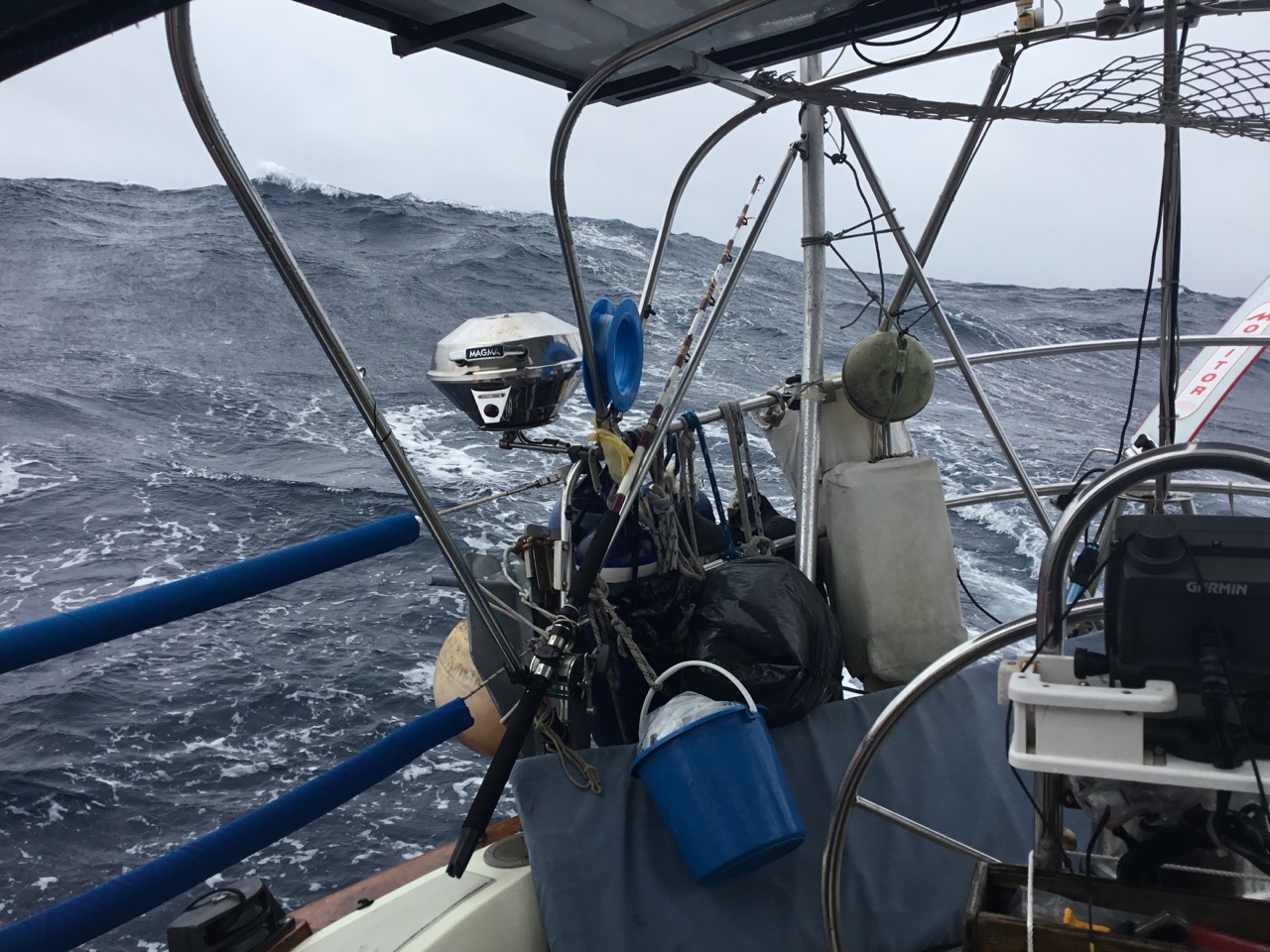
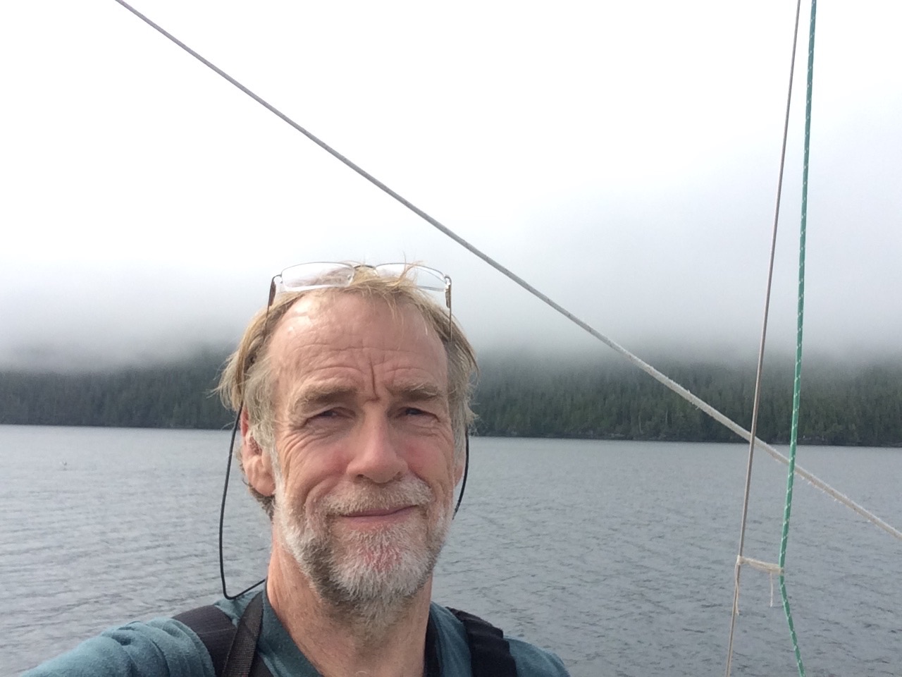
Kathy feeling relieved to be here, and happy to see the sea otters 
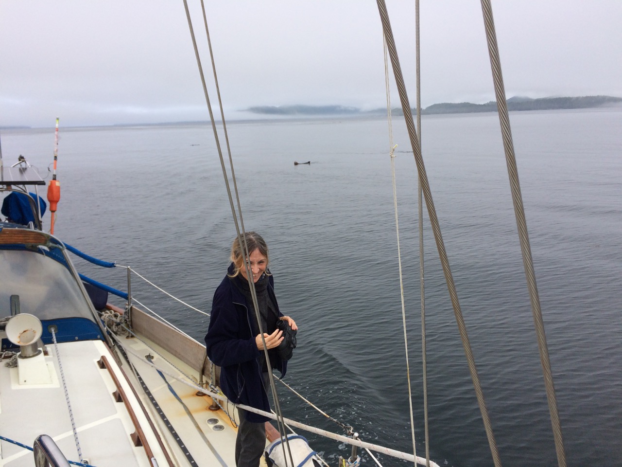
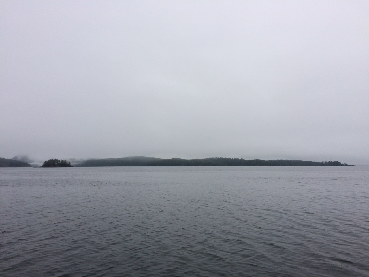
One of the clearer days in the Pacific 
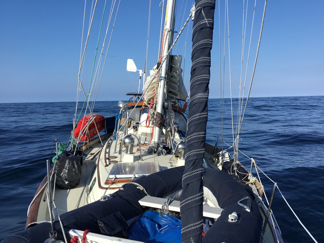
One of the rougher days.
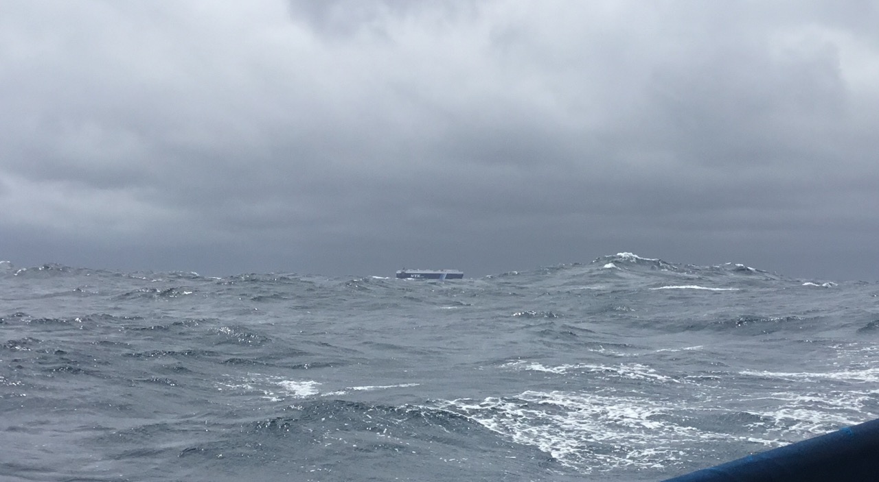
The damage caused to the dodger by the crazy sheet car whipping around
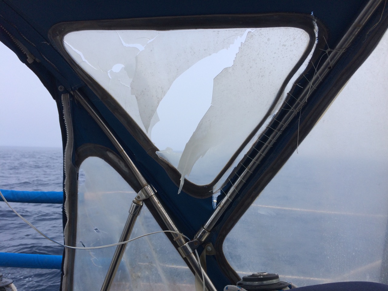
 Sea otters 
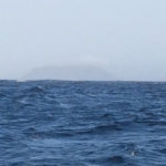
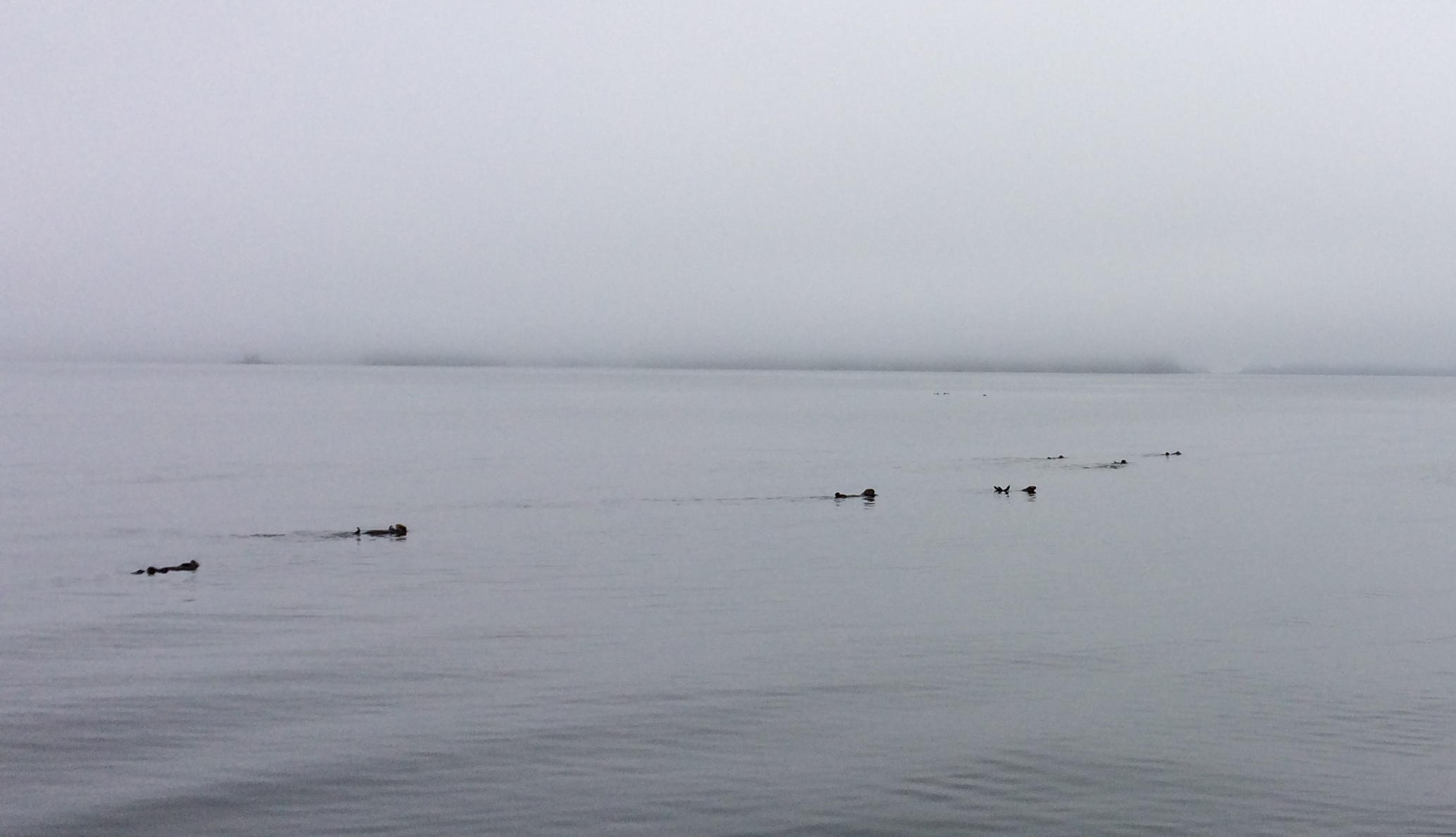
The Fishermans Wharf
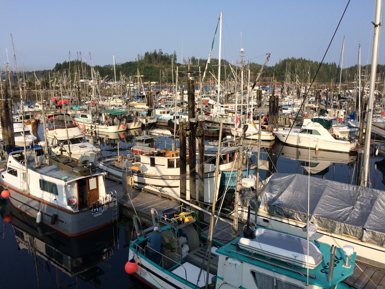
Here is a video of:

1) crossing from East to West, look at the Longitude , bottom Right.

2) the whale we saw at the end of the passage, it looked much bigger than that.

3) the cooker, when watching this, remember the cooker is staying still, it’s everything else that’s moving.

I have now had a chance to read all of the comments, thanks to everyone who posted and / or followed us on our travels. The red dot may dissapear soon as I will be cancelling our Satphone link until our next ocean adventure, but we will still be posting here as we make our way down to Seattle.


Paul Collister

Day 38, Friday 27th July. 50-42.804N, 127-29.44W. Daily Run: 111 NM. Weather: No Wind, Sunny, 0 NM to go

Day 38, Friday 27th July. 50-42.804N, 127-29.44W. Daily Run: 111 NM. Weather: No Wind, Sunny, 0 NM to go
We have arrived and are tied up to the fishermans wharf in Port Hardy, the marina we were heading for is full, so we are in what is effectively a public quay/marina, that you pay a nominal charge for. It’s a very busy harbour, lots of fishing boats here, but the place has a very relaxed feel to it. I called Customs to let them know we had arrived, often they can clear you in over the phone, but today they have decided to send a coastguard boat over to us to check us out and in, I hope. So we are waiting now for them to arrive, but very happy to be sitting here, tied up to a lovely old wooden pontoon on a very warm sunny afternoon.
We should have wifi soon, but for now I just thought I would post a quick note via the iridium to let you know we are here and safely moored, and thank you for following our little adventure so far.
Paul Collister

Week Five

The Canadian flag is ready to be hoisted as we approach the end of our journey across the Pacific. Canada will be a first time country for both of us and apart from admiring several musicians who hail from the country, I’m ashamed to say I know very little about it. I wish I’d have thought to buy guide books and maps on both the US and Canada to find out a bit more about the places we’re going to and their locations. In a way though it’s quite refreshing to arrive with no preconceptions. Naturally, as soon as we’re in a town which offers tour guides and maps, they will probably be the first things I’ll buy (if they’ll accept Paul’s US dollars). For now, though the only information we have to hand is that within the navigational chart map and pilot guide for sailors. Along with the towns and villages in Raban’s book, I’ve been looking at the names of places on the chart: Port Hardy (where we are headed), Port Alice, Queen Charlotte Sound, Hope Island and Shushartle Mountain are among the names that jump out at me. The majority of these were named by the explorers who discovered them, (often obliterating the names that Indian tribes had given them) as explained in ‘Passage to Juneau. Even without reading the details of their origins, however, it’s easy to imagine the states of mind of the 18th century captains and sailors such as Captain Vancouver, when the names allotted to certain places were Desolation Sound, Cape Disappointment, Deception Pass, God’s Pocket and Cape Caution. Raban describes leaving Misery Island to head for Cemetery Point, passing Bittersweet Rock on the way. Johnny Cash, or Nick Cave could have found a wealth of inspiration for a ballad or two just by following the coastline around here.
We added another hour to the clocks to bring us in line with North American time this week and as I type this it’s 10pm and still daylight outside! With the moon almost full, it’s still quite light at 3am so it’s darker inside the boat during the night than outside. We will be resuming four-hourly watches soon. In fact, after reading about all the potential hazards that might be in store in Paul’s blog earlier, I’m not sure I’ll sleep until we’re in a marina! This last week at sea has been mostly calm – too calm at times when the wind was absent. Without the aid of my journal, Paul’s log and the blog posts, the days would be pretty much indistinguishable. The weather hasn’t changed much either, apart from becoming milder – still no sign of a clear blue sky…or whales, dolphins and sharks for that matter. I hope this disappointment will be eclipsed by the sight of bears on the beaches. I know they have been branded as a nuisance in the same way that urban foxes in the UK have, due to their habit of visiting places where humans leave rubbish. This has given rise to their being labelled as garbage-bears but if there are bears to be seen, I would love to see one (from a safe distance on the boat as we traverse the inside passage preferably). In the Alaskan town of Ketchikan, Raban describes reports of them roaming through backyards, upending trash cans, diving into dumpsters and harassing old people on their way to the post office! The rest I can picture, but harassing old people! Why single out the elderly and why only as they walk to the post office!! They make them sound like a sinister band of ursine robbers straight out of Grimms Fairy Tales whose sole intent is to hoard the money of Ketchikan’s pensioners. There are actually strategies in place to curb their visits, which require people to put some thought and effort in to the way they dispose of food waste and cans, wrappers etc. That sounds more like the appliance of common sense to me, and would save wildlife from receiving undeserved vilification.
For most of the week we were able to move around with ease and I managed to bake some bread, some loaves of which were more successful than others. It’s hard to convey how much of a luxury it will be to go into a shop or a bakery and choose some wholemeal rolls and loaves; loaves with a good texture, unsweetened and baked by someone else :-). Meals this week have been about using up what might be frowned upon by customs inspectors. It’s possible they may just have a cursory look around, but Raban had to undergo a very thorough inspection from Canadian customs which culminated in three ‘elderly’ potatoes being confiscated and his having to pay a hefty duty on the wine he had on board. They’ll find no wine on this boat! I used up the last of our potatoes the other night in a rather indulgent dinner of burgers, ‘chips’, beans and eggs. The fridge is ready for a good clean now that it’s almost empty – ready to be restocked with all the delights we’ll find in Canadian and American supermarkets.
Anticipation is building now and I’m hoping we’ll see land soon. I left off typing at midnight last night at the end of my watch and when I woke this morning, the moderate rocking motion had gathered momentum. It’s almost 9am and we’re experiencing 15-20 knots of wind with very high waves rolling us from side to side, or should that be heaving and surging, in the parlance of sea state components (I’ve yet to discover exactly what state ‘yawing’ describes). Paul had predicted this change from the forecasts so it was no great surprise. What I did find surprising as it got rougher was how I’d got so used to the stable state, I kept forgetting to hold on to the ‘grabbers’ as I walked around. I have a few bruises to show for it, and suspect we may be having pot noodles for dinner if it keeps up.
After my lamentations concerning the ever-changing ETA last week, Paul turned off the little LED display and put markers on the chart instead which was much better because it was more realistic. Now, though the ETA is back on and showing me we have about 24 hours to go. We, or rather I, have had to put the heating on this morning and it’s pretty grim out there. The worst part is that it’s foggy and impossible to see more than a mile or so ahead. We’re still too far out for fishing boats but cargo ships are beginning to appear on the AIS more frequently. I have a feeling I might get quite emotional at the sight of land. It will make the watches more interesting anyway – a welcome change from sky and water.
I’m very pleased that I won’t be writing a week six blog entry. We’ve notched up over 4,300 nautical miles and have been at sea for 37 days, and despite my little bout of cabin fever last week I have loved the experience. I think I’ve earned a glass of wine or two when we hit land tomorrow.
Kathy

Day 37, Thur 26th July. 51-02N, 130-12W. Daily Run: 111 NM. Weather: 10-20 Knots NW, Foggy,Cold & Sunny, 106 NM to go

Day 37, Thur 26th July. 51-02N, 130-12W. Daily Run: 111 NM. Weather: 10-20 Knots NW, Foggy,Cold & Sunny, 106 NM to go
We finally escaped the clutches of the high pressure system late yesterday afternoon, however the high has pushed east after us and squashed up against a low pressure system, creating packed isobars off the coast of Vancouver Island, causing a gale warning to be issued for the southern part of the island. So we have had good strong winds and a rising sea for the last 20 hours or so. I have had to reduce sail down to just a double reefed main, and no headsail to keep our speed down to 5 knots. I also had to hand steer a few times during the night as on this course, the boat is swaying around a lot with the waves and every now and then the auto helm just gives up and lets the boat turn into the wind where it stalls and we are basically ‘heaved to’ . I expect if I had more sail up, and the headsail, we could make 8 knots or more and the steering would be more effective. However this would have us arriving in the night near the channel entrance/bar, which we don’t want.
Of course today is the day things decide to break, our last day in the ocean and the fresh water isn’t working. It doesn’t take me long to find that there is no power getting to the pressure pump. The radar also stopped working last night, so I was hoping for a common connection failure affecting both, this was not to be. The radar was fixed easily, there is an inline fuse fitted behind the main switchboard, a little twisting of this and power was restored. I remembered this has happened before, and I really must replace that fuse holder. The water pressure pump however will take some time to trace where the cable is broken, and I will probably just run a new cable from the switchboard to the pump. In the meantime I have borrowed the supply to the water maker pump, which handily sits next to it, and we have running water again, even if the tank is very low. Of course I can’t run the water maker now.
I have marked on the chart waypoints for 18:00 22:00 06:00 etc so that I can pace our arrival at the channel for 8AM tomorrow (Fri). Conditions won’t be great there, but if it’s at all feasible to enter the channel, we should have a brisk 3-4 hour run down to the marina, and be there by this time tomorrow.
We have dug out our Canadian courtesy flag which I will be hoisting later, I also need to get the red ensign out and the Quarantine flag.
I’m beginning to wonder about the coast to coast radio programme, as last night was all about witchcraft, with witches phoning in. The program is interspersed with Bloomberg financial reports and adverts for such dodgy things as shares in companies that own mortgages, enabling you ‘to have a stake in the property market’ I’m sure a similar thing was around in 2007? The fact that the program goes out after midnight might be a clue.
Everything else is great, I managed to bake a nice loaf yesterday, even if I did overdo the sugar a bit in order to help the yeast along. I can’t wait to get updated instructions from Tim about the chemistry I so obviously don’t understand. It’s too rolly today for Kathy to do any cooking, so at long last we are going to break open the reserve supply of pot noodles. I used to quite like the pot noodles we had back in the UK, but our stock here are all Asian, and the first ingredient they put in, I’m sure, is a sachet of ‘blow your head off’ spice. So it can be a bit hit and miss. We have tried to buy the blandest looking ones for me, Kathy is fine with the spices.
I’m very confident that this will be the last blog update I write from a rocking and rolling boat this year, and tomorrows entry will be from the peaceful dockside bliss of Port Hardy, Vancouver Island, BC. Assuming they have a space 🙁
Paul Collister

Day 36, Wed 25th July. 51-13N, 133-09W. Daily Run: 92 NM. Weather: 0-6 Knots SW, Foggy but Milder, 220 NM to go

Day 36, Wed 25th July. 51-13N, 133-09W. Daily Run: 92 NM. Weather: 0-6 Knots SW, Foggy but Milder, 220 NM to go
Becalmed again, but as Kathy puts it, “the fuel fairy came in the night”, as witnessed by the fact the fuel gauge is showing higher today than yesterday, so we are motoring, albeit at quite low revs. I have just downloaded the latest weather from PredictWind via the sat phone and I have a choice of four different models, 3 of them say we should have 10-15 knots of wind now, the fourth (PWG) says about 7 knots, but in reality we have zilch. Also the wind gauge (anemometer) seems to be playing up, yesterday it was showing 0-1 knot of wind, yet we were making 4 knots over water, scientifically impossible I would have thought.
One of the things I’m looking forward to is sorting out these anomalies when we get settled into the USA or Canada. Over the next 9 months I plan to do major upgrades to the systems, including a new set of Wind/Speed/Compass instruments. Added to that some luxuries, like a fuel consumption display, hopefully I can get all of these feeding back to my computer. The fuel gauge is annoying, something I didn’t pay enough attention to before, like most tank gauges you get on boats, it uses a float that goes up and down a pole inside the tank. the float has a magnet that connects switches on its travels changing the resistance, and hence the display on the meter. The problem is that there are just a few switches, maybe 6 on the cheaper ones, meaning that you get the appearance of a linear scale on the meter, but in fact it only has 6 possible readings. I’m not sure if the 1/4 empty mark is the last reading before empty, or if I have more. The reason being I never let the tank go below 1/4 full, usually 1/2 full is my limit. Also I don’t know what nasties lie at the bottom of the tank. My other problem is that the tank was replaced on the boat with two separate tanks joined by a hose at the bottom, that must affect the dynamics of the sensor I would think as they both have sloping bottoms to fit the bilge. They are both difficult to access as well. All good fun and games to look forward to. I also wondered why the starboard water tank was emptying so quickly compared to the port tank, again a bad assumption on my part, I assumed they were similar to the ones on my baba 30, both identical in size, but I think the starboard tank is somewhat smaller than the port one. Not that it matters, I put an extra 40 litres in yesterday from the water maker, and made another 10 litres to keep as spare in a jug.
We passed the 135 deg West line yesterday, which meant another hour change on the clocks. We are now on PST, the same time as Vancouver and Seattle, so no more time changes required for a while.
Despite a poor showing by the wind, we are making decent progress towards Vancouver Island. Last night I spent a few hours going over the charts and the tide tables for our destination. My job now as a navigator changes a little from before. Up until now the course only needed to be approximate, and there was little chance of hitting anything, from tomorrow onwards the course needs to be quite precise and there are lots of things to hit. The passage planning and pilotage for the last 100 miles requires us to make our way to the safe water mark near the entrance to the Goletas channel. From here we have to consider several things, firstly there is a ‘bar’ which means a shallow patch at the entrance to a river, where the tide, over time has built a sandbank at the river entrance. In bad weather, especially if the tide is running fast, it can be quite dangerous, with big steep waves. The west coast of the USA has many ports whose entrances have serious bars, and with the prevailing Pacific storms, are quite dangerous. Youtube has a stack of videos of poor yachtsmen coming to grief trying to get into the harbour through huge surf created on the bars.
We have to time our passing of the bar to coincide with slack water, which in our case is around 8AM on Friday. The next obstacle is that the current runs fast in the channel, up to 4-5 knots. If we go with the flood tide, i.e. the low tide rising, which happens to start at the same as the 8AM slack tide, then we will get a good push along the channel. To complicate matters a little, the channel is 20 miles long, and the time of slack water is different as you go along, also the tide turns at different points. The easiest way I have found to deal with this is to divide the route up into smaller chunks, in this case just 2 2 hour chunks, which means we need to travel at 5 knots to cover the channel in 4 hours, with the current pushing us, this means we have plenty of scope for error. In fact I’m looking forward to seeing if my math work (is that the correct pronunciation over here, I can’t see it), as we pass along the channel, using little engine power, if any. The other worry is stray logs, this is serious logging country, where logs are felled and chucked into the water to be rafted up and towed away. There are always strays, and they can be massive, I believe some of them can float vertically, making them hard to see, either way, hitting one might do more than scratch the gelcoat on the hull. So we won’t be doing night sails once we reach the sound, and will be keeping a constant lookout.
Another disappointing aspect is that the constant fog we get means I don’t think we will see land until we are right under it. There are some off-lying islands I would like to see, but probably won’t. I can see clouds and the sun above, but no more than 1/2 mile along the water right now.
We are picking up Coast to Coast AM Radio on the SSB, last night we heard a program all about the supernatural things, with experts testifying on the different types and their relationship to each other, the previous night was all about UFOs, and had people call in who had actually seen aliens in their garden, or watched their spaceships hover over their house with aliens at the spacecrafts window. It’s an odd station, the adverts are very funny, there are just so many things available now that will change my life, I had no idea, and can’t wait. It must all be true as well as they also have experts on the adverts.
Not long now, 200 miles to the harbour, 150 until we enter Queen Charlotte Sound, just as well, the potatoes have run out, soon we move onto the emergency food of pot noodles and Tinned Tuna, of which we have a few months supply 😉
Paul Collister

Day 35, Mon 24th July. 51-59N, 135-13W. Daily Run: 93 NM. Weather: 0-6 Knots SE, Sunny and cold, 306 NM to go

Day 35, Mon 24th July. 51-59N, 135-13W. Daily Run: 93 NM. Weather: 0-6 Knots SE, Sunny and cold, 306 NM to go
Becalmed for 5 hours in the night, I dropped the sails and we drifted aimlessly for a few hours before I decided to put the engine on and risk getting very low on fuel, putting the sails away and turning the engine on usually brings the wind, and this was no exception, in a few hours we had 5 knots of wind, and we have been crawling along ever since. Our target for today will be missed by a few hours, but overall we are doing better than I first hoped for. Our daily run of 93 Miles includes a few miles heading due north in the night.
It seems the yeast we have isn’t working too well, and Kathy’s loaves from yesterday make great toast but probably wouldn’t win first price in a baking contest. I had a go and gave the yeast a lot more time to work, and it seems to help. Sadly there is a shortage of offshore yeast suppliers in this region, so we will have to make do for a few more days.
The weather forecast I download each morning shows what I know, i.e. that we are still plagued by this high pressure system, and like yesterday it tells me it will end shortly. It’s not much of a forecast if it’s only ever correct in hindsight. All the forecasts show big winds in the charlotte sound/strait, I bet it’s beset with calms from this High by the time we get there. But that won’t mater as I have assumed we will need to motor then anyway, either against strong tides, or if needed, in weak winds, and so our reserve 20 litres will cover us for that last stretch I hope.
I have just read that the risk from stray logs in the area we are heading is very high, and a sharp lookout with no nighttime sailing is highly recommended, this adds a further complication to my tidal passage planing, but that’s a job for tomorrow, when I have a better idea of our arrival time.
So right now we are making about 3-4 knots in 6-7 knots of wind, close hauled, heading ESE, with only 300 miles to go, we are almost there.
Paul Collister

Day 34, Mon 23rd July. 52-11N, 137-41W. Daily Run: 112 NM. Weather: 5-10 Knots SE, Sunny and cold, 400 NM to go

Day 34, Mon 23rd July. 52-11N, 137-41W. Daily Run: 112 NM. Weather: 5-10 Knots SE, Sunny and cold, 400 NM to go
A disappointing 24hr run of just 112 NM, I had hoped for more, as we had passed the top of the high, but that was an illusion, the high has moved east and the top extends up like a little poking finger, and we have to face the vertical edge of it, hence the light headwinds we are seeing. The forecast says it improves Tuesday midday, and then we should have the high behind us and we can get a better course, right now we are back to a NE course which is taking us the wrong way. I’m not impressed with the forecasts at all.
We were becalmed for an hour in the night and I had to sheet in the main and furl the headsail to cut down on the racket they were making, we have a bit more swell now. The barometer has dropped now to 1030, down 5 over 24 hours, so that’s promising. However one forecast from NOAA for 96 hours on, has 30 knot winds in Prince Charlotte sound, which is a bit much for me given I don’t know the waters at all. We have to travel down a channel called Goletas Channel, it’s only about 1 mile wide and 25 long, and has fast currents flowing, I expect it is foolish to try to navigate it with 30 knots of wind being funnelled down in an opposing tide scenario. On the other hand, maybe it’s sheltered from the NW winds, and is perfectly safe? Whatever happens we will have to play it safe , always with a plan B.
The distance to go is just 400 miles now, it would be less, but I have added on the distance to port Hardy. The latest shift in wind has me wondering if we can make land by Thursday, more likely to be Friday now.
Paul Collister.

Day 33, Sun 22nd July. 52-12N, 140-34W. Daily Run: 117 NM. Weather: 5-10 Knots SE, Sunny and cold, 479 NM to go

Day 33, Sun 22nd July. 52-12N, 140-34W. Daily Run: 117 NM. Weather: 5-10 Knots SE, Sunny and cold, 479 NM to go
A lovely 24 hours of sailing, after reading up I did a bit of sail trim, and managed to squeeze an extra 1/2 knot out of the boat, but better still, the sails look like textbook examples right now with the slot between the main and genoa running parallel / even, those who sail will know what I mean.
So we are just north of the centre of the high, and have quite light winds, generally between 5 and 10 knots apparent, yet we are maintaining about 5-6 knots of speed most of the time. It just shows how a flat sea makes such a difference. We are not quite close hauled, and I don’t want to go closer to the wind as it will slow us a bit and not really get us there any quicker, as it will just get us into calmer winds sooner. Instead the wind vane is keeping us about 60deg to the wind, and from our track you can see how the wind shifts keep sending us north of the direct route to Vancouver Island. I’m banking on the wind veering a lot as we pass east of the top of the high, and with strengthening winds we should reach then broad reach at some speed towards our destination.
I plan to head for Port Hardy on Vancouver island, the only problem is that the channel to it has strong currents, given that we will be near spring tides when we get there, they could be formidable, 3-4 knots against us, I don’t want to sail at night, so timing will be everything, and may delay our arrival by a day so we can get the tides with us in daylight. We always have bull harbour where we can wait at the entrance to the channel if needed.
I was explaining to Kathy yesterday that sometimes there are big solar flares that can wipe out HF Radio propagation, and that might have happened, explaining why we couldn’t receive anything, I quipped that it could also be the fact that the antenna wire might have snapped off, so just to reassure myself I checked the wire, which had indeed snapped off. What had me doubting this in the first case was that the antenna was tuning with a SWR of 1:1 which would indicate it was fine, however this just shows how good the ATU is at tuning a few feet of feeder wire. Apologies to those who don’t know what an SWR is, but it’s not that interesting really.
I managed to cook our favourite Sunday breakfast of poached eggs on toast this morning, and with some lovely new french coffee it’s been a good start to the day, the sun seems to shine more each day as well, ensuring an ample supply of power. We haven’t needed the engine, so we are using the fuel keeping the cabin warm. The eberspacher truck heater works a treat.
I had made a brief recovery on the scrabble front, curbing Kathy’s breakaway freak streak of 7 games in a row, with my own run of 3 wins, however that came to an end yesterday. I need to find more words made entirely of vowels.
Currently we are hoping for an ETA of Thursday, possibly Friday depending on the tides.
Paul Collister

Day 32, Sat 21st July. 51-52N, 143-38W. Daily Run: 92 NM. Weather: 5-10 Knots ESE, Sunny and cold, 592 NM to go

Day 32, Sat 21st July. 51-52N, 143-38W. Daily Run: 92 NM. Weather: 5-10 Knots ESE, Sunny and cold, 592 NM to go
A lovely 24 hours of milder weather, calms seas and a gentle breeze pushing us along at 3-4 knots. It’s not exciting, but makes for a very pleasant passage. I have spent a few hours in the cockpit now looking for whales, sharks etc, but nothing. It’s mostly clear now, with the odd bit of fog rolling in.
There’s very little to report, we are passing over the top of the high pressure system, and despite the weather forecast of no wind here, we haven’t been becalmed yet. Furthermore, the near gale force winds around Prince Charlotte Strait seem to be abating so that will ease our passage into Canada.
Our gas bottle ran out last night, so we moved onto the spare one, which is only 1/3rd full, but that’s more than enough to get us to Canada and probably onto America.
At 5AM this morning the AIS alerted us to a large Chinese registered container ship due to pass within 0.5NM of us, in 180 minutes, I kept an eye on it, and about 20 minutes before it’s approach, it altered course so that instead of passing within 0.5 NM it would pass us about 1.5 NM away. This was a nice gesture I thought, as it made me feel a bit easier and also showed me that he was aware of our presence. A few minutes later he called me on VHF Ch 16, I wondered what on earth he might want? Also this was the first sound to come out of the VHF in 4 weeks, thereby proving that the VHF was still working and also that our AIS transmissions where going out as he had our ships name. Anyway, he just called us to say hello and wish us a safe journey, which was very nice. He is heading for Vancouver, but he was going directly there, whereas we are going quite a roundabout way now due to the wind keeping us pointing ENE as we go over the top of the Pacific High.
So yesterday was one of those rare days where nothing broke, and nothing needed repair except for the clock which Kathy returned to the master watchmaker, unhappy that the hands weren’t lining up properly, apparently it’s important that at half 5, the little hand is halfway between the Five and the Six, a small detail in my mind, but something that had to be corrected it seemed. All is well know and the clock is back on the wall. Poor Kathy has had a hard time (again no pun intended) with the the clocks, she has to constantly know the time in Uk and Milan for her family, and the fact that I only use Local and UTC confuses her no end.
For the last 24 hours I have been unable to pick up my main radio fax stations and last night the BBC World Service couldn’t be heard on any of its frequencies. Today isn’t looking much better. It’s interesting to see how the conditions on the short waves change so much.
Today I’m going to be re-reading my books on sail trim in the hope of squeezing a little bit more energy out of the breeze we are getting. Unfortunately there’s lots of talk of tightening my Cunningham or loosening the kicker, both of which this boat doesn’t have! However it’s worth a play, you couldn’t wish for better conditions for playing with sail trim; a close reach in a calm sea with a steady light breeze
Paul Collister