Well, take off 2 knots for a favourable current, still good considering I’m keeping the revs down. I think I got away with it, however, somethings not quite right still, I can hear a squealing at low revs from the prop shaft, there must be some line inside the bearing. But given that the prop shaft did about 442,804 (approx) revolutions today I think if something bad was going to happen, I would have known about it. I expect the worst that will happen is the prop shaft gets scarred and the bearing gets damaged. As soon as I can I will get a proper look at it, near some clearer water.
But first, last night’s mini trauma. One of the positive aspects of being disabled at the roadstead, was that it was safe there, the anchor was dug in very well, and I had a lot of scope out, for the depth, so even if the weather had got bad, things would have been fine. So just before the sun set I was alarmed to see the Garmin GPS telling me we had drifted 200ft, towards the shore. we still had a long way to go, so I let out some more chain, and backed down on it. The anchor was stuck solid in the mud. I assumed that when I was testing the prop shaft, I had driven forward and back, while at anchor, only a boats length or so, but that must have upset the anchor, seemed unlikely, but no big deal anyway.
Skip forward a few hours to 22:00 ish and I notice on the GPS we are drifting again, 400ft this time and in a bee line to the shore. The shore looks closer too, but still a long way away. I’m very confused, I look on the other GPS chart plotter, the iPad and it says we haven’t moved, but it has a lower resolution, so not as easy to tell small distances, but it would show 400ft all right. So this is one of those decisions I hate, conflicting evidence! You want to go with the GPS that makes life easy, but you can’t ignore the one that’s screaming danger approaches. So I decide to play safe, and pull the anchor up and motor off into the deep blue and reset the anchor. I haven’t had to reset the anchor in the dark on my own before, so that made it a worthwhile exercise in itself, holding the torch with one hand, the deck-wash spray with the other, and activating the windlass with the foot switch, just needed some cymbals on my back and I’d be sorted.
Up it came, and back at the helm I motored away from the shore, and guess what, the Garmin had me continuing to the shore at the same rate as before. The iPad showed me motoring away from my original anchored spot, I expect the iPad was wondering what the heck I was up to. Power cycling the Garmin, and guess what, it put me back at the original spot, plus the bit I had motored. I would never had expected this from the Garmin, maybe the iPad. I keep the Garmin running 24/7 as it struggles to acquire satellites sometimes, and as a software engineer, I’m putting my money on memory fragmentation/memory management problems in their software. A very informative exercise in all. Have they got a name for this age yet, like the “industrial age”, the “IT age”, well I think it should be called the “turn it off then back on age”, as we seen to have to do far too much of that.
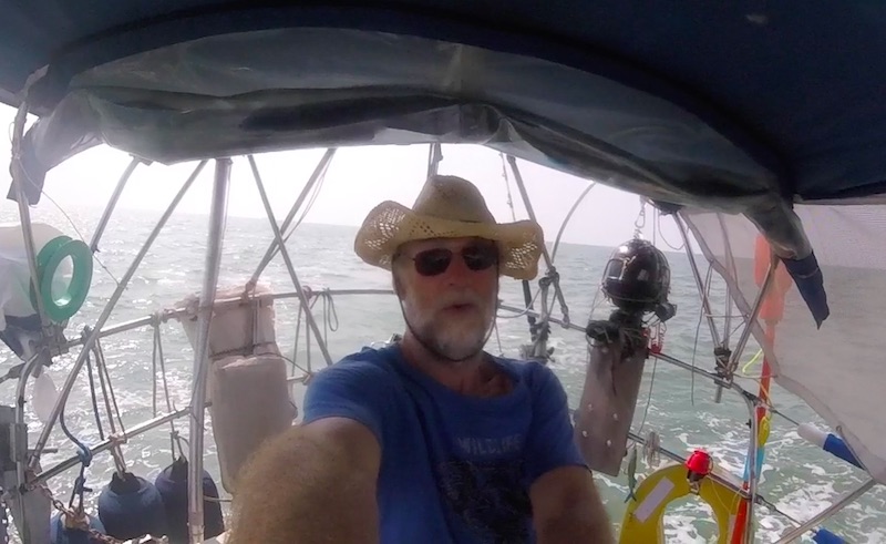
So today I was up at seven, and left before eight. I’m out of bananas, so I had a cheese butty for breakfast instead, just two more nights, then I can get ashore and restock. I headed towards Port Klang, the prop made some squealing noises, but as I increases the revs, they stopped, there is no vibration, so I’m assuming I can get away with it for now. I made great progress.
I was on constant lookout for fishing nets, of which there where many, I had read last night that these surface nets with closely spaced white floats are ok to drive over, but I wasn’t going to risk it, the very thought of another prop wrap! However as I working my was around one net, a big fast fishing boat came screaming towards me, I thought, to push me away from his net, but he was on his way somewhere else, but he motored right over the net, so that gave me confidence. At the next net I went right over it, with a marker float 20ft either side of me. I dropped the revs and go into neutral just before I pass over it, but I don’t think that’s really needed. Later I had to dodge a guy laying these nets, he was doing about 5 knots as the net streamed over the side of his boat, I could see the white marker buoys on about 10 ft of line, so I guess thats how far down the net would be.
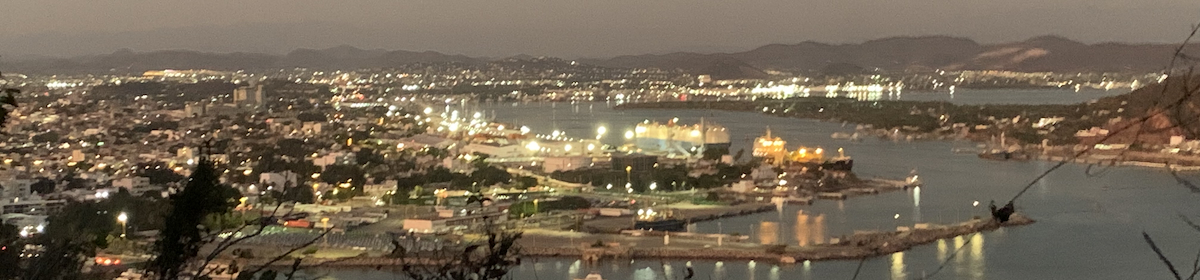
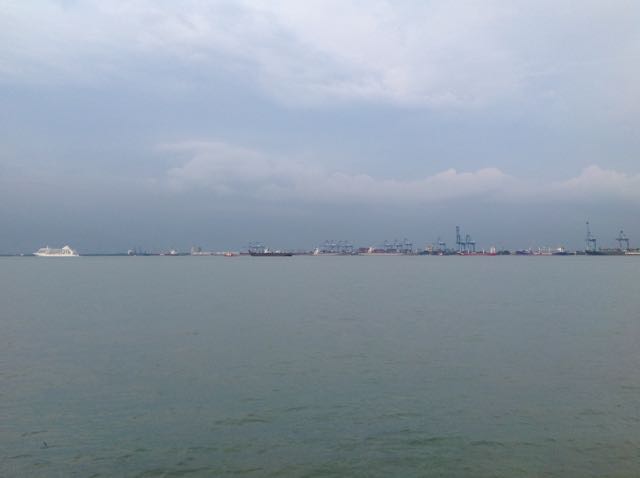
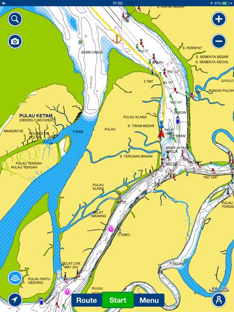
I was planning to stop before port Klang at P.Angsa, but the spot was full of fishing boats, so I pushed on into the port itself. Port Klang is very industrial, and is on the river Klang, this is the main River from Kuala Lumpur, the capital of Malaysia, some 20km from here. All of the rubbish and waste (sewage etc) from the big city used to flow down here, but that’s been cleared up now, it’s mostly organic debris floating past me now. There’s an anchorage marked on the chart, but the only boat there is a shipwrecked half sunken coaster. I anchored just along from him. The biggest tide I have seen so far in Malaysia or Thailand has had a range of 3 metres, normally more like 2, so I was shocked to find here it is 5 metres, I anchored in 9, but there is a shallower patch near me, which I hope I don’t swing onto at low water, or I will be aground. The current flows very fast here too. On one side of the river, where I am, it’s lovely mangroves, and I can hear the usual wildlife kicking off as the sun went down, on the other side it’s like Rotterdam docks, miles of container ships and other cargo ships. A cruise liner just passed too.
Tomorrow I will leave early, and head down towards Port Dickson, I will anchor somewhere along the way, and the following day, pop into Admiral Marina for some R&R, I might do a day trip into the town of Malacca itself. The Malacca straits are getting much narrower now, It wouldn’t take long to cross to Indonesia from here.
Paul Collister