I decided last night to take the inland river route to our next destination, rather than going by sea. You can see the route below.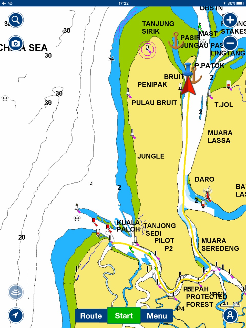
 Now this kind of sailing boat isn’t really meant to be going down rivers, for one, the rivers are usually very shallow in places restricting the boats movement, and makes sailing quite difficult if not impossible. The boat also has a deep keel, as deep as some quite big ships. But as the forecast was for no wind I thought it might be more interesting than following the coast. I checked the chart a lot, I didn’t like the navigation guidance in the admiralty publication, it stated that details wouldn’t be given as it should not be attempted without a pilot on board. However these guidelines are intended for bigger boats than me, I studied several charts and came to the conclusion that the one shallow bit at 1.5 metres would be ok if we hit it near high water which was 4.5 metres at 10:50 AM, Low water was only 1.5 mtrs so even at low water we should be ok. I also realised the currents in the river would be strong and had to factor that in, however as its neap tides right now, the tides would be at their weakest and so there wouldn’t be a better time to try. So off we went an hour late, and where straight into a 2-3 knot flood current racing us along at 7.5 knots, unfortunately, our little paddle wheel under the hull which tells me the boat speed through water, as apposed to the GPS which gives us boat speed relative to land, was all fouled up from Santubong and didn’t work.
I left Kathy on the helm to pop below and clean the paddle wheel. I really needed to be on top of the currents for this trip. The paddle wheel can be pulled back into the boat through its hole in the hull, this leaves a 2″ diameter hole in the hull a few feet below the waterline, so obviously the sea tries to come in and fill the boat up. My fancy paddle wheel fitting has a flap which closes as the wheel is removed, stopping a huge influx of water, sadly it had fouled up as well, so I got quite a soaking as the water gushed in. I have a plug that goes in, but it takes a few seconds to insert and tighten, eventually the wheel was cleaned, lots of barnacles were present, but it’s all working again.
We were going to turn North halfway along the river and exit by our destination, the island Pulau Patok, the timing meant that the tide should have turned and we would also get the ebb tide as we headed north. We met a few little fishing boats, a few bigger boats and a container ship on route. 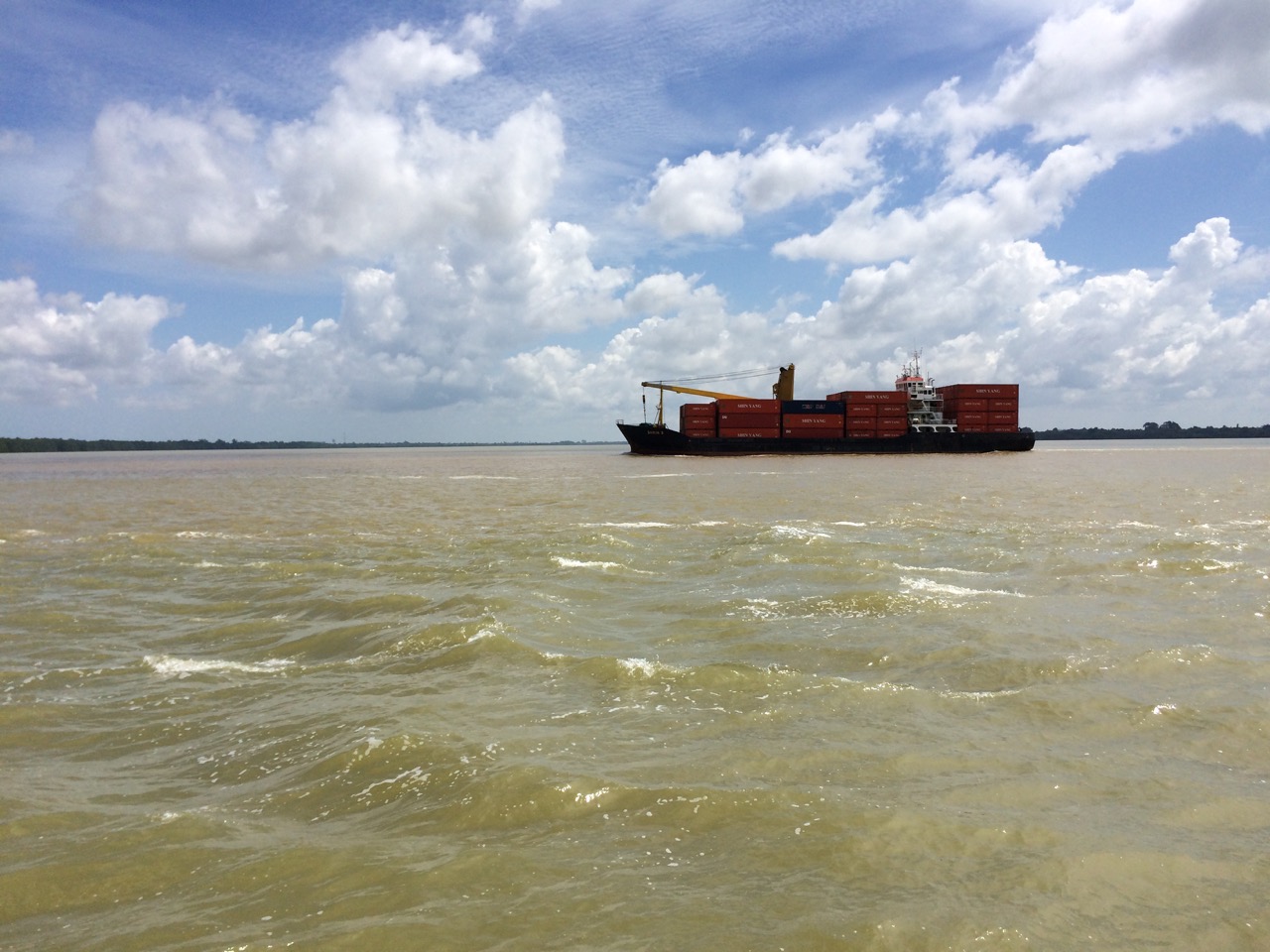 I wondered if the pilot on board was looking at us and tut tutting, I still didn’t know if the northbound passage was navigable at this point as it’s not a main shipping route, and had some seriously shallow bits on the chart.
Just after this ship passed we went around its stern and north, where we saw a few more boats, including a ferry visiting various jetties tucked into the shoreline. There was plenty of debris in the river.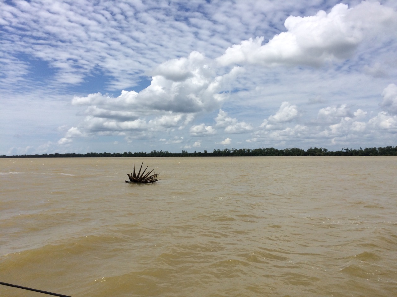 We had to keep a good lookout for these logs, this one reminded us f the ‘Statue of Liberty’, possible planet of the apes style. At our anchorage I can see where some of the tress come from, using my impromptu telephoto lens (binoculars) I took this picture
 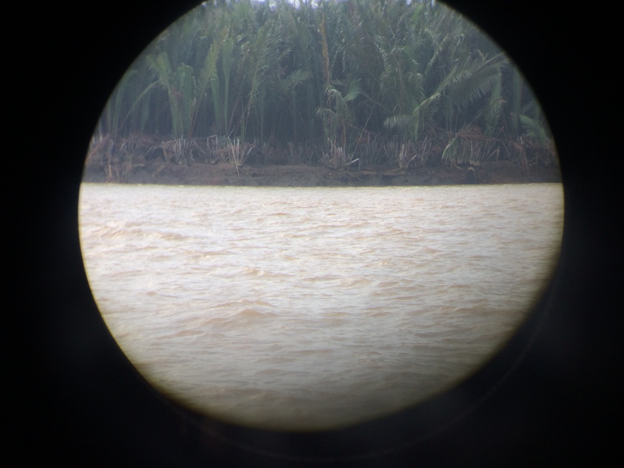 You can see the roots completely exposed at low water, soon these trees will topple over, lets hope not tonight.
What I hadn’t bargained on was the wind picking up from the North, the grib files where hinting at 5 knots, maybe going to 10 overnight, but we found ourselves with 15 knots from the north, fighting a 2 knot current going out. This creates a condition sailors know as wind against tide, with the two fighting each other, this causes the waves to rise up quite steep and close together, this slowed our passage through the water down, but the current pushed us along nicely all the same. My main problem was that our destination is protected from every direction except the north, when we arrived there was little shelter to be had, and I envisaged a rocky night, however the wind just died down, and as I write this it’s a light breeze, the tide is turning now so the sea should calm down a lot. One problem we always have is that as the tide turns, we usually have 30 minutes to an hour where we are side on to the swell and that’s usually makes the boat roll a lot.
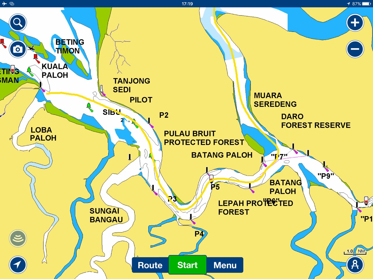
For anyone interested, I have put some pictures of our anchorage from Monday, on the charts you can see the route we planned. 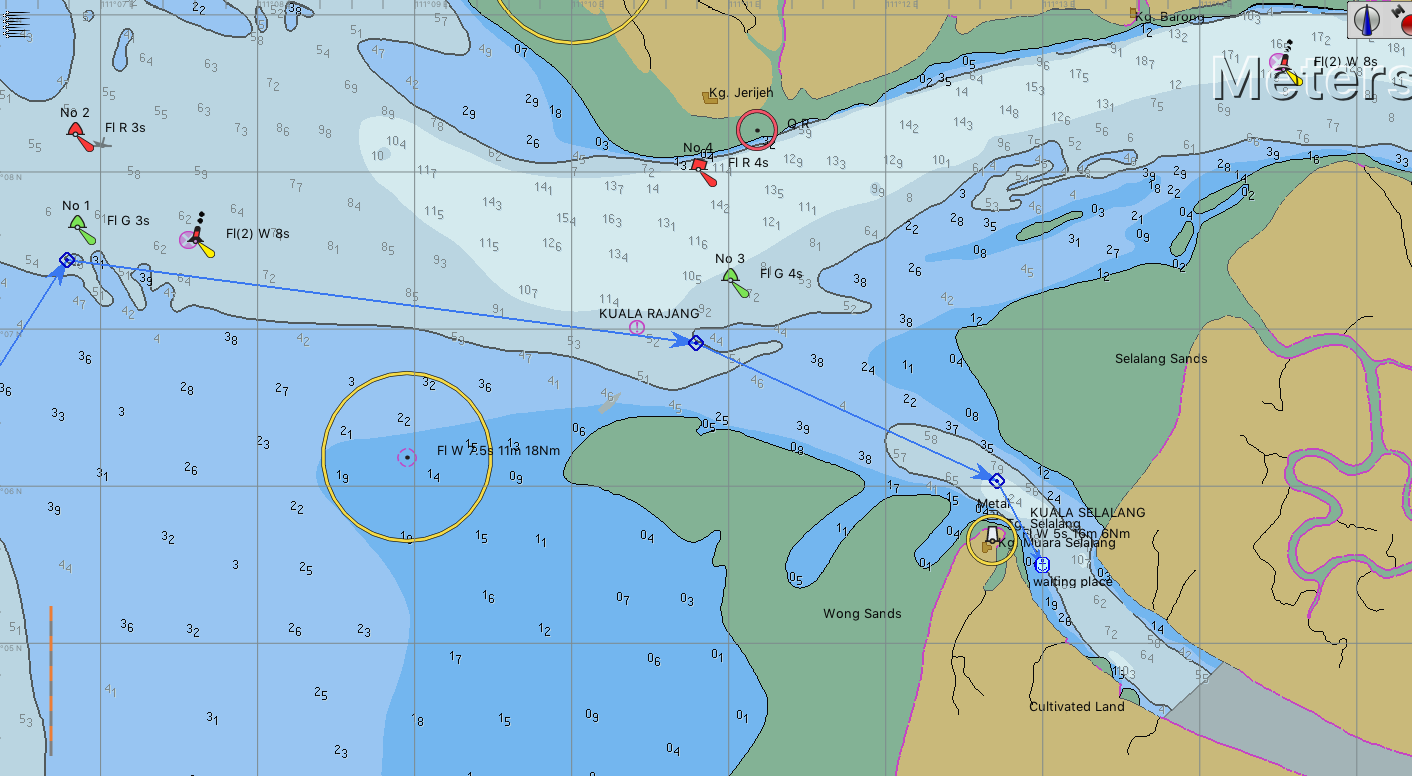 There are several buoys to guide us into the deeper water path, but half of these were missing, in one case literally half the buoy was missing, just the base in the water was left.
This is what the same place looks like from space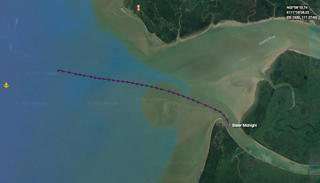
And heres a bing image I used in openCPN that really shows the sandbanks at the entrance to the river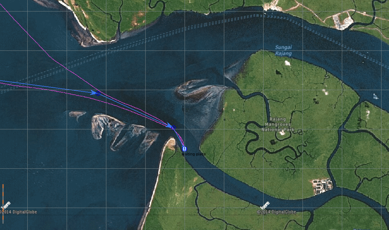 And this is what it looks like from the anchorage, looking west back to the tip we hid behind to protect us fro the westerlies
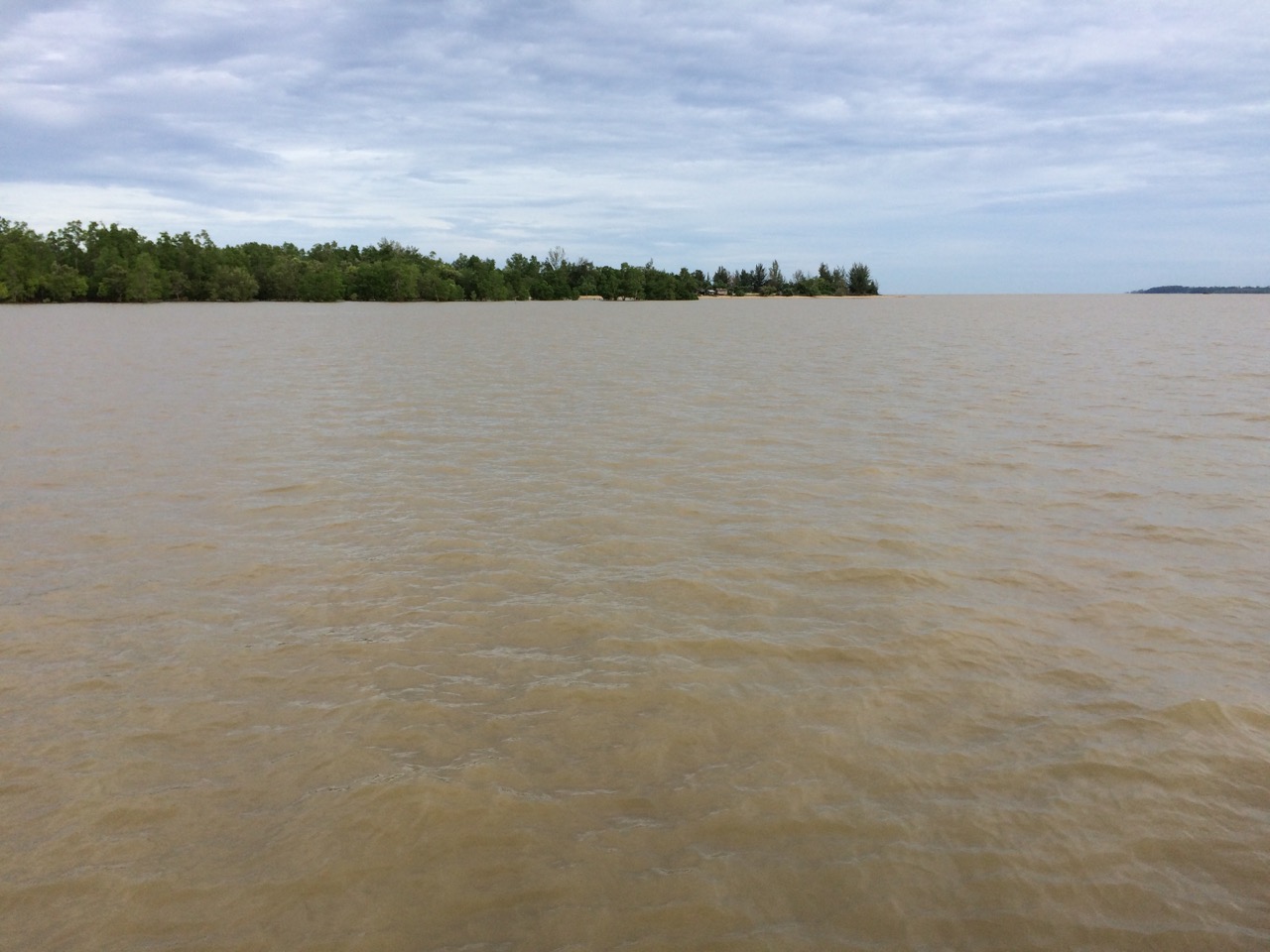
Paul Collister