Sunday 5th May 6:00 AM
Up early for a 7am departure. It’s Sunday, very quiet and very calm. The skies are clear and we have no trouble springing out of our tight mooring between two big motor boats, all alongside on one long pontoon. We motor out to sea and once we have cleared all the fishing marks/nets, I get the mainsail up, with one reef, as I’m expecting the weather to get quite windy later, and both headsails. We spotted this Hydrofoil ferry shoot past,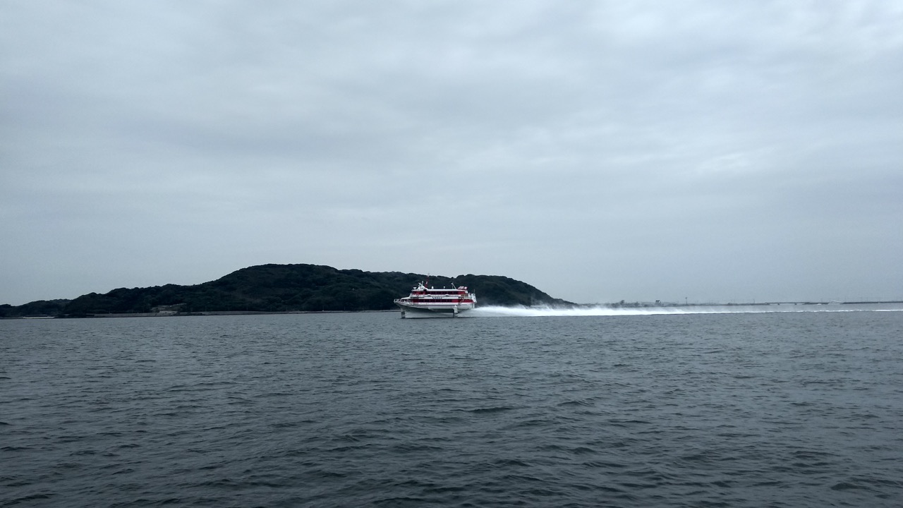 they go so fast and make no wake, but leave a foaming thin spread of white water behind them, like contrails.
The wind is on the beam and building and soon we are doing a fast 7-8 knots, on calm seas with a sunny sky, what could possibly go wrong. Well more of the same, the wind built and built, the sea soon followed with big waves and then it started to rain. Later we would add fog to the mix.
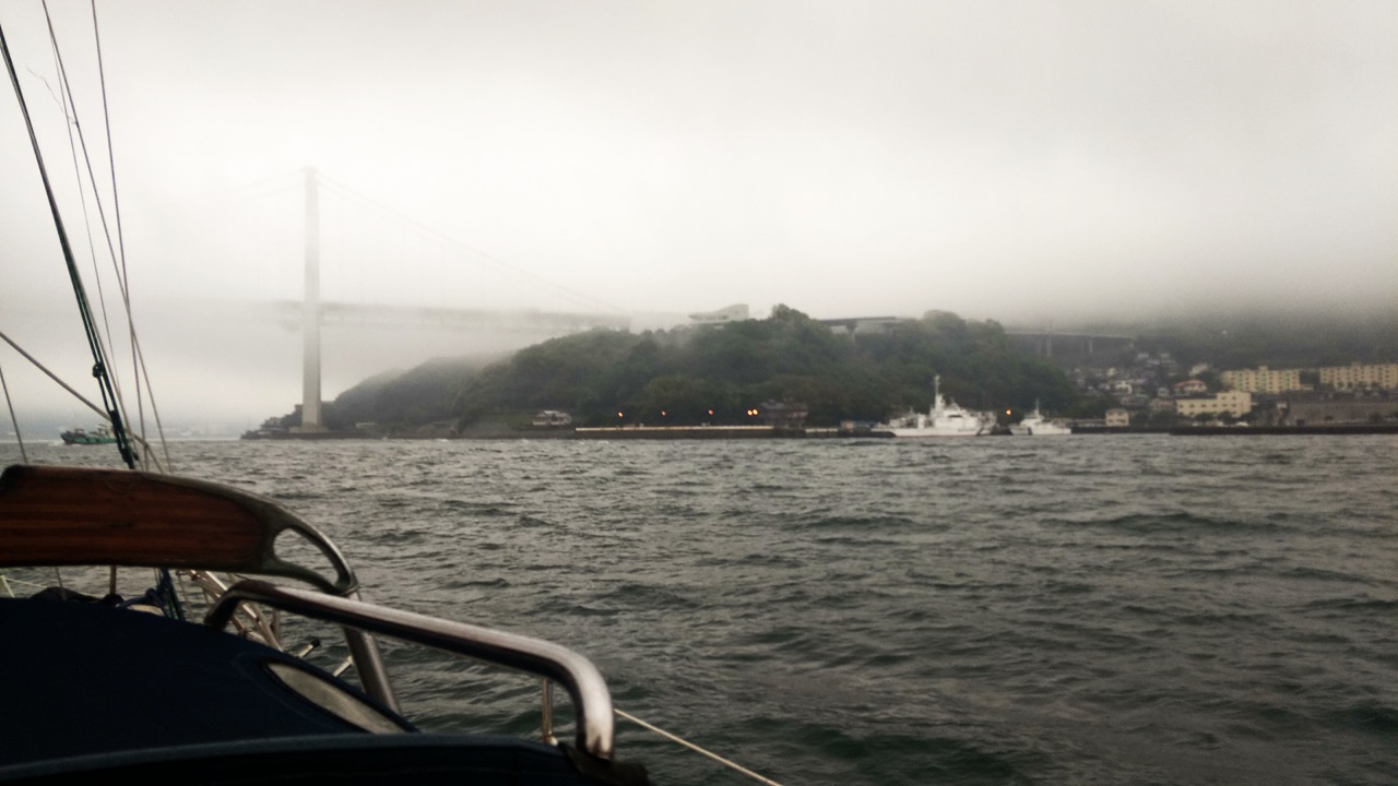
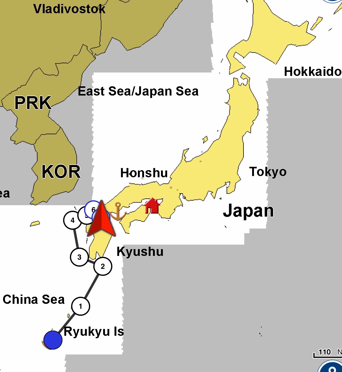
We were on our way to the entrance to the inland sea, this enclosed mass of water is similar to the Med in that it has narrow connections to the outside ocean, three in fact and although much better connected than the Med, with its single opening between Spain and Morocco, it still has a large mass of water to move in and out on each tide. Consequently the currents that race through the entrance can be quite fast. I wasn’t aware of this when I chose the narrowest entrance to the inland sea, and having arrived in Fukuoka, the nearest main open port to the entrance, I did some research and realised that we couldn’t go fast enough to cope with the worst of the current and would have to time our passage to be just after slack water, when there was little current, and race through with the increasing current. The strait we were passing through is called the Kanman Strait, and is about a mile wide and does a big u turn, it has a big city on each side and is almost as busy as Singapore for commercial shipping. I checked on a web site provided by the authorities here and found that 8am would be our best bet for a passage through, that meant arriving the night before and waiting at anchor.
Our passage there was getting rougher and rougher, and with the wind often hitting 28knots, I now had a double reef in the main, and just the staysail up, and we were still flying along and heeling a lot. I decided to get as close to the shore as possible, the wind was blowing offshore and was a little weaker near the shore, also the sea was a lot flatter there. However there were shallows, rocks, and a lot of concrete constructions to navigate around. 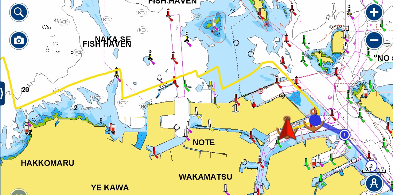
 The area was becoming more and more industrialised, and looked like a giant version of Ellesmere port/Stanlow oil refinery where I come from.
 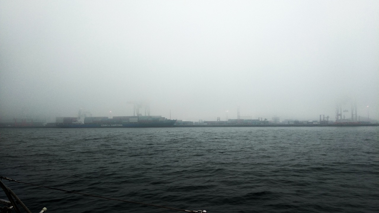 The air was full of sulphurous smoke from the power station on the shore front. I sailed between wind turbines, and while trying to understand what this huge pylon was that I was sailing towards, about 0.2 nm from shore
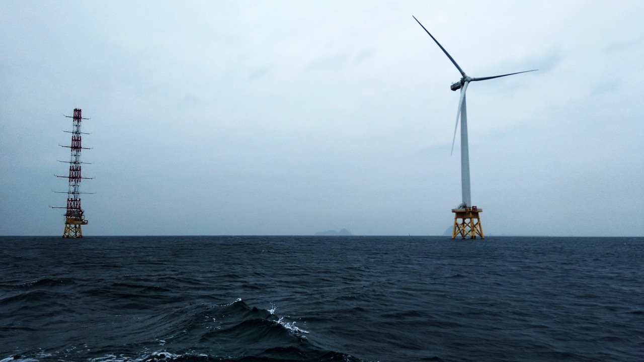 I noticed the chart had printed on it OVERHEAD POWER CABLES, crikey I thought, we’re about to be frizzled, or at best, get the electric toaster working for free. The thing was the pylon didn’t seem to have any wires on it, just a mass of aerials, and looking closer to the shore I could see the aforesaid cables going out to some big round structure off to starboard. so false alarm.
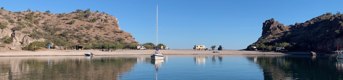
It was quite an exhilarating ride, and when we entered the Kanmon Strait at the western end, the sea was quite rough, we turned immediately to starboard into a river / tributary of the strait, which was seriously industrialised, and headed along to a spot I had marked to anchor and wait until the next morning.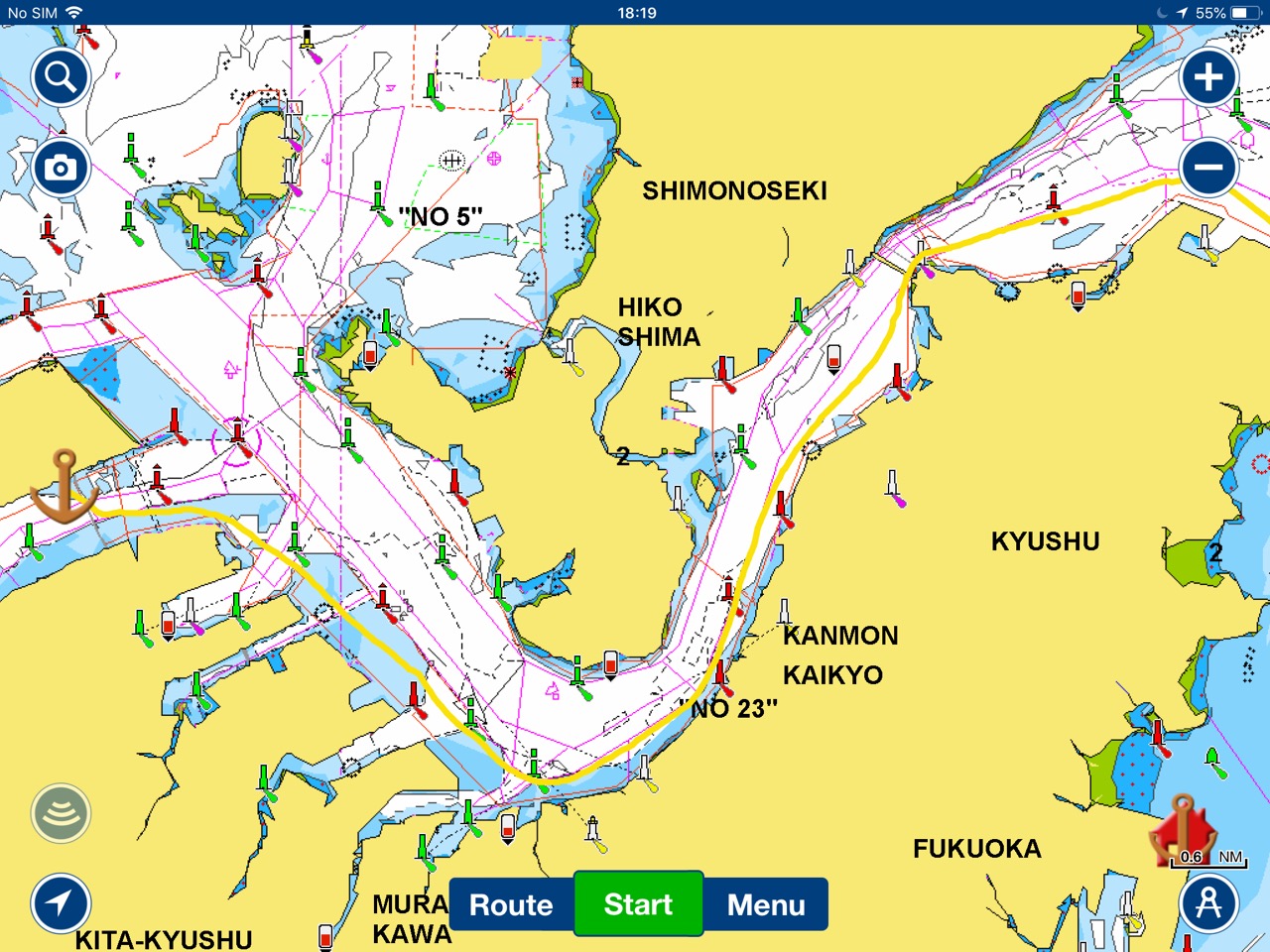 It seemed too rough there to stay, the wind was making the sea quite choppy, but I noticed a coastal cargo ship and a tug attached to a barge both at anchor where I had my waypoint. I went beyond them, turned into the wind, slowed the boat and decided it wasn’t that rough at all, we sleep through much worse on night watches, and the forecast was for an improvement anyway, so down went the hook in 10 metres of water. Kathy came to help with the anchoring, she couldn’t believe me that I was going to anchor in such a rough sea, but once the anchor was set, and we went below, shut the hatches and removed our soaking wet-weather gear, everything was just fine. We both slept very well, the new duvet we bought in Fukuoka, along with the three blankets works well, how very different from just a month ago.
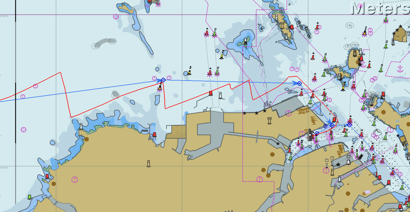
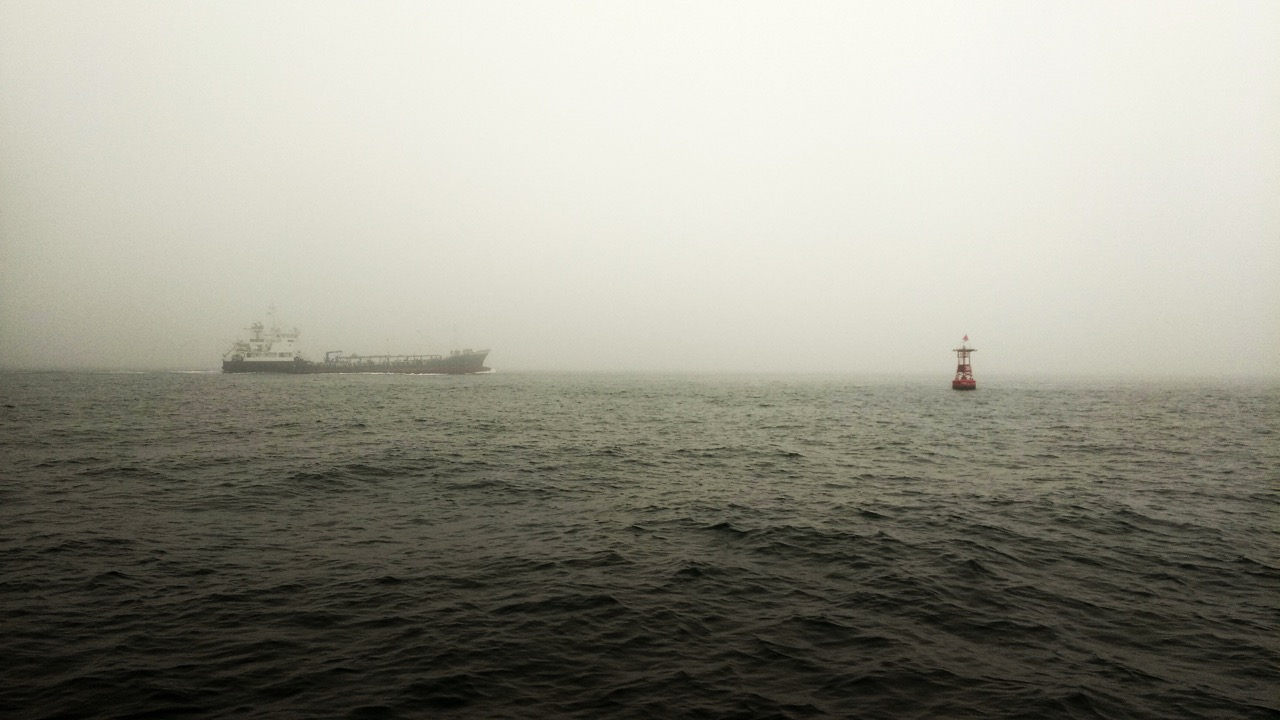
I was up early, around 6AM and checking on the VHF to see if the harbour master (Kanmon Martis) was issuing any warnings about the strait, looking outside, it was a lot calmer, but I couldn’t see much due to the dense fog. I expected the strait to be closed, but looking on the AIS I could see a stack of ships passing into and out of this end of the channel. By 7AM the fog had cleared and I could see the giant video display a mile away showing the current in the channel, it was flashing 3, then E, then Up arrow, meaning three knots eastward and increasing. I had worked out slack tide to be at about 8AM and 3 knots to be at 9AM, so I was out by an hour or more. I quickly explained to Kathy we had to get a move on. The previous evening I had heard Kanmon Martis announce at full flood that the tide was now running at 10 knots and ships that could not make 14 knots must not enter the strait! Up came the anchor and off we went, we hugged the outside of the marked channel, I hand steered while Kathy spent most of the time at the chart table shouting out AIS Collision warnings to me, several of the ships in the strait we’re entering or leaving the many docks and channels along the passage and we would need to avoid them if they crossed our path. I was very pleased to make it to the bridge, the most dangerous part, in just under an hour, and with 3 knots pushing us along, we shot through,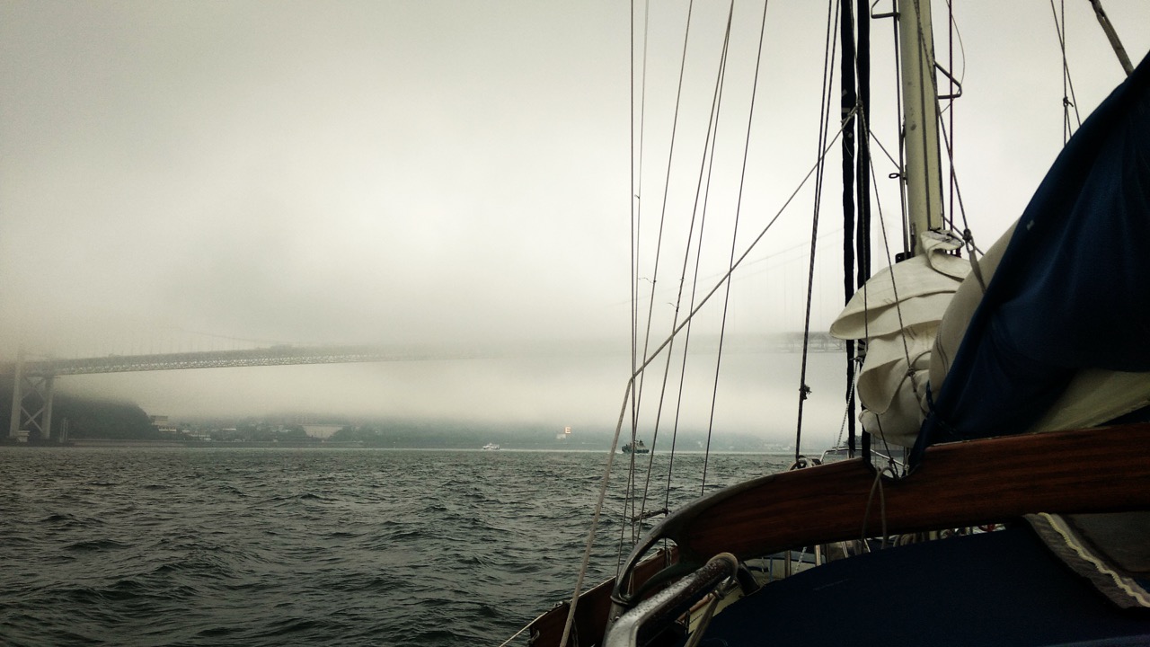
 then 15 minutes later we were in the inland sea proper. A place I had wanted to see for many years.
 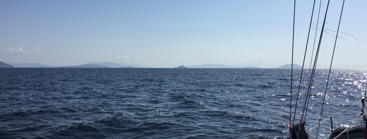 Unfortunately during our passage along the strait, the fog and rain returned, this is normal in Japan at this time of year, and so I wasn’t seeing much at all, Kathy maintained AIS watch, and I looked out for small boats from the helm. What disappointed me was the huge amount of fishing buoys/flags we encountered, I presume they have nets strung between them. They are everywhere, and although they don’t present much of a problem to us, due to the underwater shape of our hull with an enclosed propeller, it’s still a fear we might snag one, or have to deal with a fisherman who insists we go around them. Our charts show lots of Fish Havens,
 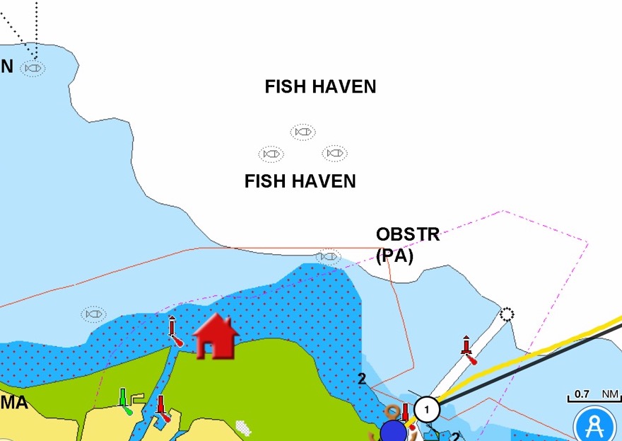 which back home usually is a place where fishing is strictly banned, I presume to allow stocks to recover. Here it seems to be a place where you can fish and string out loads of nets. Interestingly our charts also shows Fish Heavens
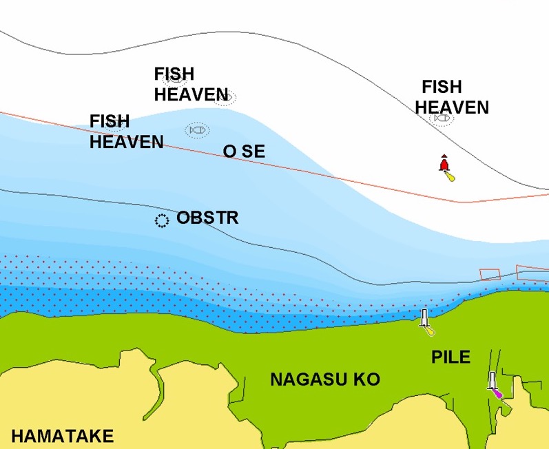
I wondered if this was heaven for fish, but Kathy pointed out that with the amount of nets in the ‘heaven’ that it’s more likely where they start their journey to heaven!
From the exit of the Kanman straight we headed over to Nakatsu Harbour, about 2 hours away, arriving early afternoon, sadly I had forgotten that wasn’t our destination. I had worked out a much better place to stop the previous night, but forgot all about it in the morning. Nakatsu has a small ‘sea station’ which is meant to be a yacht friendly small marina, often just a pontoon and maybe a water supply, but nicer to yachts than a harbour wall. Unfortunately we didn’t have any co-ordinates for it, just a fax number. We headed for the harbour in town, but realised it was way to shallow to enter, so we backed off and headed to a harbour that was shown as being under construction in the chart, several years ago. This was a big industrial harbour, and when we entered it, kathy spotted some yachts at the end, we motored along to them, but they were moored med style to concrete walls, no pontoons. then we saw a pontoon, full of commercial boats, so we turned round, found a quiet spot in the corner of the harbour, behind a breakwater and dropped the hook. very calm and peaceful.
Tomorrow is Tuesday, at least at the time of writing, when we next get internet is another matter altogether, and we have just two more day sails then we will arrive at Yugi Shima, the start port for the rally, we then have two weeks of laid back sailing, and social events, I expect we may have to drink some tea, and I’m not so sure about the naked bathing bit! Then we will start to prepare in earnest for the pacific crossing. I have been reading up on that, and my initial plan to travel 700 odd miles further north may be flawed and that we can leave from Osaka or Yokahoma and get more favourable winds, which also gives us a few weeks extra to relax and prepare the boat and ourselves.
Thursday 10th May Update
We have now arrived at Yugi port on the Island of Yugi-shima, the rally organiser was here to take our lines in a lovely quiet and pretty town. We are on a pontoon with water and electricity, unfortunately its 110v USA style, so not a lot of use to me. The journey here was fairly uneventful, except for one strait we had to pass through, underneath a huge bridge, I planned to sneak through the bridge using a route that was quite direct, unfortunately we had a tanker bearing down on us that thwarted that plan, then I had to port controller telling me off on the radio, first for not contacting him, then for not knowing the prescribed route, and finally for not being able to make 4 knots over ground, despite doing 8 knots over water. There was quite a strong current flowing. We have sailed for most of the passages in Japan, but for the last two days it has mostly been under engine, but at least that goes hand in hand with calm clear weather.
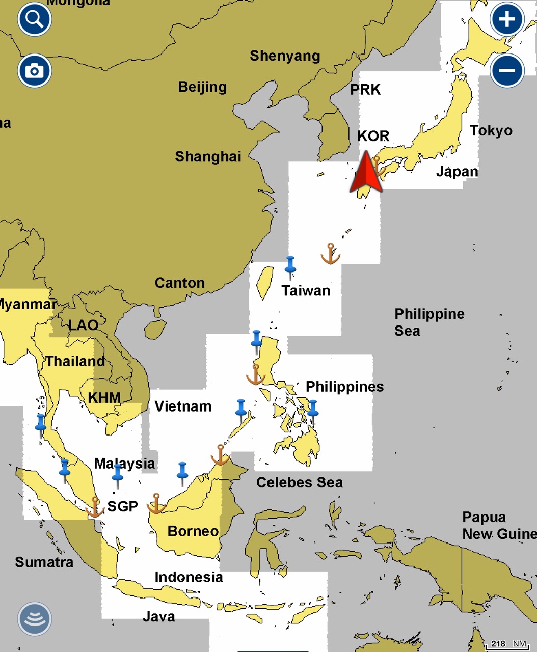
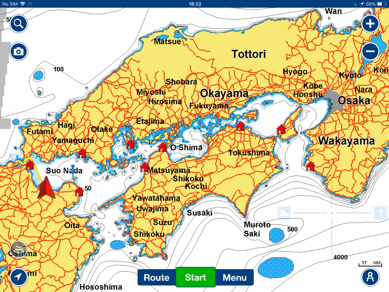
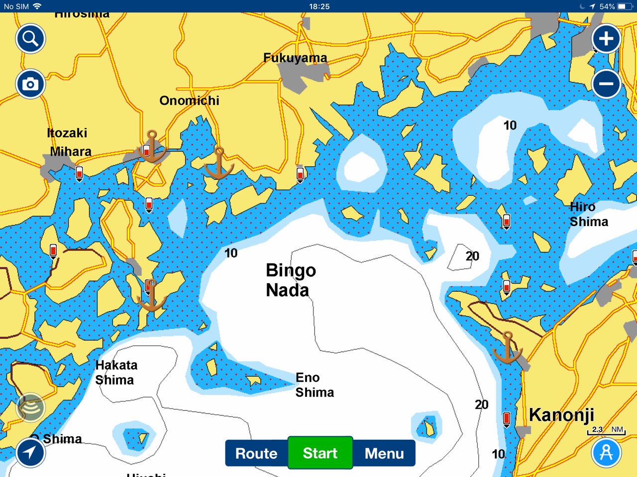
I have put some charts below showing our cruising area
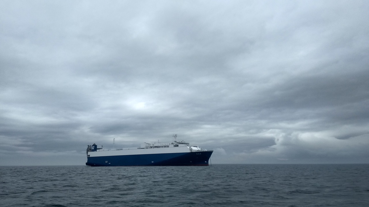
Lots of ships pass through the inland sea, we had constant warnings on the AIS telling us of possible collision risks, where the CPA (Closet point of approach) was less than 0.1 NM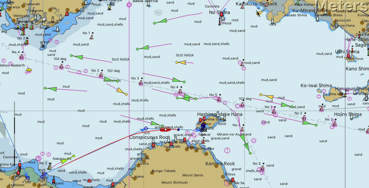
Paul Collister