Breaking news…..
You can also see our latest position courtesy of our new Iridium Go satellite device. It updates every hour when on, unlike the map I have on this site which updates whenever I remember I have a map to update.
You can find the iridium tracker at this location (Opens on a new page)
Gee your not mucking around are you, Spent some time at Puerto Galera back in the 80’s. Can’t remember you saying, whats the time constraint?. Surely the Chinese Navy and the Pirates are behind you now.
Gee your not mucking around are you, Spent some time at Puerto Galera back in the 80’s. Can’t remember you saying, whats the time constraint?. Surely the Chinese Navy and the Pirates are behind you now.
For some reason the http://www.marinetraffic.com site last recorded you on the 1st April @ 9:15, never occurred to look there before now.
Hi David, Yes, we signed up for the Japanese inland sea ‘Setouchi’ rally which kicks off on the 11th May, my fridge and illness lost us 2 weeks in Sabah, so we are racing through the Philippines to get to Japan on time, it works out well to prepare us for the north Pacific crossing this summer. I would gladly have spent a month or two in P.Galera, also Subic was worth at least a week. All in all I would need 6-9 months to do justice to this lovely country, but if I take that attitude with every country I visit, I’ll never get out of SE Asia.
Very cool. Expensive too, I imagine.
Hi Bob, Yes, the kit was about $1000 USD and about $140/Month ‘line rental’. but I get unlimited free SMS, email, phone calls and data for that. In fact I get all the data you can fit down a 2.4kbs data channel! I think that works out at about one modern html page with CSS per day. To be honest the main reason for having it, is to get the weather forecasts when offshore, the N Pacific crossing will be easy or hard depending on how well I can track the Pacific High pressure system as it moves through the summer.
This thing is *hideous*! Stop it now! Please!!! For those that haven’t yet clicked on the link, save yourselves. Run away! Run away!
I’ve just spent far too much of today following your movements, hour by hour, looking to see where you might be going, where I would go if I were you, etc, etc. I’ve just spent the last 20 minutes looking at the street-level view of the oddity that is “Subic Bay International Airport,” which makes the artist formerly known as Galway International Airport look like a massive hub. It was the aerial imagery of the runway that did it for me. On “satellite view” it looks like the runway is surrounded on all sides, by water. It’s not (I’m saving you and anyone else from hours of Google-Map-Surfing). But the bay looks nice, and I think I could feel the nice evening heat of the roadway beside the airport. For the record, it’s still hovering between 5C and 8C here in Galway. Now I have to go hit Refresh on that map window to see if there’s a new update and to see if my prediction regarding your destination is even close to accurate…
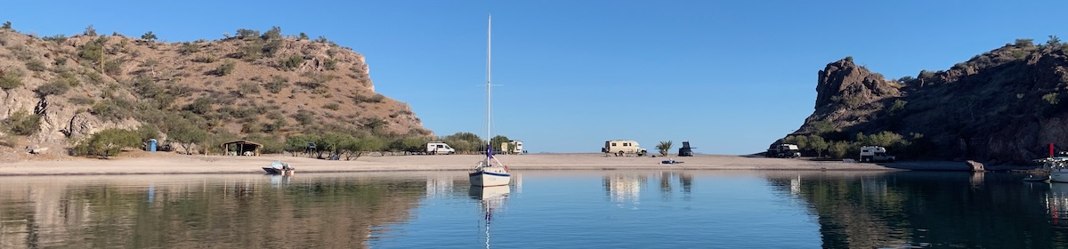
Hi Dermot, I think we have all spent far too much time doing that. Although I wish I had done it for this location, I might have chosen another overnight spot. This place has two resorts on the beach, full of screaming raucous yelling screeching people. With a very loud pop music background. At least we just get some cover from the NW swell. Had a fantastic 3 days of sailing now, hardly using the engine, just wonderful. Calm seas, 5 to 7 knots over ground, blue seas, blue skies, T shirt and trunks when the breeze gets to cool. Next stop is 109 NM north, so an overnighter tomorrow.