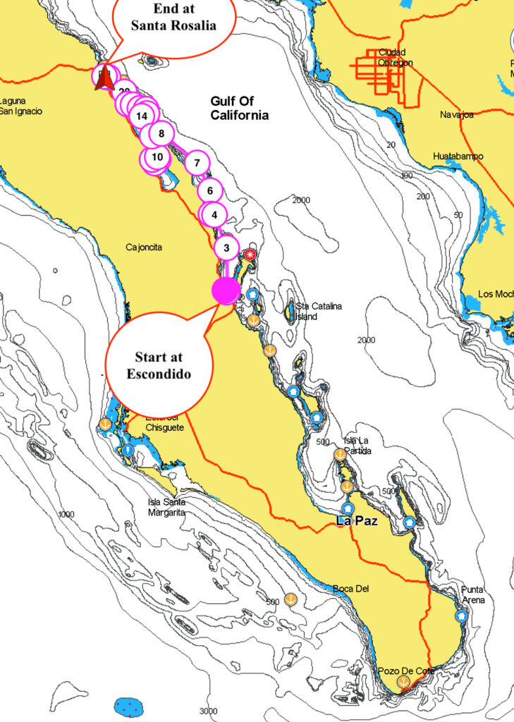
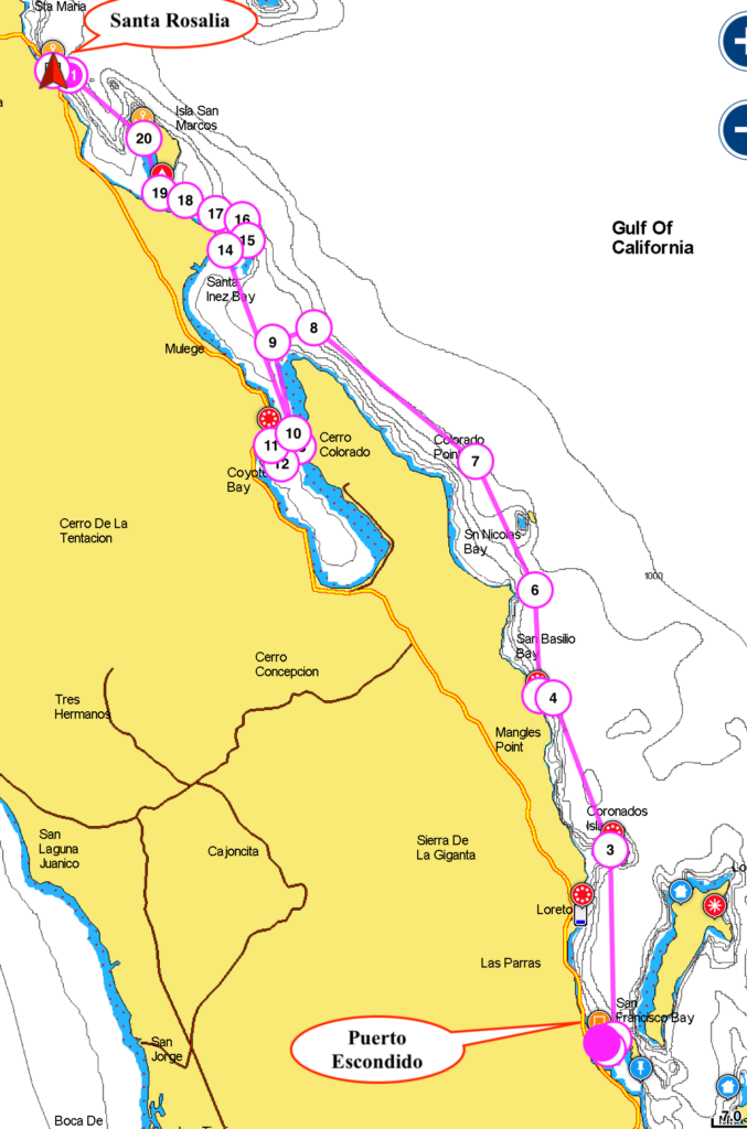
Sunday 11th April 2021
Time to leave the safe and comfortable setting of Puerto Escondido and explore to the north.
Sunday arrived and I was up at 6:30 to ferry Dirk & Sylvia to the marina dinghy dock. They had a hire car and were heading back to the USA to get their second shots for covid. Perhaps shots is a bad choice of word for the USA these days.
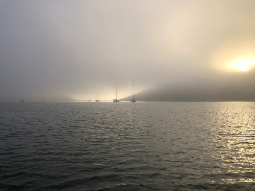
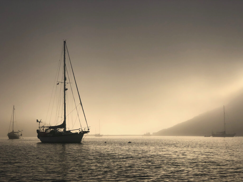
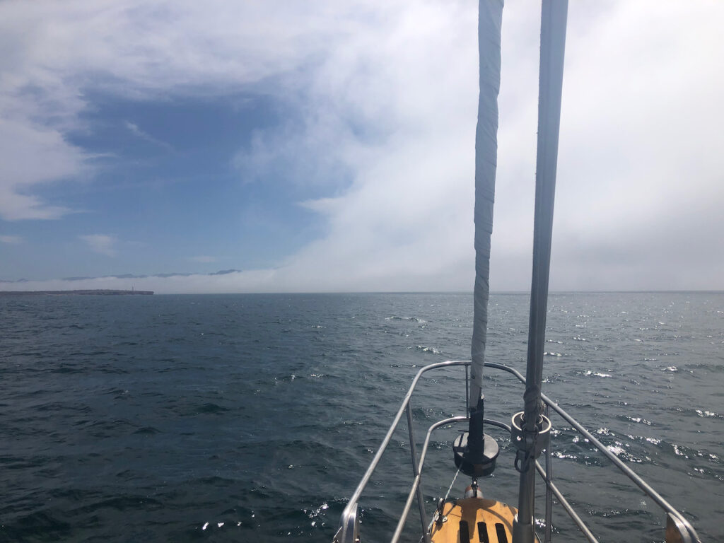
It’s been foggy the last few mornings, and today is the worst, I had to put a waypoint for the boat on my phone so I could find my way back.
Back at the boat I tidy up, have a coffee and start the engine. A msg arrives from Dirk, who is now speeding along the main BCS highway north, he says the bay and the Loreto area is clear of fog. So I cast off the lines to the mooring buoy and motor on out.

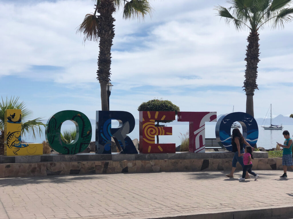
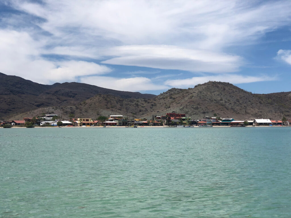
To hours later and I’m in Loreto. It’s calm and I motored all the way. A quick trip ashore in the dinghy and I’m stocked up with bread, fruit & veg and chocolate to see me through a couple of weeks. I also buy a big bag of empanadas, these are often just like pasties in shape and filled with meat or cheese etc. However these are stuffed full of sugar and chocolate, then coated in sugar. That’s pudding sorted for a while.
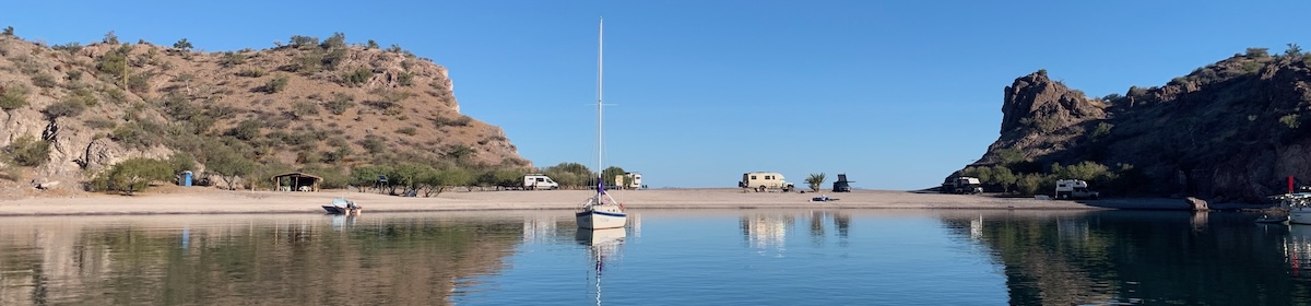
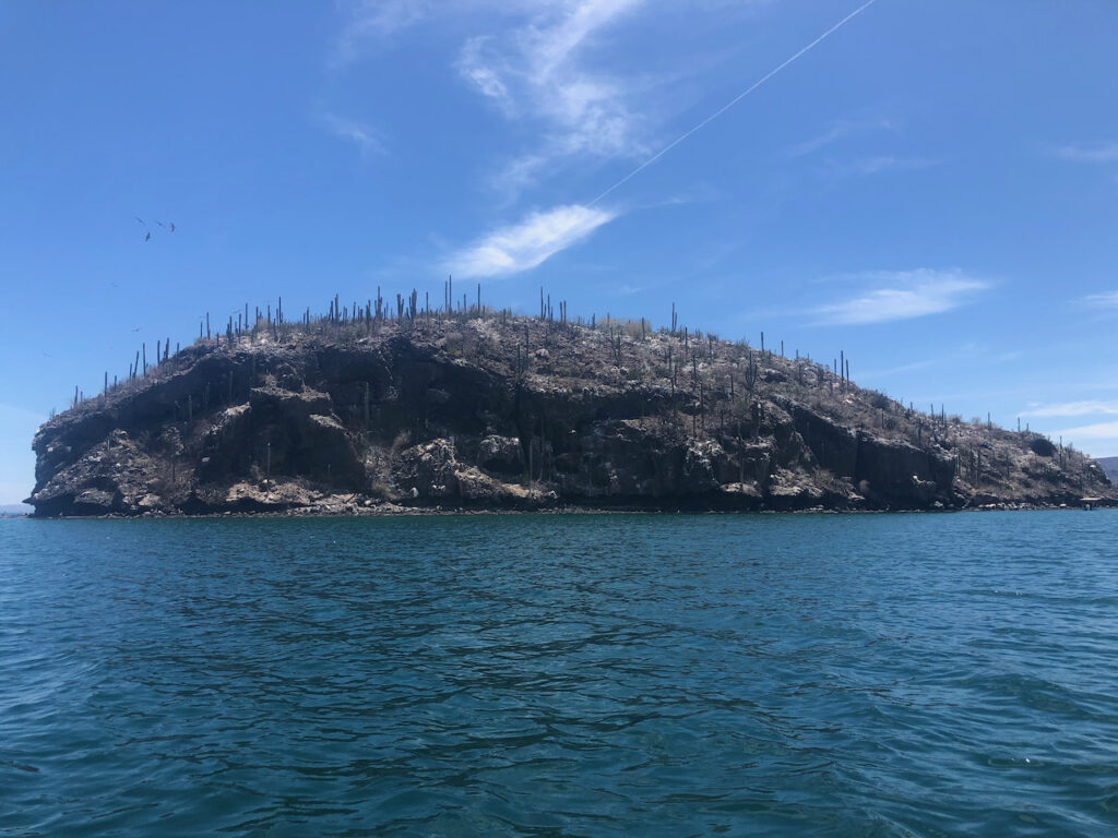
Back on the boat, I download the weather and decide that it’s early enough in the day to go north to the Coronados, One big island and the other very small. I will have two nights there and do some research for the journey ahead. The wind has picked up, from the south so I unfurl the Genoa, and very slowly, 2knts, make my way north. 4 hours later I drop the hook in the northern end of the bay. It’s gorgeous here. Quite a few other yachts and a couple of motor boats share the bay with me, but it’s not crowded.
Monday.
A lazy day after yesterday’s early start, up at ten, lovely bread for toast and coffee, and it’s going to be a hot day, probably in the 30s. I launch the kayak and head off to explore the northern side of the island. I row for 2.5 miles and get it into my head I must be about halfway around the island now so will push on and do the lot. It’s actually 8nm all round, and as I round the next headland I’m exposed to the windy wavy side of the island and it doesn’t feel so good. I’m a long way from the boat now and I start to think about what might go wrong. I’m pondering on the ‘up the creek without a paddle’ scenario, and can’t help thinking that’s got to be better than drifting in the Sea of Cortez with no paddle; surely you can just drift to the side of the creek, grab some branch and fashion a paddle out of it. It’s very barren here so I decide to turn around and head back. I had been hoping to find some good snorkelling spots as I had brought my mask and fins with me in the kayak. Sadly the best spot was reported as just after the headland, and the second best was where I started from. Should have done my homework before the trip. I stopped in a sandy cove on the way back and donned my mask and flipper and dived in. It was freezing. I only had my trunks on, and jumped out again, however on my second go it seemed ok and I did a 20 minute snorkel, I was keen to test out my new GoPro, it worked great, but visibility was poor where the best fish were.
I made a huge tuna salad for dinner and lay in the cockpit watching the stars which are so bright out here.
Around midnight I was woken by some fishy business. Going into the cockpit I could hear, what one could only assume to be a giant seal pretending to be a whale, or more likely a whale. Every two minutes a large exhalation and splash was heard, quite close by, and slowly heading north through the bay.
Tuesday, and a chat with Kathy early on, then up with the anchor and north it is again. This time to San Juanico.
There’s no wind but a lot of swell from the SE, this bay is great for every direction except the East, as I approach the swell is coming more from the east and I’m not expecting to be able to stay there. I decide that as the wind is low, and will be for days, this will be a good time to practice laying out a stern line with the Danforth anchor. It hasn’t been used since we landed on top of the rock in Thailand, some time back. It could do with an airing, and I could do with the practice. The plan would be to load up the dinghy with the anchor and its 10 metres of chain, row to the shore with the remaining 60 mtrs of rope line trailing out from the boat, and position the anchor so that when I tightened the line back on the boat, the bow would point into the swell.
The bay is very popular according to the guide/pilot book, and I was expecting it might be crowded, but with the swell I expected most people would leave. It’s rare to see an AWB (average white boat) or first timers stay long when it’s rolly.
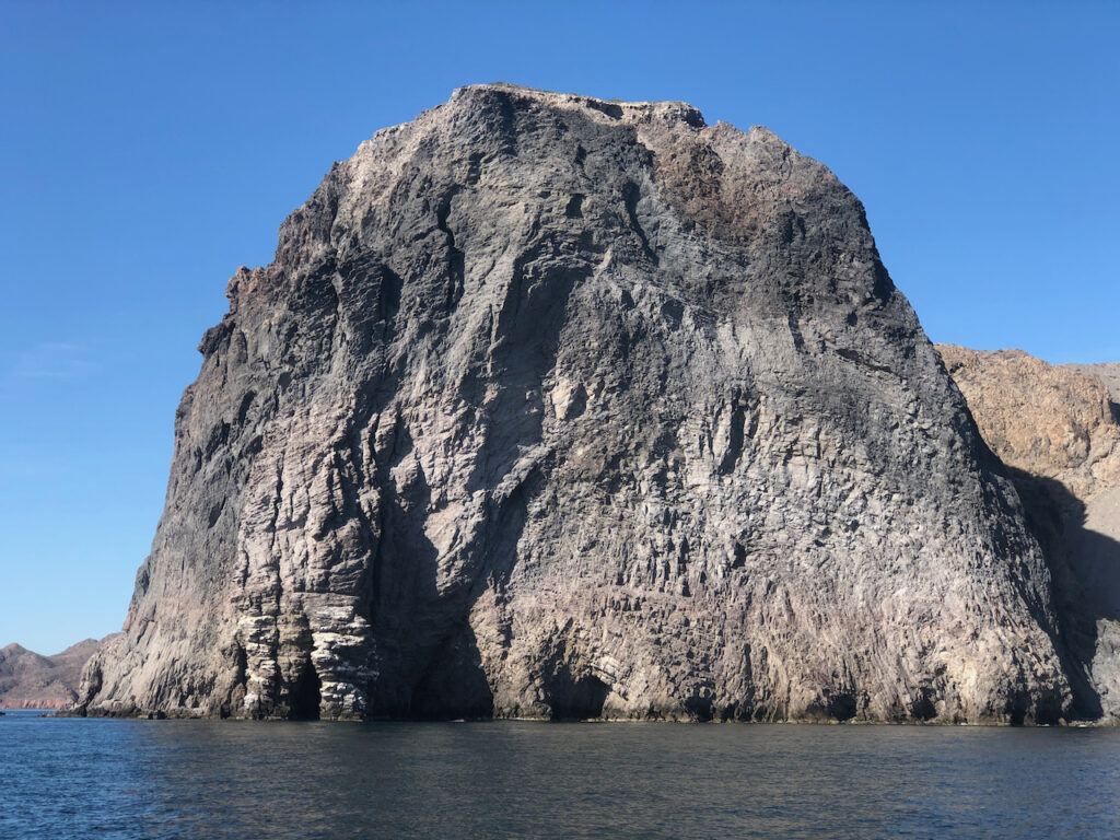
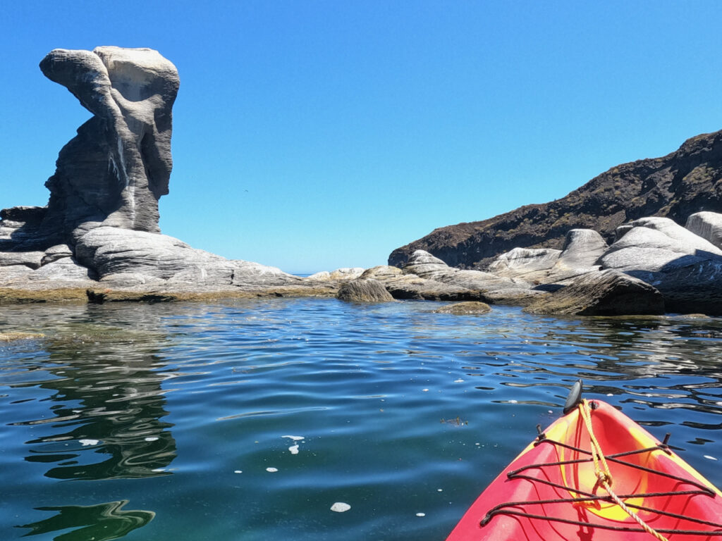
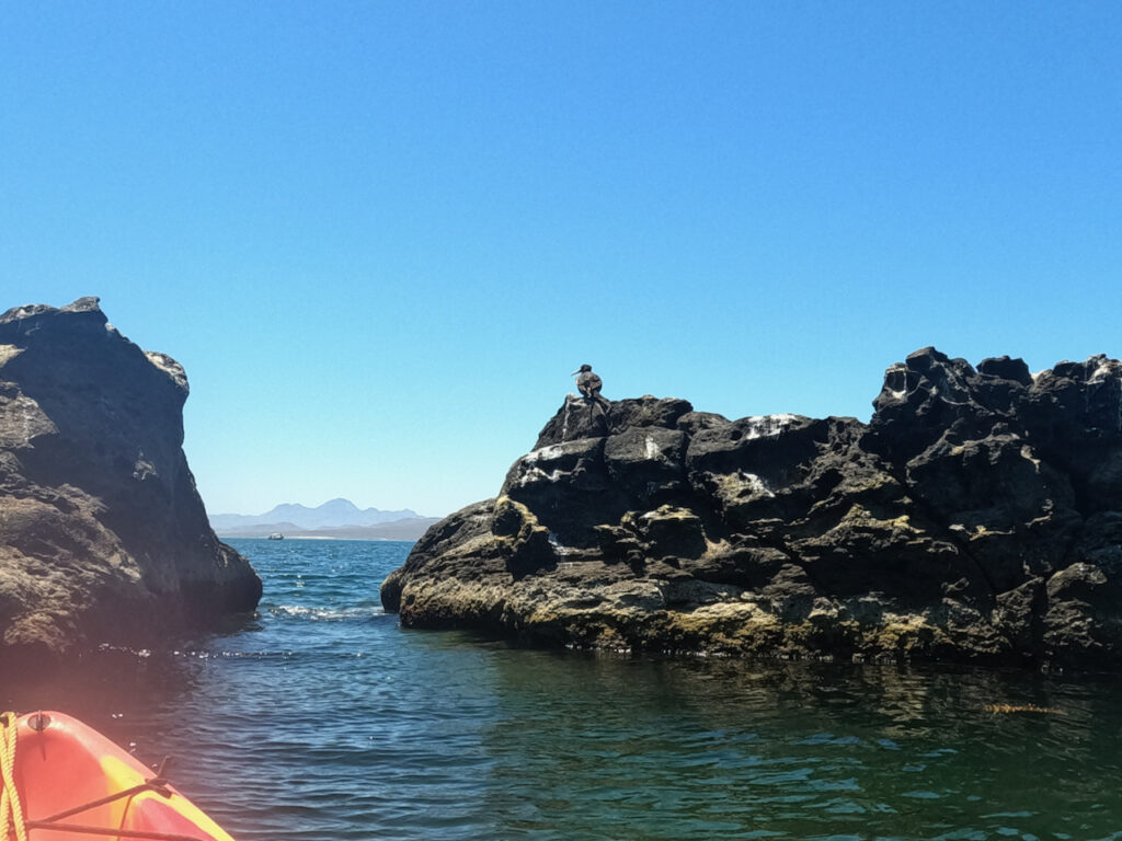
Turning into the bay I was stunned with the beauty of the place, the rock formations are amazing. If possible I might dwell here a few nights. I saw no boats until I was further around the corner when a boat, looking a bit like mine came into view. But between us the waves were breaking ferociously on a line of rocks. He must have gone behind them. Getting closer I could work out how he got there, and I copied him. Behind the line of rocks, the swell was much reduced, so I dropped the hook, waved to my new neighbour and just spent 15 minutes staring at my new surroundings; Stunning. An hour later a pod of dolphins swam in, but I won’t put pictures on as I have posted the last video I will make of dolphins on YouTube here, I can’t imagine ever getting better footage of them again, so if you like watching a huge pod of them leaping and diving, check it out.
The wind increased, with it the swell, and although I felt safe, I didn’t fancy braving the waves and exploring ashore.
Wednesday.
The swell was still rolling in, and I figured there probably wasn’t going to be any places I could stop safely before the Bahia Concepción, so decided to leave early. 7:30 and I’m away heading north, the plan is to go to the top of Bahia Concepción and nip around the corner to a small bay protected from the east and pass the night there. En route the wind moved to the NE which allowed me to sail for a good part of the trip and on turning into the bay, some 8 hours later, the wind was from the NW so my plans to stop at the head were out. Instead, given that I had a few more hours of daylight, I pushed on to a little cove at Santispac, roaring down the bay with the main fully out.
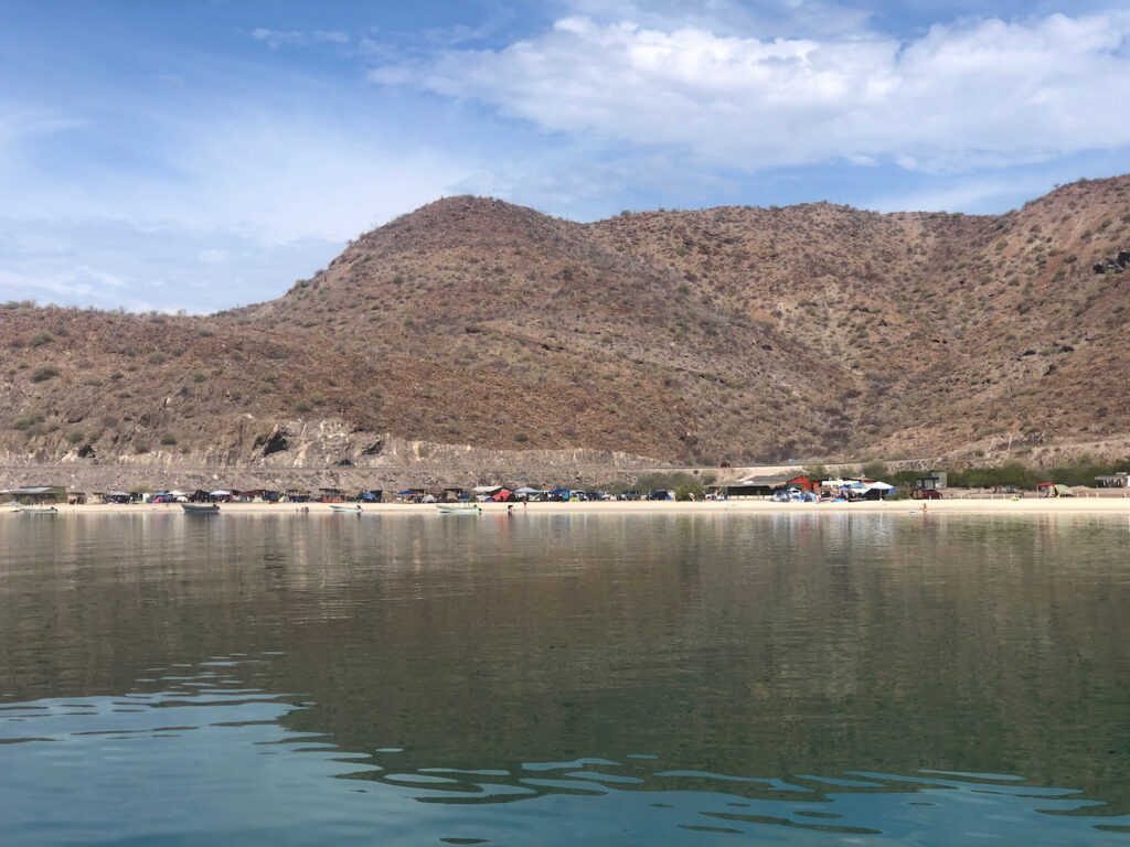
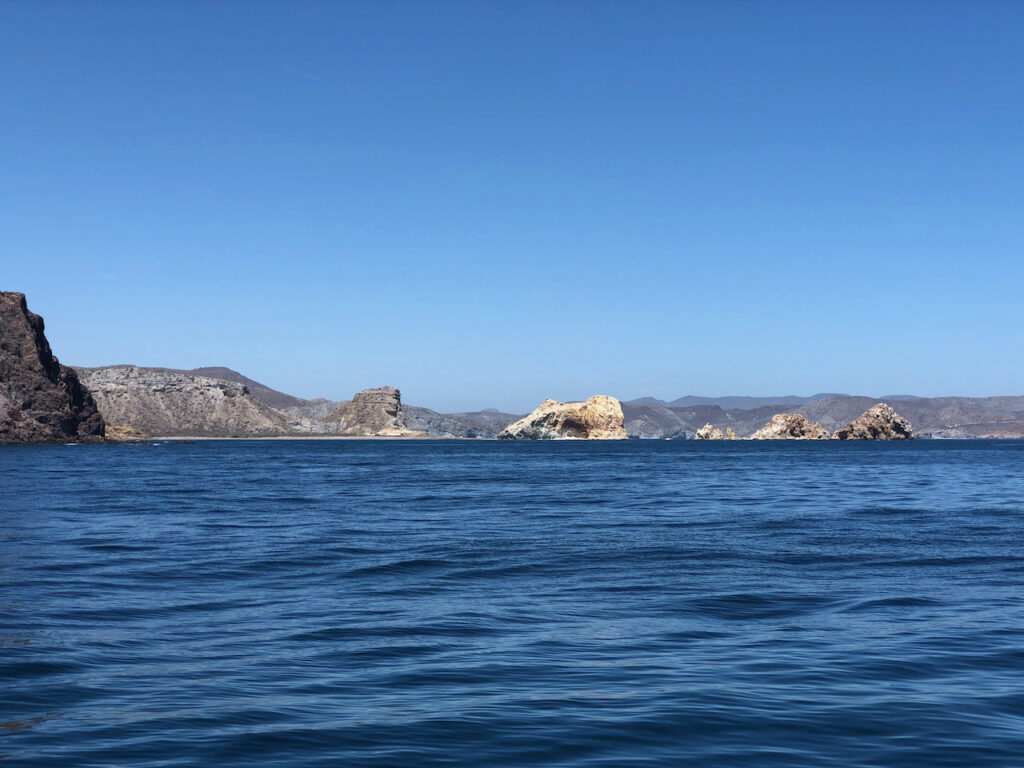
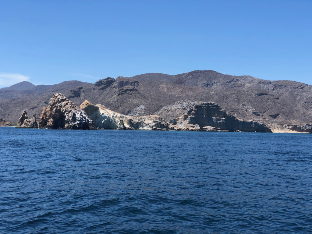
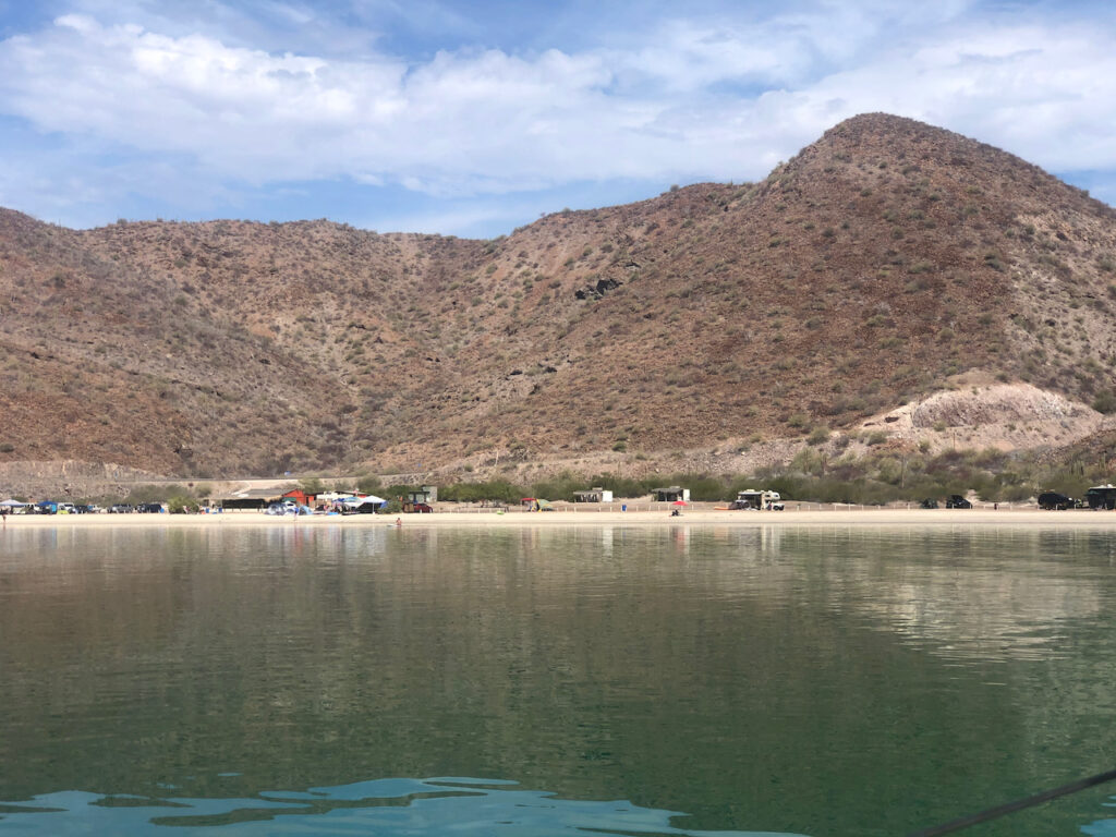
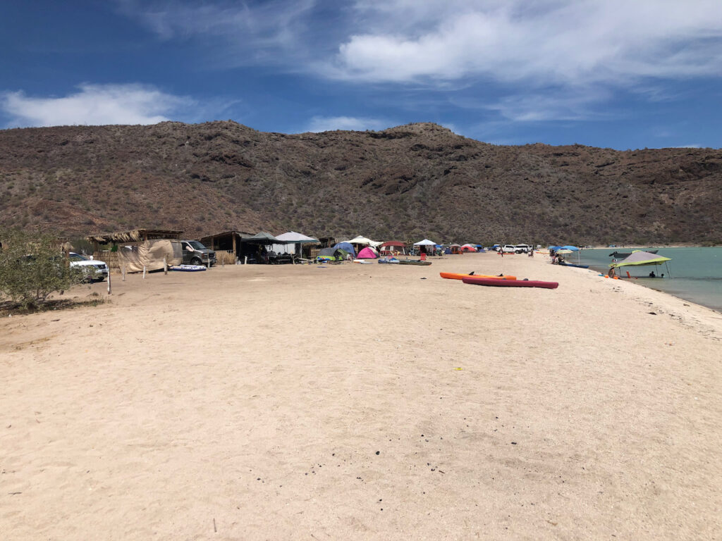
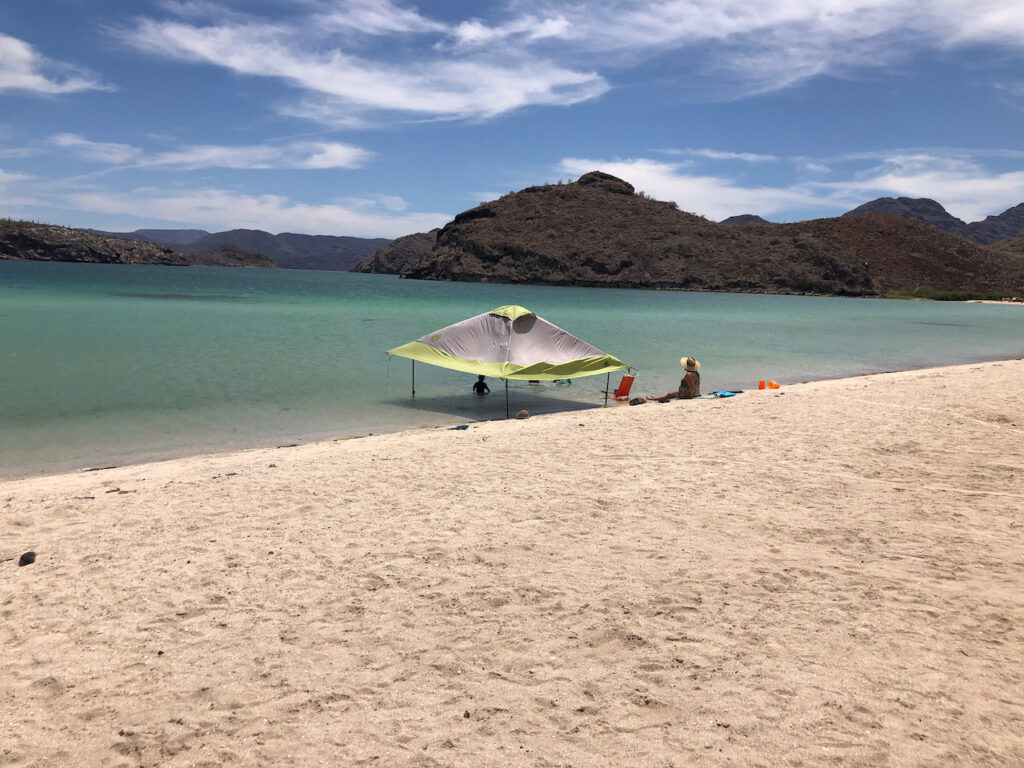
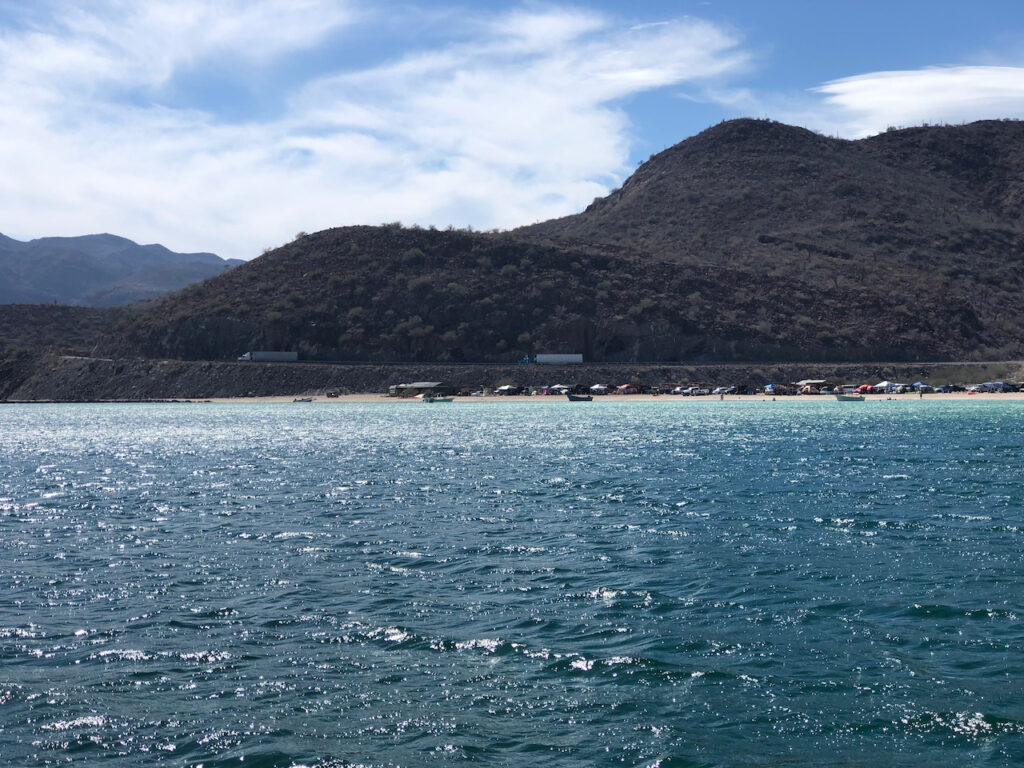
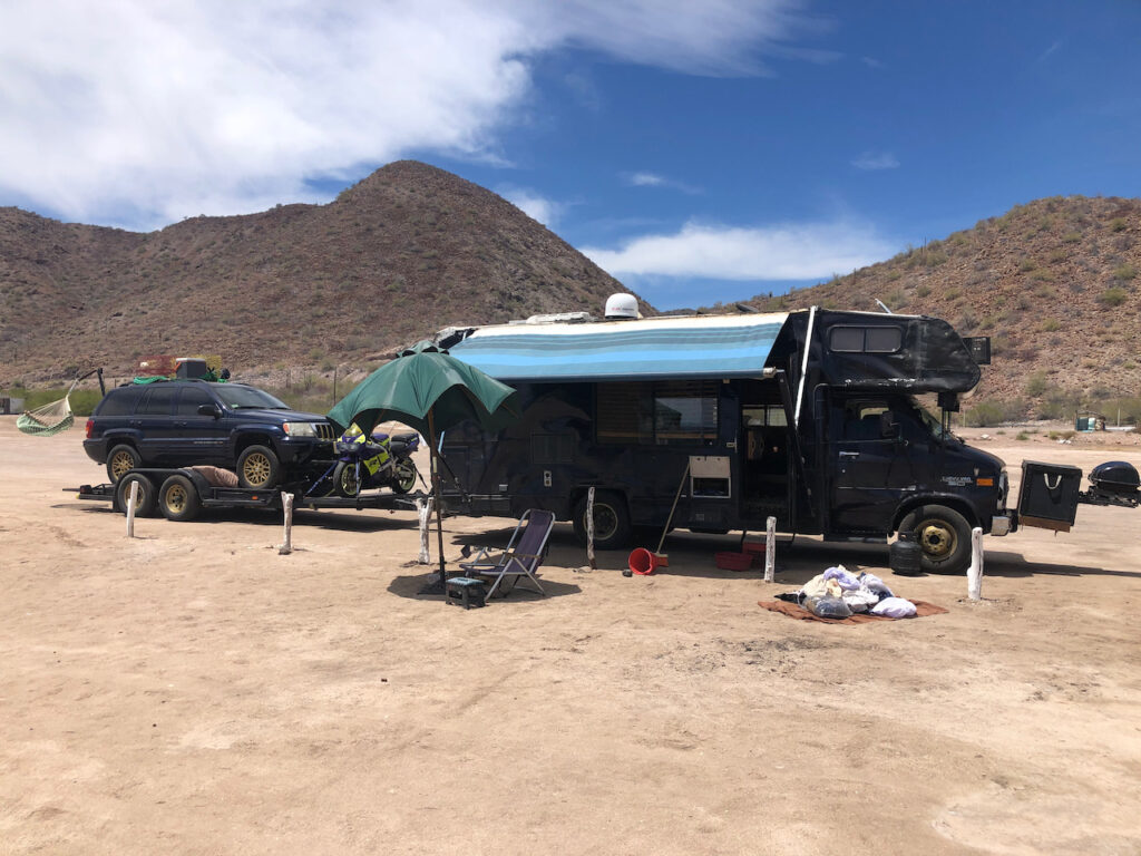
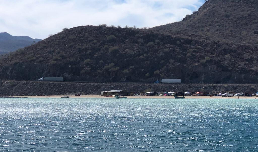
Again the scenery is stunning, volcanic remains all around, a geologists dream. It was just as I was thinking how I really should rig the gybe preventers that the boom took off, A crash gybe, however the dutchman saved the day, a device made of ropes and pulleys attached to the boom that slow it down as it tries to fly across. One of the reasons I like this boat’s design is that the boom is so high and short, it’s hard to get in its way when it crashes across. The end of the boom has foam padding on it, that won’t stop it killing you when it strikes, but it might cut down the amount of blood spilled around the cockpit, especially on the new spray dodger. Turning west out of the wind I arrived at my destination. What an odd place, very pretty, little sandy coves dotted around a bigger cove, with pretty islands dropped in for effect, just one sailboat and two motor boats in this cove. Along the beach of my tiny cove were RVs (Mobile Homes) lined up with no end of attachments adorning them. Further along were groups of tents, and little palapa style huts with cars/trucks backed up to them. Lot’s of families, and extended family groups come here to holiday on the beach. The big RV’s seem to be from the USA, with the tents and smaller setups being Mexican. There are 2 restaurants on the beach, and everyone seems to be having a great time, kids in the water, adults in kayaks and SUPs (Stand up paddle boards).
Come the evening, there are campfires, music and singing drifting across a very calm bay.
I have a terrible snobby attitude to RVs , seeing them as souped up caravans, and in some way an inferior mode of travel compared with, say, yachting. Of course, there’s not a lot in it. They can’t visit Santo Esperitu in their RV, and I can’t get too close to the Grand Canyon in Sister Midnight. Other than that, both modes of transport are pretty similar, weird toilets, cookers, electric supplies etc. I’m pretty sure if I hadn’t got into this boating malarky I could well have ended up RV’ing it around Europe and further afield.
One guy, and I don’t know why I presume that, but I’m sure it will be a guy, has his RV towing a trailer with his 4WD SUV on it, hanging from the cars rear is a hammock chair, on the roof of the SUV as fishing traps, on the front of his RV is a barbecue grill. For American readers you will surely know the kind of thing, for the Brits out there, this is not like caravanning as we know it.
Thursday.
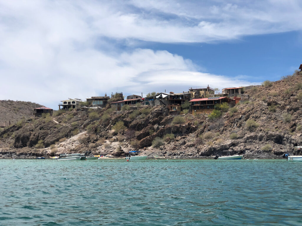
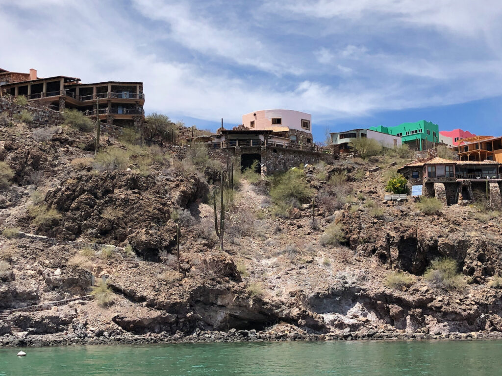
I’m not going anywhere today, so I launch the dinghy and have an amble around the next bay from here. It’s lovely, and proved popular as many houses have been built on the beach and cling to the rocky hillside at the edges of the cove. I suspect the main reason for this development is its close proximity to Highway 1. This is the main road from the USA border that runs the length of the Baja Californian peninsula, ending in Cabo San Lucas. But thinking more about it, the road is probably here because of existing communities. The town of Mulege a few miles to the north has been here a long time. I once read that everything that ever happened, is down to geology, The clashing of the tectonic plates and volcanic activity here created a beautiful, safe harbour, along with fresh water supplies, leading to a safe place for humans to prosper, and ultimately to bring giant mega trucks pounding down the highway behind the beach every ten minutes or so as they take their goods south.
Friday.
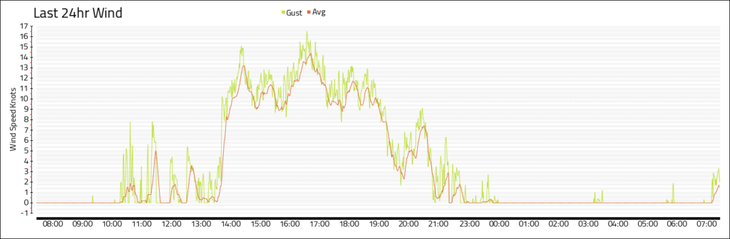
I weigh anchor, and head further south down Concepción, I go to what I think might be the furthest south worth visiting, a place called Playa Santa Barbara, but later when I do my homework, I realise there’s many more places to explore. However this spot is just fine. I’m alone in the bay, there’s a few holiday homes set back from the white sandy beach, but nobody seems to be in. It’s a little early in the year still. I’m very exposed to the north here, but as we haven’t had a northerly wind in the Sea for a while, I’m hoping it will be ok. Yesterday, the wind from the north reached 25 knots in Santispec, and it was windy the day before, but I’m sure this can only be down to katabatic winds caused by the afternoon cooling of the surrounding mountains & hills. As both evenings turned out to be completely still. I did push on last night and got my boat web system to display a rolling 24 hour wind report, as logged at the top of my mast. A picture is below, it’s the last 24 hours since whenever I screenshotted it around 8pm and you can see the wind falling off quickly as night arrives.
I kayak to the rocky promontory and snorkel around, masses of weed on the rock, loads of fish, but little variety.
I’m away from everybody here, the highway is a few miles inland and the sky is clear. I’m hoping to get some stargazing in tonight, perfect conditions. I can now easily find the North star using Ursa Major & Minor and I can also spot Orion easily. Last night I found Mars, just under the sliver of a moon, I don’t think I have ever seen it before so clearly. I must be due a badge or something for all this.
Saturday 17th
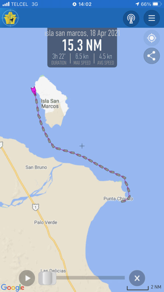
I depart early, not quite sure where my next stop will be, my destination is the marina at Santa Rosalia, a mining town 30-40 miles north of here, but I want to check out the Island of San Marcos on the way. As I progress north I pickup a signal again and download a weather forecast, it seems I’m in for another week of very calm weather, I decide to stop at Punta Chivato for the night and catch up with the internet world. Like a lot of spots around here, it’s a lovely coast line with many low lying areas and beaches. This, and the close proximity of highway one, has caused a lot of fancy properties to be developed here, along with a few resorts.
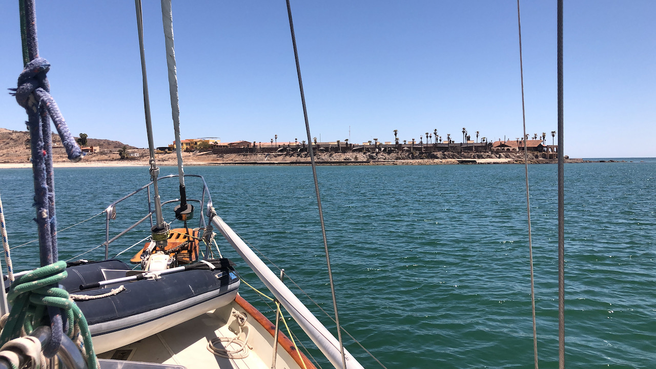
I anchor off a quite flash looking hotel, but there’s no one around so it’s a very quiet. I’m annoyed to see many of the beach front properties have put obstructions out to make it difficult to walk along the beach in front of their properties. As with many countries, the beach is public property and cannot have access restricted. There have been a few high profile cases here, one where a hotel had a man arrested by the local police for walking on the beach in front of the hotel, hundreds turned up at the weekend to set up on the beach and protest until the policeman was arrested, which he was. It shouldn’t annoy me, especially as no one would want to walk on these beaches, there’s hundreds of others close by that are better, it’s just the principle. Although I’m sure if I had a beachfront property I would probably hate people walking in front of my exclusive view out to sea.
Sunday 18th
Whilst talking to Kathy in the morning a gang of rays swim past the boat, they wave their wings in a funny way to propel themselves, it’s like they make a sine wave shape.
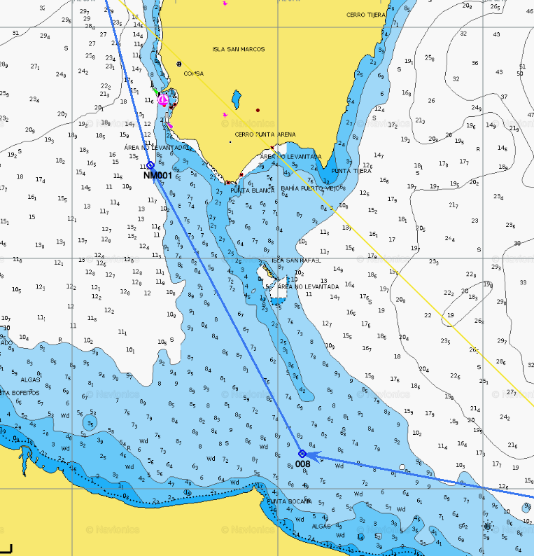
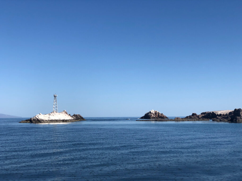
I leave around 10am and head for San Marcos island, around the headland and a little further north. Between the island and the mainland, there’s a channel I have to navigate, it’s about 5 miles wide, yet it’s recommended to stay in a small section under a mile wide, near the coast. A large rocky reef extends from the island’s southern end, it has many visible rocks, but continues much further than you might expect to the mainland. To add to the fun, in the middle of the channel, just before the reef is a pinnacle rock, think of something the size and shape of the eiffel tower, but made of hard solid rock, sitting on the bottom of the sea, with the tip just below the surface. Best avoided, the annoying thing is that it’s not marked on the charts I have, so I add it from coordinates in the pilot book. I use the Eiffel tower as an analogy, as I’m going to visit a church next week made by the same man Monsieur Eiffel himself, Made in France and shipped out here to Santa Rosalia, so the mine workers had a church to go to. I hope to learn more next week once I’m in the marina.
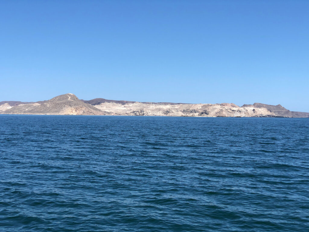
Safely past the obstacles, I motor up the west side of the island, the wind is showing 20 knts now, on the nose, with an open sea ahead, normally I wouldn’t dream of anchoring in this, but I’m assuming this is the normal afternoon blow we have had here for the last 3 days. The forecast has nothing more than 10 knots.
I pass the mine/quarry workings, this island is being disassembled by diggers, loaded into big ships and sent around the world. The product is Gypsum, used in plasterboard/drywall, portland cement, food production and a stack of other things.
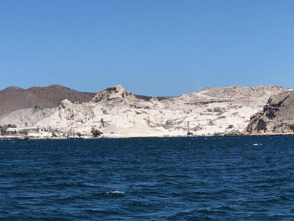
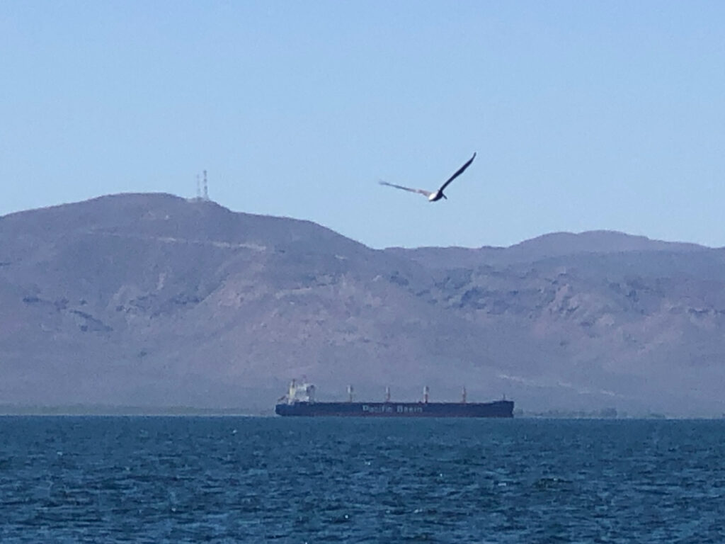
Sitting at anchor a few miles away is a large cargo ship, I suspect it’s waiting to load up.
I have seen a few islands, especially in Japan, being carved up and shipped out. This can’t be a sustainable way to behave, surely. So I start to think about volumes, and decide to research how many islands the size San Marcos will be consumed in our need to have smooth walls? a quick wikipedia search tells me that one source in New Mexico (White sands) has enough Gypsum to supply all of the USA’s needs for the next 1000 years, so perhaps it’s not too bad. I drop anchor on a ledge of sand, so the guide says, but it sounded like rocks to me, just north of the mine in a small indent called ‘Sweet Pea Cove’. The wind is already dropping and there’s little swell here. Tomorrow I hope to get a place in the Marina and move there.
Monday 19th April
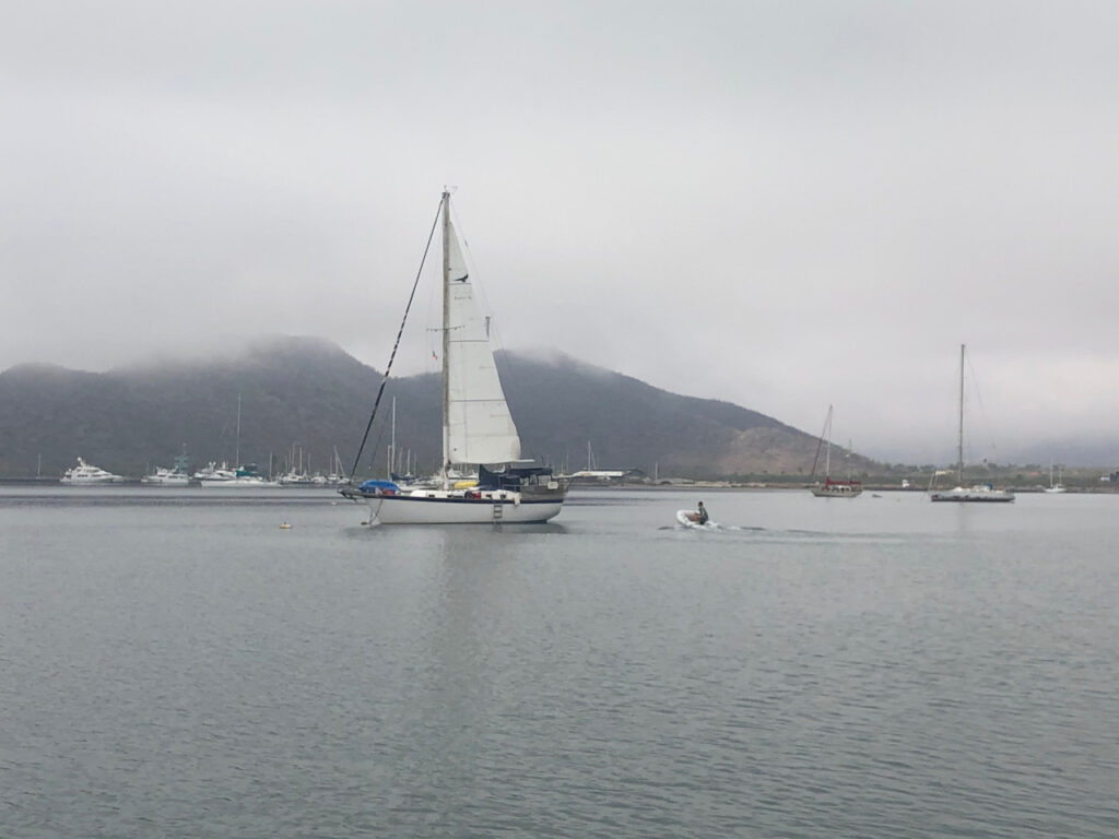
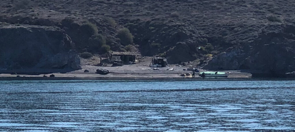
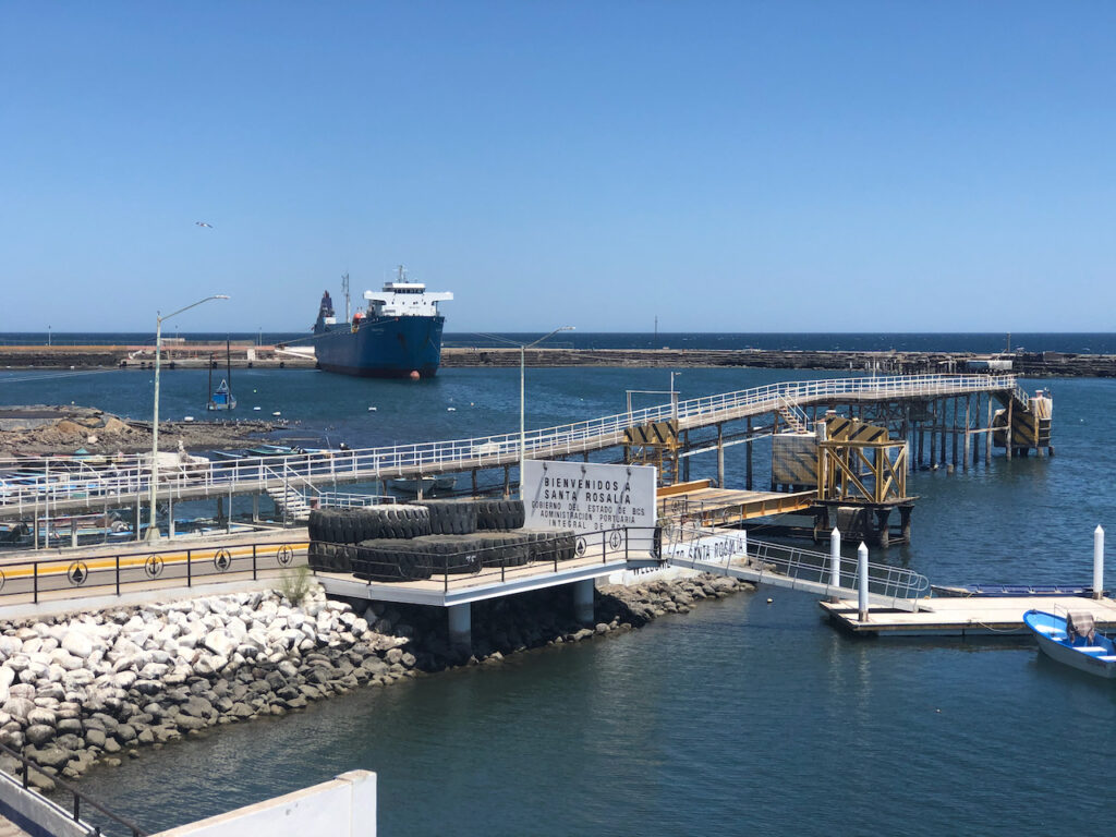
Not a great night, the wind dropped but the swell continued. When this happens the boat no longer points into the wind, which is usually the direction of the swell, but instead turns side on to the swell and rolls. A boat rolling side to side is much more annoying than front to back. Eventually I fell asleep and at 9 in the morning the anchor was raised as I made the short trip to the Marina in Santa Rosalia. On the way out the fishermen on the small beach camp wave as they work on their nets. It looks so lovely, but I’m wondering if they delivered a load of shark fins to their customer in the night or maybe worse.
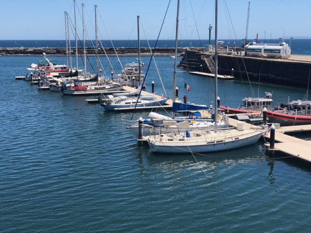
I had been trying for days to contact them to reserve a space, I had initially thought if they were full I could anchor off, but I just found out that’s no longer allowed, so I was a little worried I might be turned away and have to return south, the wind change meant I couldn’t go back to Sweet Pea cove, but would be heading back towards Concepción. But as usual, things turned out for the best, as I approached the marina, a man waved me in from the end of the dock, and I could see spaces available. Two guys where waiting to take my lines, which I hadn’t got out yet. Ten minutes later I was safely tied up in the harbour and looking forward to mad crazy shore life again.
After I left the office to check in, I bumped into Karl, I think he is Latvian, but we met him the day after we arrived in Port Hardy, Canada from Japan. He had arrived from Alaska. He said he was sailing to Mexico. Later we met him near Seattle and again in Ensenada. What a small world.
I’m expecting to spend a week here before I cross to the mainland, I have to get the weather right so it’s an easy passage. Rosalia is a working town, not for tourists, but it has plenty to see, including the Effiel designed church, a museum, and plenty of historic sites.
Paul Collister.